We looked at the weather forecast for today and decided we could manage the 6.5km walk we wanted to do. The entire walk is just over 13km but we decided that ending at the village by Dwerja Tower and then taking a bus back to Victoria, cutting out the last 6.5km, would be fine. Chances are that the last bit would have been more road-walking which would not have been fun anyway. We were able to catch the 9:09 #301 bus to Victoria and start our walk under cloudy skies but with a temperature that was still quite warm.
We worked our way through the streets of Victoria. Just a few hundred meters into the walk we were checking the walking notes to be sure where we had to go next. A local person was pulling out of a parking spot and asked if we needed help. We were fine and Dad let him know that.
“Australians, ” asked the older fellow?
“Americans,” was Dad’s response.
Smiling the driver said, “Heil Hitler,” followed quickly by, “Heil Trump.”
He went his way and we ours.
As we continued, we soon came to the narrow Lumuzjata Valley. The signs we saw note that the valley has many natural springs and they must be the life-giving source for all the vegetation. There are caves in the valley walls but I did not see the caves let alone the cave dwellings. To be fair I didn’t really look either but I don’t think Mom and Dad saw them either. Up the several dozen steps and back onto city streets with their one-person-wide sidewalks with obstructions of entry steps or construction to make them more of an annoyance to walk along.
Soon the roads would become more quiet as we passed an old Coca-Cola machine and began passing by fields to either side of us. The fields appear barren but they are clearly used as the pungent aroma of manure filling our noses informed us. We think that perhaps there will be another growing season for Fall planting. Now and then large working trucks and tractors would pass by causing us to hug the wall on the road’s edge. There are no shoulders. We plodded on. We began to notice that the skies ahead were darkening. Then we noticed, now and then, a distant flash of lightning. The weather was turning bad.
When we finally reached what the notes call the Roman Pond and my map identifies as San Raflu Lake it was becoming quite obvious that our chances of not getting caught in the storm were vanishingly small. We still paused to chat with an English couple who were walking in the same direction as we were though they started somewhere else. We had a snack at the little rest area with tables and benches and wished for a roofed structure. We were pretty sure that the pause wouldn’t matter; we were going to get caught out before reaching the village, San Lawrenz I believe is name, by Dwerja Tower.
The skies continued to darken and the temperature began to drop. The wind picked up speed and the flashes of lightning were increasing in frequency along with the accompanying booms of thunder. As we left the minor road to start following an actual dirt and limestone path the storm with all its wind and rain arrived. Torrents of rain fell and the wind whipped the pummelling water about us. We were not going to stay dry even with our rain jackets on. The temperature dropped several degrees but it was still quite warm. We were getting quite wet but we were not getting chilled. We pushed ahead along the sometimes overgrown path that was turning into a stream. We didn’t have attention to spare to look out and around: heads down; watching our feet. We passed by small family-owned quarries but did not notice. After almost a kilometer and easily 20-25 minutes of pounding rain we came to a turning point. The apparent path seemed to go right. The plowed allotments on our left.The right went up a hill where Mom spotted a building. She thought it might provide protection from the storm. She forged up to check it out and then waved Dad and me to follow. About 110 meters climbing up about 20 meters and we were getting ready to enter the building through an empty window opening to whatever protection we could get from the howling wind and driving rain. Mom stepped through. Dad started to step through and came up short with a thud and an anguished cry. The footing required care but he gave that a bit too much attention and failed to duck his head sufficiently. The building made him pay a painful price with a big cut on his and no little amount of pain. I entered unscathed.
Dry. No wind. Comfort.Refuge.
Mom used the supplies in Dad’s emergency medical kit to stop the bleeding.
We took refuge in this abandoned quarry building for a bit over a half an hour. We thought the rain was subsiding though it seemed like it wasn’t going to truly stop anytime soon. We zipped ourselves back into our rainjackets and braved the aforementioned opening to depart the refuge and hike the last slightly-less-than 1km to the village associated with Dwerja Tower. This little right hand path was an error. In fact, we were supposed to follow close to the allotment and pick up the path just a few steps further on. Perhaps we would have seen the real trail if we weren’t dealing with the weather. We continued on the limestone and dirt path. We listened to streams of water flowing down the limestone as we walked. We tried not to slip in the sections of near-frictionless mud. The path was taking us towards the sea and we followed it and the occasional blue-and-white way-mark. The storm was spent but it was still raining a bit as we approached Dwerja Tower and the couple we had met before, out for a 2-nights and 3-days hike around Gozo, caught up to us. They are staying at hotels along the way but we couldn’t figure out where they took shelter from the storm. They said, we thought, under a rocky ledge but nothing like that was noticed by us between San Raflu Lake and where they caught up to us. They seemed in good spirits as they moved on past having several kilometers to go to wherever their lodging for this, I think their second night would be.
If the flag is flying at Dwerja Tower it means the tower is open for people to visit. No flag was flying though I doubt we would have visited even if it had been. It’s the location of a centuries-old observation tower, restored in 1997. It had some cannons in ages past, 6-pounders I believe, but they were never fired in combat. During World War II it was strictly an observation post. We passed by and walked the final 400 or so meters along a road, though on the limestone and sand wide border that travelled the same way to the village of San Lawrenz. We settled in at the souvenir shop to wait for the Uber I ordered. We had no desire to explore the village.
The Uber ride was easy and after the 7 or so mile ride we were deposited back at the Grand Hotel. We were able to get out of our wet clothing and start to recuperate from the adventure we just had.
Mom called Mercedes about Dad’s head wound, and what additional supplies we needed to keep the cut clean. The visit to a pharmacy required a climb up a flight of about 50 stairs through a tunnel then a seemingly longer-than 0.25 miles (what the GPS map suggested). Navigating narrow sidewalks once again and getting wet once again. But we found what was needed at the pharmacy and returned to the hotel. Relax. Minister to aches and pains. An early dinner and then off to an early bedtime.
Photos
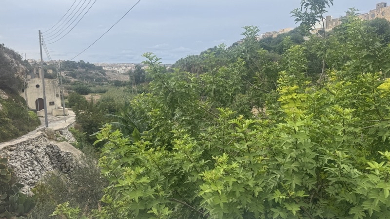
There may be more in this lush valley than we saw. The walk is taking us through Victoria but this valley is an oasis of quiet in the city. This is Lunuzjata Valley. There are several springs that count for the valley’s less than green at this time of year plethora of plants. There are also cave dwellings, but I did not notice them.
--September 19, 2026 at 9:53 AM.
Maps are centered on the photo: Google map, Apple map, CalTopo mapOpenTopoMap map
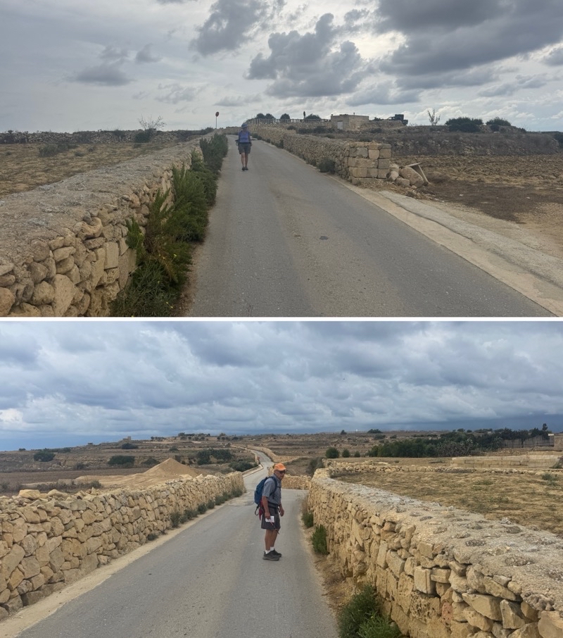
We have been tromping down this road past fields that seem barren but are clearly active (the smell of manure is the give away). Over 2km on this road as the clouds become more threatening. Looking back (top) and ahead (bottom).
-- September 18, 2026 at 11:16 AM Maps are centered on the photo: Google map, Apple map, CalTopo mapOpenTopoMap map
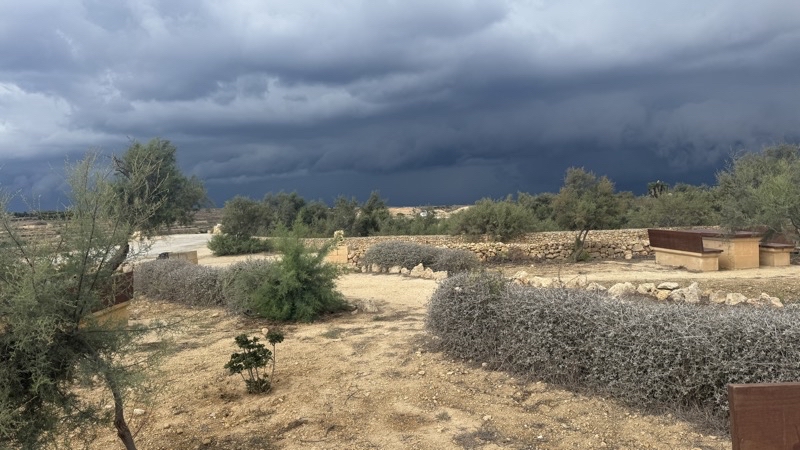
We met an English couple, living in Malta, here at this little rest area. I wonder if they made it to the village of San Lawrenz before the storm hit. Perhaps we should not have spent the 10 or so minutes here having a bite to eat, but there is no way we would’ve beaten the storm.
--September 19, 2026 at 11:21 AM.
Maps are centered on the photo: Google map, Apple map, CalTopo mapOpenTopoMap map
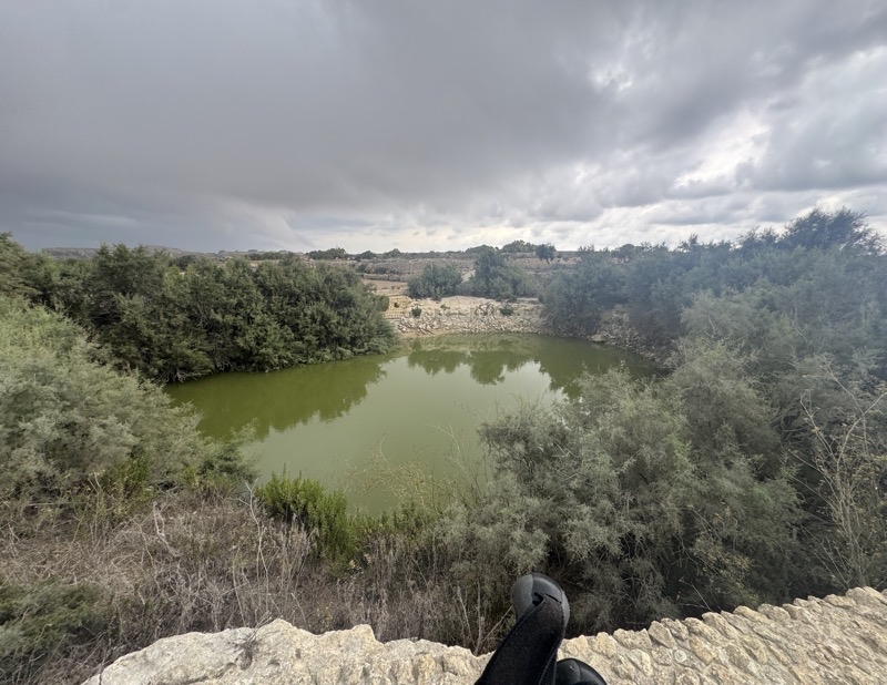
The Inntravel notes say, assuming I’m reading them right, that this is the Roman Pond. On my map it’s called San Raflu Lake. It is home to Painted Frogs which are the only indigenous amphibians I believe here on the Maltese islands. We did not see the frogs, but the pond was surrounded by much greenery.
--September 19, 2026 at 11:33 AM.
Maps are centered on the photo: Google map, Apple map, CalTopo mapOpenTopoMap map
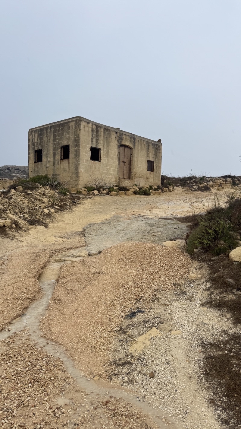
Our refuge from the storm.
--September 19, 2026 at 12:50 PM.
Maps are centered on the photo: Google map, Apple map, CalTopo mapOpenTopoMap map
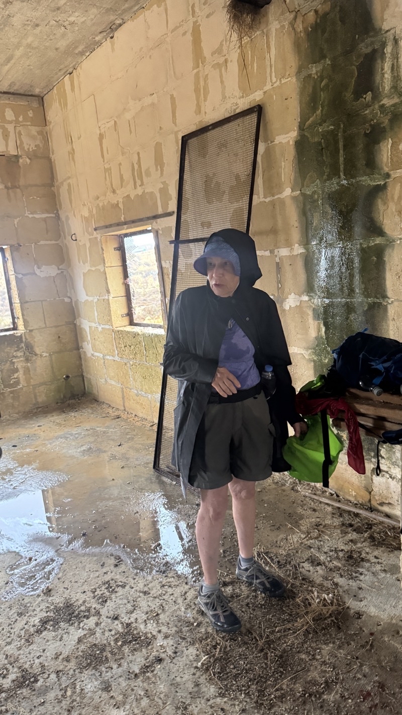
Lightning flashed and thunder boomed, the temperature dropped as the wind picked up speed, and a few raindrops turned into a torrent. It really started to come down as we turned down a dirt and stone narrow path. I think we plodded along for about 700 meters before Mom spotted the building atop a hill off to the right (about 110 meters distant). We were quite soaked so taking cover from the wind and rain was wonderful. I’m sure we were there for easily a half hour if not closer to 45 minutes.
--September 19, 2026 at 12:27 PM.
Maps are centered on the photo: Google map, Apple map, CalTopo mapOpenTopoMap map
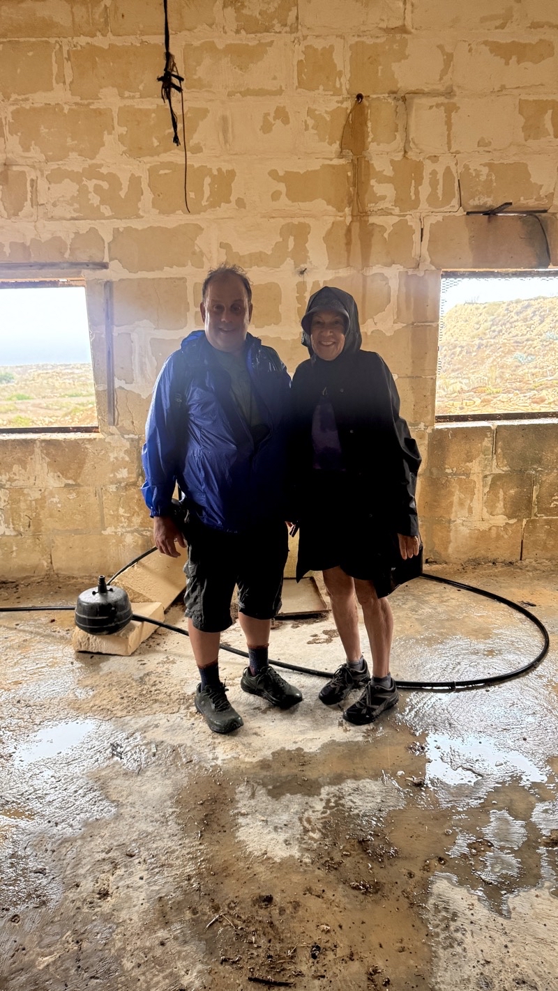
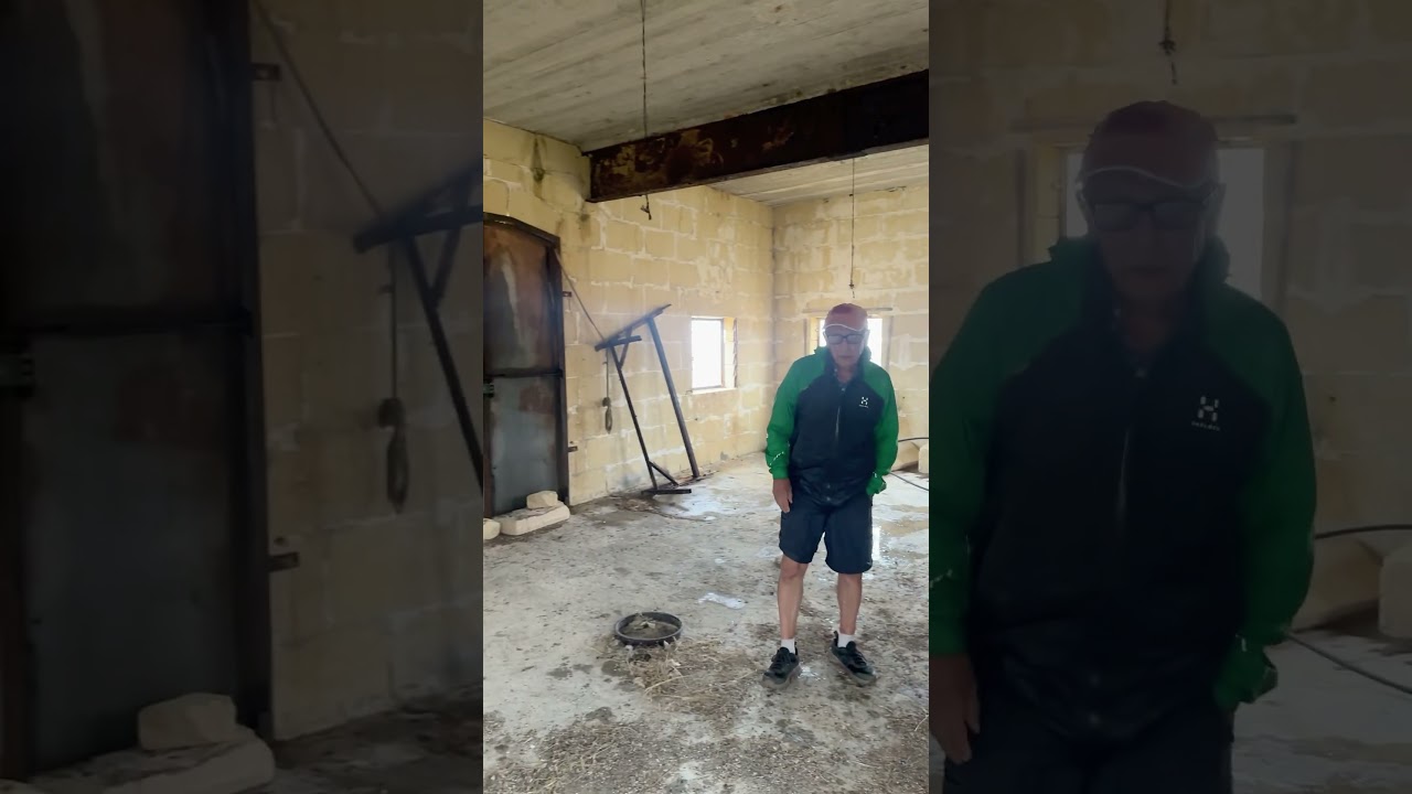
Ken snd Mom in our refuge from the storm. It’s been a few minutes since Dad gave himself quite a knock on the head as we came into this building. That was definitely an unexpected and unwanted extra bit of adventure to our already unexpected adventure in the stormy weather. Photo by Jonathan.
--September 19, 2026 at 12:29 PM.
Maps are centered on the photo: Google map, Apple map, CalTopo mapOpenTopoMap map

I expect an hour earlier this scene looked quite a bit different. I am sure the wind was ripping up whitecapped waves. But visibility was probably such that you likely could not really see them. Not a quiet scene now but it’s nice to see the turquoise sea as we neared the end.
--September 19, 2026 at 1:11 PM.
Maps are centered on the photo: Google map, Apple map, CalTopo mapOpenTopoMap map
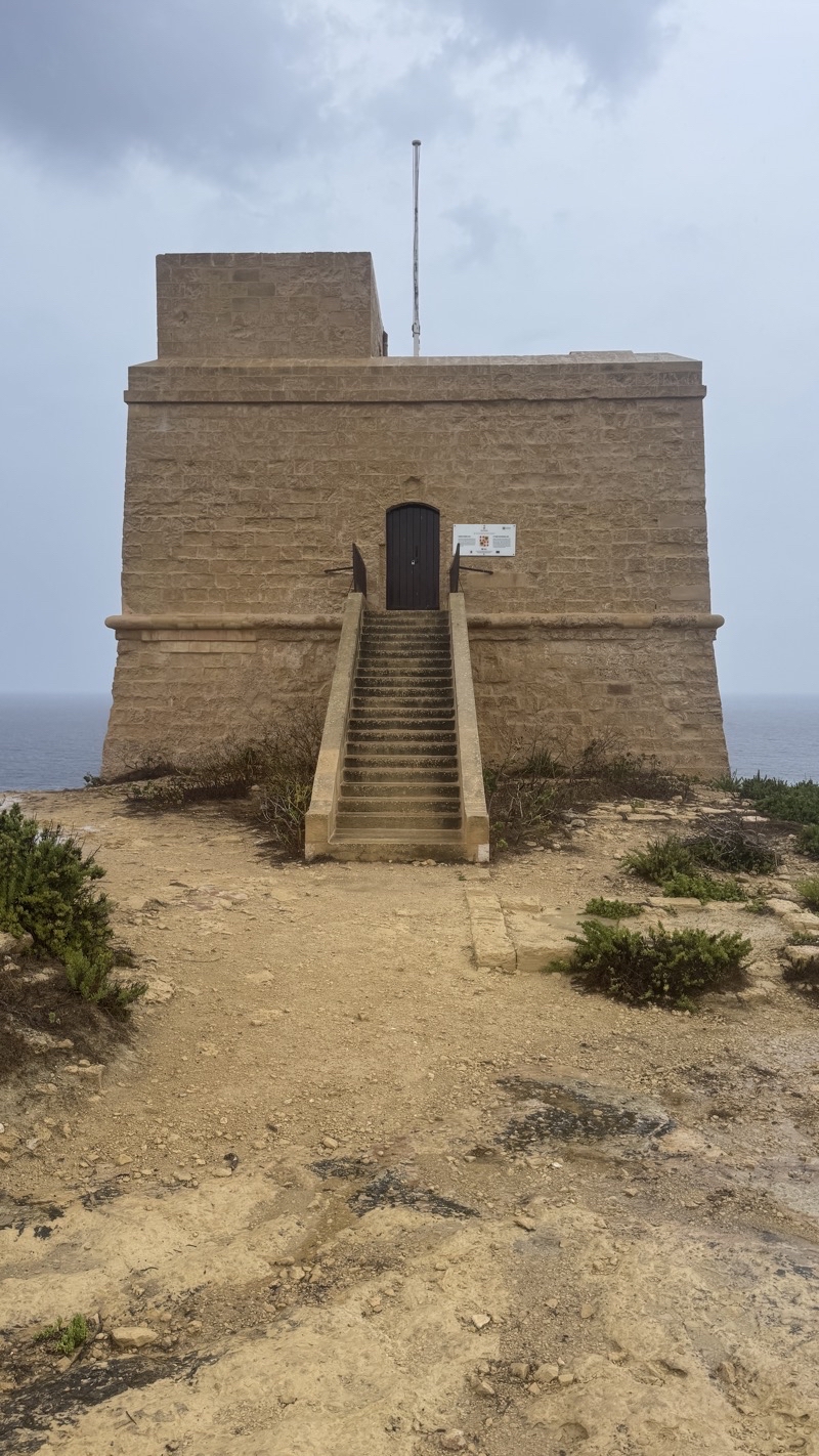
Even if the flag had been flying, I doubt we would have stopped to Dwerja Tower. The rain had slacked off quite a bit, but it had not ceased. We were ready to be done, especially given the knock that Dad took. Just a few hundred more meters to the protection of the umbrellas at what I suspect is a souvenir shop. We certainly were not going to check out anything else around there.
--September 19, 2026 at 1:18 PM.
Maps are centered on the photo: Google map, Apple map, CalTopo mapOpenTopoMap map


No comments:
Post a Comment