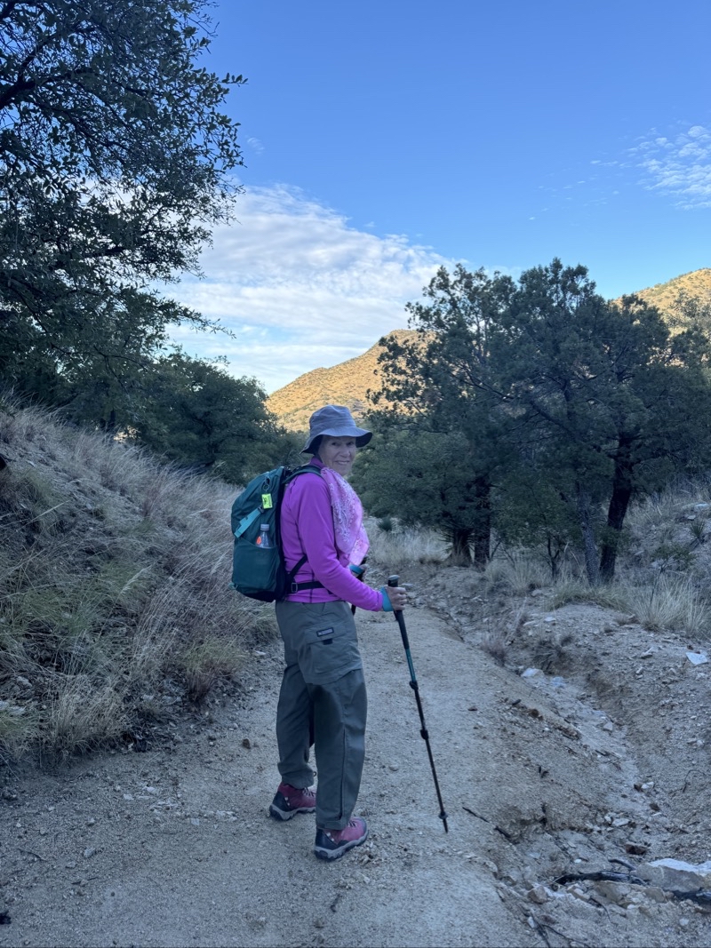
We have been visiting Tucson around this time of year for about a week over the past 25 years. We have a variety of hikes we consistently like to do. Some hikes we have not done in many years. Some hikes we used to do consistently have now fallen by the wayside for various reasons. Times change. What follows is a photo essay for our most recent trip to Tucson.
Note: Some maps are different in appearance. It was easier to present them that way and not make them all consistent. The blue dots on some of the maps are 1/2 mile apart from each other.
Day 1
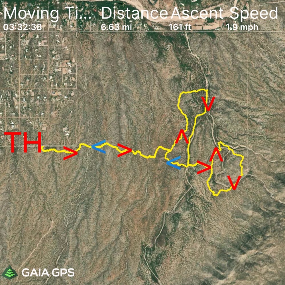
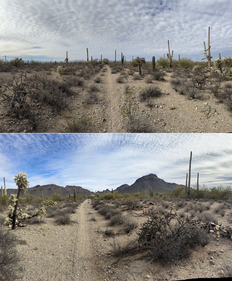
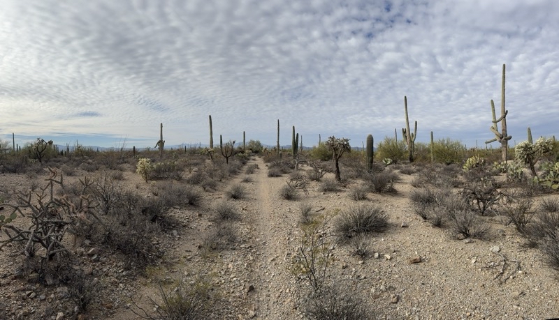
Our first hike would follow a lollipop-like path from the Broadway Trailhead. It ended up not quite being what we initially planned. We start and end at the Broadway Boulevard trailhead (TH) and head east. We turned north and then curled back south along Monument Wash. From there we follow a loop clockwise that will get us close to Garwood Dam. After closing the loops we retrace our outbound trail back to the car.
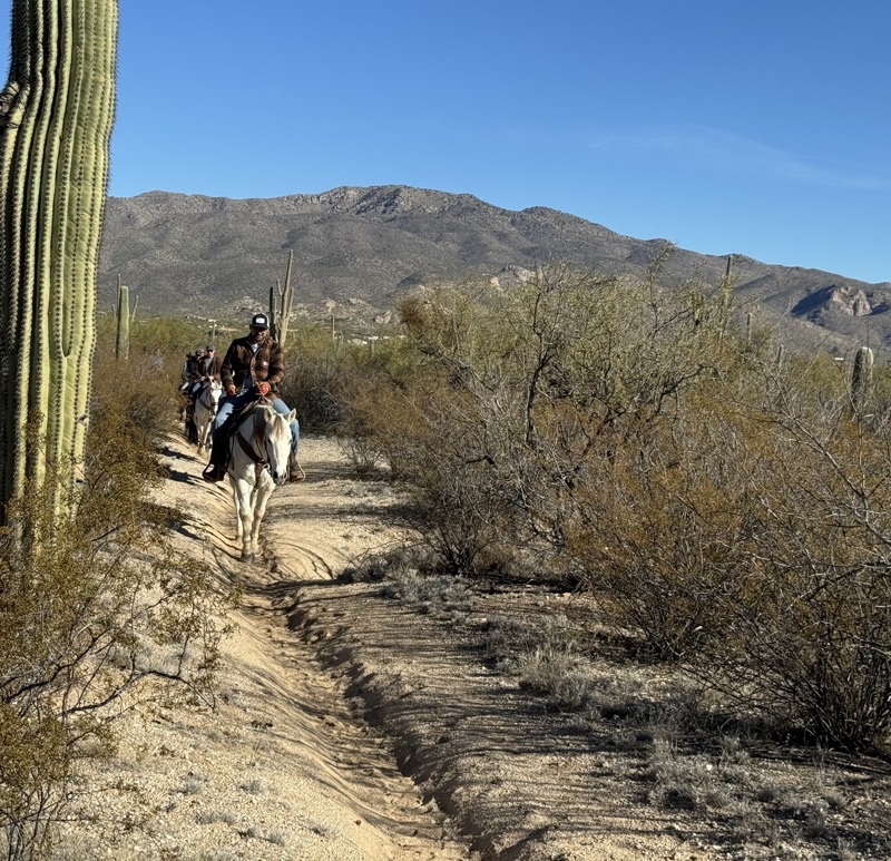
The trails in the Pink Hills area (Saguaro National Park eastern district) are numerous and it is easy to do something other than what you initially planned. But our errors in navigation let us encounter some groups of horse riders that I don’t think we would have otherwise met.
--December 28, 2023 at 10:25 AM.
Maps are centered on the photo: Google map, Apple map, OpenTopoMap map
Day 2
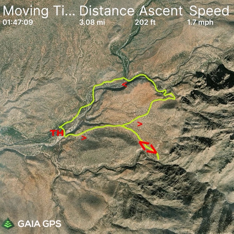
We like this loop hike in Catalina State Park. However, our side trip to the Montrose Pools was a bust: no water was flowing. In fact, no water was visible anywhere which is a first for us. Follow us from the trailhead to the out-and-back, 0.5 miles one way, spur to Montrose Pool. Continue counterclockwise to complete the hike.
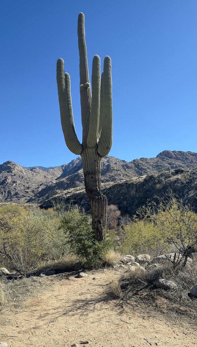
I should have checked to be sure I took this photo from the same vantage as a superb shot I managed of this Saguaro cactus a few years back. But it is still an impressive cacti along the Catalina Canyon Loop trail. This year there was no water flowing anywhere along the trail which is a first for us. In fact, it has seemed drier in general this year.
--December 29, 2023 at 11:24 AM.
Maps are centered on the photo: Google map, Apple map, OpenTopoMap map
Day 3
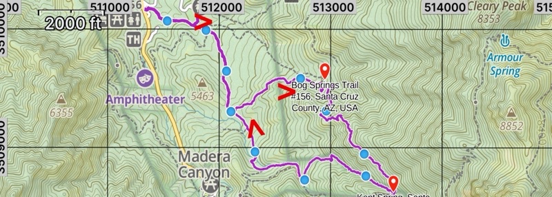
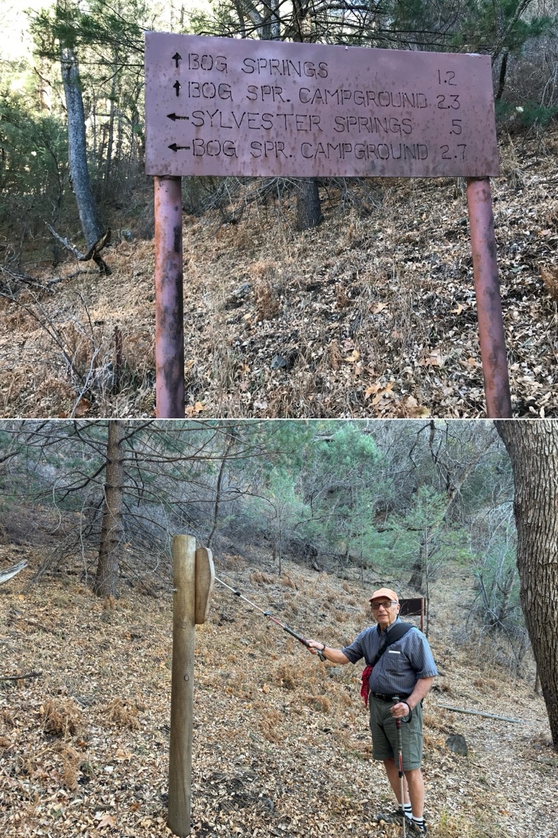
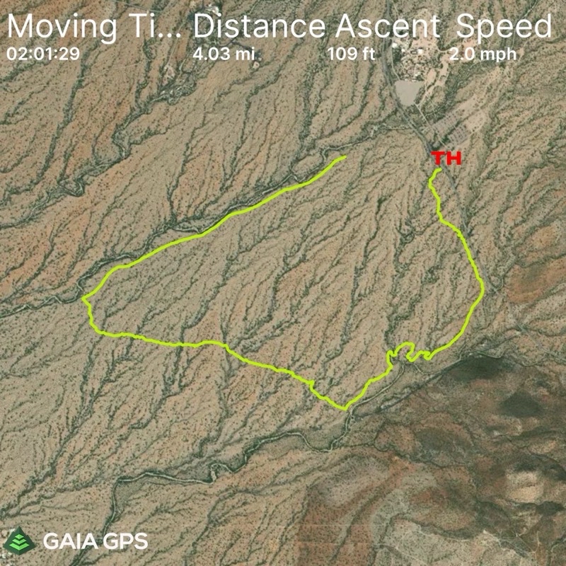
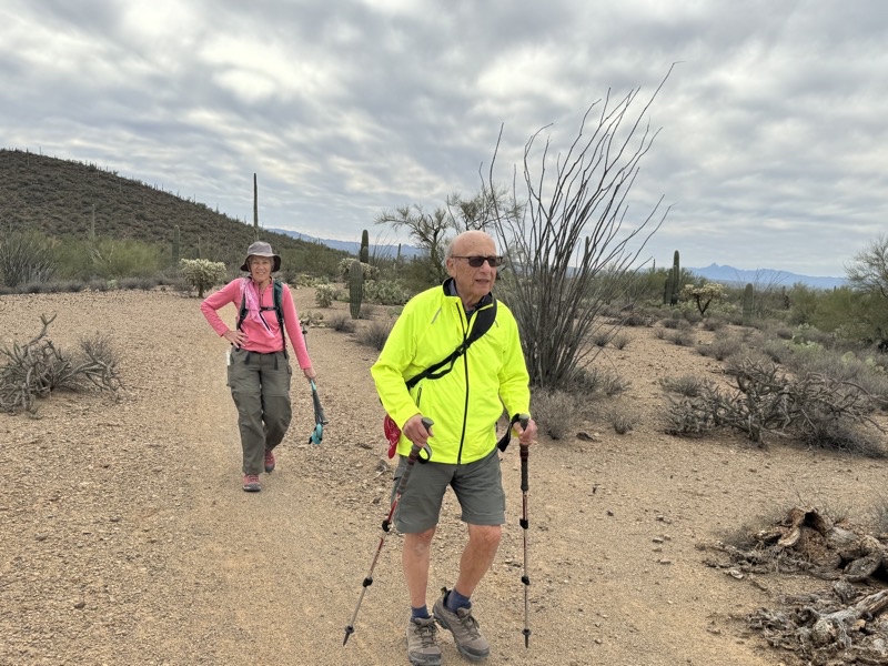
This turned out to be rather more challenging a hike than we thought it would be. I think it was tougher than it was when we last did it in 2008 (which we really weren’t sure of). Mom found the general ascent enjoyable. The slog between Bog Spring and Kent Spring was the worst for me; the descent from near Kent Spring to the end was worst for Dad. I’ve provided a bit more detail here. The blue dots are 0.5 miles apart. The start and end of the hike is at the upper left purple line terminus. You can see where Bog Spring and Kent Spring are by the orange pins. Sylvester Spring is about 0.5 miles west of Kent Spring.
We start and end at the picnic area. Heading east and then southerly to the start of the loop. At this point we travel clockwise past Bog Spring, continue up - and a little down - to Kent Spring, descend steeply past Sylvester Spring, and finish the loop. We finish by retracing the last mile down to the picnic area.
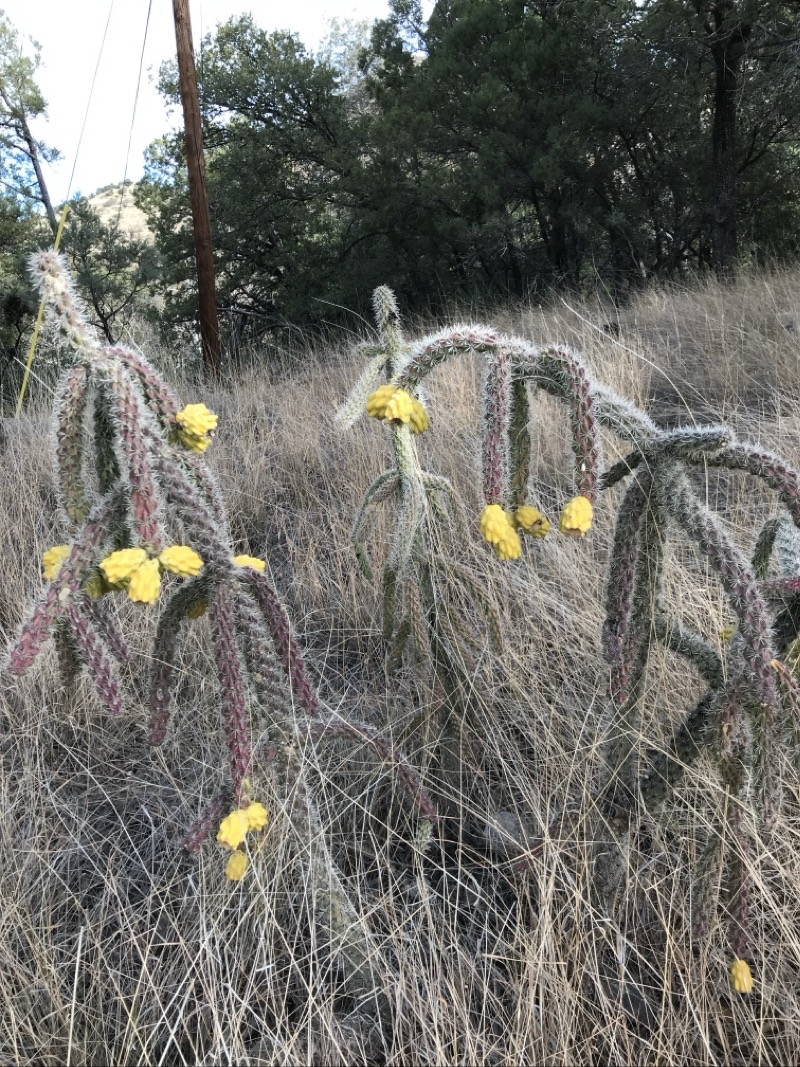
After the mighty Saguaro cactus I think the Sonoran desert seems to be best noted for the wide variety of cholla cactus species. Perhaps this is because cholla exist at a wide variety of elevations. Here is a Cane Cholla not that far from the Madera Canyon Picnic Area Trailhead. This is the start of what would prove to be a long, rock-strewn, steady climb towards Bog Spring. Photo by Judy Knight
--December 30, 2023 at 10:09 AM.
Maps are centered on the photo: Google map, Apple map, OpenTopoMap map
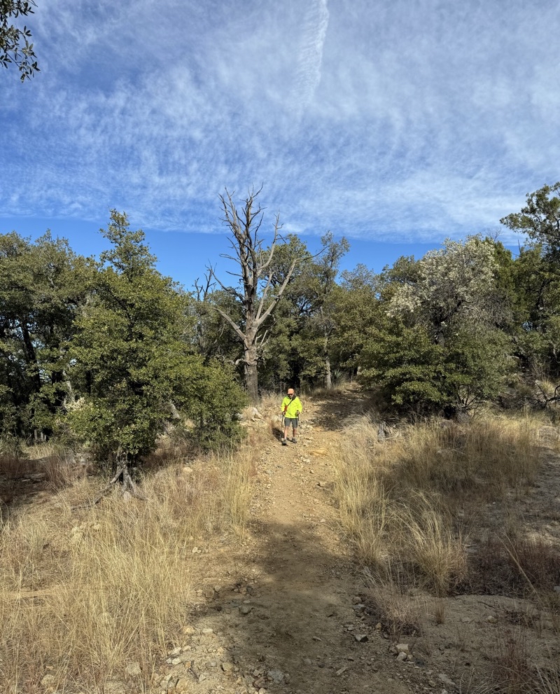
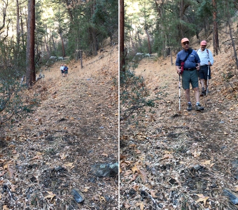
We are moving slowly. At this point the footing is actually pretty good and there are no drop offs to worry about. But this is a steady climb and we aren’t as young as we were 15 years earlier which is when we last did this hike (we figured that out when Mom returned home and was able to check notes in an older version of the trails book we like by Betty Leavengood - Tucson:Hiking Guide).
--December 30, 2023 at 10:51 AM.
Maps are centered on the photo: Google map, Apple map, OpenTopoMap map
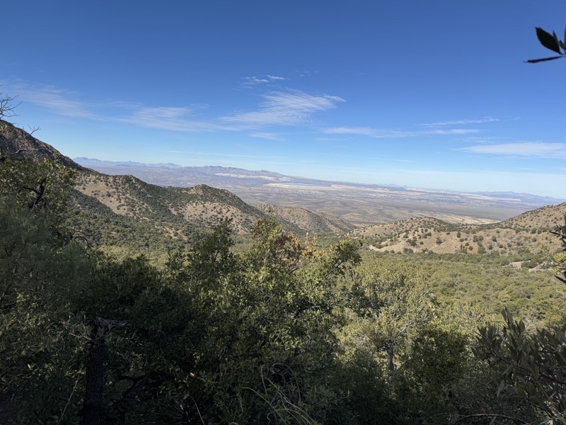
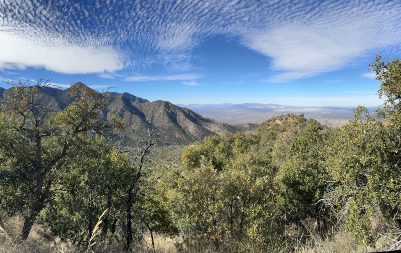
Getting closer to Bog Spring. The trail is narrowing and the drop off is steep and long. But the views as we creep through the forest are sometimes quite good.
--December 30, 2023 at 11:34 AM.
Maps are centered on the photo: Google map, Apple map, OpenTopoMap map
We stopped at Bog Spring for lunch. Now we are plodding along a narrow, maybe two-feet wide, shale strewn, trail with a perilous drop-off on one side. We have hiked perhaps 2.0 miles gaining about 1,300 feet in elevation. We are still a few hundred feet below our high point and maybe three quarters of a mile from Kent Spring. Mom is finding the climb a real challenge. I loathe the footing. Dad is doing alright. But we are creeping up at less than one mile-per-hour at this point. The views are expansive and special but hard to really enjoy.
--December 30, 2023 at 1:00 PM.
Maps are centered on the photo: Google map, Apple map, OpenTopoMap map
Kent Spribg is a small wet area just beyond this sign. From now on, with a few short breaks, the trail will descend at times steeply. Photos by Judy and Ken.
--December 30, 2023 at 2:25 PM.
Maps are centered on the photo: Google map, Apple map, OpenTopoMap map
This is one of the steeper bits of trail between Kent Spring and Sylvester Spring. Mom is moving with ease; Ken is doing better though the descent is still tough; Dad does not like it at all. As Mom shot a bit of video it took Dad and Ken about 40 seconds to reach her. Photo by Judy
--December 30, 2023 at 2:31 PM.
Maps are centered on the photo: Google map, Apple map, OpenTopoMap map
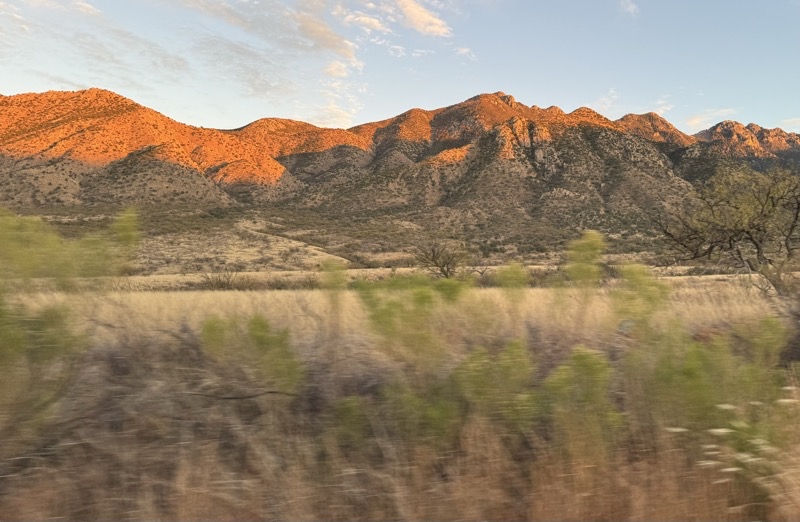
We have about one mile to go and the sun is starting to create a lovely glow on the mountains.
--December 30, 2023 at 4:14 PM.
Maps are centered on the photo: Google map, Apple map, OpenTopoMap map
That last mile took a while. We probably should have walked past Kent Spring Csbin to the road and taken it back to the trailhead. We would’ve still had to descend a few hundred feet but a road walk would have been easier even if a bit lengthier. We finished just a little after 5:00PM and this is a view from the car as we leave Madeira Canyon. We were on the trail for just over 7 hours and took 95 minutes in breaks. Especially between Bog Springand Kent Spring we were moving well below 1.0 mile-per-hour.
--December 30, 2023 at 5:25 PM.
Maps are centered on the photo: Google map, Apple map, OpenTopoMap map
Day 4
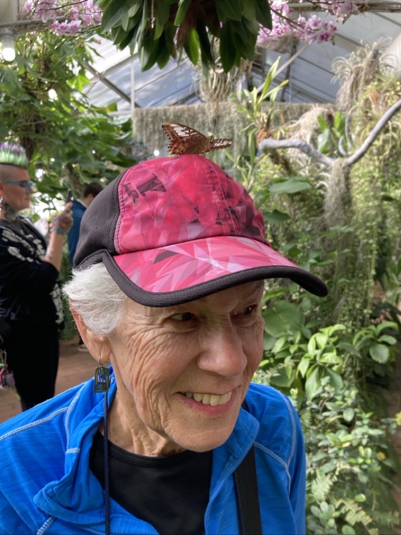
Besides the butterflies in the butterfly house in the Tucson Botanical Garden, the garden does a nice job presenting the flora of the region.
--December 31, 2023 at 12:14 PM.
Maps are centered on the photo: Google map, Apple map, OpenTopoMap map
Day 5
This loop in the western district of Saguaro National Park is nice enough but the desert sounds are frequently interrupted by gunfire from a nearby shooting range. We did start and end at the trailhead (TH) but I neglected to start recording our walk counterclockwise along the Ironwood Loop Trail for about 0.5 miles. Where the yellow line starts is the place I realized my error.

We are at the start of the David Yetman trail. It has some shade as it winds up into the Tucson Mountains past the stone remains of Ruby and Sherry Bowen house. We have done this trail before (for example this hike) and hoped our legs wouldn’t complain.
--January 1, 2024 at 9:36 AM.
Maps are centered on the photo: Google map, Apple map, OpenTopoMap map
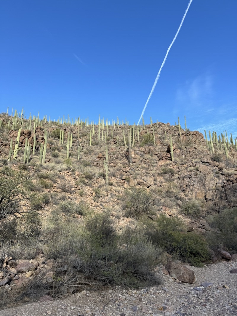
Dad’s legs were quite unhappy with even modest descents so after hiking in a half mile we turned around to find trails on the far flatter desert floor. On the way back this slowly moving cloud streak caught our attention as it drifted to the right above the line of Saguaro cacti.
--January 1, 2024 at 10:04 AM.
Maps are centered on the photo: Google map, Apple map, OpenTopoMap map
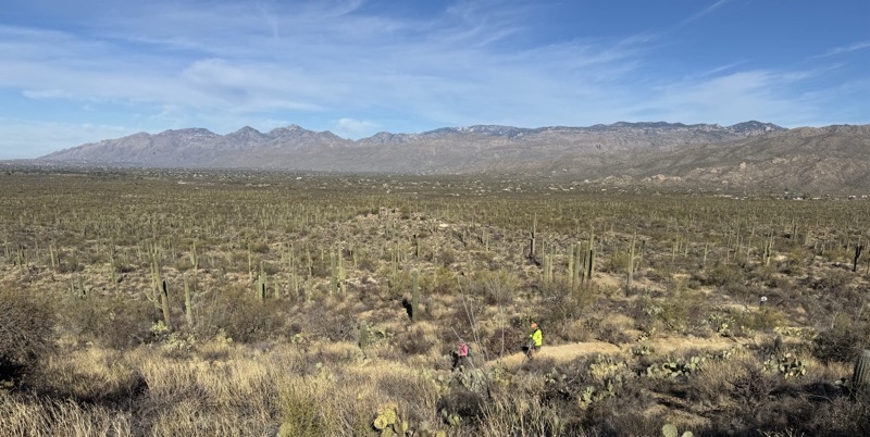
Here in this part of the western district of Saguaro National Park the desert seems much flatter than what you find in the Pink Hills area. We are all still feeling the effects from the Madera Canyon hike so a hike with little elevation change might be a bit dull but physically easy. The morning had been sunny earlier but clouds have made a rare appearance on a slightly blustery day.
Top: facing west in the direction we are following the Ironwood Loop Trail. Bottom: facing southeast towards the mountains (Golden Gate Pass) from whence we came.
--January 1, 2024 at 10:59 AM.
Maps are centered on the photo: Google map, Apple map, OpenTopoMap map
Here in this part of the western district of Saguaro National Park the desert seems much flatter than what you find in the Pink Hills area. We are all still feeling the effects from the Madeira Canyon hike so a hike with little elevation change might be a bit dull but physically easy.
--January 1, 2024 at 10:59 AM.
Maps are centered on the photo: Google map, Apple map, OpenTopoMap map
We are about 3.7 miles into this 4.2 or so miles hike. We have seen a couple other hikers and several bikers today.
--January 1, 2024 at 1:25 PM.
Maps are centered on the photo: Google map, Apple map, OpenTopoMap map
Day 6
On a day that we did not hike, we visited for the first time the Saint Xavier Mission.
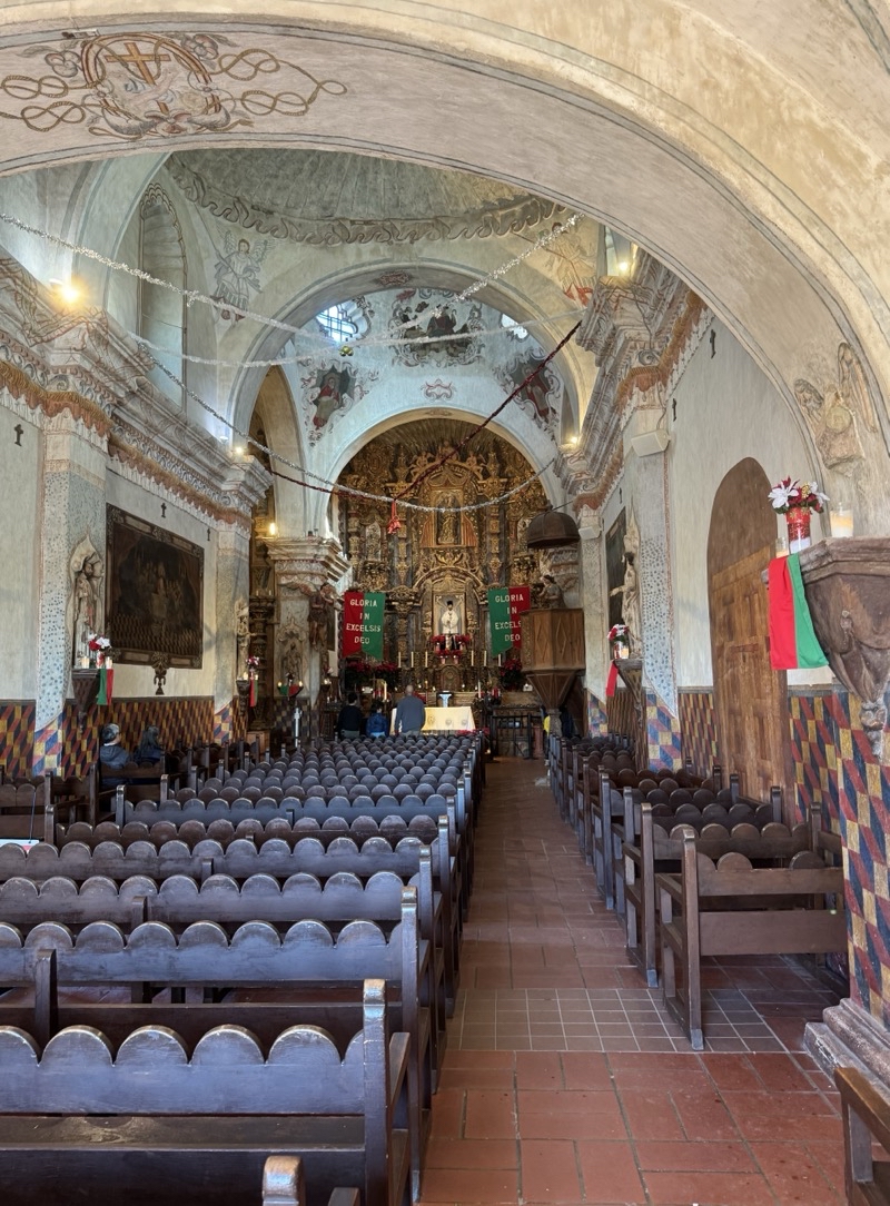
The photo is misleading. It’s not nearly this bright inside the San Xavier Mission. It dark and what are likely pretty ornate art featuring all sorts of catholic iconography are really hard to see.
--January 2, 2024 at 10:05 AM.
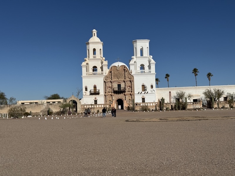
The San Xaviermission was established in 1692 by Father Eusebio Kino. The present building was built between 1783 and 1797 and is the oldest European structure in Arizona. I think the building is more remarkable than what it contains but no doubt my lack of knowledge about Catholic art and what it means combined with low vision (and a dark interior) account for some of this opinion. The two towers are different colors. It’s not a trick of the camera.
--January 2, 2024 at 10:47 AM.
Maps are centered on the photo: Google map, Apple map, OpenTopoMap map
Day 7
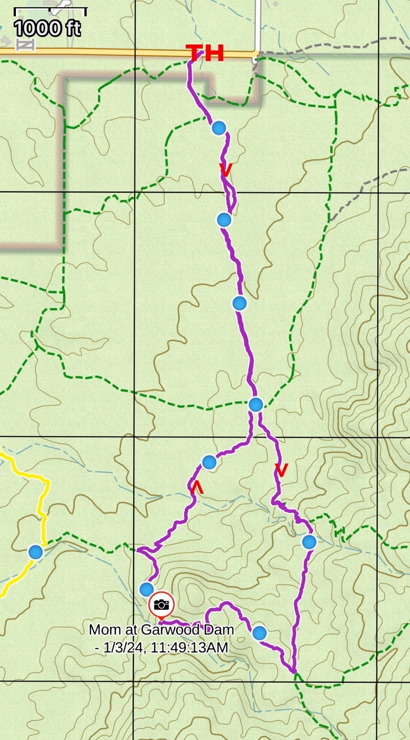
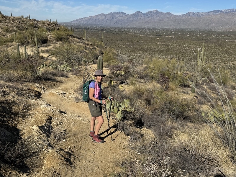
Back to the Pink Hills but this time starting at the Speedway trailhead. We intended to have lunch at Garwood Dam.
We start and end at the Speedway Boulevard trailhead (TH) and head first south on the desert floor before starting our clockwise ascent towards Three Tanks. We descend towards Garwood Dam eventually closing the loop near the desert floor. At that point we retrace our outbound hike back to the trailhead. We were on trails for 3 hours and 40 minutes. We took almost an hour in breaks. The bulk of the 420 feet of ascent and descent is in the loop which is about 2 miles.
This will be our last day and hike in Tucson and we have returned to the Pink Hills below the Rincon Mountains. We are determined to have lunch at Garwood Dam. At this point we are climbing up off the desert floor along Wildhorse Tank Trail. It’s a lovely morning. One thing we prefer about this region over the desert floor by the Old Tucson Film Stufio where we were on New Years Day) is the quiet. There, really most of the time, you hear gunfire from a shooting range. Here once out of earshot of Broadway and Speedway you just have (mostly) the sounds of the desert.
--January 3, 2024 at 10:12 AM.
Maps are centered on the photo: Google map, Apple map, OpenTopoMap map
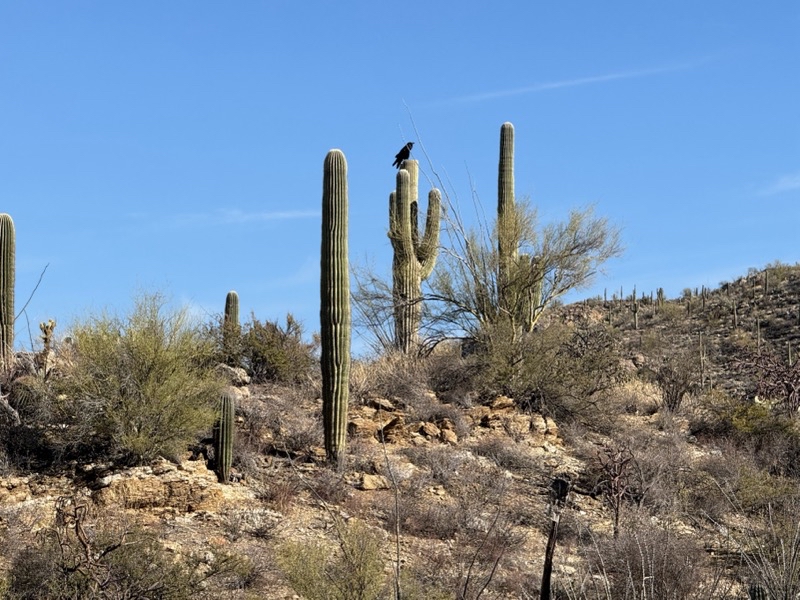
Look closely and you’ll see what I believe is a Common Raven sitting atop a Saguaro cactus. We heard its croaking call as we neared (though surely a ways off) and moved away for several minutes.
--January 3, 2024 at 10:32 AM.
Maps are centered on the photo: Google map, Apple map, OpenTopoMap map
--January 3, 2024 at 11:14 AM.
Maps are centered on the photo: Google map, Apple map, OpenTopoMap map
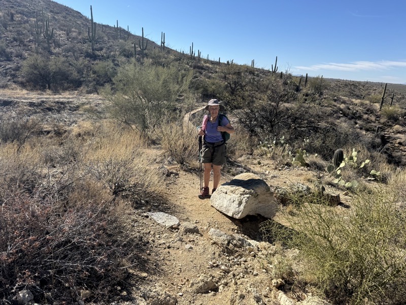
Out in direct sunlight it feels much warmer than the forecast temperature. An occasional breeze cools you down but it is certainly a fine day for shirt sleeves and shorts. We have just finished lunch by Garwood Dam. There are a few routes back to our car at the Speedway Boulevard trailhead and we will take a shorter one there. The curved wall behind Mom is the top of the dam.
--January 3, 2024 at 11:49 AM.
Maps are centered on the photo: Google map, Apple map, OpenTopoMap map
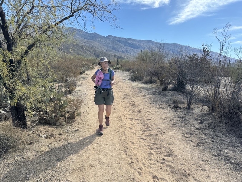
Almost back to the trailhead. Here comes Mom knowing the car is minutes away. This 4.25 or so mile hike was a nice way to wrap up our week in Tucson.
--January 3, 2024 at 12:50 PM.
Maps are centered on the photo: Google map, Apple map, OpenTopoMap map