Saturday, October 3, 2026

The Final Walk - South of Gargnano (October 1, 2026)

We have 2 full days left but I am pretty sure that this will be the last official walk. There is one more I think would be lovely to do but it requires a lot of public transportation to get to and from and we just are not up for that effort. Getting the times right, managing the fares, and just being in transit is just more than is wanted. Therefore, the final full day - tomorrow - we will do something else. But that is for tomorrow and today is today and we are going to explore just south of town.

Right away we had a bit of confusion about the directions. I suppose they are correct in there way but they are not well written. Perhaps there is a way to walk behind the large building to the next intersection where we start the climb up into the mountains but we did find our way: just not as easily as we should have done. We had been wondering how people moved boats to and from the lake. We were about to learn as we came upon a boat yard. A modest-sized boat was being pulled along by a truck which was reasonable enough; then, a fellow carrying some type of remote controller came on by and it seemed he was controlling the vehicle that had a bigger boat on it as he walked down the narrow and sloping alley down to the cobblestone road that runs through town (actually at that point it is paved). I don’t think I am describing this as well as I should because it certainly got an “oh ah” type impressed sound from Mom and Dad.

We continued up the incline steadily leaving the lake behind. People who live here and walk around no doubt develop good leg muscles beause if you are even a moderate distance from the lake you are likely ascending or descending. The walk was already proving a nicer choice as we ascended a forested path a few hundred meters before re-joining a small paved road that eventually took us to a lovely cometary where we could catch our breath for a moment. The morning was warming up. The road steepened as we passed through the hamlet of Fornico. If you need to get anything you definitely need some sort of conveyance to help you. You aren’t going to carry much on your back given the steep inclines you must contend with. For that matter I don’t think we have seen a grocery or even small market store nearby - I am sure we must have seen something down by the part of Gargnano where the promenade is located which is the better part of a mile from here let alone a hamlet like Fornico.

We worked our way along another wooded path and as we passed a fenced property we were surprised by loud and brash braying. I am pretty sure that was a donkey giving us a vocal announcement though I suppose it could have been a mule. We think we know were the manure piles on the path came from. He settled down swishing his tail and ears to drive off the flies that were all around. All we could do was hurry on and hope those flies would stay with the larger beast. They pretty much did.

Now and then the views would open up and we could gaze out across the sloping lands towards Lake Garda about 2km distance and nealry 200 meters below our vantage point. The views would have been lovely if it hadn’t been hazy. We continued on our way passing through settlements here and there, past a small church that’s clearly still in active use, and by many homes. Soon we descended down towards Cecina.

We hoped to get a bite to eat there but the restaurant the notes mentioned was serving far more substantial food than we wanted. We found it with the help of a, I think, local lady who gave us directions but it’s too bad she couldn’t point us at something better. We did find the tiny grocery/market where the proprietor made us baguette-style salami and cheese sandwiches. Plain but sufficient. We found him just in time as he quickly closed up shop for I suppose an afternoon siesta. It seems pretty common for small shops around here to take several hours off in the afternoon.

We worked our way out of Cecina passing a restaurant that probalby would have served us well had we only known about it before getting our market lunch. But we continued on leaving town and starting the walk alongside and through the local golf course. It’s nestled in here, a long skinny course with an unknown number of holes. People were smacking golf balls and hopefully having fun. Our fun we limited to Dad finding a stray Wilson golfball on the road. We were well over halfway on the walk. We just had to pass by one more restaurant which may have just been open before we arrived but was clearly between lunch and dinner service as we sat on cushioned benched to eat oranages. One last little incline to go.

We descended down minor roads and then along a cobblestone pedestrian path that swtiched back and forth by a more major road as we headed down into the village of Bogliaco. Had anything like a gelato shop been open I think we would have stopped but despite having a sizeable square on the lakefront it seemed pretty dead to us. We soon found our way out of town and hugging the narrow sidewalk along the busy lake road as we walked the last several hundred meters past the stony beach associated with the hotel, and then 200 meters further along to the best feature around here: the gelato shop. After our several hours out in the sun and nearly 10km of walking we were quite ready to enjoy a couple scoops of gelato.

We had dinner away from the hotel again. While Mom and Dad had pasta dishes I tried a veal scallopini in mushroom sauce. My meal wasn’t bad but I suspect they fared better. However, it was nice to sit outside before the sun set and have dinner by the lake.

Photos
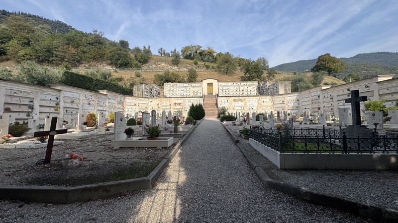
Photo taken Oct 1, 2026 at 10:19 AM

The quiet cemetery in the foothills above Gargnano.

--October 1, 2026 at 10:19 AM.

Maps are centered on the photo: Google map, Apple map, CalTopo mapOpenTopoMap map
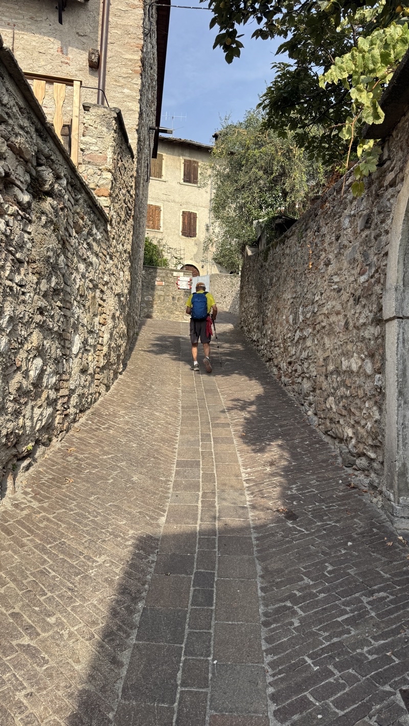
Photo taken Oct 1, 2026 at 10:36 AM

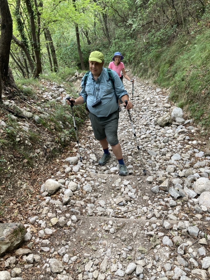
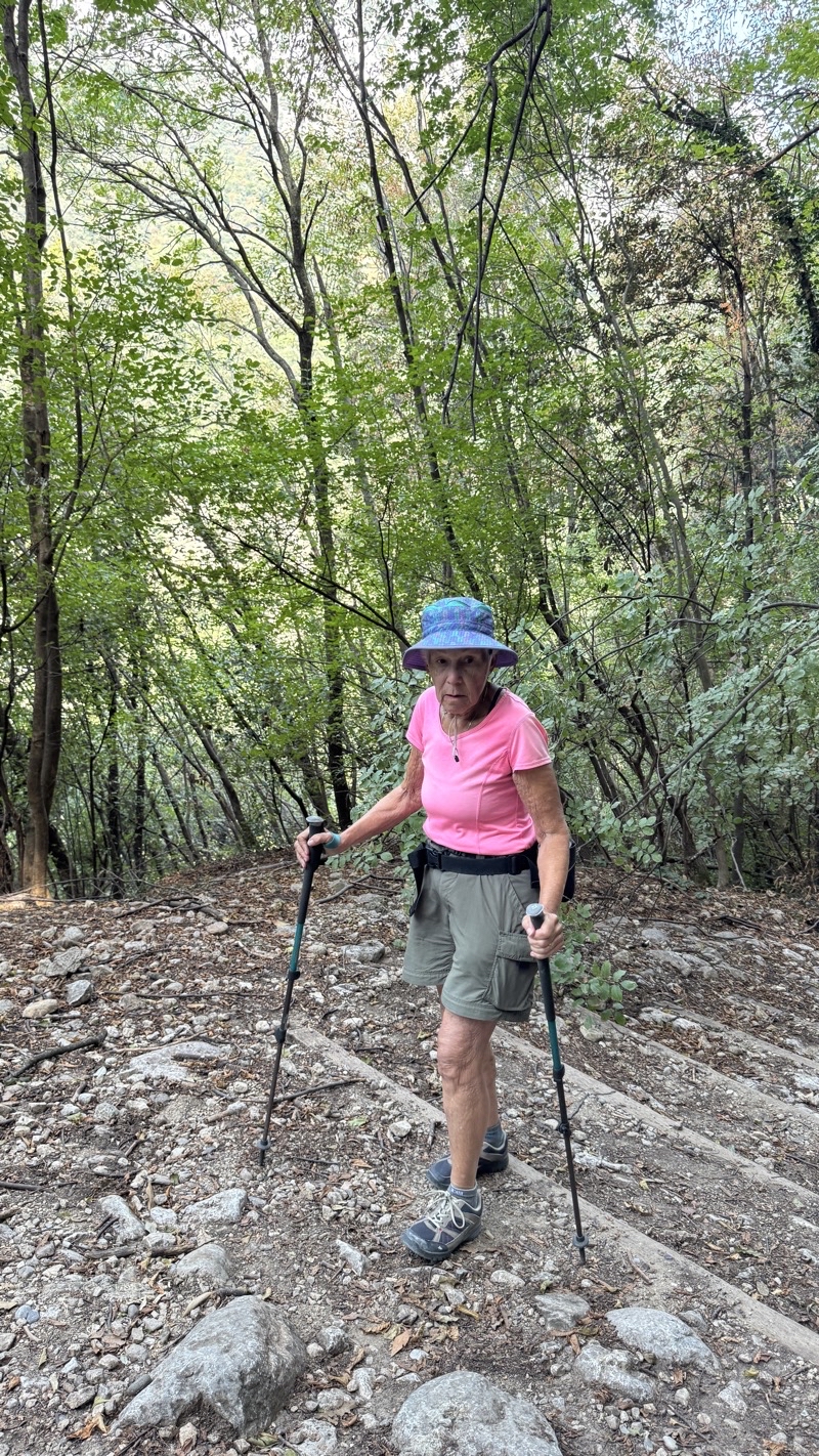
Climbing up or down is the way of things here. Your brakes, mechanical or biological, better be in good shape.

--October 1, 2026 at 10:36 AM.

Maps are centered on the photo: Google map, Apple map, CalTopo mapOpenTopoMap map
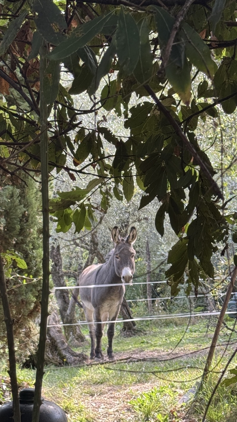
Photo taken Oct 1, 2026 at 10:51 AM

Donkey or mule? When he treated us to a surprisingly loud bray I thought donkey but we aren’t sure. But perhaps we now know where the animal droppings on the wooded path came from.

--October 1, 2026 at 10:51 AM.

Maps are centered on the photo: Google map, Apple map, CalTopo mapOpenTopoMap map
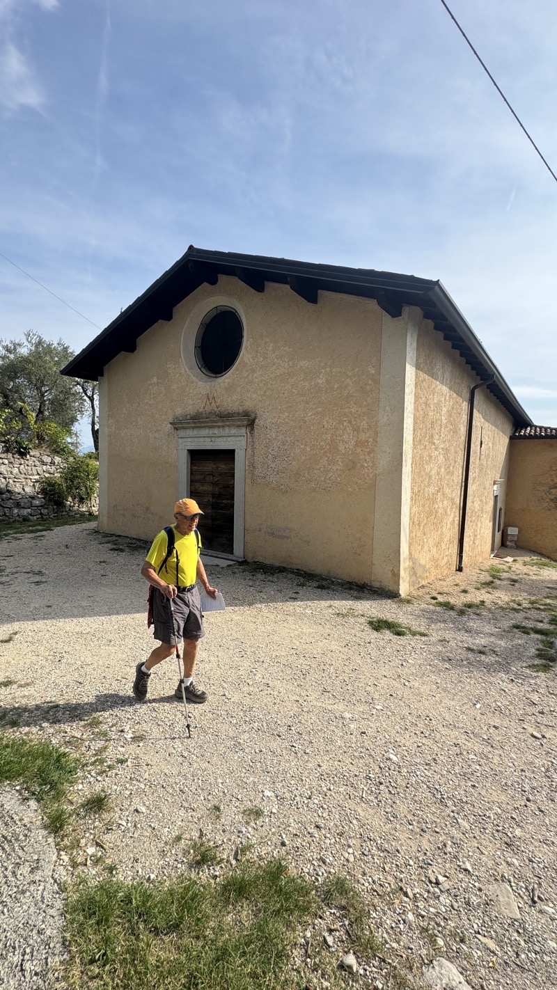
Photo taken Oct 1, 2026 at 11:03 AM

This church is still in use. Dad took a peek inside and said it looked quite nice. I couldn’t see much.

--October 1, 2026 at 11:03 AM.

Maps are centered on the photo: Google map, Apple map, CalTopo mapOpenTopoMap map
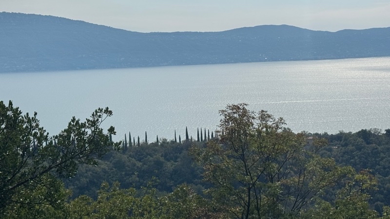
Photo taken Oct 1, 2026 at 11:22 AM

Hazy views of Lake Garda a couple hundred meters below and almost 2km distant.

--October 1, 2026 at 11:22 AM.

Maps are centered on the photo: Google map, Apple map, CalTopo mapOpenTopoMap map
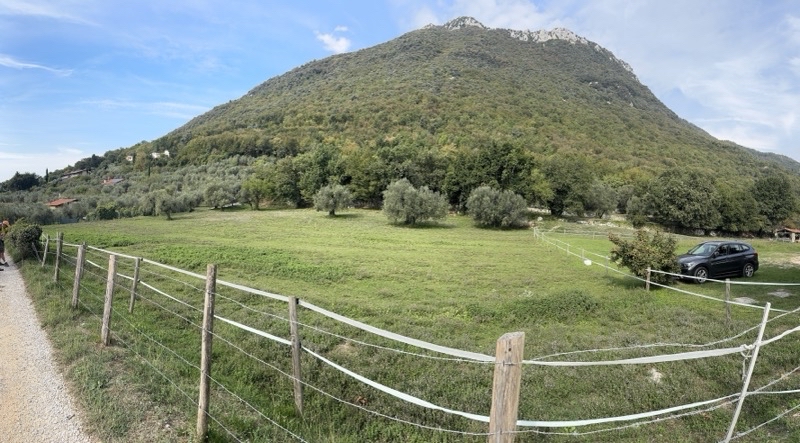
Photo taken Oct 1, 2026 at 11:33 AM

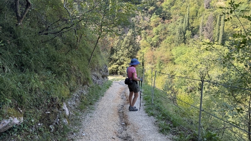
As you can see there is land here that is flat and ample enough for building. It just feels like we are either going up or down the bulk of the time.

--October 1, 2026 at 11:33 AM.

Maps are centered on the photo: Google map, Apple map, CalTopo mapOpenTopoMap map
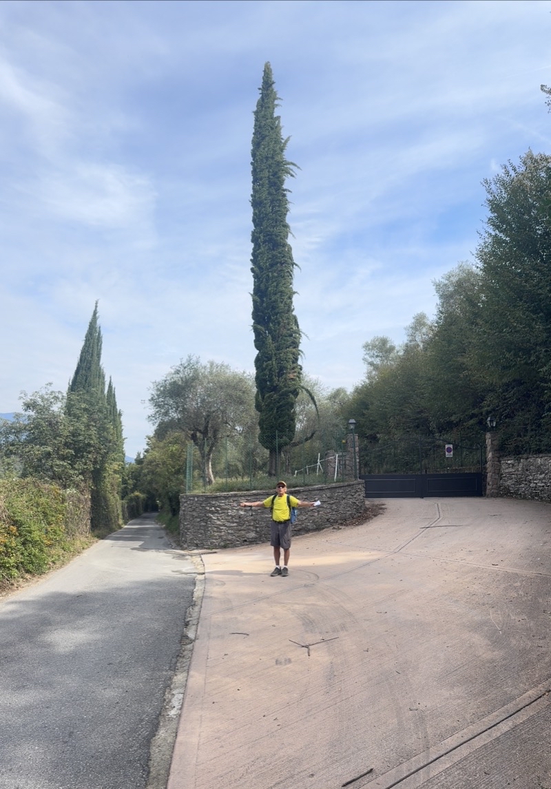
Photo taken Oct 1, 2026 at 12:52 PM

We think this is an Italian Cypress tree and it’s 50-60 feet tall though it looks taller as Dad provides scale.

--October 1, 2026 at 12:52 PM.

Maps are centered on the photo: Google map, Apple map, CalTopo mapOpenTopoMap map
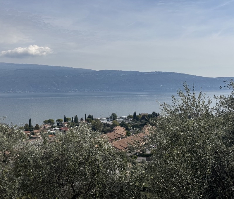
Photo taken Oct 1, 2026 at 1:54 PM

Above Bagliaco. At this point I think we are about 2.5km from the hotel and a bit farther from a welcome treat of gelato. It’s all downhill from here.

--October 1, 2026 at 1:54 PM.

Maps are centered on the photo: Google map, Apple map, CalTopo mapOpenTopoMap map

Friday, October 2, 2026

A Surprising Discovery in Gardone (October September30, 2026)

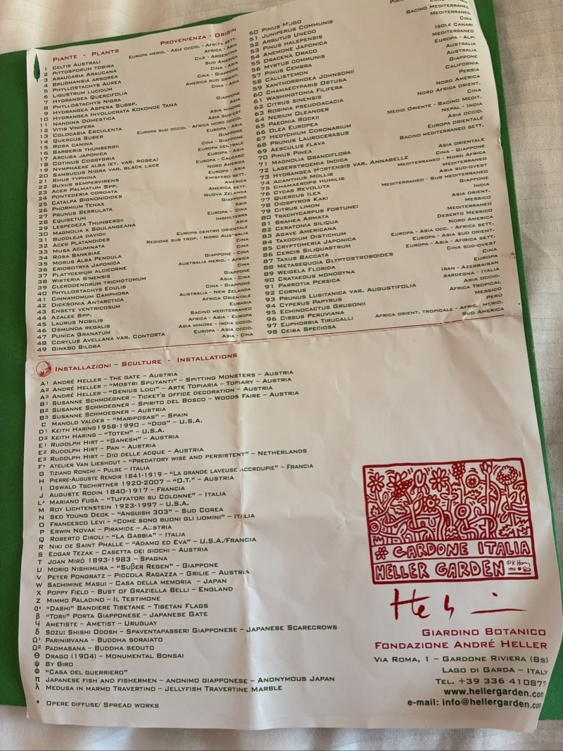
After our walk through Valle delle Cartierewe wanted a more relaxing day. One of the excursions that Inntravel recommends is a vist to the town of Gardena Riviera. They mention two places that could be of interest but we really would just focus our attention on the botanical garden. This is a 1.5 hectare garden that was created in 1910 and developed until 1971 by Arturo Hruska. The notes tell us he was a dentist and avid naturalist. I think it is this second aspect of his life that should be focused on. What he built is remarkable. There are 500 species of plants here from all over the world. If you know your plants you will find all sorts of things to marvel at. Even if , like me, you know next to nothing you will enjoy yourself as you stroll the twisting paths amongst the lush plantings that are everywhere.

If art is more your thing than plants then you will fare just as well as there are scores of sculptures throughout. The garden is a feast for the senses. There are places to just sit and relax too. I am not going to attempt to truly describe what we saw. We spent a couple hours just enjoying our time in this quiet bit of property admiring what was created and now is sustained by the Andre Heller Foundation which took ownerships in 1988.

We did explore a bit more of the town after leaving the garden but that was the highlight of the day for us.

Photo taken Sep 30, 2026 at 10:21 AM
Photo taken Sep 30, 2026 at 10:22 AM

Photo taken Sep 30, 2026 at 10:22 AM

This will give you a sense of how the paths twist and turn through the numerous art works, pools of water, plants, and the few buildings. Photo by Judy.

--September 30, 2026 at 10:22 AM.

Photo taken Sep 30, 2026 at 10:22 AM

We are visiting the Heller Garden in Gardone. Built from 1910-1971 by Arturo Hruska this is a 1.5-hectare garden. In 1988 the Andre Heller foundation took ownership.

--September 30, 2026 at 10:22 AM.

Maps are centered on the photo: Google map, Apple map, CalTopo mapOpenTopoMap map

Photo taken Sep 30, 2026 at 10:30 AM

Paths wind through all sorts of plants , sculptures, and water features.

--September 30, 2026 at 10:30 AM.

Photo taken Sep 30, 2026 at 10:35 AM

A Buddha in a water feature. Contemplative in this quiet lush spot.

--September 30, 2026 at 10:35 AM.

Photo taken Sep 30, 2026 at 10:43 AM

Anguish by South Korean artist Seo Young Deok is a good representation of how dad looked and felt the afternoon he slammed his head into the limestone wall of a building on the island of Gozo during the storm just about two weeks ago. In this setting, I wonder why the sculpture is feeling anguish.The piece is made of bike chains.

--September 30, 2026 at 10:43 AM.

Photo taken Sep 30, 2026 at 10:47 AM

Ken by Totem created by Keith Haring. Photo by Judy.

--September 30, 2026 at 10:47 AM.

Photo taken September 30, 2026, 11:19 AM 

I can certainly agree with the idea this fellow seems to have about diving into the water. I can’t describe the wide variety of plants and sculptures here. Hundreds of species; scores of sculptures. It’s a remarkably maintained space.

--September 30, 2026 at 11:19 AM. 

Photo taken September 30, 2026, 11:30 AM

Topiary. It’s the same one viewed from the back on the left and the front on the right.

--September 30, 2026 at 11:30 AM. 

Photo taken Sep 30, 2026 at 11:30 AM

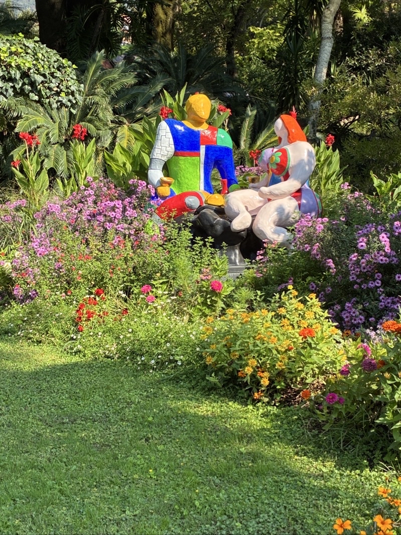
Adam and Eve by Niki de Sant Phelle. Photo by Judy.

--September 30, 2026 at 11:30 AM.

Photo taken Sep 30, 2026 at 11:35 AM

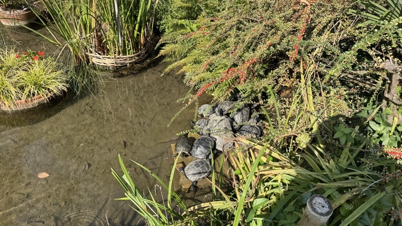
We watched these turtles for a minute or two.

--September 30, 2026 at 11:35 AM.

Photo taken Sep 30, 2026 at 2:26 PM

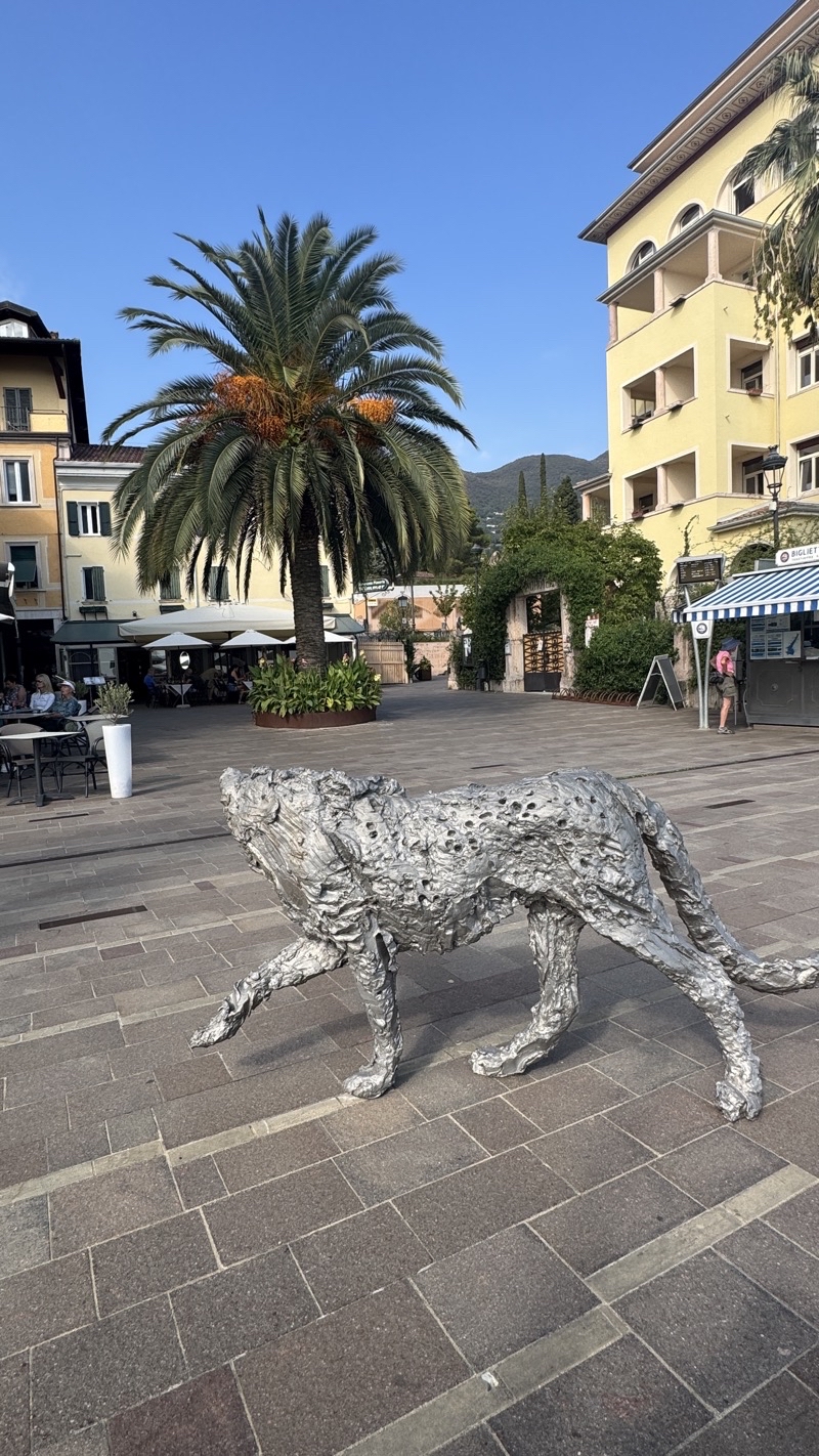
Should this large dog be facing the lake if it is meant to guard the town of Gardone Riviera from the lake? It is impressive no matter what is actually being guarded. Mom is off in the shade on the right. We are waiting for the ferry to arrive and return us to Gargnano.

--September 30, 2026 at 2:26 PM.

Maps are centered on the photo: Google map, Apple map, CalTopo mapOpenTopoMap map
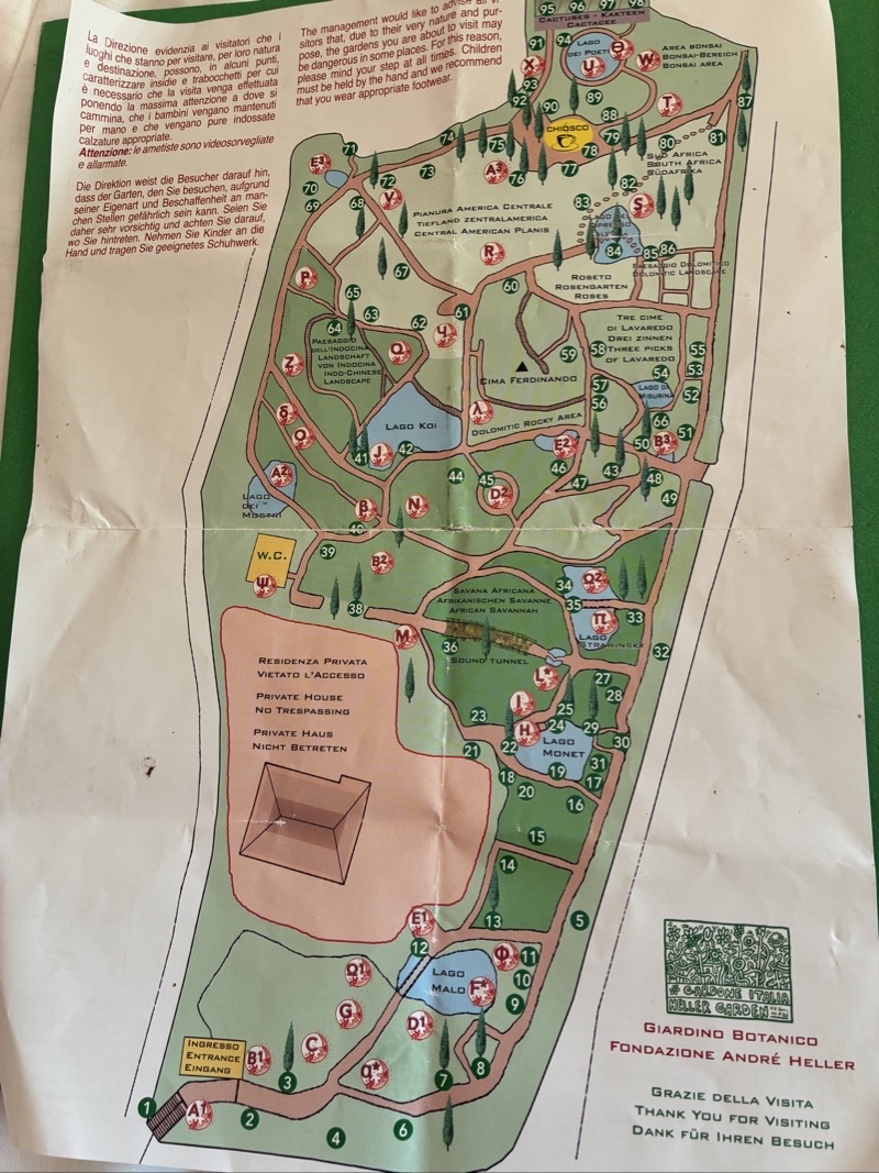
Photo taken Sep 30, 2026 at 2:47 PM

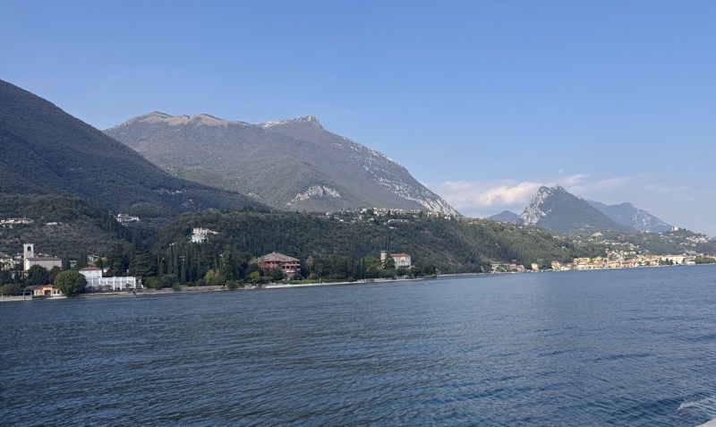
On our way back to Gargnano. It is about a 40 minute ferry ride. If you are in a hurry and want a less expensive option than the bus system is definitely the way to go, and on the busses you get to see the small towns you passed through as well, but there is something special to be said about taking the ferry and I’m glad we chose to do so going both ways. After all, we certainly are not in a rush.

--September 30, 2026 at 2:47 PM.

Maps are centered on the photo: Google map, Apple map, CalTopo mapOpenTopoMap map
Thursday, October 1, 2026

Into the Mountains and Calle delle Cartiere (September 29, 2026)

The morning dawned overcast. That is a first for this trip. We found our way to the local bus stop and took an easy ride down to Toscolano-Maderno just about 3 miles south of here. The plan today was to explore a little into the mountains and valleys that surround Lake Garda. We were going to climb up into Valle delle Cartiere (Valley of Paper or Valley of Paper Mills perhaps). The valley was a regional center for the making of paper for some 400 years from the 16th through at least some of the 20th century. Numerous buildings remain and there is a museum dedicated to the history of the valley. But we would just note those in passing.

Getting into the vallley is a nice experience. You gradually travel upstream along Torrente Toscolano along a reasonably quiet paved road. You pass through several tunnels that I assume have been there in one way or another for hundreds of years. What a task it must be to make even a sort tunnel before the age of high explosives. To be sure gunpowder-based explosives existed but that probably couldn’t help in a huge way.But what do I know: nothing really. In a little more than a kilometer you start to see the old buildings. Some of them are clearly derelict but others have been re-purposed and are still in use today. It is a pretty enough spot that I can imagine, if the cafe is any good, people come here for a view and a bite to eat. There is a parking area within a couple hundred meters aftr all. But our goal was to walk so we moved on down the road.

In time we crossed the stream again, flowing rather farther below than we expected, and soon we would tackle the major ascent of the walk.

The big climb travels 670 meters in length gaining about 75 meters in angle of ascent as it goes. Most of that climb, about 500 meters, is along a path through forest on a proper trail. The trail does switch back and forth some but really it is a steady climb up the shoulder of the valley wall. Along the way you climb up well over 100 shallow steps to gain elevation. THe grade is certainly more than 10%. It’s a shame the path is so heavily forested because you really have no views as you leave the valley floor behind. When you clear the forest and start travelling up a rough road to cover the remaining distance to the top you still do not have views: just a steady climb. We found a shrine up there and soon began our descent down through a village whose name I do not know.

Construction sounds banged and boomed in this tiny high village. We didn’t even check to see of the local bar was open for cold drinks. It wasn’t really inviting. We pushed on ahead down a decent road that passed by plenty of homes as it gradually descended. Things changed to a dirt road, then track, and then a dirt and stone trail. Down we went.The grade was gentler but the footing a bit tougher. But we were in the mountains and off hard surfaces. That was nice even if the walk wasn’t going to live in our memories for scenic views. Over 2km we steadily descended back towards the bridge we had crossed a few hours earlier. In time the path widened out to a better quality track but it still was never really scenic. We were getting our work in.

Eventually we found our way back towards the complex of buildings that includes the extensive paper museum. We had hoped to get a bite to eat but they seemed rather swamped with patrons and just one fellow servicing tables. We managed to get some Magnun ice cream bars.

Down the road back to town. The sun was out and the afternoon ws warm. We were ready to be done. We found the bus stop and had a modest wait before catching the bus back to the stop by the hotel. An afternoon of rest before finding tasty pasta and pizza dinners at a restaurant in the heart of Gargnano (the place we had been the night before seemed closed), and then an easy walk under surprisingly well lit streets back to our hotel ended our day.

Photos

Photo taken Sep 29, 2026 at 9:40 AM

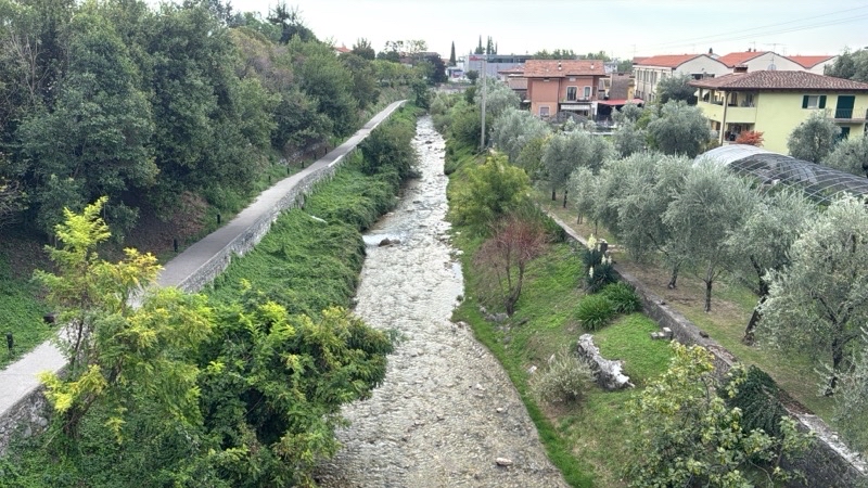
Torrente Toscolano. It sounds impressive with the translation I believe would be Stream Toscolano. But it is clearly a lengthy stream rising up into the valley we are about to explore.

--September 29, 2026 at 9:40 AM.

Maps are centered on the photo: Google map, Apple map, CalTopo mapOpenTopoMap map
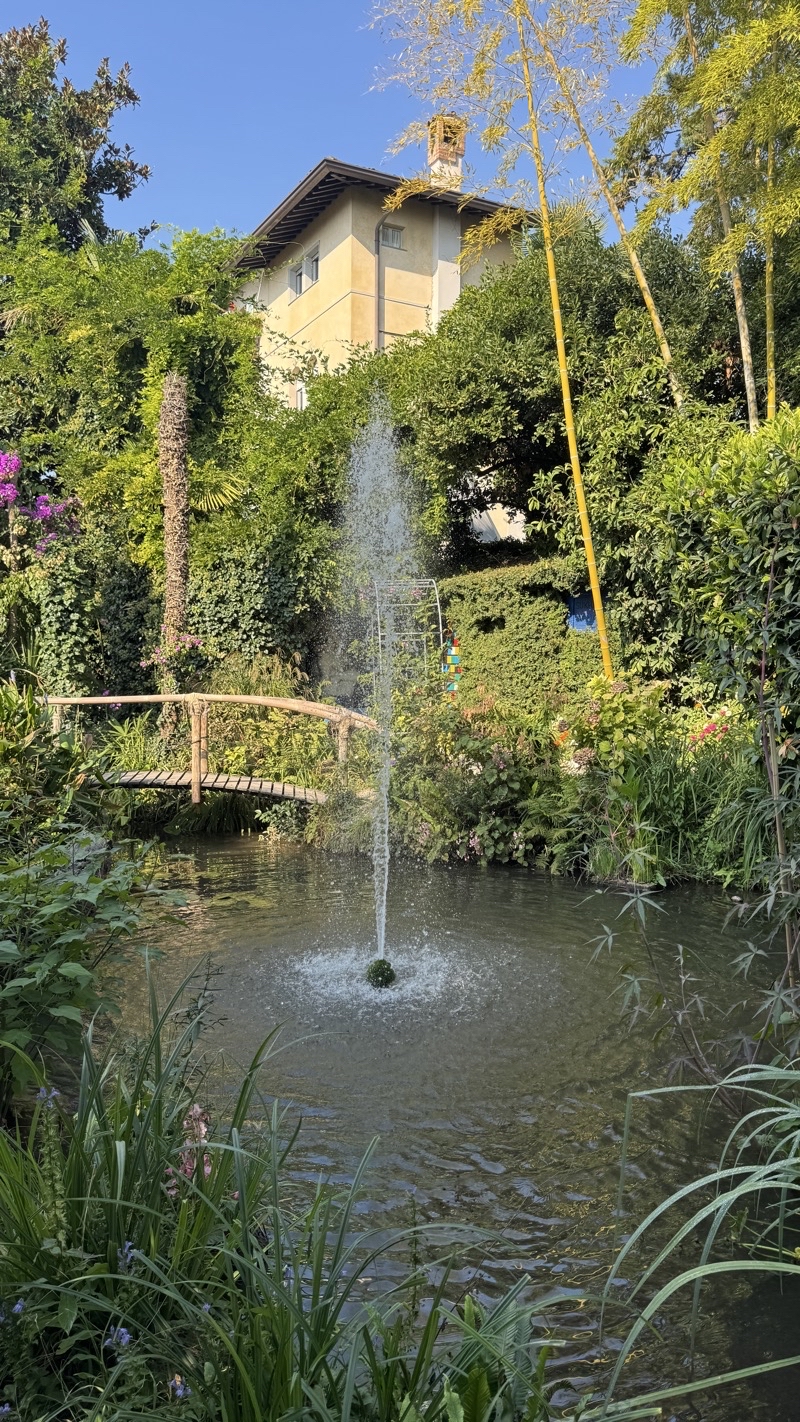
Photo taken Sep 29, 2026 at 10:10 AM

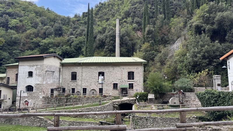
One of many buildings, some no longer in use, that is centuries old. I believe this one with its one remaining tall chimney started as a paper mill back in the 16th century. We are in Valley delle Cartiere where paper making was a major industry for close on 400 years.

--September 29, 2026 at 10:10 AM.

Maps are centered on the photo: Google map, Apple map, CalTopo mapOpenTopoMap map
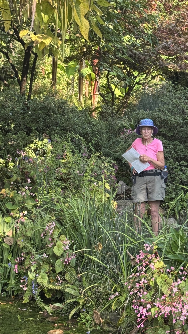
Photo taken Sep 29, 2026 at 10:22 AM

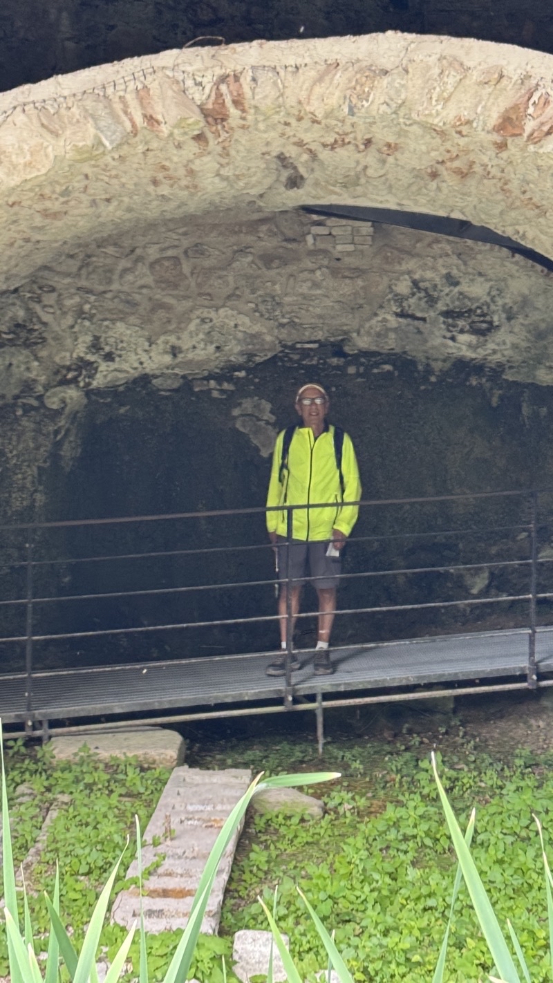
Dad is standing in these ruins of buildings.

--September 29, 2026 at 10:22 AM.

Maps are centered on the photo: Google map, Apple map, CalTopo mapOpenTopoMap map
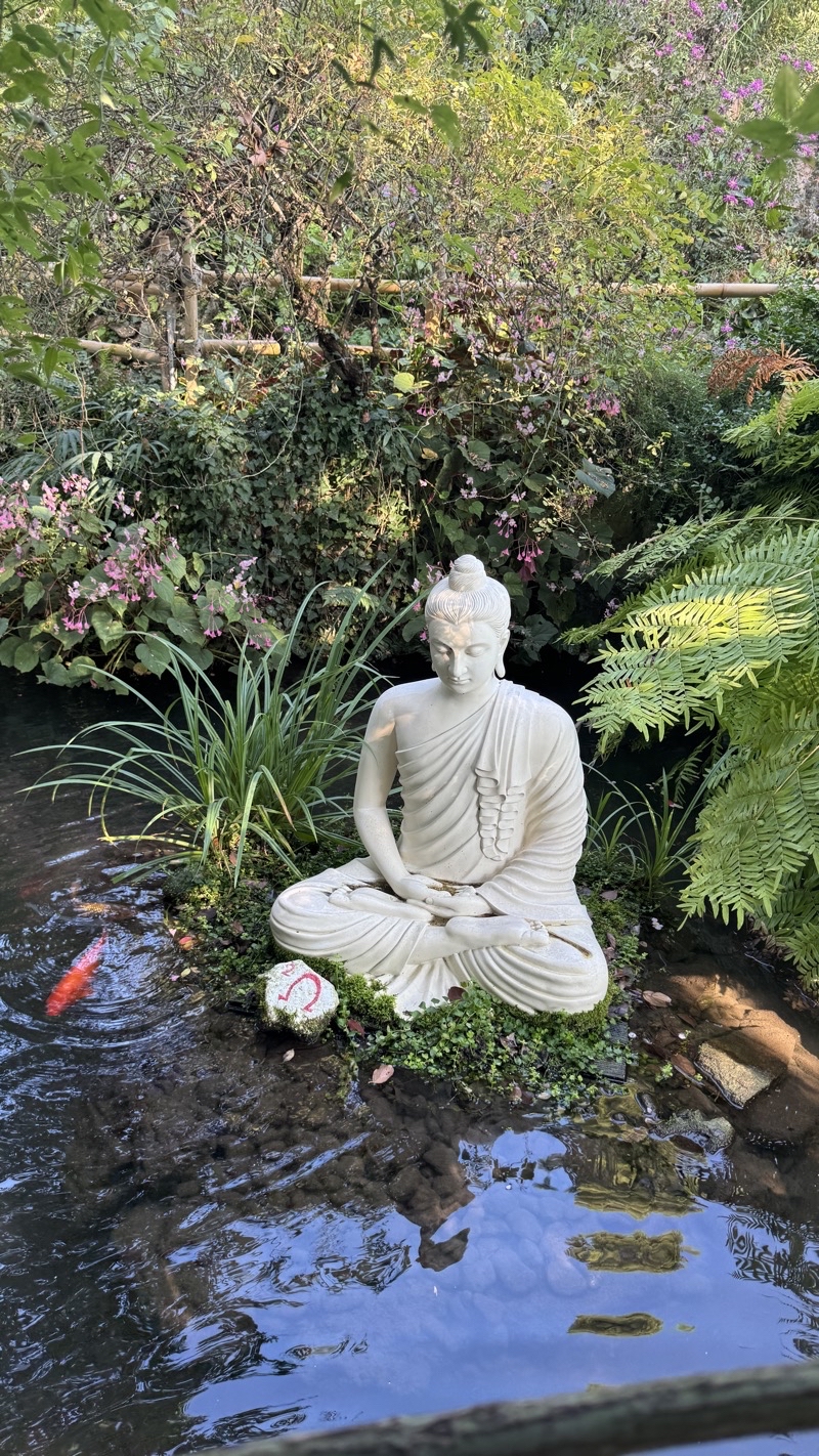
Photo taken Sep 29, 2026 at 10:39 AM

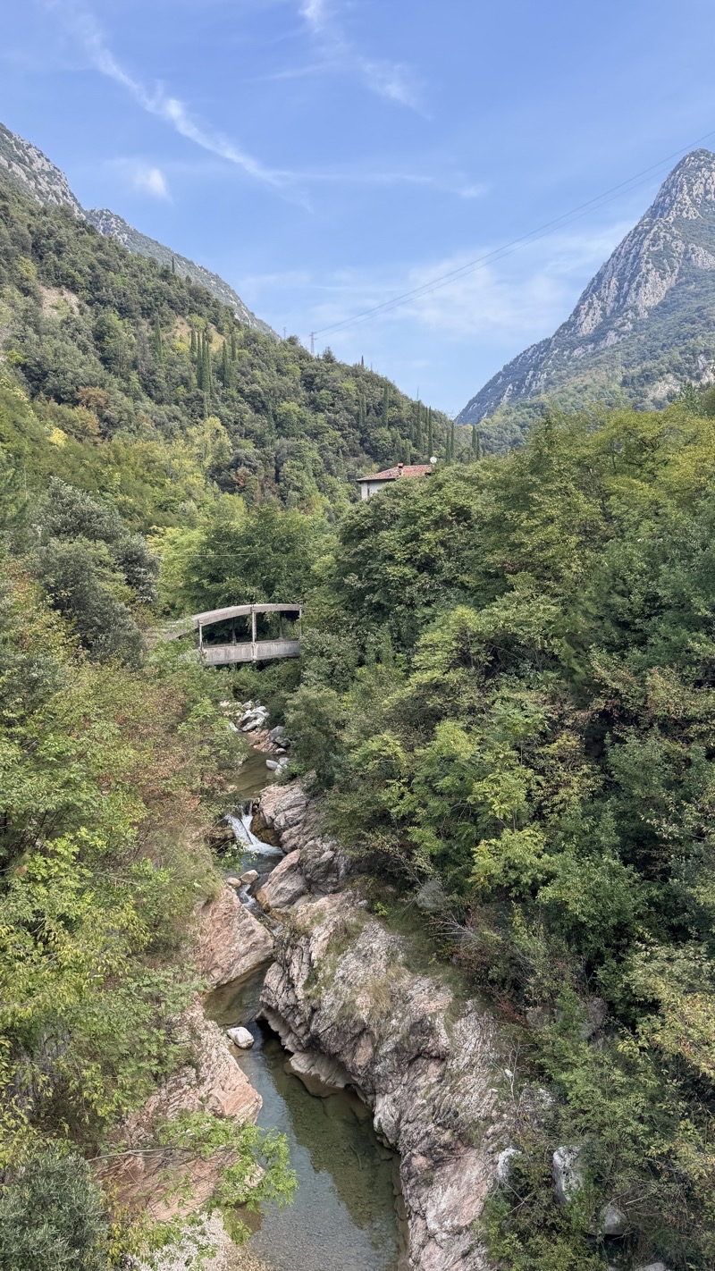
Crossing Torrente Toscolano. There is an old bridge up there.

--September 29, 2026 at 10:39 AM.

Maps are centered on the photo: Google map, Apple map, CalTopo mapOpenTopoMap map
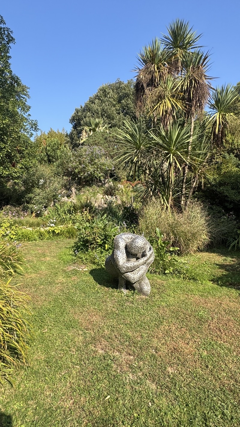
Photo taken Sep 29, 2026 at 11:04 AM

Near the start of our climb up a large number of short steps along this trail up the valley wall. Photo by Jonathan.

--September 29, 2026 at 11:04 AM.

Maps are centered on the photo: Google map, Apple map, CalTopo mapOpenTopoMap map
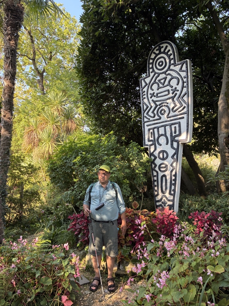
Photo taken Sep 29, 2026 at 11:16 AM

We are in the middle of a steady steep ascent. The notes suggest it’s about 670 meters long with about 500 meters along this stepped forested path and the rest on a roughly paved road. I think we gained 75 meters in elevation. Because the path is forced, you do not actually have expanse views of the valley down below.

--September 29, 2026 at 11:16 AM.

Maps are centered on the photo: Google map, Apple map, CalTopo mapOpenTopoMap map
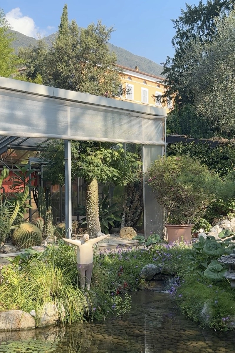
Photo taken Sep 29, 2026 at 1:06 PM

After the big asscent we passed through the remote village whose name I do not know. Construction was making an awful racket. We should’ve seen in the bar was open to at least get a cold drink. We pushed on ahead instead down a road, gravel road, a trail that eventually became more of a wide dirt track. Down we went over 2km dropping 200 meters or so. At this point we are nearing the bridge we crossed a few hours earlier.

--September 29, 2026 at 1:06 PM.

Maps are centered on the photo: Google map, Apple map, CalTopo mapOpenTopoMap map
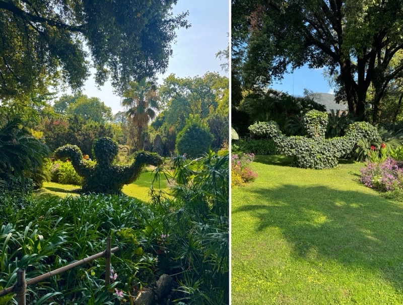
Photo taken Sep 29, 2026 at 2:23 PM

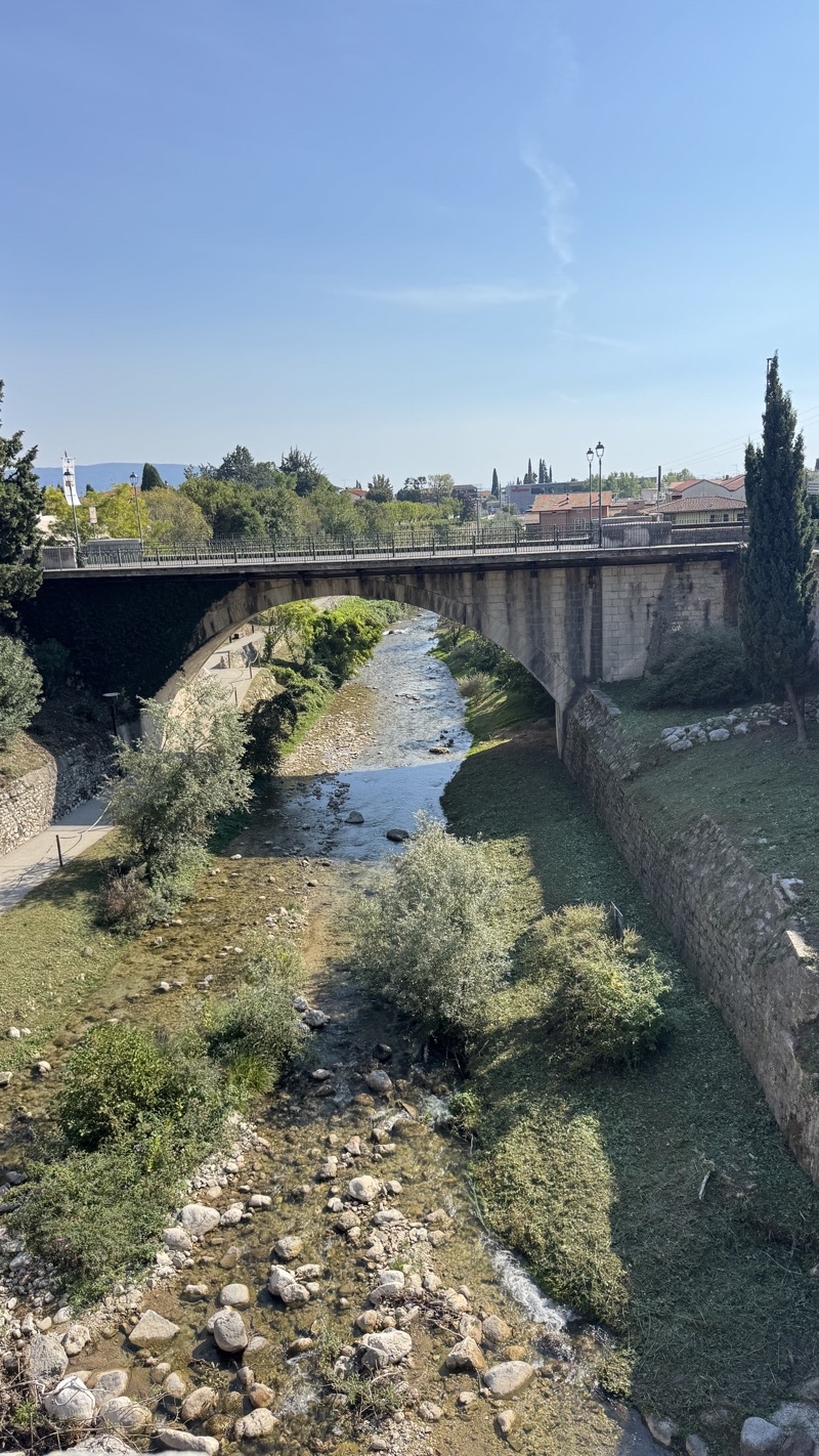
We tried to get a snack at the cafe at the museum devote to the Valley delle Cariete’s history in paper making. Too busy. We snagged a couple Magnum bars. Then it was time to retrace our path down the road with its tunnels back to the town of Toscolano-Maderno. The sun is shining now upon the stream that flows into Lake Garda. In time we will catch a bus back to the stop near our hotel.

--September 29, 2026 at 2:23 PM.

Maps are centered on the photo: Google map, Apple map, CalTopo mapOpenTopoMap map