Better Late Than Never
For one reason or another sometimes I do not post much of anything about a trip I have tkaen. This happens even when I have material I could share. Perhaps I just don’t feel a strong urge to share anything at the time. Perhaps I think the photos, videos, or written thoughts I may have had aren’t really good enough. Perhaps I was just lazy. However, now and then I go through old material to see what memories are forced to the surface.Because of this and some prompting from others I am going to slowly and likely with no real process in mind start to share what hasn’t been shared before.
Rae Lakes Loop in Kings Canyon National Park: August 31 through September 6, 2017
Andy and I visited the Rae Lake May 2016 and only went as far as Dollar Lake. There was plenty of snow and the snow-line was, as I recall, around 9,400 feet. streams were flowing with great vigor and we made much use of our Crocs as water shoes. It was a totally different experience for us than this late-summer trip would turn out to be. That may be an obvious statement but it bares keeping in mind. For Steve and Mark this was their first backpacking trip. It was a 45th birthday treat for him. We had already changed our plans at the last minute so we wanted it to be good (fires closed Yosemite and we switched to the Rae Lakes Loop. This decision was made as I was flying to California to get to Yosemite a day before everyone else to secure a backcountry permit). With all that in mind we got ourselves to Kings Canyon National Park mid-afternoon of August 31, 2017 and got ready for what we all hoped to be a wonderful trip. The photos and video that follow will hopefully give you a good idea of just how well we did.
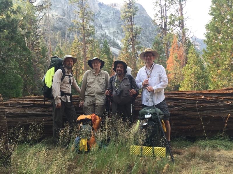
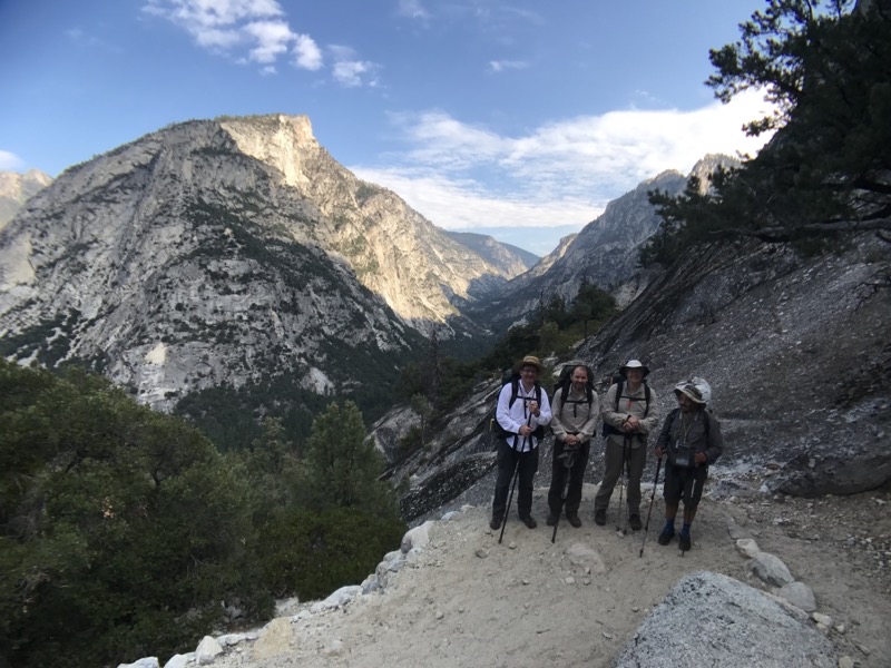
Andy and I got up early to drive over to the backcountry ranger station at Road’s End. We wanted to be there before anyone else might show up to try and get walk-up permits for backcountry travel. A very limited number, as I recall it was 5 per direction of travel, of permits are given each day. We had 4 people in our group so 4 permits were required. It was a good thing we got there as early as we did. A lady backpacker arrived maybe an hour after us: she got the last clockwise-travel permit.
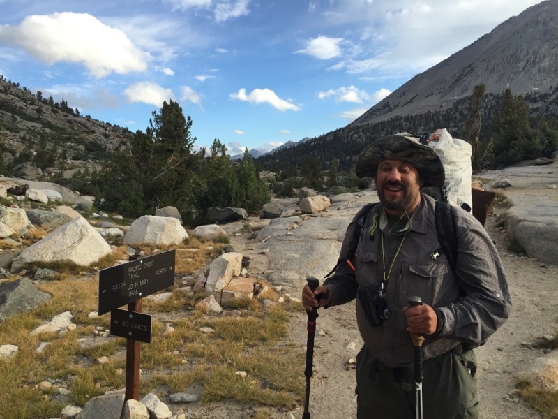
--August 31, 2017 at 5:44 AM. Woods Creek Trail, Shaver Lake, CA, United States
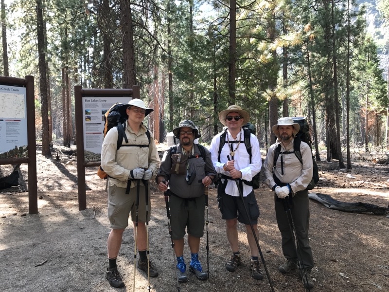
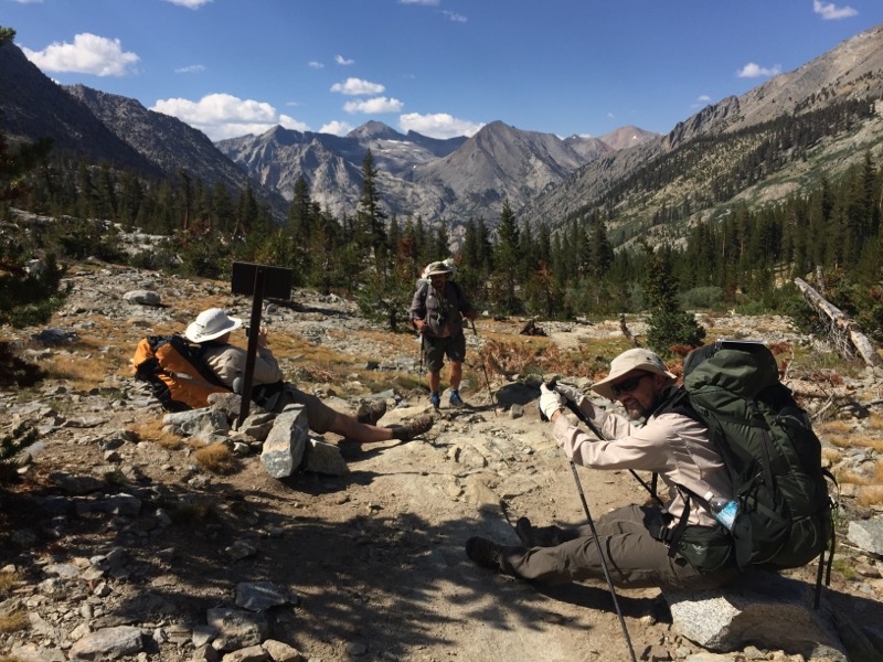
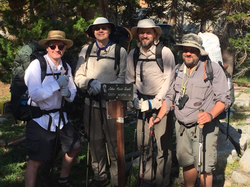
Left to right: Steve, Ken, Andy, Mark. With our packs on we got this photo taken at the ranger station at Road’s End in Kings Canyon National Park.
--August 31, 2017 at 9:27 AM. Woods Creek Trail, Shaver Lake, CA, United States
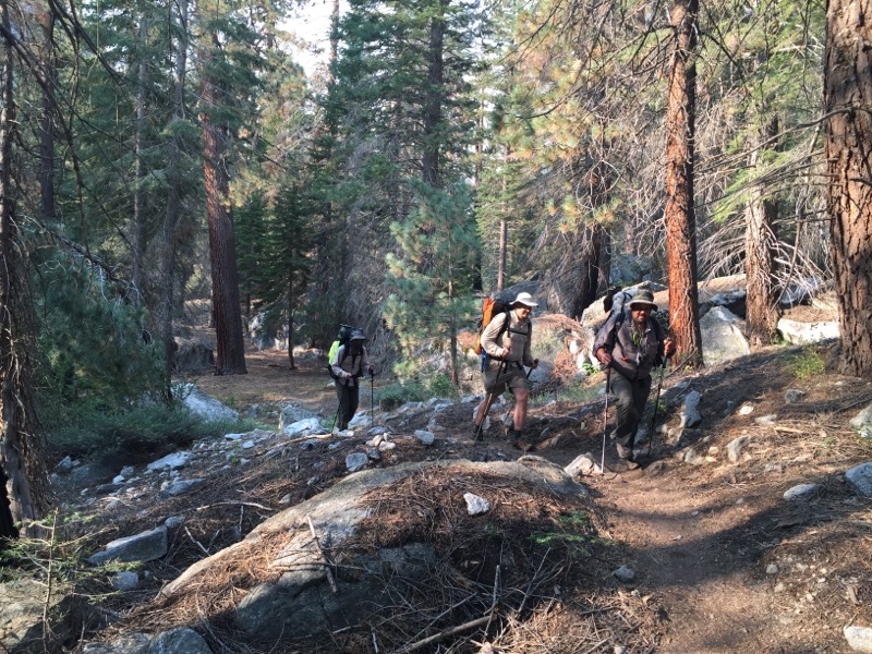
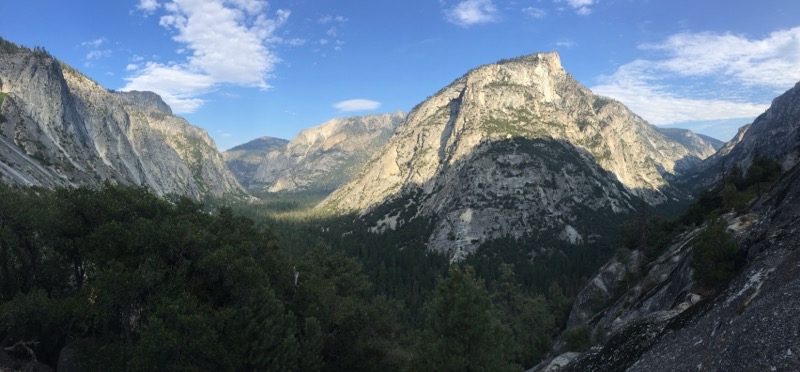
The trail is initally pretty gentle before it swings northward along the South Fork Kings River and rapidly ascentds to Mist Falls. This is a remarkable set of waterfalls of violently frothing water that is a great place to take a break before the push up and on towards Lower Paradise Valley.
--August 31, 2017 at 11:32 AM. Woods Creek Trail, Shaver Lake, CA, United States
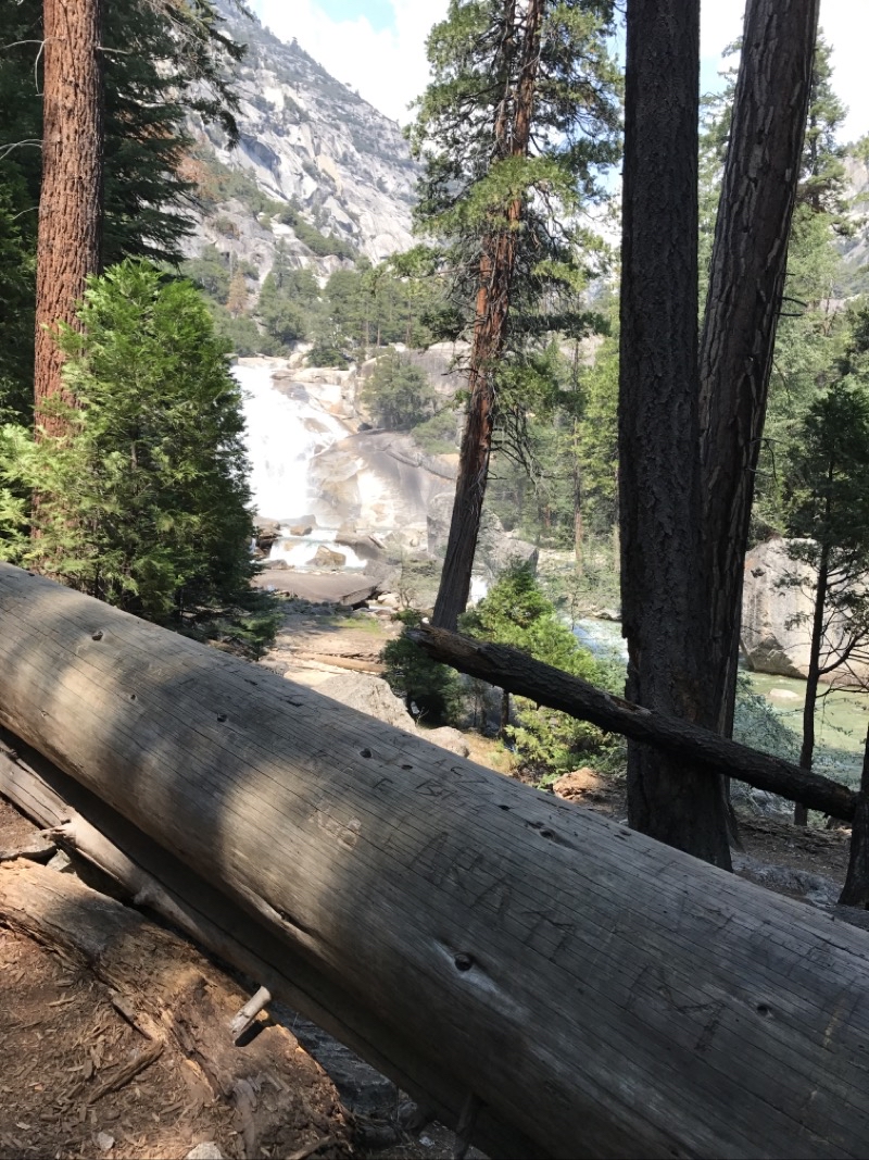
Still in the area of Mist Falls which are definhitely a dayhike worth doing if you aren’t planning a backpacking trip.
--August 31, 2017 at 1:13 PM. Woods Creek Trail, Shaver Lake, CA, United States
We’ve left Lower Paradise Valley where we camped our first night. Almost right away we had to cross some flowing water over downed logs. hoto by Andy
--September 1, 2017 at 8:50 AM. Woods Creek Trail, Shaver Lake, CA, United States
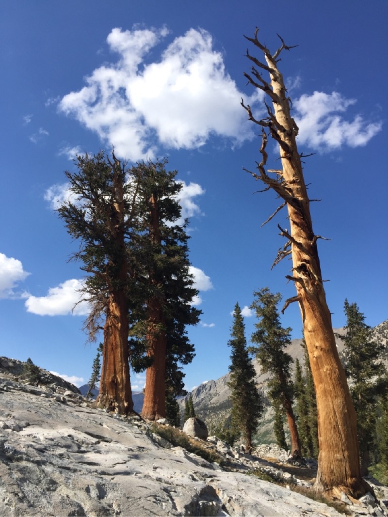
You never find small downed trees in this area even if they aren’t Sequoias (though I think this one was).
--September 1, 2017 at 9:42 AM. Woods Creek Trail, Shaver Lake, CA, United States
Now and then as we gradually ascended you enter a somewhat more open area such as this. Photo by Andy.
--September 2, 2017 at 9:58 AM. Pacific Crest Trail, Shaver Lake, CA, United States
We watched this bear move back and forth along the trail for several minutes. I think it is unlikely the bear did not know we were there as it was quite open terrain and we certainly had no trouble seeing the bear (well I could see it with my monocular). The bear was probably 50 or so yards away though it sure looks closer in the photo. Photo by Andy.
--September 2, 2017 at 11:40 AM. Pacific Crest Trail, Shaver Lake, CA, United States
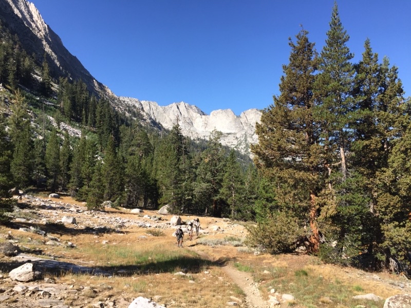
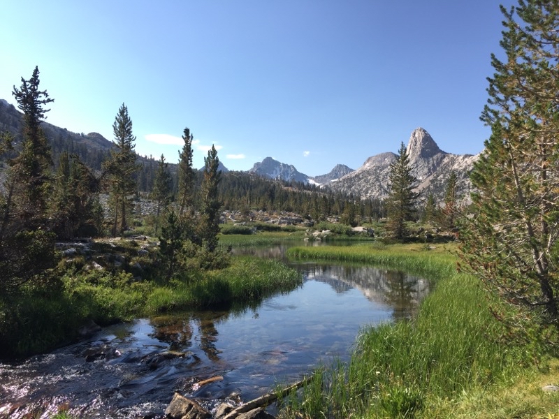
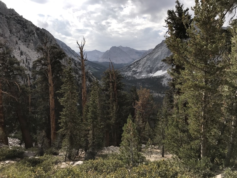
It really opens up after you leave the vicinity of Woods Creek and continue on towards the Rae Lakes Basin. At this point though we are likely within a mile of Dollar Lake on a lovely sunny afternoon. Photo by Andy.
--September 2, 2017 at 3:17 PM. Pacific Crest Trail, Shaver Lake, CA, United States
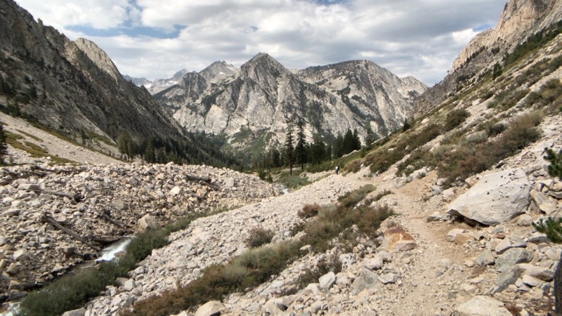
Just a hop, skip, and a jump from Dollar Lake. Trees are growing a bit scarcer but by the lake they abound. Photo by Andy.
--September 2, 2017 at 3:46 PM. Glen Pass S, Shaver Lake, CA, United States
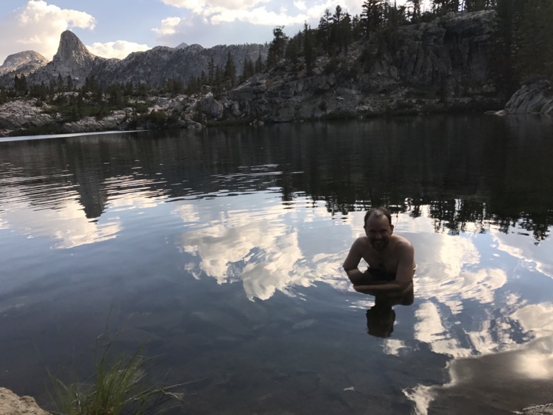
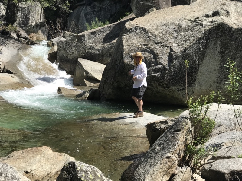
Mark is in the chilly water of Dollar Lake. It did wonders to wash off trail grime but it is definitely chilly. Photo by Andy.
--September 2, 2017 at 4:53 PM. Glen Pass S, Shaver Lake, CA, United States
Our campsite at Dollar Lake. we would move our bear canisters a bit farther away from where they currently are (though probably could’ve been moved farther than we put them). On our way to Dollar Lake we saw a good sized black bear crossing the trail.
--September 2, 2017 at 5:11 PM. Glen Pass S, Shaver Lake, CA, United States
It is approaching sunset at Dollar Lake. This really is a lovely spot to stop if you want to take your time in the region of the Rae Lakes Basin.
--September 2, 2017 at 6:09 PM. Glen Pass S, Shaver Lake, CA, United States
Yes, we are on the John Muir Trail.
--September 3, 2017 at 9:25 AM. Glen Pass S, Shaver Lake, CA, United States
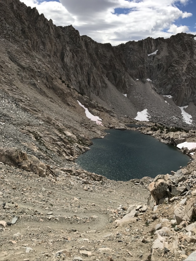
Arrowhead Lake.
--September 3, 2017 at 9:40 AM. Glen Pass S, Shaver Lake, CA, United States
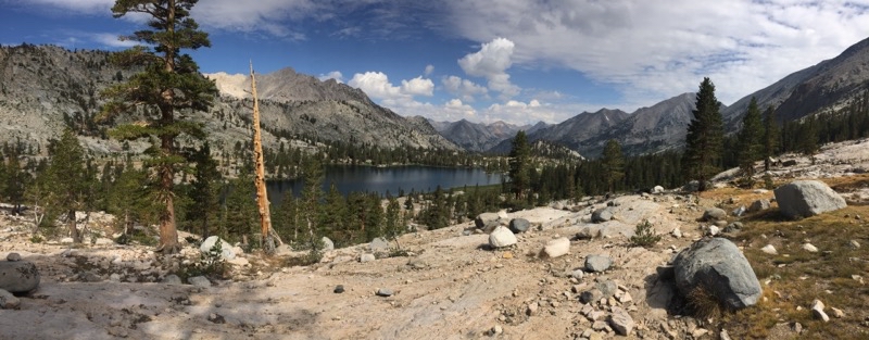
Arrowhead Lake again. It took us a while to pass this lake. Sure was lovely.
--September 3, 2017 at 10:23 AM. Glen Pass S, Shaver Lake, CA, United States
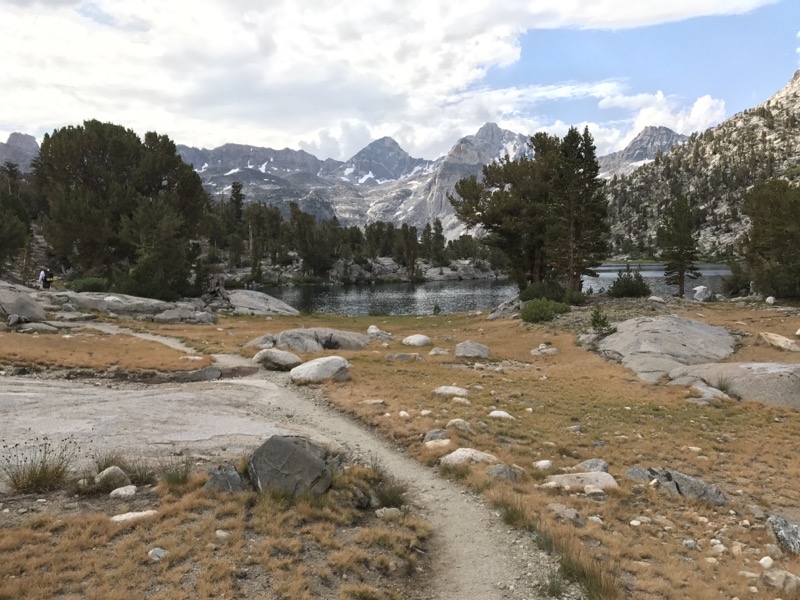
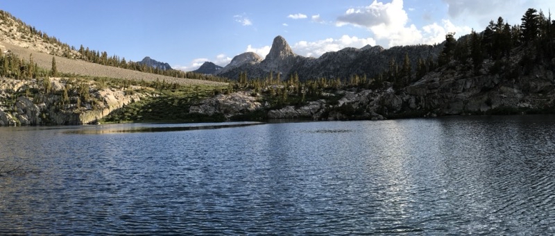
Rae Lake is in view.
--September 3, 2017 at 10:49 AM. Glen Pass S, Shaver Lake, CA, United States
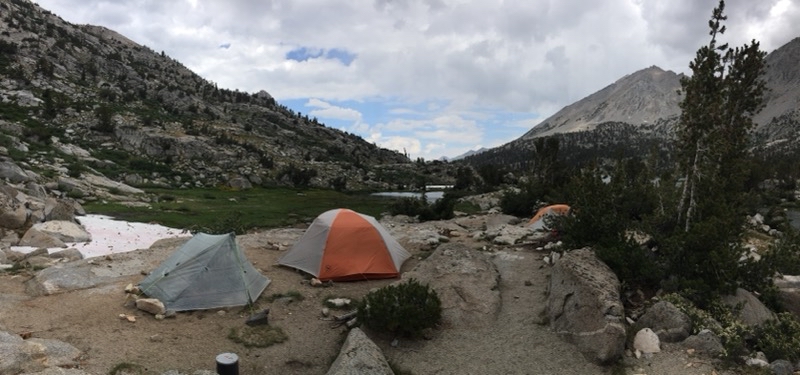
Our campsite within the 60 Lakes Basin. Rae Lake can be seen in the background. Andy and Mark will scamper off on a short dayhike to explore a bit. Steve, who was feeling unwell, got some much needed rest. I just hung out around camp, napped maybe a bit, and just relaxed. Photo by Andy.
--September 3, 2017 at 5:04 PM. Glen Pass S, Shaver Lake, CA, United States
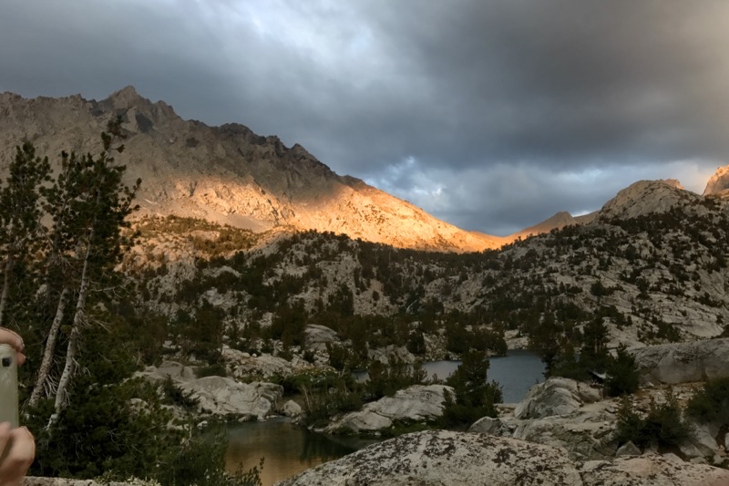
Here comes the alpinglow.
--September 3, 2017 at 6:46 PM. Glen Pass S, Shaver Lake, CA, United States
Dinner under a mixed-up sky.
--September 3, 2017 at 6:49 PM. Glen Pass S, Shaver Lake, CA, United States
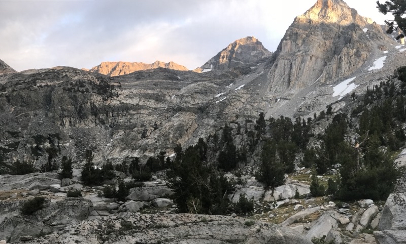
Good morning. We were up before sunrise so we could tackle Glen Pass and be sure to be on our way down the other side before any afternoon storms. Photo by Andy.
--September 4, 2017 at 7:31 AM. Glen Pass S, Shaver Lake, CA, United States
Leaving the 60 Lakes Basin.
--September 4, 2017 at 7:26 AM. Glen Pass S, Shaver Lake, CA, United States

We are climbing up to the pass.
--September 4, 2017 at 7:57 AM. Glen Pass S, Shaver Lake, CA, United States
The wind is rising and the temperatyre is dropping.
--September 4, 2017 at 8:14 AM. Glen Pass S, Shaver Lake, CA, United States
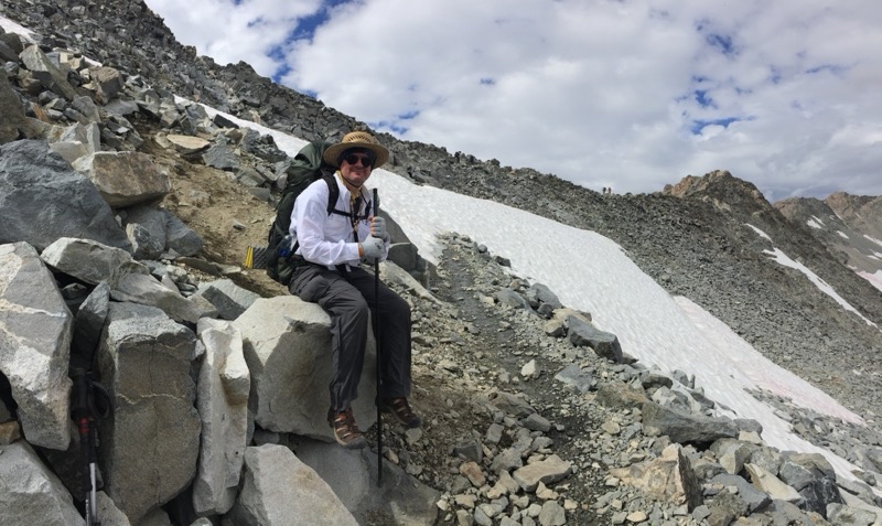
Andy has forged ahead. Mark and I are taking a break as we wait for Steve to catch up. We are almost to the top.
--September 4, 2017 at 10:39 AM. Glen Pass S, Shaver Lake, CA, United States
Almost to the pass. Just have to push through the snow and go a little bit farther. Photo by Andy.
--September 4, 2017 at 10:44 AM. Glen Pass S, Shaver Lake, CA, United States
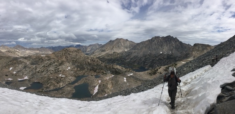
It took about three hours and 20 minutes to reach the pass but I made it. Everyone else did too. Looking ahead to what we have to do send towards.
--September 4, 2017 at 11:15 AM. Glen Pass S, Shaver Lake, CA, United States
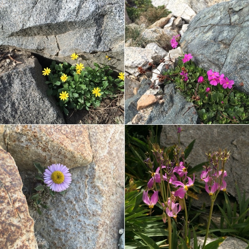
Wildflowers of Glen Pass. Photos by Andy.
--September 4, 2017 at 11:15 AM. Glen Pass S, Shaver Lake, CA, United States
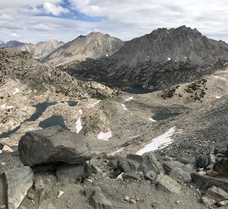
Heading southward off of Glen Pass we would descend steeply down a rocky and somewhat scree-like trail. This still slightly snow-bound tarn would be in view much of the way down.
--September 4, 2017 at 11:36 AM. Glen Pass S, Shaver Lake, CA, United States
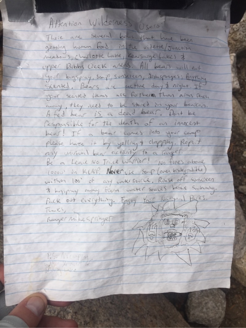
As if we needed more proof that bears are active in the region. We watched a good-sized bear wander back and forth across the trail a couple days previously. Now we encounter this notice by the trail junction to Charlotte Lake. We were continuing on to Vidette Meadow. Photo by Andy.
--September 4, 2017 at 2:51 PM. Vidette Switchbacks, Shaver Lake, CA, United States
Well back amongst the trees.
--September 5, 2017 at 8:45 AM. Vidette Switchbacks, Shaver Lake, CA, United States
It’s hard to see why they call the roaring torrent of water merely a creek: Bubbs Creek froths below.
--September 5, 2017 at 10:46 AM. Junction Meadow Switchbacks-Bubbs, Shaver Lake, CA, United States
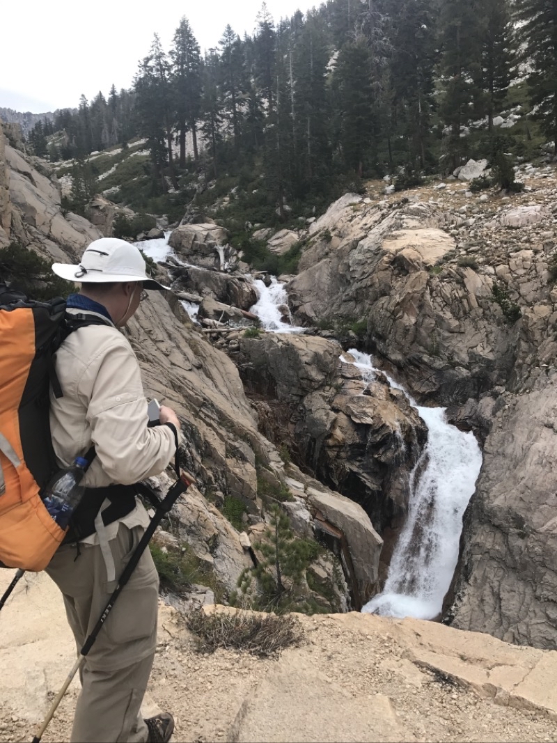
We had a nice break at this set of waterfalls along Bubbs Creek.
--September 5, 2017 at 11:08 AM. Junction Meadow Switchbacks-Bubbs, Shaver Lake, CA, United States
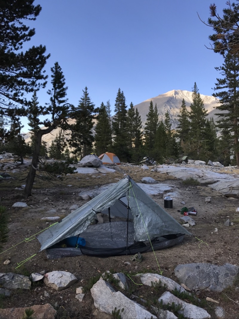
Leaving our last camp by the Sphinx. It’s a lovely morning.
--September 6, 2017 at 5:46 AM. Junction Meadow Switchbacks-Bubbs, Shaver Lake, CA, United States
The trail from Sphinx down to the crossing of Bubbs Creek is a modest descending well built and wide trail. We weren’t in a hurry.
--September 6, 2017 at 8:47 AM. Junction Meadow Switchbacks-Bubbs, Shaver Lake, CA, United States