Showing posts with label travel. Show all posts

Tuesday, September 22, 2026

Malta - Ggantija (September 20, 2026)

Malta - Ggantija (September 20, 2026)

After our greater than planned adventure of the day before we deided that a low-energy day was in order. The Ggantija (rougly, “Juh-gen-tee-yuh” or “juh-gant-EE-ah”) is a notable neolithic temples sites on Gozo. It’s not the only such site from 5,000 years ago but it is here and one of the best preserved. The temples are located in the town of Xaghra (“SHAH-ra”, more or less though I think I heard it as “Zah-ra” as well) which is a sizeable place, second only to Victoria, in population. We would only see a tiny portion of it as we did not choose to explore beyond finding a place for lunch.

Getting there was straightforward once we learned where the bus stop for the #322 was lcoated. Perhaps on weekdays that bus (and many ohters) runs more than once-per-hour but we were not in a hurry so that wasn’t a concern. The buses have all been on time which is nice. The ride was quick and perhaps a bit nerve wracking for Mom and Dad who could see us squeezing by over traffic and parked cars on the just-wide-enough roads that twist through the towns. It is obvious that the buses drivers, and surely other drivers too, are comfortable driving here and they must have good training. We were dropped off pretty much right where we needed to be though we did not realize it right away.

We found our way to the site of the temples and began our walk through history. I am not going to try and reprise the history of this place. There is plenty of information available that is going to be more convincing than my mere re-stating of facts from other places. I know what you can find out. Even a cursory reading of what is available is still impressive. The two temples were built around 3,600BCE through 3,200BCE. Though the temple building started several hudred years before these were completed and continued for centuries more. It’s thought the people who arrived here well over 4,100BCE came from Sicilily which is about 57 nautical miles (105 km) from here. I suppose on a clear day from a height of over 100 meters (higher is better) you could see the relatively flat top of Malta. Still a daunting water crossing over 6,000 years ago but it could be, and obviously was, done. When you think about that it becomes easier to imagine these intrepid people with simple stone tools deciding at some point to build neolithic structures such as we have here even though they only had use of their muscles, perhaps rounds stone balls serving as ball bearings, and I imagine basic pulleys which are pretty simple machines too though incredibly useful.

It’s too bad the roofs collapsed ages ago. I think it would be easier to imagine these structures being used for if the the roofs were still there. These were not, apparently, homes but ritual sites. What sort of events were celebrated here? I suppose we can never really know. We can see evidence of things done such as the use of fire or the marking of how things were to be built in etched stone (which feels different than graffiti of initials etched in just a couple hundred years ago). But we can’t really know. We can marvel at the dedication to biuld the temples. That is what we did.

We didn’t, and still do not, know much about the town. I am sure there are things to do here but we were not going to wander aimlessly to figure out what hidden gems might be about. We simply found our way to a bustling square and then the Coronation Bistro where we had surprisingly good pizzas for lunch. I was expecting a lighter crust, far more Neopolitan style, and a small overall pie. The pie was about the size of the dinner plate it came on and a crust any American would recongnize. Ample toppings of meat and vegetables (on mine) made for a good repast. Had we known they’d be what they were I think we would have gotten just one: we had to leave several slices on the plates.

We took an Uber, got the same driver as the day before, back to the hotel where as we arrived a cloud burst and poured a moderate amount of rain down for a little while. A lazy afternoon of doing pretty little but resting before dinner.

Photos

Photo taken Sep 20, 2026 at 11:17 AM

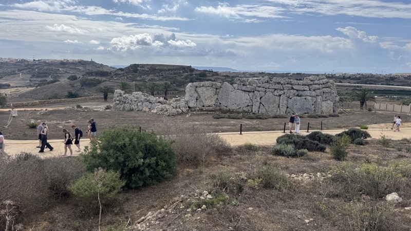
The first view of a temple at the Ggantija site. It’s named because people who saw the Neolithic temples millennia after they were built could not imagine anyone but giants making them. I think that shows a lack of imagination at the creativity m, capability, and determination of people from time way gone by.

--September 20, 2026 at 11:17 AM.

Maps are centered on the photo: Google map, Apple map, CalTopo mapOpenTopoMap map

Photo taken Sep 20, 2026 at 11:23 AM

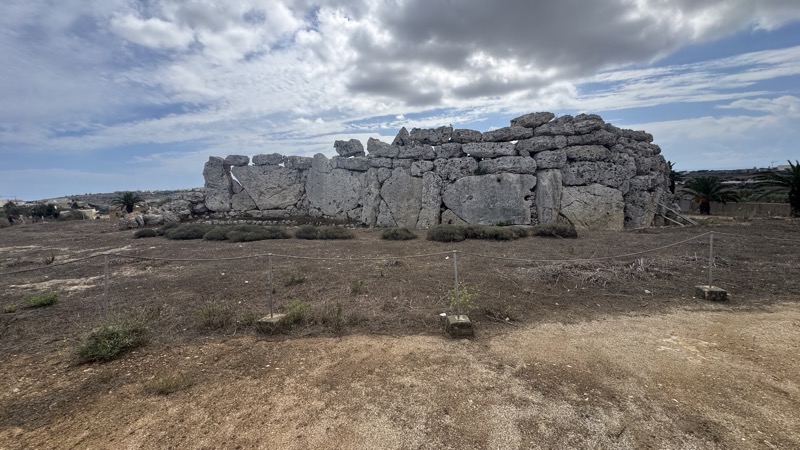
Moving closer to a temple.

--September 20, 2026 at 11:23 AM.

Maps are centered on the photo: Google map, Apple map, CalTopo mapOpenTopoMap map

Photo taken Sep 20, 2026 at 11:36 AM

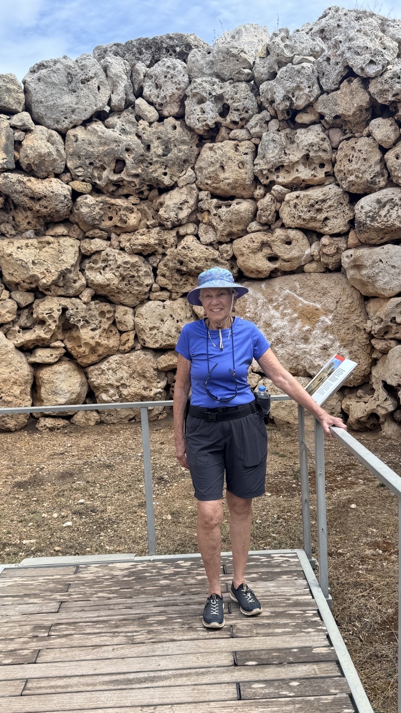
Inside one of the rooms of a temple structure.

--September 20, 2026 at 11:36 AM.

Maps are centered on the photo: Google map, Apple map, CalTopo mapOpenTopoMap map

Sunday, September 20, 2026

Malta - A Refuge and a Storm

Play video Refuge From the Storm
▶️ Play Refuge From the Storm

We looked at the weather forecast for today and decided we could manage the 6.5km walk we wanted to do. The entire walk is just over 13km but we decided that ending at the village by Dwerja Tower and then taking a bus back to Victoria, cutting out the last 6.5km, would be fine. Chances are that the last bit would have been more road-walking which would not have been fun anyway. We were able to catch the 9:09 #301 bus to Victoria and start our walk under cloudy skies but with a temperature that was still quite warm.

We worked our way through the streets of Victoria. Just a few hundred meters into the walk we were checking the walking notes to be sure where we had to go next. A local person was pulling out of a parking spot and asked if we needed help. We were fine and Dad let him know that.

“Australians, ” asked the older fellow?

“Americans,” was Dad’s response.

Smiling the driver said, “Heil Hitler,” followed quickly by, “Heil Trump.”

He went his way and we ours.

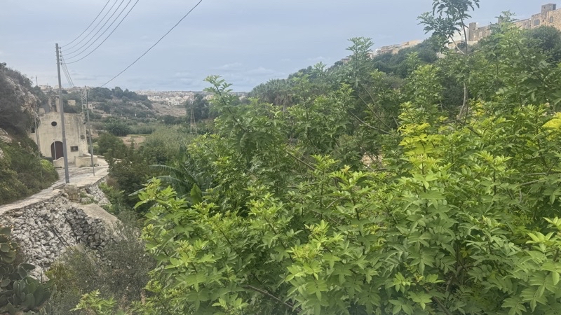
As we continued, we soon came to the narrow Lumuzjata Valley. The signs we saw note that the valley has many natural springs and they must be the life-giving source for all the vegetation. There are caves in the valley walls but I did not see the caves let alone the cave dwellings. To be fair I didn’t really look either but I don’t think Mom and Dad saw them either. Up the several dozen steps and back onto city streets with their one-person-wide sidewalks with obstructions of entry steps or construction to make them more of an annoyance to walk along.

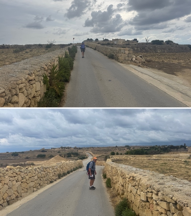
Soon the roads would become more quiet as we passed an old Coca-Cola machine and began passing by fields to either side of us. The fields appear barren but they are clearly used as the pungent aroma of manure filling our noses informed us. We think that perhaps there will be another growing season for Fall planting. Now and then large working trucks and tractors would pass by causing us to hug the wall on the road’s edge. There are no shoulders. We plodded on. We began to notice that the skies ahead were darkening. Then we noticed, now and then, a distant flash of lightning. The weather was turning bad.

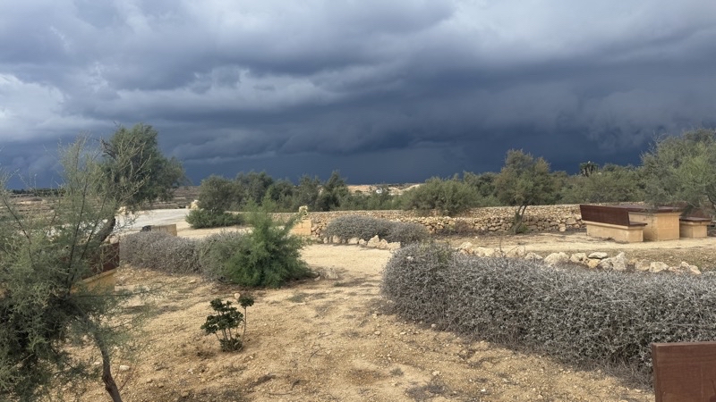
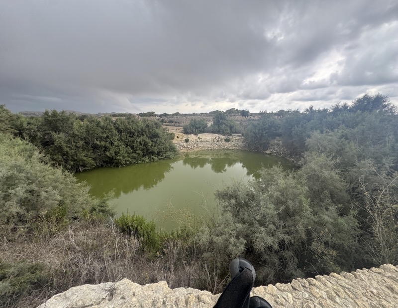
When we finally reached what the notes call the Roman Pond and my map identifies as San Raflu Lake it was becoming quite obvious that our chances of not getting caught in the storm were vanishingly small. We still paused to chat with an English couple who were walking in the same direction as we were though they started somewhere else. We had a snack at the little rest area with tables and benches and wished for a roofed structure. We were pretty sure that the pause wouldn’t matter; we were going to get caught out before reaching the village, San Lawrenz I believe is name, by Dwerja Tower.

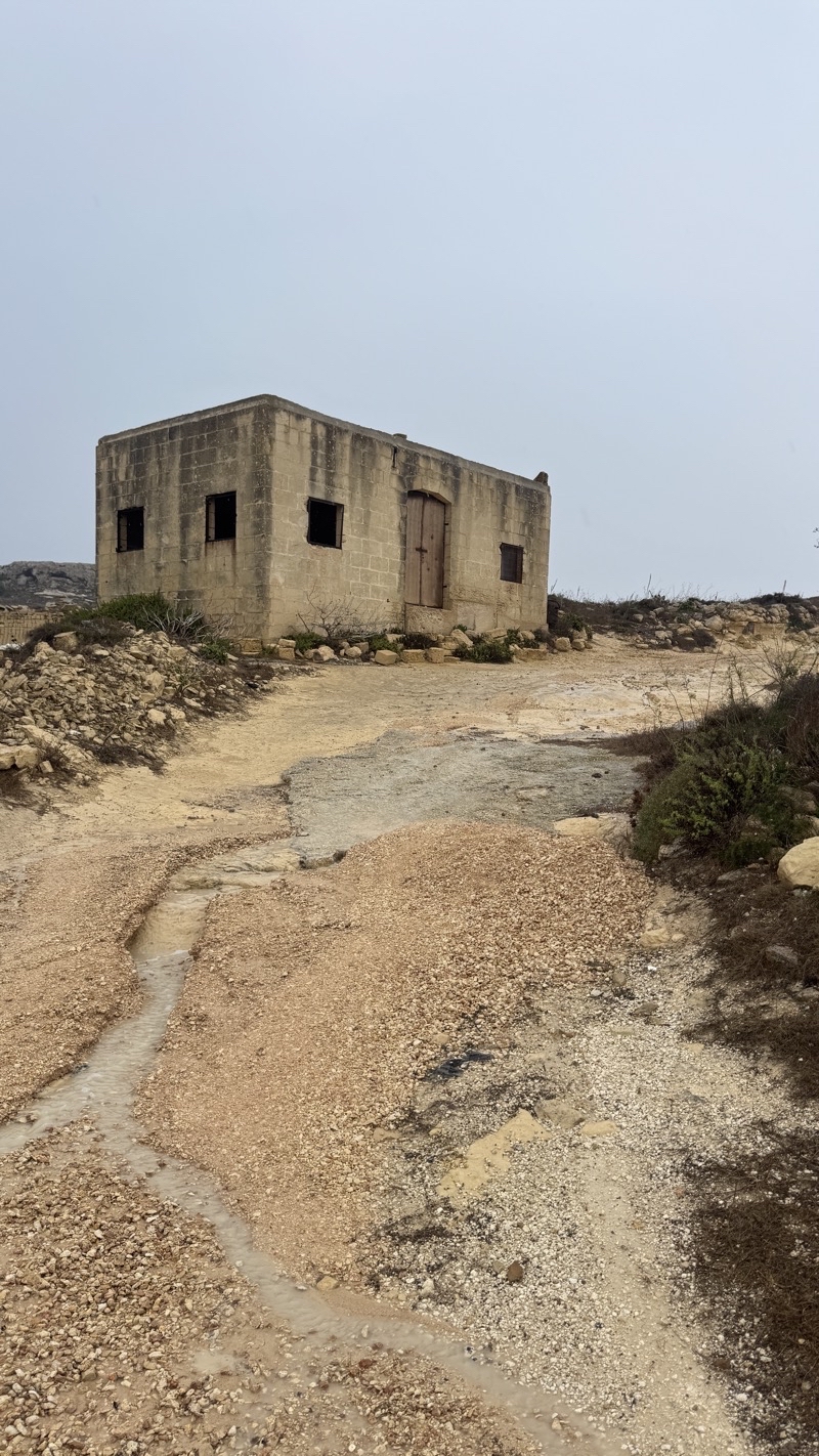
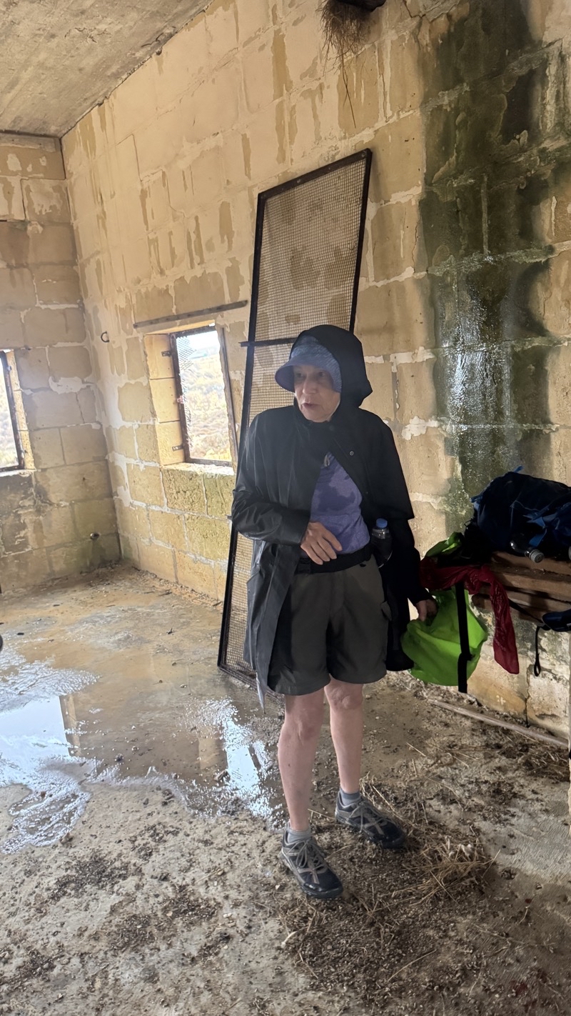
The skies continued to darken and the temperature began to drop. The wind picked up speed and the flashes of lightning were increasing in frequency along with the accompanying booms of thunder. As we left the minor road to start following an actual dirt and limestone path the storm with all its wind and rain arrived. Torrents of rain fell and the wind whipped the pummelling water about us. We were not going to stay dry even with our rain jackets on. The temperature dropped several degrees but it was still quite warm. We were getting quite wet but we were not getting chilled. We pushed ahead along the sometimes overgrown path that was turning into a stream. We didn’t have attention to spare to look out and around: heads down; watching our feet. We passed by small family-owned quarries but did not notice. After almost a kilometer and easily 20-25 minutes of pounding rain we came to a turning point. The apparent path seemed to go right. The plowed allotments on our left.The right went up a hill where Mom spotted a building. She thought it might provide protection from the storm. She forged up to check it out and then waved Dad and me to follow. About 110 meters climbing up about 20 meters and we were getting ready to enter the building through an empty window opening to whatever protection we could get from the howling wind and driving rain. Mom stepped through. Dad started to step through and came up short with a thud and an anguished cry. The footing required care but he gave that a bit too much attention and failed to duck his head sufficiently. The building made him pay a painful price with a big cut on his and no little amount of pain. I entered unscathed.

Dry. No wind. Comfort.Refuge.

Mom used the supplies in Dad’s emergency medical kit to stop the bleeding.

We took refuge in this abandoned quarry building for a bit over a half an hour. We thought the rain was subsiding though it seemed like it wasn’t going to truly stop anytime soon. We zipped ourselves back into our rainjackets and braved the aforementioned opening to depart the refuge and hike the last slightly-less-than 1km to the village associated with Dwerja Tower. This little right hand path was an error. In fact, we were supposed to follow close to the allotment and pick up the path just a few steps further on. Perhaps we would have seen the real trail if we weren’t dealing with the weather. We continued on the limestone and dirt path. We listened to streams of water flowing down the limestone as we walked. We tried not to slip in the sections of near-frictionless mud. The path was taking us towards the sea and we followed it and the occasional blue-and-white way-mark. The storm was spent but it was still raining a bit as we approached Dwerja Tower and the couple we had met before, out for a 2-nights and 3-days hike around Gozo, caught up to us. They are staying at hotels along the way but we couldn’t figure out where they took shelter from the storm. They said, we thought, under a rocky ledge but nothing like that was noticed by us between San Raflu Lake and where they caught up to us. They seemed in good spirits as they moved on past having several kilometers to go to wherever their lodging for this, I think their second night would be.

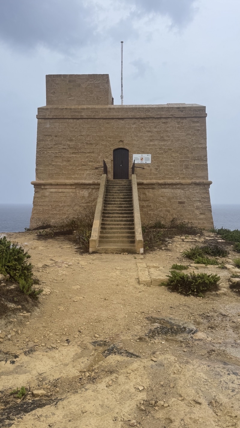
If the flag is flying at Dwerja Tower it means the tower is open for people to visit. No flag was flying though I doubt we would have visited even if it had been. It’s the location of a centuries-old observation tower, restored in 1997. It had some cannons in ages past, 6-pounders I believe, but they were never fired in combat. During World War II it was strictly an observation post. We passed by and walked the final 400 or so meters along a road, though on the limestone and sand wide border that travelled the same way to the village of San Lawrenz. We settled in at the souvenir shop to wait for the Uber I ordered. We had no desire to explore the village.

The Uber ride was easy and after the 7 or so mile ride we were deposited back at the Grand Hotel. We were able to get out of our wet clothing and start to recuperate from the adventure we just had.

Mom called Mercedes about Dad’s head wound, and what additional supplies we needed to keep the cut clean. The visit to a pharmacy required a climb up a flight of about 50 stairs through a tunnel then a seemingly longer-than 0.25 miles (what the GPS map suggested). Navigating narrow sidewalks once again and getting wet once again. But we found what was needed at the pharmacy and returned to the hotel. Relax. Minister to aches and pains. An early dinner and then off to an early bedtime.

Photos

Photo taken Sep 19, 2026 at 9:53 AM

There may be more in this lush valley than we saw. The walk is taking us through Victoria but this valley is an oasis of quiet in the city. This is Lunuzjata Valley. There are several springs that count for the valley’s less than green at this time of year plethora of plants. There are also cave dwellings, but I did not notice them.

--September 19, 2026 at 9:53 AM.

Maps are centered on the photo: Google map, Apple map, CalTopo mapOpenTopoMap map

Photo taken September 18, 2026 at 11:16 AM

We have been tromping down this road past fields that seem barren but are clearly active (the smell of manure is the give away). Over 2km on this road as the clouds become more threatening. Looking back (top) and ahead (bottom).

-- September 18, 2026 at 11:16 AM Maps are centered on the photo: Google map, Apple map, CalTopo mapOpenTopoMap map

Photo taken Sep 19, 2026 at 11:21 AM

We met an English couple, living in Malta, here at this little rest area. I wonder if they made it to the village of San Lawrenz before the storm hit. Perhaps we should not have spent the 10 or so minutes here having a bite to eat, but there is no way we would’ve beaten the storm.

--September 19, 2026 at 11:21 AM.

Maps are centered on the photo: Google map, Apple map, CalTopo mapOpenTopoMap map

Photo taken Sep 19, 2026 at 11:33 AM

The Inntravel notes say, assuming I’m reading them right, that this is the Roman Pond. On my map it’s called San Raflu Lake. It is home to Painted Frogs which are the only indigenous amphibians I believe here on the Maltese islands. We did not see the frogs, but the pond was surrounded by much greenery.

--September 19, 2026 at 11:33 AM.

Maps are centered on the photo: Google map, Apple map, CalTopo mapOpenTopoMap map

Photo taken Sep 19, 2026 at 12:50 PM

Our refuge from the storm.

--September 19, 2026 at 12:50 PM.

Maps are centered on the photo: Google map, Apple map, CalTopo mapOpenTopoMap map

Photo taken Sep 19, 2026 at 12:27 PM

Lightning flashed and thunder boomed, the temperature dropped as the wind picked up speed, and a few raindrops turned into a torrent. It really started to come down as we turned down a dirt and stone narrow path. I think we plodded along for about 700 meters before Mom spotted the building atop a hill off to the right (about 110 meters distant). We were quite soaked so taking cover from the wind and rain was wonderful. I’m sure we were there for easily a half hour if not closer to 45 minutes.

--September 19, 2026 at 12:27 PM.

Maps are centered on the photo: Google map, Apple map, CalTopo mapOpenTopoMap map

Photo taken Sep 19, 2026 at 12:29 PM

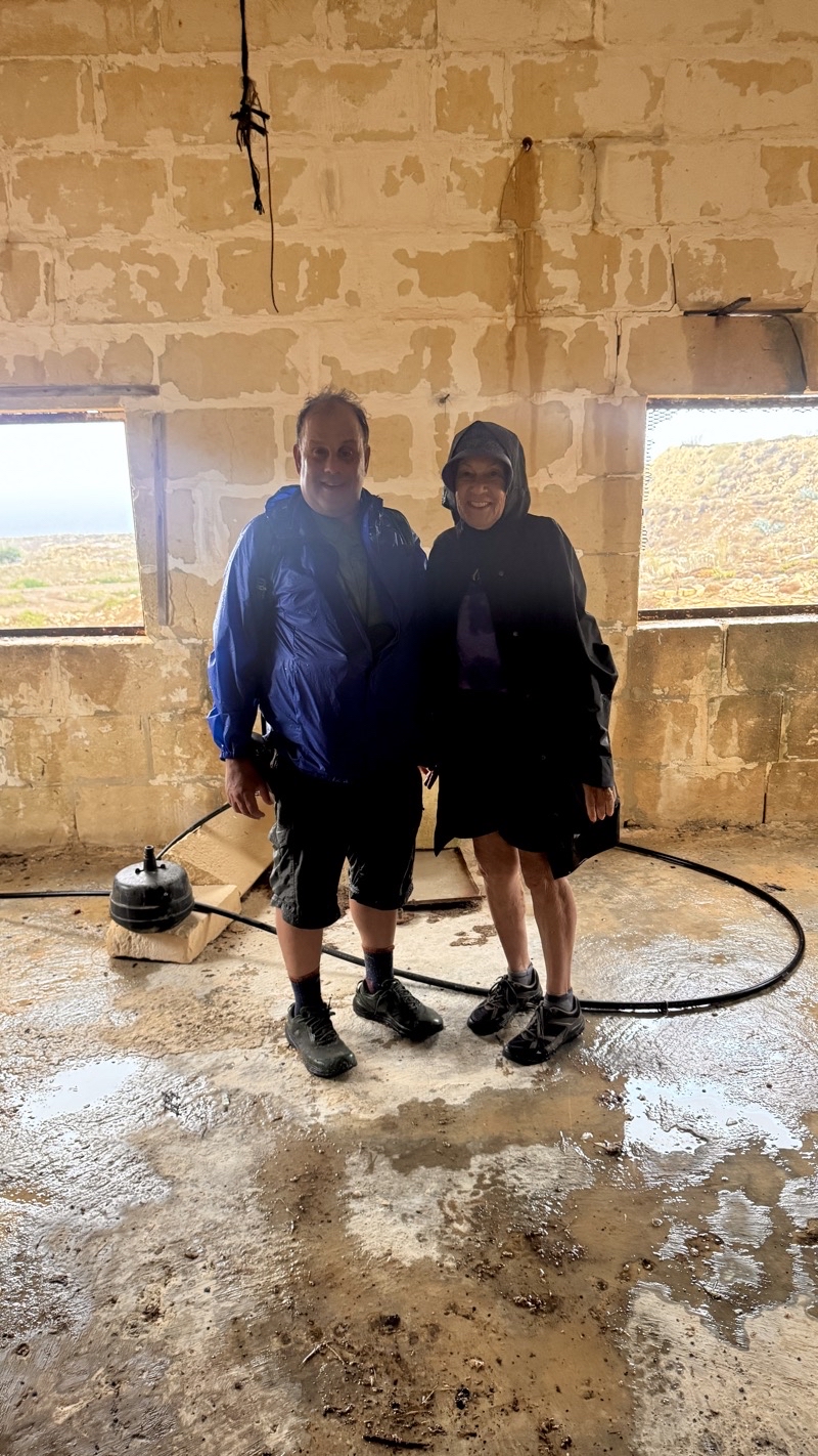
Dad standing tall next to Mom after giving himself quite a knock on the head as we came into this building. That was definitely an unexpected and unwanted extra bit of adventure to our already unexpected adventure in the stormy weather.

--September 19, 2026 at 12:29 PM.

Maps are centered on the photo: Google map, Apple map, CalTopo mapOpenTopoMap map

Photo taken Sep 19, 2026 at 1:11 PM

I expect an hour earlier this scene looked quite a bit different. I am sure the wind was ripping up whitecapped waves. But visibility was probably such that you likely could not really see them. Not a quiet scene now but it’s nice to see the turquoise sea as we neared the end.

--September 19, 2026 at 1:11 PM.

Maps are centered on the photo: Google map, Apple map, CalTopo mapOpenTopoMap map

Photo taken Sep 19, 2026 at 1:18 PM

Even if the flag had been flying, I doubt we would have stopped to Dwerja Tower. The rain had slacked off quite a bit, but it had not ceased. We were ready to be done, especially given the knock that Dad took. Just a few hundred more meters to the protection of the umbrellas at what I suspect is a souvenir shop. We certainly were not going to check out anything else around there.

--September 19, 2026 at 1:18 PM.

Maps are centered on the photo: Google map, Apple map, CalTopo mapOpenTopoMap map

Friday, September 18, 2026

Malta: The First Days (September 15 through 17, 2026)

Photo taken Sep 17, 2026 at 7:00 AM

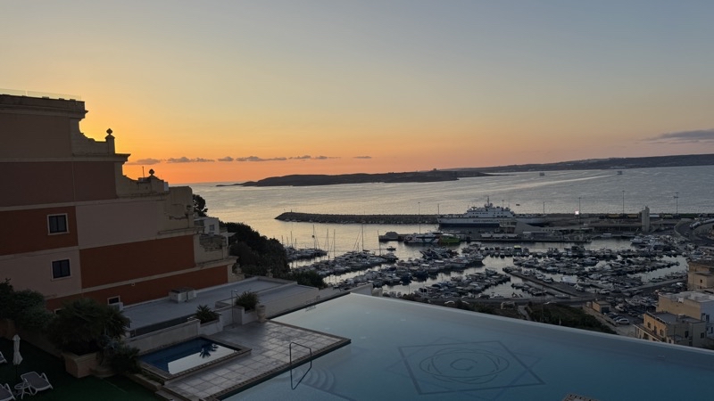
Sunrise was about 15 minutes ago. This is the view from my room.

—September 17, 2026 at 7:00 AM.

Maps are centered on the photo: Google map, Apple map, CalTopo mapOpenTopoMap map

I woke up rather earlier this morning than I would have preferred. The jet-lag and mediocre sleeping on the planes caught up with me right after dinner here at the Grand Hotel in Ghajnsielem roughly said, ”Ayn-see-LEM”) on the island of Gozzo. I was asleep not long after 8:00PM and pretty much awake for good not long after 4:30AM this morning (September 17). I hope it doesn’t wreck my day. Let me give you a sense of the time spent travelling the several thousand miles from Michigan to here. It was easy and hard:

  • Hour 0: Wake up and get ready (and forgot to do something that could become important in time but I can’t really fix).
  • Hour 1.0-1.5: Get my ride to the Detroit airport with Lil. Traffic was a bit of a pain but we got there when we should and I got through security and to my gate with no trouble.
  • Hour 3: Flight to Boston leaves on time.
  • Hour 5-6: Landing in Boston. Figure out how to get from Terminal A to Terminal E and the check-in counters. That turned out to be tougher than it should have been. I misread a sign and added 15-20 minutes walking under the tarmac to somewhere that wasn’t necessary. But I found the shuttle and it took me to gate E13 in Terminal E. I had to find my way out so I could meet Mom and Dad at the check-in counters. Of course, I also had to deal with the just-discovered breeze where a breeze should not be: my fly zipper was broken. Fortunately I had a change of clothes so that wasn’t too much of a hassle.
  • Hour 7-7.5: Mom and Dad find me at couner 74 where the Lufthansa check-ins are located. I feel that could be better managed. The signs saying what airlines are at which counters are tiny compared to the lovely big numbers identifying each counter. Once you find a display screen that tells you which counter is assigned to your flight getting where you need to be is simple enough but I did not find such a sign quickly. More extra walking that I did not need. But we got through ticketing pretty smoothly considering our flights had been changed just the day before by ITA Airways to route through Frankfurt instead of Rome. Lufthansa didn’t quite get all our information (KTN numbers for TSA Precheck) but they did mange to book us in 3 adjacent seats which was surprising given that the flights were quite full.
  • Hour 7.5-10: Waiting to board. I was able to get a bite to eat at a restaraunt. It would turn out to be a far superior meal than what the plane had to offer.
  • Hour 10: Boarding. Another passport check and scan of boarding passes and we got on the bus to take us to the plane. That was a long bus ride. W e did not lave on time. Our flight would end up being about 40 minutes late arriving into Frankfurt.
  • Hour 17ish (time from getting up on the 15th; we also jumped 6 hours ahead): We had less than 2 hours until boarding for our flight to Malta. We had to clear European customs. The new Entry/exit System is in place. You stand at a kiosk to scan your passport and provide a photo and perhaps fingerprints. Then you get in a long long line to see a border control agent. We had requested special assistance. That caused us some trouble because we didn’t properly follow thorough but it certainly sped us past the long line at the control point. However, people on our flight managed to get through and catch the same Malta-bound flight as us so perhaps it wasn’t necessary. It both reduced and increased stress as we had to wait for carts and we got nervous having heard some horror stories about wait times. But it probably was wise to do what we did. I am sure I’d not have made it alone: I just am not a fan of needing to have a wheelchair. I can walk. Granted there were no wheelchairs used: just electric carts.
  • Hour 19: Boarding our flight to Malta. This would be about a 2 hours-long flight. It went fine.Shockingly hard seats; think Spirit Airlines.
  • Hour 21: Land in Malta. Thank goodness we don’t have to deal with any more border control points. We were able to get our luggage and then begin our next round of waiting for our driver to arrive to take us to Gozo. I am not sure if he was on his way already or not. We had to wait the better part of an hour for him to arrive. Hurry up and wait. Joy.
  • Hour 22.5-24: The shuttle takes about 45 minutes to get to the dock where the car ferry to Gozo awaits. The ferry ride is about 20 minutes. The ride to the ferry was not particularly enjoyable. A combination of being in the way back, being tired, and the speed and curves in the road, made it less than ideal. The ferry ride was nice and smooth and pretty.
  • Hour 24.5: Checking in at the hotel. Hurray.

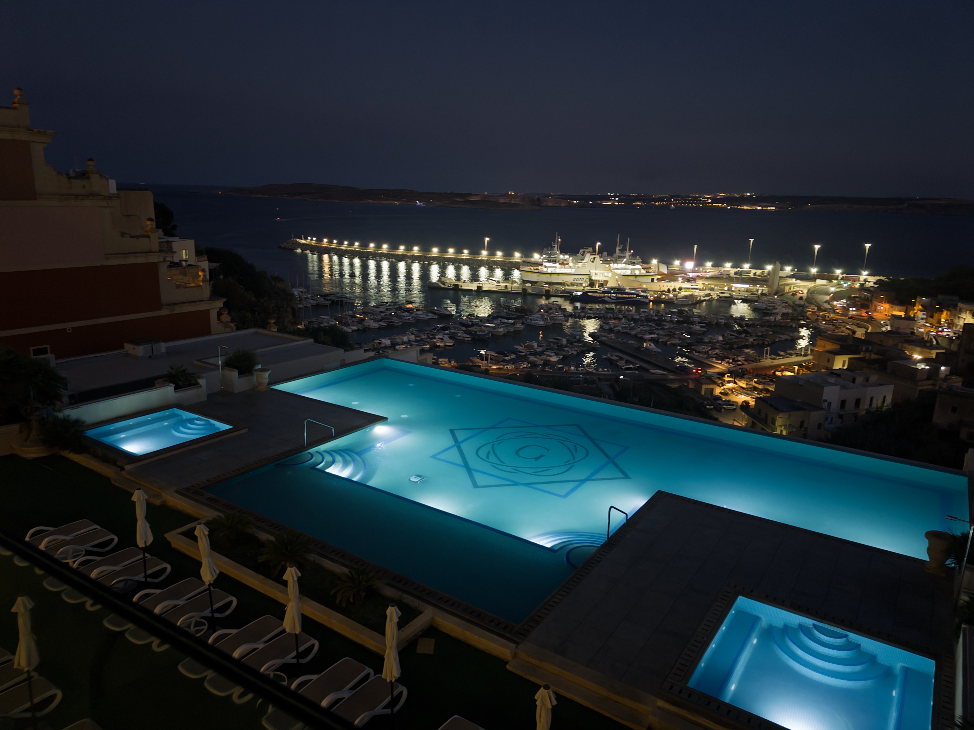
We settled in to our respecitive rooms and took time to make ourselves feel more alive (hurray for a good shower). But that can only take you so far. We were tired and while we had the thought of exploring a little aorund the hotel we ended up not doing so. We hung out at the outdoor pool on floor 4 (an indoor pool is on floor 2) for a bit before finding dinner at the hotel restaurant. They have a rooftop dining space that several days a week does some sort of barbecue but we were not going to spend 40 euros each for that. On non-barbecue days you can either order from a set menu of choices a 3-course meal or do something ala carte. The ala carte option exists every day and that is what we did. A tasty spaghetti in rich beef sauce (beef ragu). Then it was off to bed.

Our First Walk

It warmed up quickly. We had breakfast just before 8:00AM which is a bit later than we were aiming for, but it our first full day. While the choices for food are comprehensive the quality is a bit hit or miss and certainly won’t hold a candle to a hotel like the one we stayed in during our time in Oslo or, if I recall correctly, Alesund, Norway: no omelet chef. By the time we were ready to start our first walk it was edging past 9:30AM and the sun was sitting in a nearly cludless deep blue sky.

Inntravel provides a very basic map for each walk. Where they excel is with the directions that describe how you are to travel. If your walk takes you past something distinctive like a trio of palm trees where you make a sharp left turn the notes will say so. If there may be a concern about certain sections being iffy in poor weather you will be informed. If you are likely to get confused by an area where the most obvious option is wrong the walking notes will note that fact. Having a nice map and downloading the available GPX files to use with a proper mapping app are good extras but you can get by without them.

This walk started from the hotel. We moved along the street navigating the narrow sidewalk with its bumps and dips (not a city friendly to people with any mobility issues) hoping we wouldn’t have to step into the road as traffic zipped past. Then we turned and began following the next road. This was the nature of the bulk of the walk: road walking. Usually along the edge of the roads which granted were often far quieter than the initial road. It isn’t hard but it is a bit tedious.

We ascended towards a higher point (about 80 meters) and were presented with panoramic views of, I think, Ramla Bay. We also saw less wondrous things like trash. We were heading into the village of Qala (pronounced, “AH-la”). I am not sure where the border between villages is in what feels like one big habitation.We passed by the Buket Bar where several jeeps carrying tourists, we saw many, had just pulled in for a late-morning drink. Personally, I think it might have been nice to get a cold drink there after the 1.2km climb. We ascended about 75 meters but with the sun already high in the sky it felt harder than it should have. Of course, our water was already warming up making it less palatable to drink.

One nice thing about walking through bustling villages is that you find the fine little shops that make the places work. In the space of a few meters we found a well stocked pharmacy which sold travel-sized shaving gel, sunscreeen, and toothpaste plus all sorts of other things; a small mini-mart where we picked up cold water and I wish we had (I was voted down) potato chips (crisps); and a very well stocked pharmacy which- seemed a bit higher-end, small grocery store where we managed to purchse some clementines (I wish I had a small grocery store like that one near me back home).

We worked our way through Qala along much quieter roads. Expansive views of the bays down below were frequent but they won’t blow your mind. We also wondered about what seemed like maintained fields for agricultural use but nothing seemed to be growing in them. Along the way we passed by home with American flags. I suppose their is an ex-pat community here. THe houses all had names like Big Apple and Sun Valley. When we reach the Church of the Immaculate Conception of Our Lady we found a modest shady spot to rest. It was just before noon and had I been on the ball I could have recorded the noon seranade of the bells. THe music sounded a bit dicordant to me as if the notes being struck were a bit off pitch. Dad thought it sounded tinny but I don’t think that is quite right. He stepped inside and surprisingly found it stuffy and not any cooler. I would have thought it would be cooler because it is a centuries-old church with thick stone walls but clearly it wasn’t and it also lacked ventilation.

We found our way to a 600-meter detour walk that would take us out to near the edge of the cliffs overlooking Hondoq (Hon-dok) Bay. We didn’t go quite to the end of the recommended walk but came close enough. If the sun had been pouring heat down upon us I think we have stayed to have our handmade-at-the-hotel-by-us little sandwiches. We returnd down the slightly rocky path, past the supposedly millennia-old cart ruts. They did not look like much to Dad and I don’t think I saw them at all. We returned to the fly-inhabited shady spot for lunch.

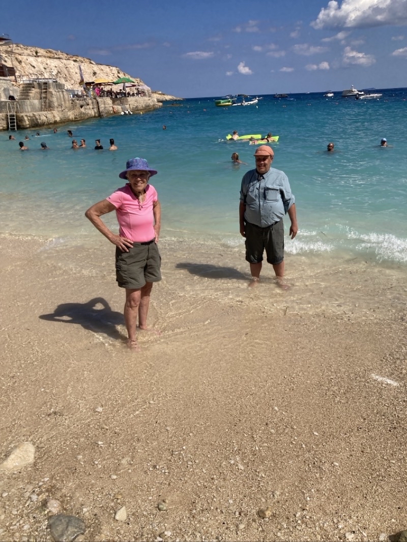
Down a winding road, the steepest descent down to the sea, and the joys around Hondoq Bay. For us that meant sitting down under the umbrellas at the beachfront set up by the soda and ice cream truck. Orange Fanta and Magnun Ice Cream bars may not be the healthiest things to devour but under the certainly well above 80ªF they were very welcome treats. The notes say you can spend hours here in the bay but we certainly did not do that. We walked onto the small mostly-rocky beach, typical of so many we have seen in Europe, and watched people playing in the water. Lots of small kayaks and other things were bobbing in the calm blue-green and clear water. For Mom and I it was a lovely chance to take off our shoes and step into the lapping waves of Hondoq Bay. The water is quite warm; a far cry from the chilly water of Lake Superior. As the waves lapped at our legs and the undertoe pulled sand out from under our feet we relaxed in the pleasant embrace. Of course, then we had to step out and take the few irritating (maybe others find it less so as they pick better stepping spots) steps back to rocks to sit on and put socks and shoes back on.

From the beach the walk would spend the next few hundred meters gradually ascending along a coastal path of hard sand and some rocks: a hard surface but at least it wasn’t a road.Views of inlets and the blue-colored waters were lovely. But we certainly were getting tired as we made our way. A final ascent up to another road and we had about one mile to go. Too bad we had to first climb the ascending road over a distance of 600 meters perhaps gaining 40-50 meters along the way. I found myself wondering if we could have taken the coastal path around and then returned to the hotel from there. It might well have been longer but the climbing would have been considerably lessened. We found ourselves back on the street where we started.From here we would retrace our steps back to the hotel. Down and down we went. Mom was feeling it by this point and we paused for her to rest a few times along the last 1.3km of the walk. We managed to navigate the narrow sidewalks of the last couple hundred meters and once again were back at the hotel.

I’ll end with a quick note about our first three-course meal. Mom and Dad tried a pasta starter in a tomato sauce while I had a creamy risotto. I found my starter a bit bland and the rice may have been a bit undercooked. But I admit I don’t eat risotto often so what do I really know. I prefer its cousin the arancini balls which I realize are really rather different. I don’t think they were too excited about the chicken they had. My braised lamb shank was tender, very mild in taste, and came with plenty of nice vegetables. The chocolate cake with whipped cream and a cherry sauce made an excellent dessert leaps and bounds ahead of Dad’s strawberry ice cream.

Photos

Photo taken Sep 16, 2026 at 2:35 PM

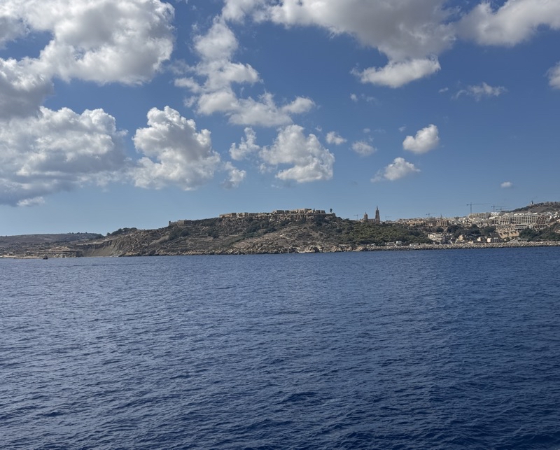
After about a 45 minute drive from the airport, we would reach the dock for the car ferry that would take us to Gozo. It’s about a 20 minute ride on the ferry and we are about 1 km from Gozo at this point. As it would turn out, that means we were not that much farther away from the grand hotel, which is where we are staying.

—September 16, 2026 at 2:35 PM.

Maps are centered on the photo: Google map, Apple map, CalTopo mapOpenTopoMap map

Photo taken Sep 16, 2026 at 7:36 PM

—September 16, 2026 at 7:36 PM.

Maps are centered on the photo: Google map, Apple map, CalTopo mapOpenTopoMap map

Photo taken Sep 17, 2026 at 9:44 AM

Our first panoramic view of Ramla Bay. We are ascending along a road with, overall, no sidewalks ; and when they exist they’re meager. We probably have nearly a kilometer of climbing to still do. It’s a gentle climb but it’s in full sunshine and already over 80°F.

--September 17, 2026 at 9:44 AM.

Maps are centered on the photo: Google map, Apple map, CalTopo mapOpenTopoMap map

Photo taken Sep 17, 2026 at 11:09 AM

There are some intriguing home in Qala (sounds like, “AH-La”). But I think this one might be scheduled for demolition, which would be a shame. The Buttigieg family seems to have quite a presence here. I don’t know if that’s the same family as American Pete Buttigieg but I think it is.

--September 17, 2026 at 11:09 AM.

Maps are centered on the photo: Google map, Apple map, CalTopo mapOpenTopoMap map

Photo taken Sep 17, 2026 at 12:42 PM

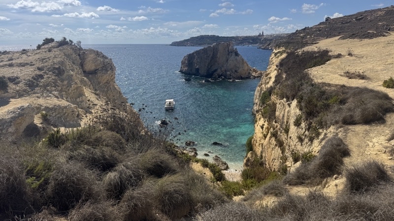
This is just perhaps 20 or so meters from the end of this path at the cliff’s overlooking Hondoq (pronounced more or less like, “Hon-dok”) Bay. If the sun hadn’t been punishing us relentlessly I think we would have had our modest lunch here.

--September 17, 2026 at 12:42 PM.

Maps are centered on the photo: Google map, Apple map, CalTopo mapOpenTopoMap map

Photo taken Sep 17, 2026 at 12:43 PM

This is just perhaps 20 or so meters from the end of this path at the cliff’s overlooking Hondoq (pronounced more or less like, “Hon-dok”) Bay. If the sun hadn’t been punishing us relentlessly I think we would have had our modest lunch here.

--September 17, 2026 at 12:43 PM.

Maps are centered on the photo: Google map, Apple map, CalTopo mapOpenTopoMap map

Photo taken Sep 17, 2026 at 1:28 PM

We took a respite here at the Church of the Immaculate Conception of Our Lady just before and after noon (I wasn’t able to record the noon bells concert which sounded a bit off key to my ears and Dad called it tinny) and then after our jaunt down to near the top of the cliffs about 750 meters southeast of here.

--September 17, 2026 at 1:28 PM.

Maps are centered on the photo: Google map, Apple map, CalTopo mapOpenTopoMap map

Photo taken Sep 17, 2026 at 2:17 PM

The water here in Hondoq (Hon-dok) Bay is quite warm. It sure felt good on aching and hot feet. The beach here, like so many we have seen throughout Europe, is rocky. You will feel it as your stroll barefoot into the water. But it is a beach and the water is inviting so, as you see, people come to play. Photo by Jonathan.

--September 17, 2026 at 2:17 PM.

Maps are centered on the photo: Google map, Apple map, CalTopo mapOpenTopoMap map

Photo taken Sep 17, 2026 at 2:48 PM

We are following a coastal path of hard sand strewn with rocks up out of Hondoq Bay. It is definitely a change of pace from the road walking we’ve done up to this point. But it is hard to enjoy the glorious shades of colors dancing through the calm inlet below. The heat is exhausting us. I wonder if it would have been easier, if possible, to continue on the coastal path and climb to the hotel from the sea. In a few dozen meters we will turn inland and climb this path to a road before starting a 1.2 km descent down the road we ascended earlier.

--September 17, 2026 at 2:48 PM.

Maps are centered on the photo: Google map, Apple map, CalTopo mapOpenTopoMap map

Saturday, June 20, 2026

Backpacking Pictured Rocks National Lakeshore- Memorial Day Weekend 2026

For over 20 years Andy has organized a trip to Pictured Rocks National Lakeshore. We usually go for four or five days over the Memorial Day weekend. The group hikes the Lakeshore Trail. However, this would be my first backpacking trip since shoulder surgery the previous fall so I decided to do something different and not slow others down. I’d spend time in the Beaver Creek wilderness before joining the group type the western part of the Lakeshore Trail.

Play video Backpacking Pictured Rocks—May 2026
▶️ Play Backpacking Pictured Rocks—May 2026

Photos

Photo taken May 21, 2026 at 12:56 PM

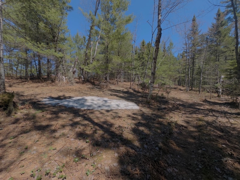
Patches of dense compressed snow linger on the Lakeshore Trail between Coves and Beaver Creek campgrounds. In a couple days they’l be much smaller though still not quite melted away.

--May 21, 2026 at 12:56 PM.

Maps are centered on the photo: Google map, Apple map, CalTopo map

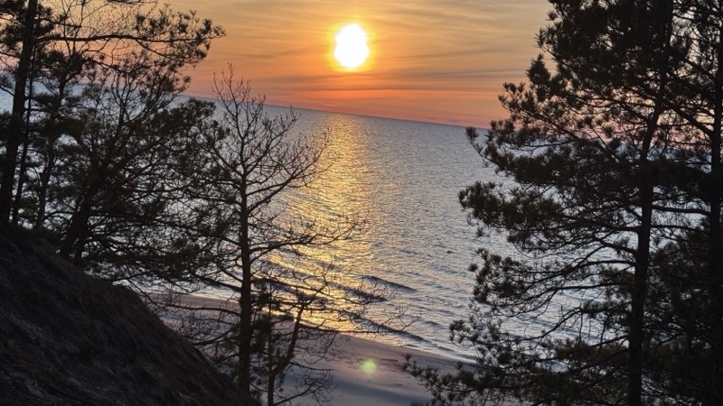
Photo taken May 21, 2026 at 8:57 PM

It was rather windy on the beach so I settled down on top of the bluff to watch the sun set over Lake Superior.

--May 21, 2026 at 8:57 PM.

Maps are centered on the photo: Google map, Apple map, CalTopo map

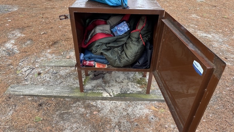
Photo taken May 22, 2026 at 8:23 AM

I have no idea why someone would leave this camping gear, cheap gear, in the bear box. Other gear was hanging off of a tree. I guess somebody felt they had to hurry back to their car and so left this bulky and likely heavy gear behind. Bad behavior: definitely not leave no trace.

--May 22, 2026 at 8:23 AM.

Maps are centered on the photo: Google map, Apple map, CalTopo map

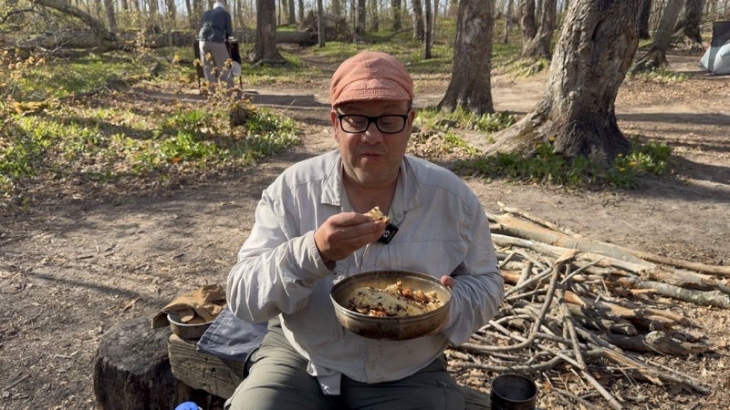
Photo taken May 23 at 6:10 PM

Time to try my baked here at Coves Group camp chocolate chip French-style yogurt cake. I baked this in my Hajka Outdoors Camp Oven: turned out rather well. Parker, for what it’s worth, gave it a 10 out of 10 though I suppose we need to give up a point or 2 for the enthusiasm of youth.

-- May 23, 2026 at 6:10 PM.

Maps are centered on the photo: Google map, Apple map, CalTopo map

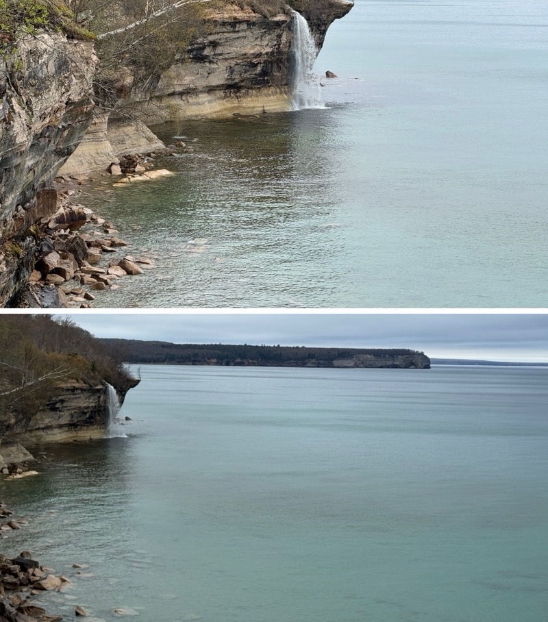
Photo taken May 24 at 8:54 AM

Spray Falls.

-- May 24, 2026 at 8:54 AM

Maps are centered on the photo: Google map, Apple map, CalTopo map

Photo taken May 24, 2026 at 1:00 PM

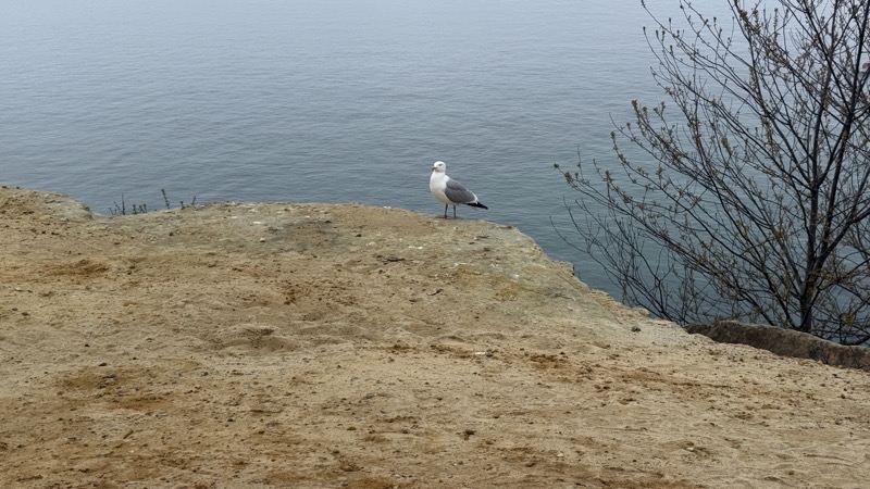
We are pretty sure this gull is guarding a nest.

--May 24, 2026 at 1:00 PM.

Maps are centered on the photo: Google map, Apple map, CalTopo map

Photo taken May 24, 2026 at 8:08 PM

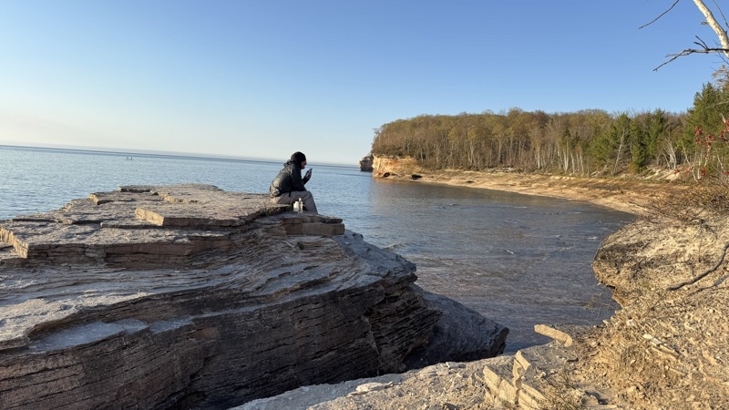
Andy and I came down to this Rocky beach to watch the sun set. Sunset will be in about 70 minutes. It should be lovely for us and the people on tour boats who will see the sandstone cliffs bathed in colors far more clearly than we will.

--May 24, 2026 at 8:08 PM.

Maps are centered on the photo: Google map, Apple map, CalTopo map

Photo taken May 24, 2026 at 9:07 PM

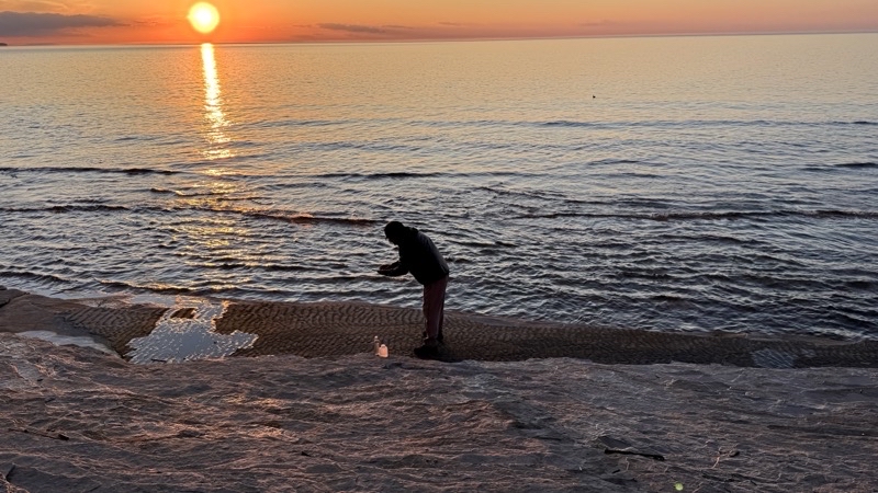
It turns out that the rocks Andy is standing over have an intriguing pattern on them. It’s just perceptible in the picture. Sunset is 10 minutes away.

--May 24, 2026 at 9:07 PM.

Maps are centered on the photo: Google map, Apple map, CalTopo map

Photo taken May 24, 2026 at 9:21 PM

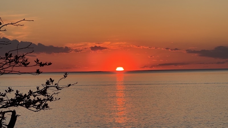
Just a few more minutes to go before the sun dips below the horizon. We started our walk back to camp just after I took this photo. The group campsite is about 0.25 miles away and twilight was fully upon us when we returned to the site.

--May 24, 2026 at 9:21 PM.

Maps are centered on the photo: Google map, Apple map, CalTopo map

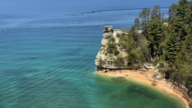
Photo taken May 25, 2026 at 2:24 PM

Miner’s Castle isn’t what it once was. Several years ago a turret-like piece came off. This is where my hike would end. Andy, Jill, John, and Parker continued, at a far faster pace, to Sand Point. They’d pick me up about an hour after I took this photo.

--May 25, 2026 at 2:24 PM.

Maps are centered on the photo: Google map, Apple map, CalTopo map

Sunday, March 1, 2026

Whale Watching Tour Off San Diego Bay

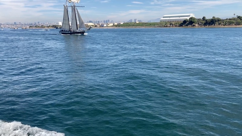
We boarded the mighty Marietta for a whale watching tour outside of San Diego Bay. Spotting marine mammals is a challenge at the best of times; capturing a photo or video harder still. On this tour people spotted upwards of six whales: 5 Gray and 1 Humpback. I was fortunate to hear a couple blows, the whale exhale, and spot one. We were fortunate to have superb conditions. The swells outside the bay, especially at Nine Mile Bank where we hung out, were less than one foot high. The wind was negligible. As the heat scorched the land we felt pretty comfortable as the sun shone down upon us.

Besides the whales we saw countless marine birds, sea lions basking on channel markers, and scores of dolphins playing around the boats. I suppose I should say everyone else saw the vast array of life. I saw the birds near the boat but not much else. I still had fun.

Photos and Video

Play video Whale Watching Tour
▶️ Play Whale Watching Tour

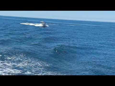
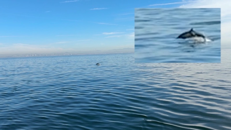
Photo taken February28 at 10:32 PM

Dolphins seem to enjoy playing around the boat. They particularly like to jump on the wake.

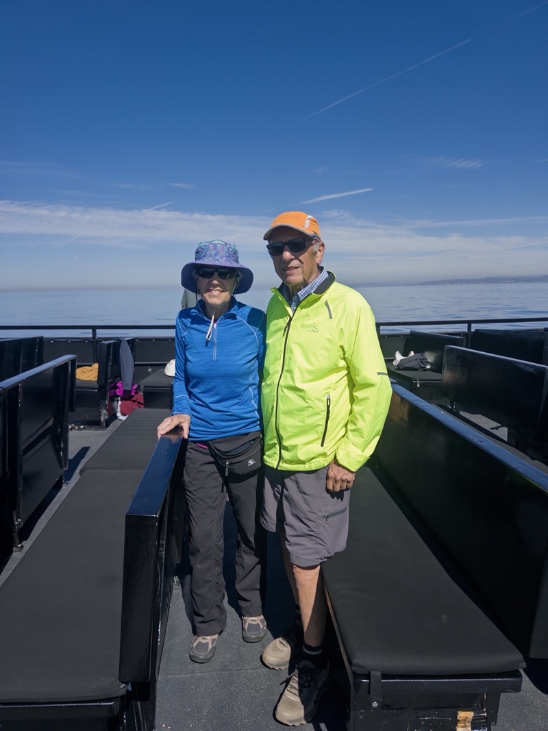
Photo taken Feb 28, 2026 at 11:06 AM

Mom and Dad standing on the sun deck of the Mighty Marietta. We’ve seen sea lions, dolphins, and maybe by this point the blow and back of a Gray Whale. I think four or maybe five whales were spotted. I heard a couple blows and was lucky to see one blow. I don’t think I really ever saw the dolphins.

--February 28, 2026 at 11:06 AM.

Maps are centered on the photo: Google map, Apple map, CalTopo map

Photo taken February28 at 12:15 PM

Almost back at our dock. It has gotten much busier in San Diego Bay. We certainly are noticing many more sailboats. Photo by Jonathan.

Saturday, January 10, 2026

Out and Back on the David Yetman Trail

Out and Back on Part of the David Yetman Trail

Play video Out and Back on the David Yetman Trail
▶️ Play Out and Back on the David Yetman Trail

Tucson Mountain Park has a surprisingly large network of trails. We have been here many times before we decided to revisit a part of the David Yetman Trail. We would hike from the Camino de Oeste trailhead as far as we felt good about and then retrace our steps back. We picked this hike because overall we thought it would be a gentle hike not requiring me to work my left shoulder: well we were mostly right.

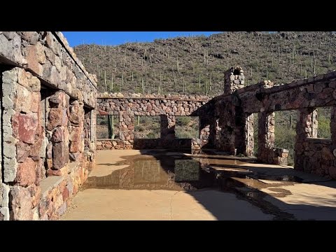
The remains of the Bowen house. We have visited this place many times but this is the first time we have seen standing water.

--January 9, 2026 at 10:51 AM.

Maps are centered on the photo: Google map, Apple map, CalTopo map


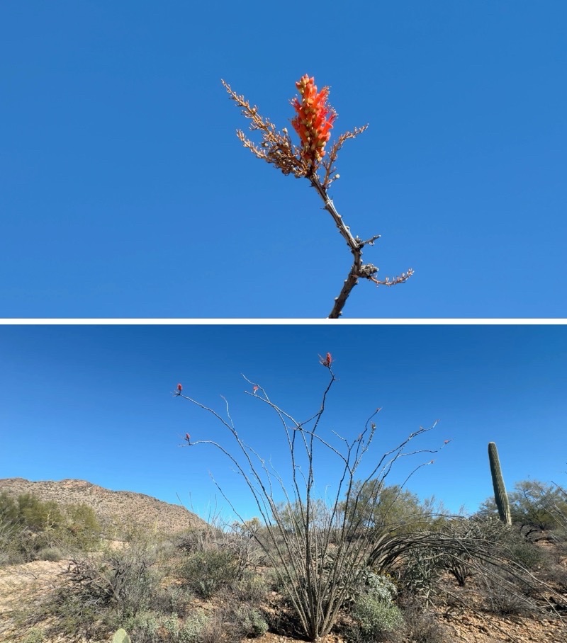
Mom spotted this ocotillo. I don’t recall ever seeing it getting ready to bloom like this.

-- January 9, 2026 at 13:34 PM.

Maps are centered on the photo: Google map, Apple map, CalTopo map

A watery Desert Loop Hike in Catalina a State Park, Arizona

A 3-mile hikes with the side trip to Montrose Pools. We have done this loop numerous times. Last year we didn’t see any water. This time I think we may have seen the greatest awater. With air temperatures barely touching the mid-50s we certainly felt our chilly wet feet as we passed through the rushing stream. It was a wonderful hike and the stream crossings add to its memorability.

Sunday, May 18, 2025

Black Forest Trail - Spring 2025

The First Days - April 29 and 30

A small red light blinks up high by the ceiling, generators purr not far away, a confused Killdeer chirps even though it is almost midnight, our headlamps cast some light into the completely dark hotel room, water fails to refill the toilet or flow into the sink: the power is out. I think this has to be a first for starting out on a backpacking trip. Fortunately, we don’t really need power to get into bed or for Andy to do a bit of improvising to make a pack cover for his pack since he left his rain cover at home. We will get what sleep we can.

During the night the power was restored. We were able to get ourselves ready around 5:40 AM with proper lighting and running water. The hotel provided a nice basic breakfast (who doesn’t enjoy waffles) and we were pulling out of the parking lot in good order under clear sunny skies for the remaining drive to Slate Run, Pennsilvania where we would park the car by Pine Creek and set out on our hike of the Black Forest Trail.
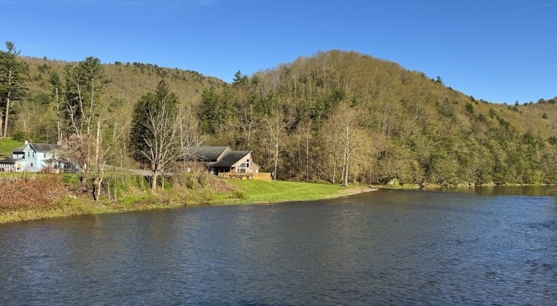
Photo taken Apr 30, 2025 at 8:41 AM

Good morning. Crossing Pine Creek. Sure seems rather wide and brisk to be just a creek.

—April 30, 2025 at 8:41 AM.

Maps are centered on the photo: Google map, Apple map, OpenTopoMap map
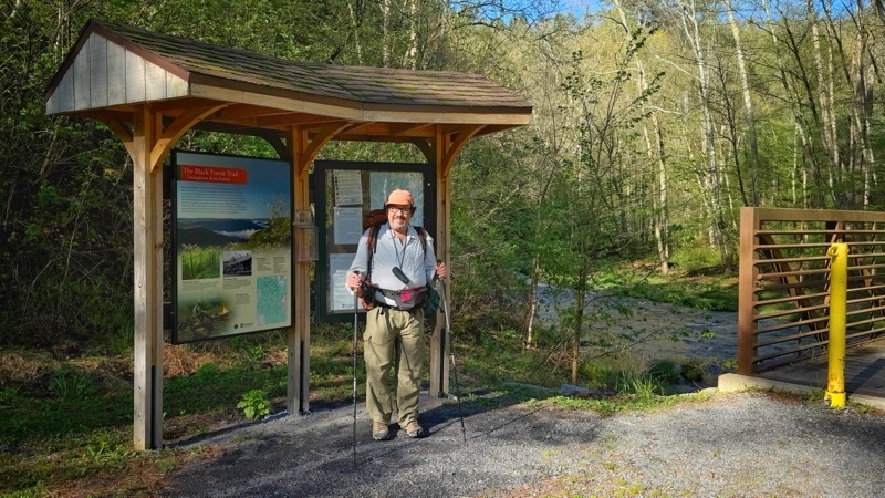
Photo taken Apr 30, 2025 at 8:45 AM

It’s time to start our hike. Ken with his gear on. Photo by Andy.

—April 30, 2025 at 8:45 AM.

Maps are centered on the photo: Google map, Apple map, OpenTopoMap map
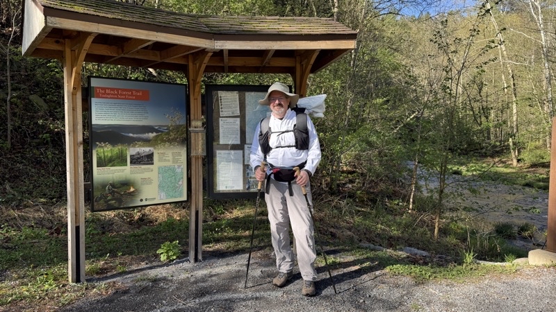
Photo taken Apr 30, 2025 at 8:45 AM

Andy is all set to hike too.

—April 30, 2025 at 8:45 AM.

Maps are centered on the photo: Google map, Apple map, OpenTopoMap map

The trail, in Tiadaghton State Forest, is a 43-or-so mile loop. It’s known for great views, very steep and lengthy ascents and descents, and numerous water crossings. I was expecting it to be a tough challenge. I was also ready to accept that I might have to make adjustments to my hike depending on how slow - and I thought it coupd be very slow - I was travelling. If that happened I would hike portions of the trail by myself while Andy forged ahead along the official trail by himself. We hoisted our packs, about 28 and 30 pounds for me and Andy respectively, and started out in a clockwise direction along the Black Forest Trail (BFT) around 8:40 AM with clear sunny skies and steadily warming temperatures.

The first couple of miles are deceptive as you trod along a good footbed through wonderful forest with Pine Creek rushing off to one side. Now and then we would step over a blowdown but if the trail stayed like this it would be a gentle walk through dense forest with ample access to water. This can’t last. Shortly after crossing Slate Run Road, which had never been that far away, our first big ascent of the day arrived. Up and up. The footing is not bad with just occasional big step-ups. But it is steep. The map suggests the trail gains nearly 1,000 feet in about 1.0 mile. The map is certainly right. Andy slowed down; I slowed down even more. It was hard to appreciate the splendor that was around us because I was working so hard. Andy did better (granted he sees more anyway). Up and up we went. We rose and the temperature rose too: internally and externally. It took the better part of two hours to complete that climb though that did include a snack break about halfway up. Two slow moving, hard working, hours. More was yet to come.
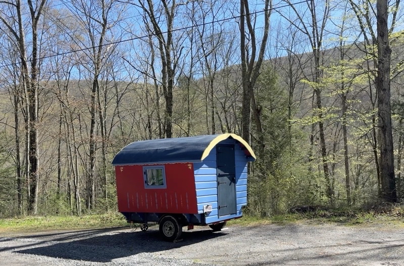
Photo taken Apr 30, 2025 at 9:59 AM

Not your typical camper. Soon our first really big ascent will begin.

—April 30, 2025 at 9:59 AM.

Maps are centered on the photo: Google map, Apple map, OpenTopoMap map
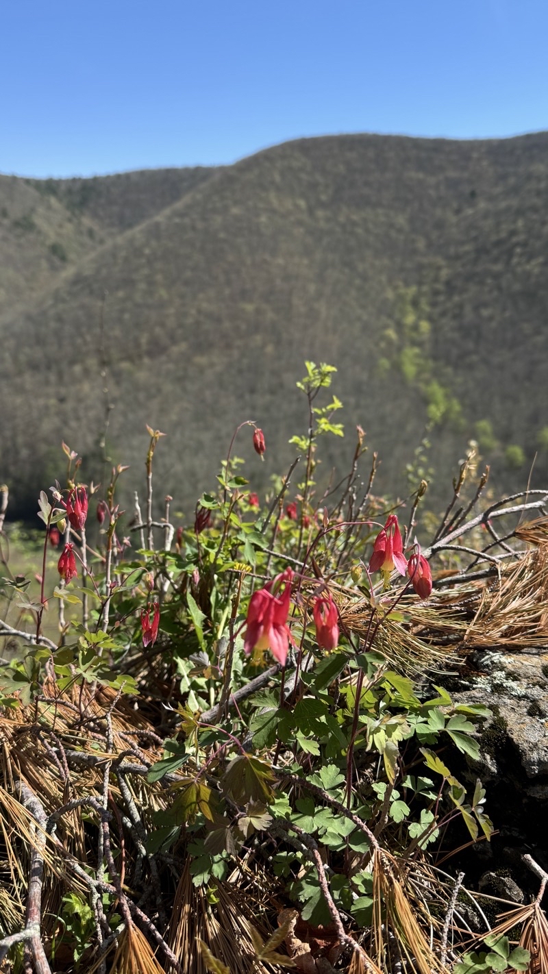
Photo taken Apr 30, 2025 at 10:39 AM

I am quite sure I never saw these brilliant red columbine Andy has paused to photograph. Look for signs of charming life as you toil up (or down) the mountainside. Photo by Andy.

—April 30, 2025 at 10:39 AM.

Maps are centered on the photo: Google map, Apple map, OpenTopoMap map
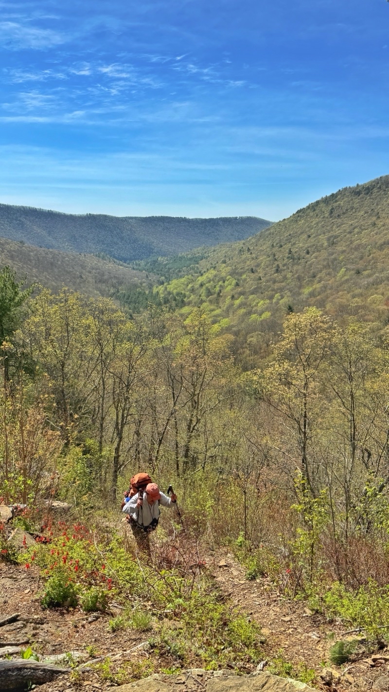
Photo taken Apr 30, 2025 at 10:43 AM

While Ken inches up the mountain Andy can catch his breath. The footing is actually pretty good but it is quite steep. Photo by Andy.

—April 30, 2025 at 10:43 AM.

Maps are centered on the photo: Google map, Apple map, OpenTopoMap map
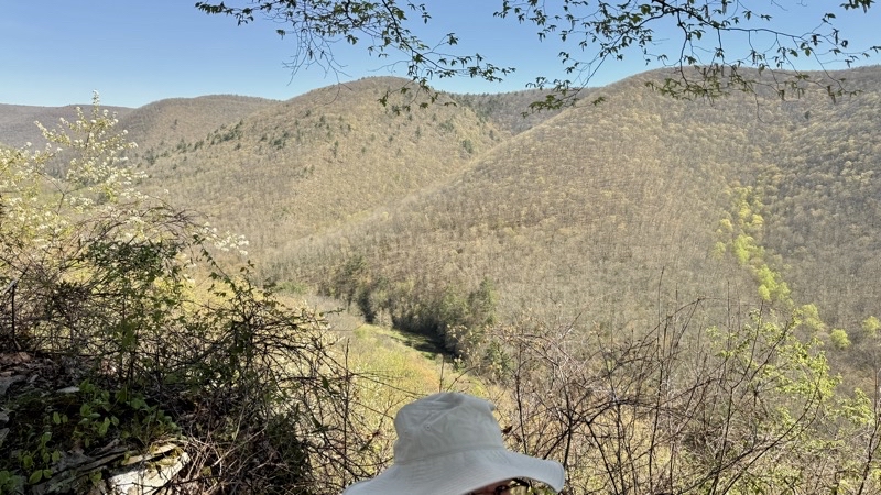
Photo taken Apr 30, 2025 at 10:45 AM

I am pretty sure we aren’t halfway through this big ascent. I think it gains nearly 1,000 feet over maybe a trail mile. We’ve risen about 400 feet from the start of the climb. Gorgeous hard work.

—April 30, 2025 at 10:45 AM.

Maps are centered on the photo: Google map, Apple map, OpenTopoMap map
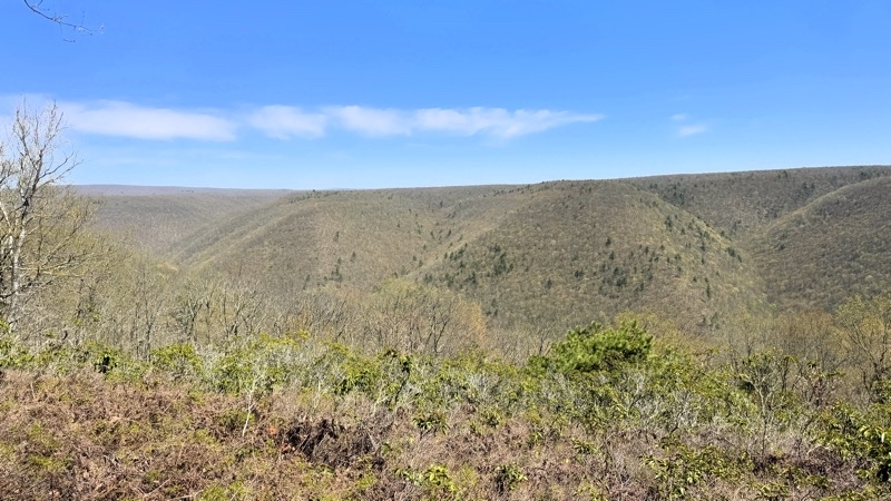
Photo taken Apr 30, 2025 at 12:06 PM

2 hours. That is how long it took me to gain some 900 feet over the past not-quite one mile of trail. It is lovely up here but it’s hard to appreciate when your body is letting you know what you just achieved was really tough going. But still a lovely day.

—April 30, 2025 at 12:06 PM.

Maps are centered on the photo: Google map, Apple map, OpenTopoMap map

Around 2:30 PM, at a road crossing perhaps 4.5 miles from the start, it was clear I wasn’t going to manage the 12.5 miles we had to go to get to the campsite for that night. Could I have done it? Yes, but it would have been dark when I got there - likely well past dark. When the trail joined Manor Fork Road, about mile 6, Andy would go his way and I would go mine. We would link back up the following evening. For me, taking the Manor Fork Road Bypass lopped off 14 miles of trail with a few big ascents and descents. I would find a campsite sourthwest of Route 44 (or maybe at the Pump Station Camp on Manor Fork Road) while Andy pushed on to Naval Run.

Pump Station Camp might have water but if it does it was not obvious. The most obvious thing, besides a big open area, were the huge cement pipes clearly there for some sort of water project. I continued down Manor Fork Road completing the 2-miles long bypass when I found the BFT again just south of the intersection with Route 44 heading southwest. Eventually I found a reasonably flat area not far past a rivulet that provided ample water. It turned out not to be the site Andy was thinking of which was another 0.3 mies distant but it was sufficient for my needs even though not as pretty as it could have been. I had made it, got things set up, not gotten lost - a good end to the day.
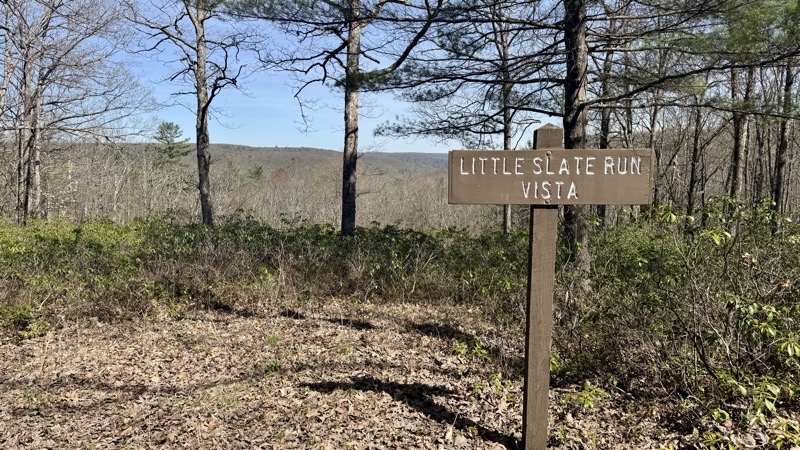
Photo taken Apr 30, 2025 at 3:25 PM

I am going too slowly. Barely more than 1.0 MPH and the miles to the camp Andy picked have more tough climbs. It’s time to be prudent and take the bypass route. It runs along Manor Fork Road basically between trail mile 6 and 20 (located just southwest on Route 44) for about 2 miles. Andy will hike the Black Forest Trail. I’ll find a camp and we will meet up tomorrow farther down the BFT.

—April 30, 2025 at 3:25 PM.

Maps are centered on the photo: Google map, Apple map, OpenTopoMap map
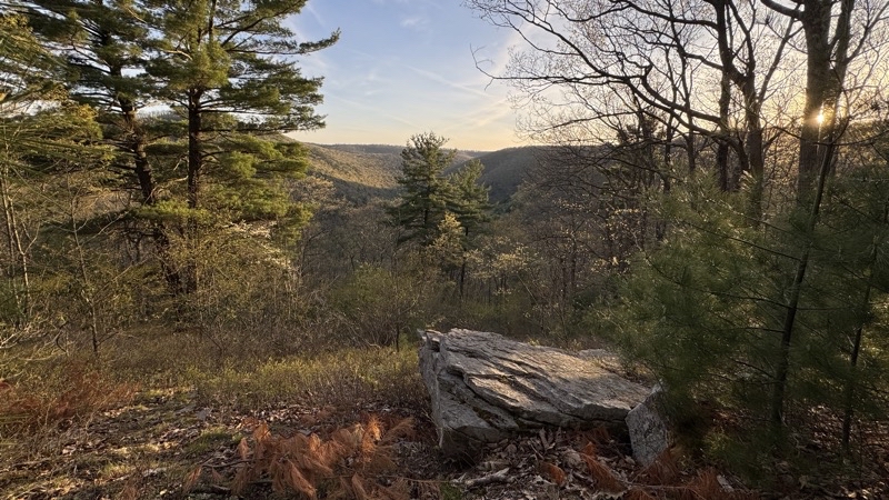
Photo taken Apr 30, 2025 at 7:27 PM

Andy is closing on his camp. I think he has just under 2 (descending 800 feet over a mile or so) miles to go to his camp by Naval Run. Photo by Andy.

—April 30, 2025 at 7:27 PM.

Maps are centered on the photo: Google map, Apple map, OpenTopoMap map

As I settled in the life of the forest became a bit more notable. The drumming of wood grouse, a sound I always enjoy, was heard. A woodpecker or maybe some other bird pecked at a tree searching for food or calling for a mate. As the sun set a whip-poor-will trilled in the distance and I hoped it would stay far off. I wondered how Andy was doing. I knew I’d eventually get a satellite message but that technology has limitations: a message might not get out until the sender has a very clear view of the sky; a satellite receiver might not get a message until it has a very clear view of the sky. A clear view really does mean that; foliage can severly impact the signal which I always find surprising given the distances the radio signals must travel. Andy’s “in camp” message was sent at 8:40 PM (though he might have pressed “send” earlier) but I didn’t get it until much later. Time to listen to the world and sleep the sleep of the tired.
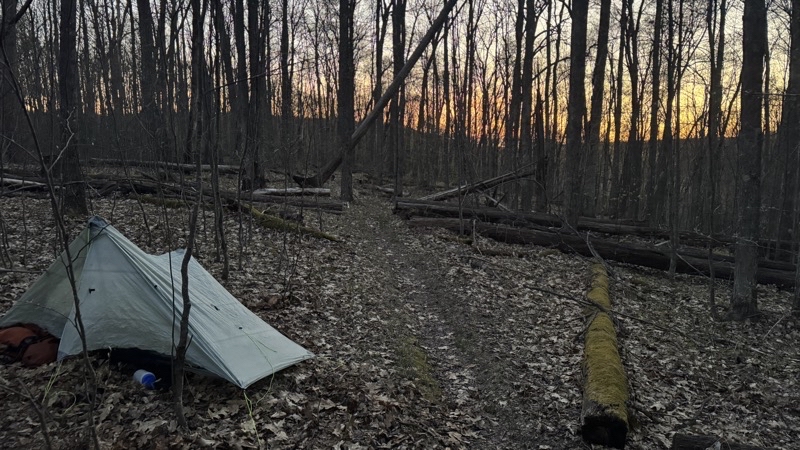
Photo taken Apr 30, 2025 at 8:25 PM

I found this camping spot. It turns out I should have gone another 0.3 miles (and down a couple hundred feet in elevation) to a truly lovely creek but I didn’t realize it was there. This site was pretty enough.

—April 30, 2025 at 8:25 PM.

Maps are centered on the photo: Google map, Apple map, OpenTopoMap map

Day 2 - May 1

I did not feel any reason to get up before the sun and its light brought me to wakefulness. I did not have that far to go to reach our campsite for the second day. If Andy caught up to me before I got there that would be grand but I wasn’t going to wait for him because if I travelled as slowly as yesterday it was going to take 5 hours to get there. Not to much before 09:00 I was packed up and ready to go. I’d heard from Andy but still saw no reason to wait twiddling my thumbs. Off I went. And soon I found the great descent, about 200 feet down over a tenth or so of a mile down to a far lovelier and substantial creek and place to camp than I had just been. Oh well. The BFT follows this creek, right at the edge at times, for the next mile and change. Since it is the BFT and the land is what it is the trail crossings through the creek several times. I paused to take off my Darn Tough wool socks and slip into the waterproof socks. My feet might get chilly, though I doubted that, but they would stay dry even if the creek flooded my boots: which it did. Along the creek I went, sometimes veering up and away from it, but returning back and across more than once. Over the next 1.5 miles I think I crossed 7 times. It was a lovely area and I was pleased that I was making my way through it even if it wasn’t at a speedy pace. I had plenty of time. I had a gorgeous day. The trail had no big ascents or descents for several miles to come. Life was good.
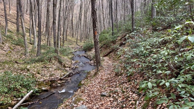
Photo taken May 1, 2025 at 9:38 AM

Talk about running along the edge of a stream. The

—May 1, 2025 at 9:38 AM.

Maps are centered on the photo: Google map, Apple map, OpenTopoMap map
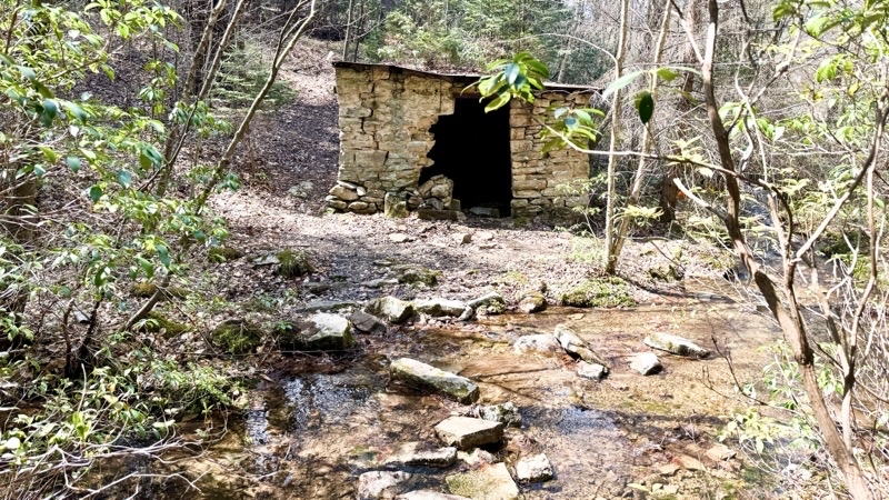
Photo taken May 1, 2025 at 11:31 AM

This is some sort of old pump house. I suppose if you got caught in a heavy rain storm it could serve as emergency shelter too though I think it might be iffy. I have been following this stream for about 2 hours (with breaks) and I believe I’m going to leave it soon after six water crossings. My waterproof socks have worked out well.

—May 1, 2025 at 11:31 AM.

Maps are centered on the photo: Google map, Apple map, OpenTopoMap map
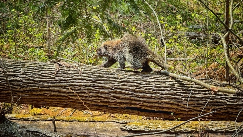
Photo taken May 1, 2025 at 12:37 PM

Andy is walking trail I skipped. Along the way he finds critters like this porcupine. Photo by Andy.

—May 1, 2025 at 12:37 PM.

Maps are centered on the photo: Google map, Apple map, OpenTopoMap map

In time the BFT would leave the stream and follow cross-country ski trails through glades and forested areas for a few miles. About as easy going as you could probably ask for. I even had good views now and then and was enticed to stop and rest and enjoy the scenery around me. Andy was toiling behind me. His ETA to near where I had camped had slipped back a few times confirming that my decision to not wait was certainly the right choice. I am confidnet that while he was expending more effort than I was that he was having a fine time too.
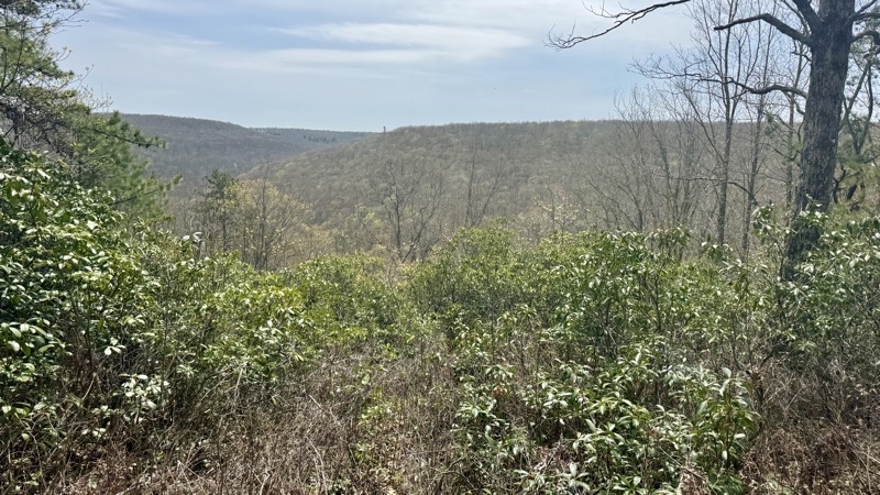
Photo taken May 1, 2025 at 1:01 PM

When a spot is marked on the map as a lookout you should stop and look. I took my shoes off and relaxed for a while. The campsite for tonight is certainly less than 2 miles from here.

—May 1, 2025 at 1:01 PM.

Maps are centered on the photo: Google map, Apple map, OpenTopoMap map

In time the BFT had to leave its gentle pathway for a 200-foot elevation loss over a modest distance. Maybe not as steep as some before but not a gentle grade. The trail opened up on a lovely rushing stream at trail mile (going clockwise) 25 where we would set up camp for the night. It was about 3:30 PM and though skies were clouding over the air temperature was certainly over 70°F.I whiled away my time waiitng for Andy to arrive. I was pretty sure this was the right place, especially when I found the stone chairs around the fire ring, but not positive. That , in hindsight, was silly. I should’ve set up my shelter regardless of whether I was right or wrong immediately. Always have a shelter ready to go if the option is available. Instead I relaxed and ate an early dinner. It wasn’t quite as good as the PackIt Gourmet pasta bolognese I had the night before but it was, especially for a thrown-together homemade meal, good enough.

Andy strode into camp just after 6:00 PM; the rains started striking the ground not long after he arrived. We got our shelters up in short order. I got a little more damp than I should have because I did not set up right away when I arrived. Oh well. Hardly wet; just damp. I suspect it was a greater annoyance for Andy because he didn’t get to cook a hot meal. I suspect he could have used a good solid meal instead of the snacks he ate: calories yes; as morale-boosting as a nice dinner: no. We both snuggled down into our shelters and waited for the next day to begin.
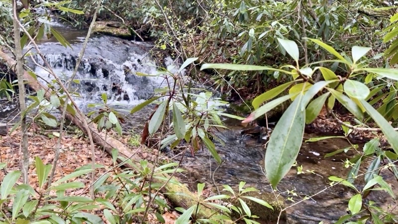
Photo taken May 1, 2025 at 7:43 PM

A good source of water, a fire ring with some stone chairs, and flat-ish spots for shelters. Home for the night. I arrived around 3:30 PM and Andy walked in a bit past 6:00 PM. The on-and-off rain started not long after Andy arrived.

—May 1, 2025 at 7:43 PM.

Maps are centered on the photo: Google map, Apple map, OpenTopoMap map

Day 3 - May 2
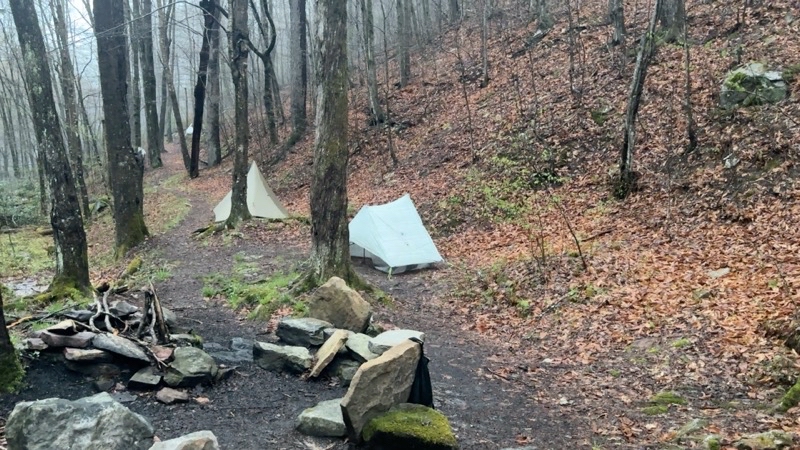
Photo taken May 2, 2025 at 6:15 AM

A better view of our camp. It’s drizzling a bit. The trail is going to be a mess.

—May 2, 2025 at 6:15 AM.

Maps are centered on the photo: Google map, Apple map, OpenTopoMap map

On-and-off light rain for a good part of the night. When we started moving at 5:30 AM drops from the leaves above were pretty much all that was striking the ground. Our goal was to be on the trail by 7:30 AM since today was going to be at least 11 miles long, feature something like 20 creek crossings, and have one nasty rocky descent that while not long was going to be wretched. I hoisted my pack and set out just before 7:30 AM as Andy finished up dealing with his morning camp chores. We had no doubt he would catch up.

Up and out along an actual switchback I left the creek valley for higher ground. As I walked I passed by, or through, small pour-offs of water flowing downhill to the creek below.The trail was flooded but the footing was good. The morning had that quieter feel that comes just after a rain but before everything alive decides its really time to come out for the day. I continued on at a modest rate of speed. I am sure I would have been moving faster if following someone else but I was happy with my pace. I remained pretty happy as I entered an open glade and the trail seemed to vanish in the soggy grassy ground. Perhaps there was an orange blaze (I had not seen any so far the whole trip) on the far side but I just had to figure out where the trail seemed to be and put one foot in front of the other. That’s what I did. I always wonder what causes these open areas to develop and not fill in with trees.
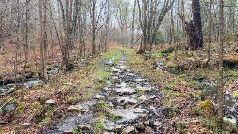
Photo taken May 2, 2025 at 7:52 AM

The trail and water run-off intermingle.

—May 2, 2025 at 7:52 AM.

Maps are centered on the photo: Google map, Apple map, OpenTopoMap map
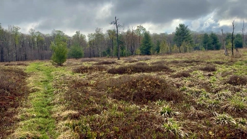
Photo taken May 2, 2025 at 7:59 AM

It’s a soggy mess in this open area. I was still solo as Andy had more packing to do when I was done: he would catch up. This section was a bit slower going because I needed to stay on the trail. A trail that was not particularly obvious here.

—May 2, 2025 at 7:59 AM.

Maps are centered on the photo: Google map, Apple map, OpenTopoMap map

Andy would catch up to me just after I reached a forest road - not much more than a two-track - and not long after we had both negotiated a big blowdown. There have been occasional blowdowns along the trail: some you can push straight through; others it is best to navigate around them going off trail to get to the other side. That last one was of the latter sort and so took a bit longer. We were together again with likely about 10 miles to go.

Even if Andy had not caught up to me where he did I would have been forced to wait soon enough. The nasty stretch was almost upon us. You can’t tell how bad it is - just that it is bad. It is, in fact, worse. Big rocks that you have to scramble down. Your trekking poles are apt to get in your way too. One huge rock made me really uncomfortable as I squirmed around it. SLow, very slow, steady progress. One foot in front of the other but not until I am sure I have secure points of contact with the ground and rocks. Andy claimed it was considerably easier last fall when he ascended through this stretch. Over the next half-hour we travelled perhaps 500 feet descending 55 feet. It was a section I would not characterize as precisely fun but you will feel satisfied when you reach the end. That feeling will not last all that long as the BFT has more to throw at you before you even reach County Line Branch and all the water crossing you could want.
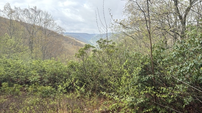
Photo taken May 2, 2025 at 8:53 AM

You get views even on overcast mornings like this.

—May 2, 2025 at 8:53 AM.

Maps are centered on the photo: Google map, Apple map, OpenTopoMap map
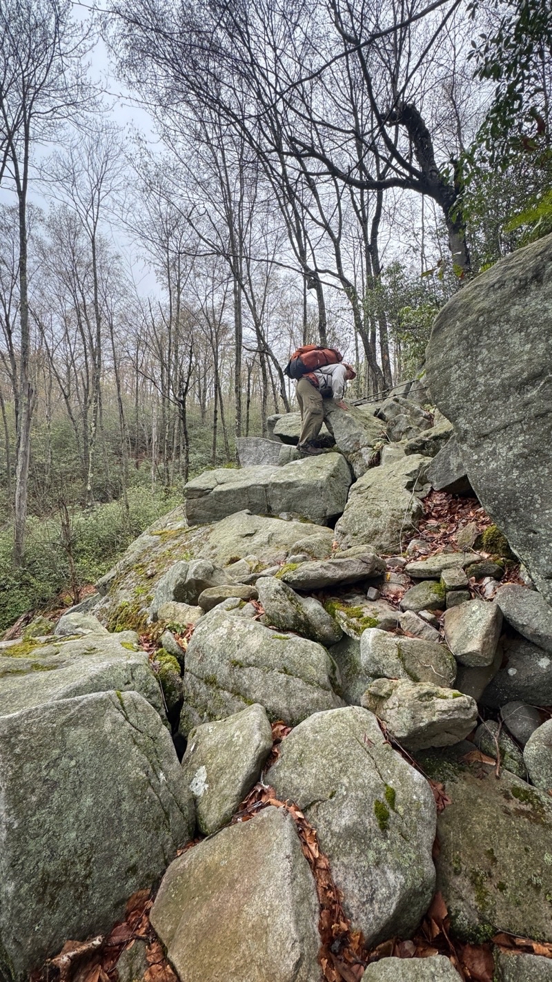
Photo taken May 2, 2025 at 9:11 AM

I think I am in the middle of this nasty section of rocks. It’s a slog. Nerve-wracking. Photo by Andy.

—May 2, 2025 at 9:11 AM.

Maps are centered on the photo: Google map, Apple map, OpenTopoMap map
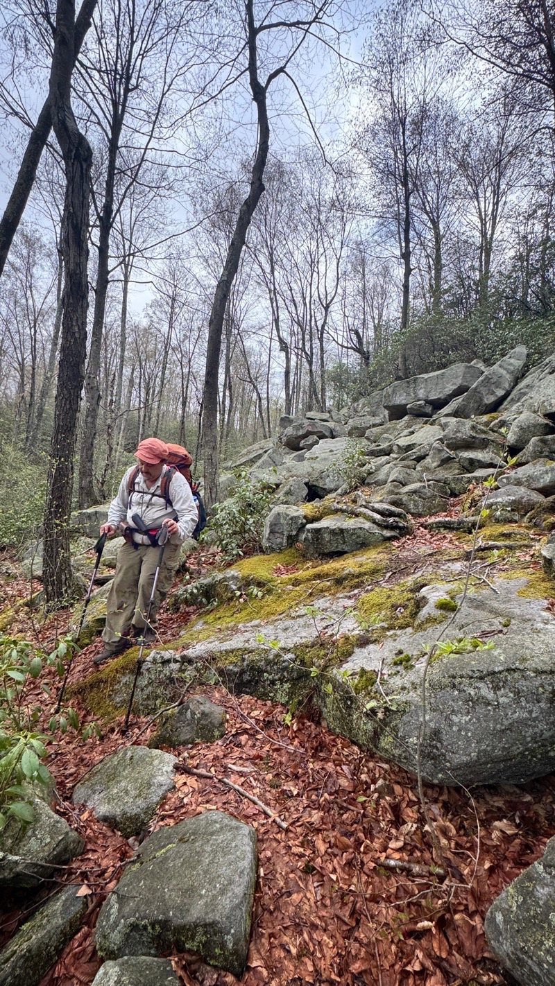
Photo taken May 2, 2025 at 9:21 AM

After perhaps 500 linear trail feet which dropped us 55 feet could the rocks be ending? It’s taken nearly 30 minutes to get through this stuff. Photo by Andy.

—May 2, 2025 at 9:21 AM.

Maps are centered on the photo: Google map, Apple map, OpenTopoMap map

The morning was dry. Overcast but dry. The trail zipped up a bit, got fainter in a dense patch of rhododendron. We almost got ourselves confused looking at the map and thinking it was oriented on our screens opposiite to what it was (yes, an argument for a paper map; though had either of us looked at the compass display, which is present, we’d have noticed right away instead of making a tiny error). We descended through the rhododendron tunnel, found mountain laurel (I’d not have known except when Andy told me) and kept going. We reached the valley floor with the sound of rushing water in our ears. The 2-miles of following a big creek with numerous water crossing was upon us. It was a pleassant morning: temperature in the mid-60s though it felt cooler. We were ready for what the trail had to offer. What it had to offer was a small river valley. County Line Branch was rushing downstream as we walked upstream. The creek is reasonably wide and clearly had deep spots everywhere. Our shoes would certainly flood and I fully expected the water to reach above my knees at some point. Over the next couple miles we walked along the creek, crossing through it 21 times, as we went. I was right there were many places where the water was above my knees and the current did its best to push me off balance. Slow and careful are the watch words when you work your way through surging water. Neither of us fell and we only got as wet as we expected we would. It was a lovely morning. However, I can understand the value of having a high-water bypass option available. County Line Branch could easily get considerably more powerful after a substantial rainstorm.
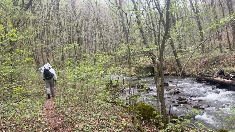
Photo taken May 2, 2025 at 10:22 AM

If you aren’t climbing or descending you are likely by a roaring creek. County Line Branch is off to our right. We have already crossed through it at least once.

—May 2, 2025 at 10:22 AM.

Maps are centered on the photo: Google map, Apple map, OpenTopoMap map
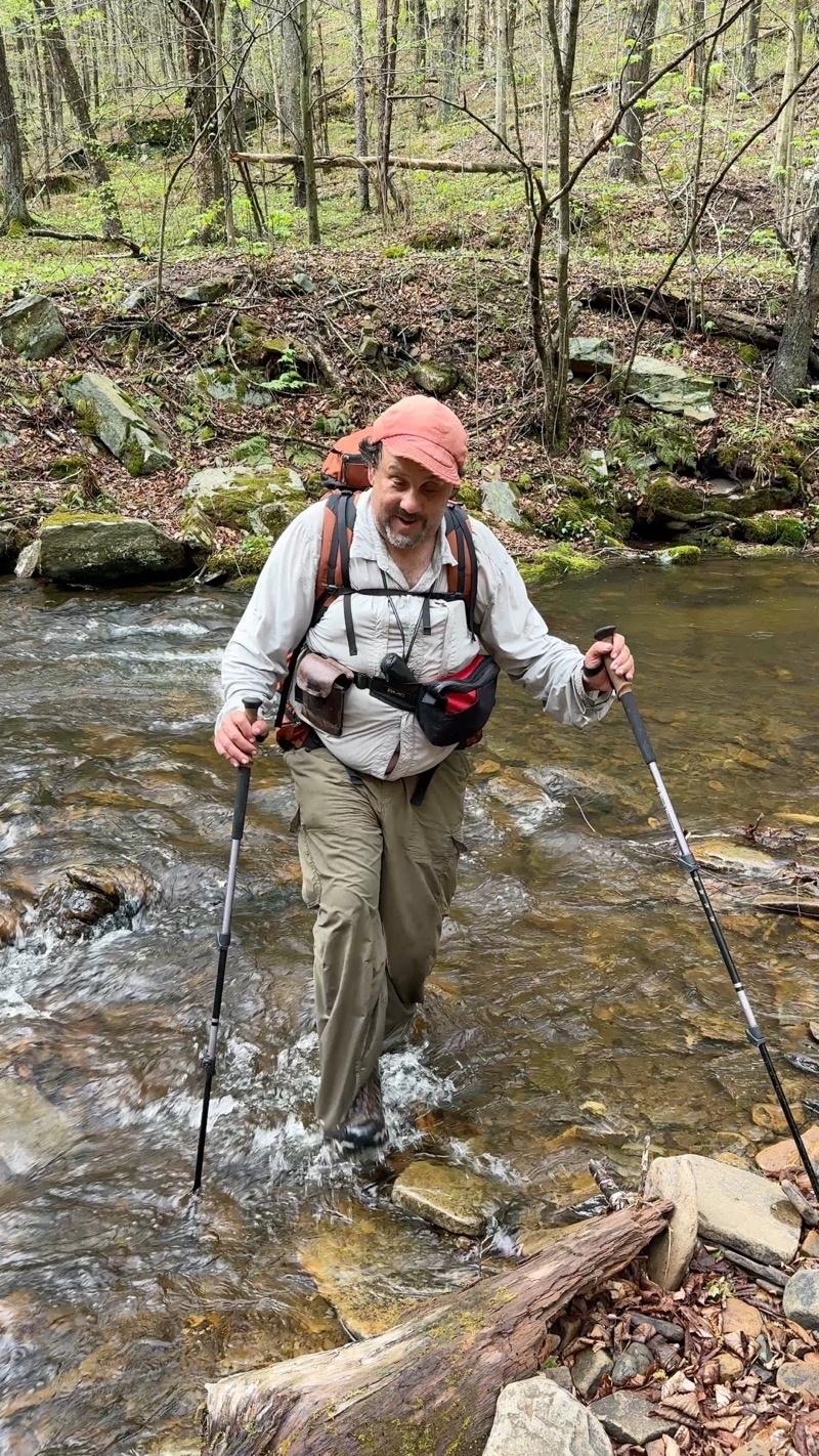
Photo taken May 2, 2025 at 10:35 AM

An early crossing of County Line Branch. The waterproof socks are keeping our feet dry if not toasty warm. Dry is enough. Photo by Andy.

—May 2, 2025 at 10:35 AM.

Maps are centered on the photo: Google map, Apple map, OpenTopoMap map
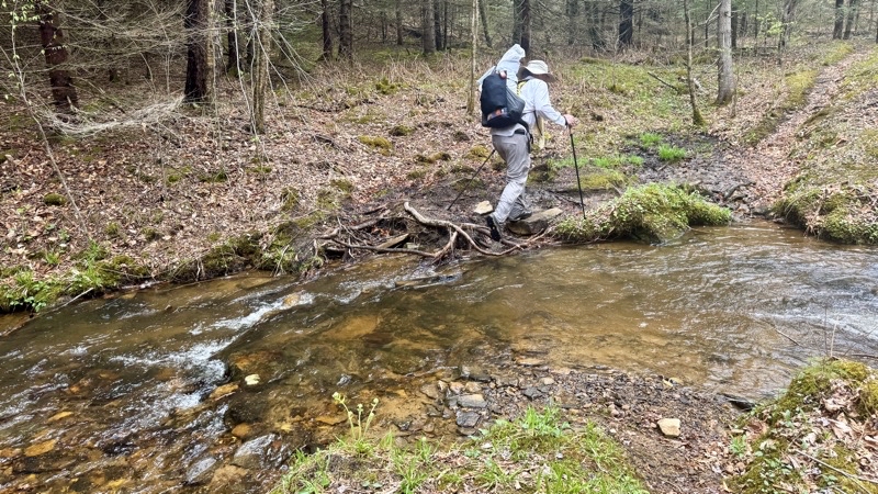
Photo taken May 2, 2025 at 11:40 AM

I think this was the 14th crossing of County Line Branch. 21 crossings through the waters of the creek; one small bridge.

—May 2, 2025 at 11:40 AM.

Maps are centered on the photo: Google map, Apple map, OpenTopoMap map

By the time we came to a nice campsite by another creek, not far from Route 44, we had dried out. Here we ran into our third set of people. Earlier in the day we encountered a trail runner who Andy had met the previous morning. He was running the entire BFT over two days (1 night). The fastest-known-time record was not in danger but even doing what he was is hard to imagine. It’s not something I could do even if I was in peak physical condition. He admitted that his legs were, “cooked.” Later, perhaps around creek crossing 16 we met a couple coming the other way. I think they must have started not too far away from where we met them. We could still smell soap on them; clearly fresh from town. Finally, at this pretty site around trail mile 30 we found a trio of Canadians who were out doing the whole loop in a counter-clockwise direction. They’d started at Slate Run, like us, and for some this was their first really tough backpacking trip. I think they were having a good time; but they had some really tough trail to come (though many options for bail-outs if needed). By this point the sun was breaking through the dispersing clouds and morning was coming to an end. We had about 6 miles to go and it was supposed to be easier going all the way. Well...

You take the good with the bad. The afternoon was warm but not overly hot. A sun-shower or two happened. Just enough to make us ponder putting pack rain covers on the backpacks. We continued through the forest. The trail meandered through slightly rolling terrain but was trending gently down. We were having a good time. It couldn’t last. When the trail reached what was clearly an old forest road it began descending that road. It kept descending. It descended more. The footing was good but the descent was relentless. Over the next couple of miles we dropped down about 900 feet. For the BFT that means the grade was quite reasonable. But it was turning into a tiring day. I was starting to feel it. I was starting to wonder when it would end and where was camp. When we reached Francis Road, not that I knew the name at the time, I was very happy. I thought camp was amost here. It wasn’t: quite. We traipsed down the dirt road, found the BFT dropping down a hillside, and found another dirt road. That road would take us into the area of Little Morris Runk and eventually across a narrow swaying bridge to the trail that would, after a long half-mile or so, reach widely spaced campsites. I was so ready to be done. I expect Andy was too but he surged ahead. He had to. We were caught up to, and passed, by two younger fellows carrying huge packs who were intent on finding a campsite too. I doubt they were doing the whole trail but they were out doing something. I lagged behind. I found the first campsite with a couple big tents. I found the next site. I kept going. I hoped Andy would spot me as I passed by because otherwise I might miss the campsite. He did. By the time I got there he had his shelter set up. I was bushed. The hiking portion of the day was done. Setting up camp, never a speedy process, was about to begin: a 10 hour hiking day.
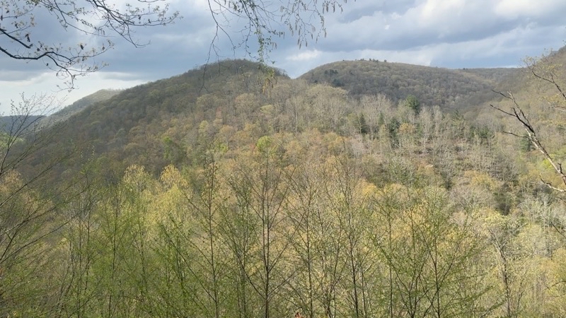
Photo taken May 2, 2025 at 4:39 PM

This view showed up just after leaving an old forest road for Francis Road. That old road was not super steep, dropping about 900 feet over 2 miles, but it was relentless.

—May 2, 2025 at 4:39 PM.

Maps are centered on the photo: Google map, Apple map, OpenTopoMap map
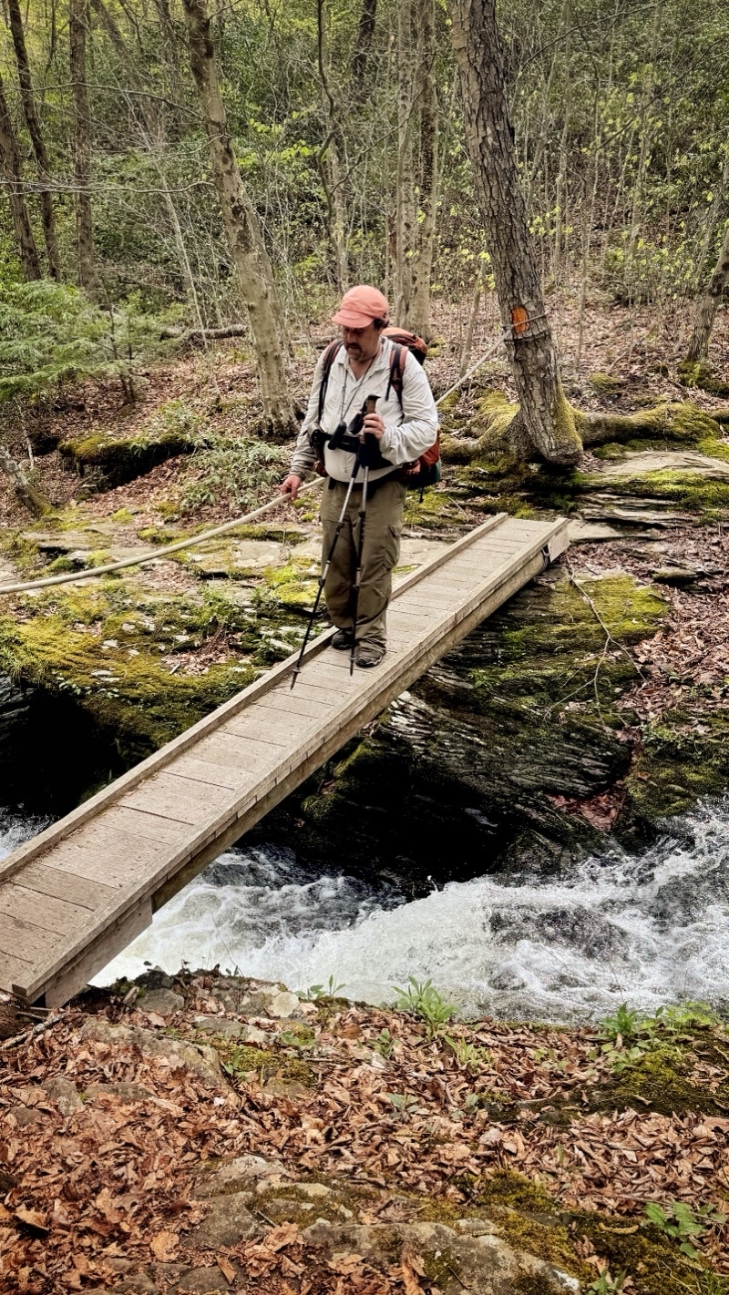
Photo taken May 2, 2025 at 5:14 PM

I am really slowing down. We left Francis Road, slowly descended a hillside, joined a dirt road (Morris Run road I think) that took us to this bridge over Little Morris Run. I am very tired. I am more than ready to be done hiking. Camp is somewhere downstream.

—May 2, 2025 at 5:14 PM.

Maps are centered on the photo: Google map, Apple map, OpenTopoMap map

You have to do your camp chores. It might be a lovely afternoon or a cruddy one but the chores have to be done. Today was a lovely late-afternoon with a creek rushing just out of effective view. I was ready for a hot meal and tonight I was hoping to enjoy my dehydrated faux jambalaya. Andy was going to enjoy his Asian-inspired sticky noodles. Two different approaches to our meals tonight. I just had to re-hydrate and heat my meal, add some extra spices and some olive oil. Andy had a bucnh of prep work to do while some of his food soaked up water rehydrating. He had noodles to cook, items to lightly sauté (maybe), and eggs to cook before creating something like a stir-fry. When it works it results in wonderful food. My food was pretty good too but I can’t help but be more impressed by what Andy routinely does on backpacking trips. I sometimes do it too but I think Andy does more. He is certainly more organized which is possibly the single biggest key to success.
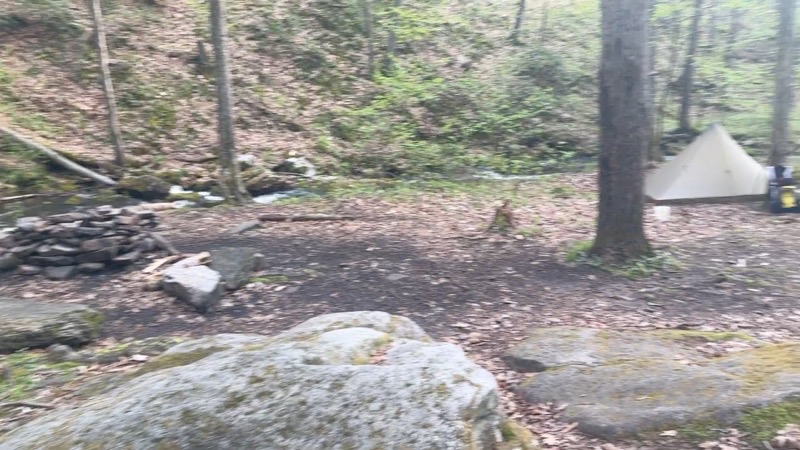
Photo taken May 2, 2025 at 6:27 PM

Campsites often don’t look like much. I got here 40 minutes ago. I was so happy to dump my pack. Though not visible my shelter is set up and I am getting ready for a dinner of faux jambalaya. Andy is set up by the rushing creek. I am sure he is ready for a hearty dinner too. That last 0.7 miles sure felt longer; the end to an eleven plus miles day.

—May 2, 2025 at 6:27 PM.

Maps are centered on the photo: Google map, Apple map, OpenTopoMap map

Day 4 - May 3

Prelude

As night fell we settled into our shelters and it began to rain. At this point we were still hoping to get up very early and be done with the steep rocky segment before the mid-morning rains arrived and soaked the truly nasty rocky third-of-a-mile very steep big rocks ascent about 0.3 miles away. The rain that we thought shouldn’t have really been here intensified. I started wondering about the prudence of tackling this upcoming ascent. Andy said it was worse trail than the shorter descent we cotended with earlier. We would be going uphill but if the rocks were slick we would be asking for greater risk and possible trouble. The rain continued. Sometime during the night, during an “on” portion of the rain, I decided that I was going to follow the trail back to the roads and follow them back to the car. The mountains aren’t going anywhere.

* * * *

At 6:00 AM Andy came on by and told me he wanted to take a “safety hike” and not tackle the last few miles of the BFT including the awful ascent. We were in agreement and life was good if a bit damp.
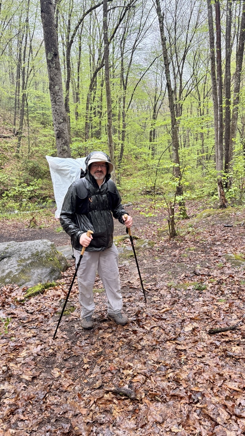
Photo taken May 3, 2025 at 7:34 AM

We had on-and-off and sometimes heavy rain through the night. It’s drizzling now as we slowly pack up camp in preparation to depart. We have decided to take the safer route out since the very steep and rocky climb is now slick with water. I think it will be about 7 miles of mostly road walking along Francis Road and Slate Run Road.

—May 3, 2025 at 7:34 AM.

Maps are centered on the photo: Google map, Apple map, OpenTopoMap map

Bundled up in our rain gear with our pack covers protecting our packs we began to retrace our steps. Soon we passed by the two fellows who hustled past us yesterday afternoon. Andy noted that their approach to breaking down camp was far from ideal as the inner mesh tent of a double-wall tent was being rained into because they had taken down the fly and stowed it. Maybe they were just spending one night out and did not care if the tent got soaked. But, still... We continued on. We both felt sure that the trail back to the brdge across Little Run now had more blowdowns for us to step over than had been present the previous afternoon. We were too tired or too focused to notice yesterday. Over the bridge and up the stupidly steep short climb to the dirt road that takes you out of this small state park. We continued on. The aroma of bacon tickled our noses. The aroma drew us, like moths to a flame, to a car camp site. We found two guys clearly out for some trout fishing cooking under a canopy. Our hopes of some free bacon vanished; where was the bacon? Had they digested the evidence already or were they just cooking with bacon grease? Disappointment. We continued on and up the hillside we had come down the day before. Ugh. Then we were at Francis Road and standing by an overlook gazing across the valley where Morris Run was flowing. Trying to gaze across as the mist shrouded us. From this point we figured we had about 6 miles to go: one foot in front of the other. At least the footing is sure and any grade is gentle. But it is still a dirt road.
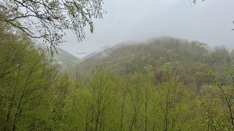
Photo taken May 3, 2025 at 8:39 AM

I think it isn’t quite as misty as this photo at the same general lookout point as yesterday’s photo suggests. It is misty though and spitting rain. We are both happy to wear our rain gear. Photo by Andy.

—May 3, 2025 at 8:39 AM.

Maps are centered on the photo: Google map, Apple map, OpenTopoMap map
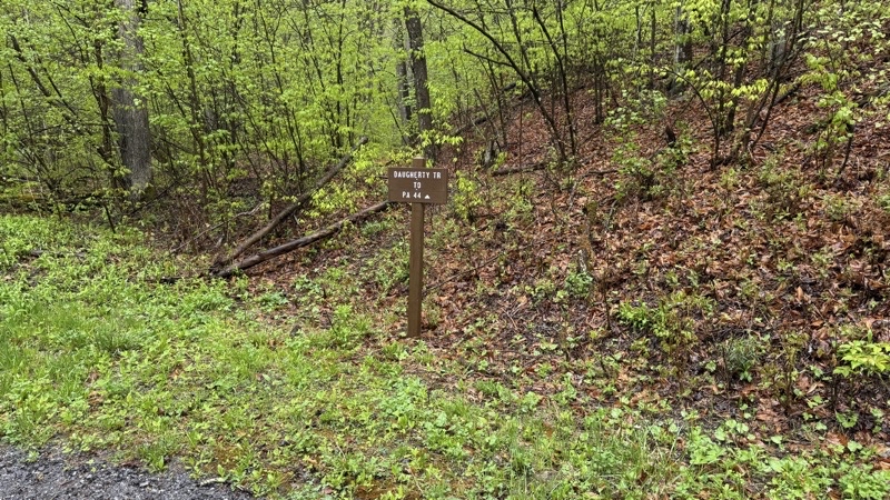
Photo taken May 3, 2025 at 9:13 AM

A bit more than 3 miles down; and 4 miles to go. A couple trucks have passed by including, we think, the fellows whose camp enticed us to it with the aroma of bacon and let us down with no bacon to be found.

—May 3, 2025 at 9:13 AM.

Maps are centered on the photo: Google map, Apple map, OpenTopoMap map
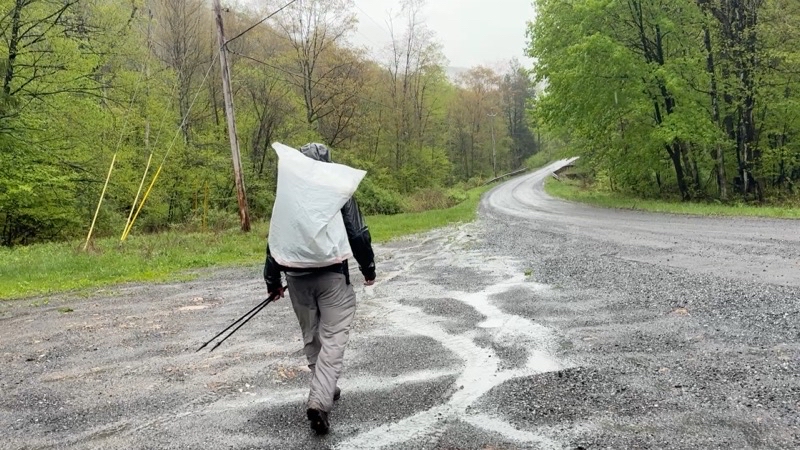
Photo taken May 3, 2025 at 9:13 AM

I think it’s going to take 2 hours to reach the car as we plod down Slate Run Road. Andy thinks it’ll be less.

—May 3, 2025 at 9:13 AM.

Maps are centered on the photo: Google map, Apple map, OpenTopoMap map

We plodded forward. Now and then a pickup truck would pass by. Light rain fell now and then. At this point it’s more about getting to where you want to be than enjoying being outside. There wasn’t much to see. In time we turned on to Slate Run Road: 4 miles to go; 2 hours though Andy thought it would be less. We plodded forward. At one point I passed Andy and did not notice: one foot in front of the other. He passed by and moved ahead: his feet moving more quickly than mine. He was right it took me about 100 minutes to cover the distance which he covered somewhat more quickly. I crossed over the fast-flowing Pine Creek, which really looks more like a small river, just before 11:00 AM. I found Andy well into the process of shedding trail clothing and gear for more comfortable duds. That was something I was looking forward to doing as well. Our journey along the Black Forest Trail might have ended with maybe more of a whimper than a bang but it was a good trip and by many measures, and the ones that count, a successful trip. It was time to be done and to pack up and head home.
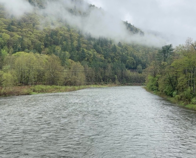
Photo taken May 3, 2025 at 10:52 AM

The car is in the parking lot a couple hundred yards away. Andy is surely there. It is going to be less than 2 hours after all. The hike is done. We achieved a lot but I am glad to be crossing Pine Creek and arriving at the car.

—May 3, 2025 at 10:52 AM.

Maps are centered on the photo: Google map, Apple map, OpenTopoMap map