Tuesday is our first full day here in San Diego. Monday we took a bit of time and visited Pacific Beach but while we walked some it wasn’t really a hiking day. Today is the first hiking day. Our first plan didn’t come together. So we decided to fall back on a previous idea. It would turn out to be a very good choice. We drove to the San Elijo Natural Park. This is located near Encinitas. The lagoon is part of an estuary that I suppose flows into the Pacific Ocean. There are numerous trails around the water. Many, if not all, are easy walking paths that are fully accessible. The paths are almost completely flat. The trail bed is packed dirt and very firm. The walking actually gets a bit tiring because of this (though I admit I am still not healed from the bad fall and subsequent shoulder surgery). This area is within spitting distance of highways. A notable feature in and around San Diego are the endless highways and constant traffic. The sound of the traffic is omnipresent and loud.
We walked around the lagoon through a profusion of yellow flowers. Black feathered ducks drifted by upon the water. People, often with dogs, strolled by. We kept walking the road-wide path. Bikes are not allowed but vehicles can drive by as long as they stay below the 10MPH limit. This seems a bit strange.
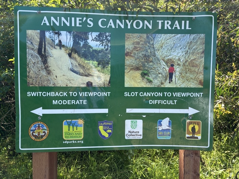
In time, it seemed more and farther than it was, we reached the bottom entry of Annie’s Canyon. At this point, you have a choice to take the tougher route up through the slot Canyon or follow a dirt path that climbs up the hillside. If you choose the latter option you will not get to see the slot Canyon. We chose to climb up through the slot canyon and descend on the moderate path back down. While there are no signs saying you cannot descend through the slot canyon we feel sure you shouldn’t do so. After all, it’s a slot canyon which often narrows to perhaps 12 inches wide. There is no way people could pass by each other.
Climbing up the canyon was fun. It was tough especially when you had to squeeze through spots and climb up 18-inch (more?) high steps. We did it.
After dropping back down we continued on the hard packed path towards busy roads and the highways. We passed under the highway along the flowing g water to join a path alongside a bustling road. The GOS track says we walked just over 3 miles: felt like more. Annie’s Canyon really makes this hike shine.
A fly-over view of the hike.
Photos and Video
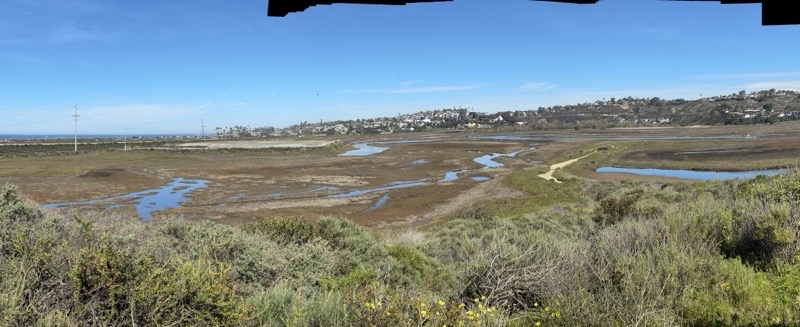
Looking across the San Elijo Lagoon. This nature area has seen considerable improvement over the last several years. It’s great that this place is here but it’s a shame the traffic noise is so intrusive.
--February 25, 2026 at 10:35 AM.
Maps are centered on the photo: Google map, Apple map, CalTopo map
At the bottom of Annie’s Canyon. What makes the slot tough is the need for agility as you squeeze through and up the slot.
Mom took this picture while waiting for Dad and Ken to come down the moderate trail from the top of the canyon. That trail is really easier but in some ways more challenging for Ken than the ascent of the canyon. Photo by Judy.
--February 25, 2026 at 11:27 AM.
Maps are centered on the photo: Google map, Apple map, CalTopo map
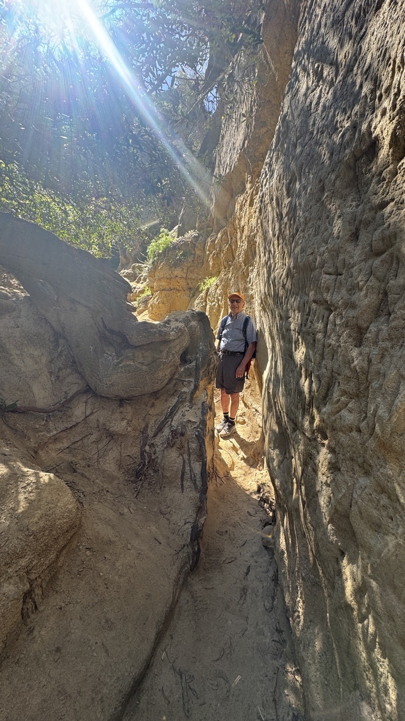
Not far from the lower end of Annie’s Canyon. After this point this slot canyon frequently narrows down to perhaps 12 inches: just enough to squeeze through sideways with a squeezable backpack.
--February 25, 2026 at 11:03 AM.
Maps are centered on the photo: Google map, Apple map, CalTopo map
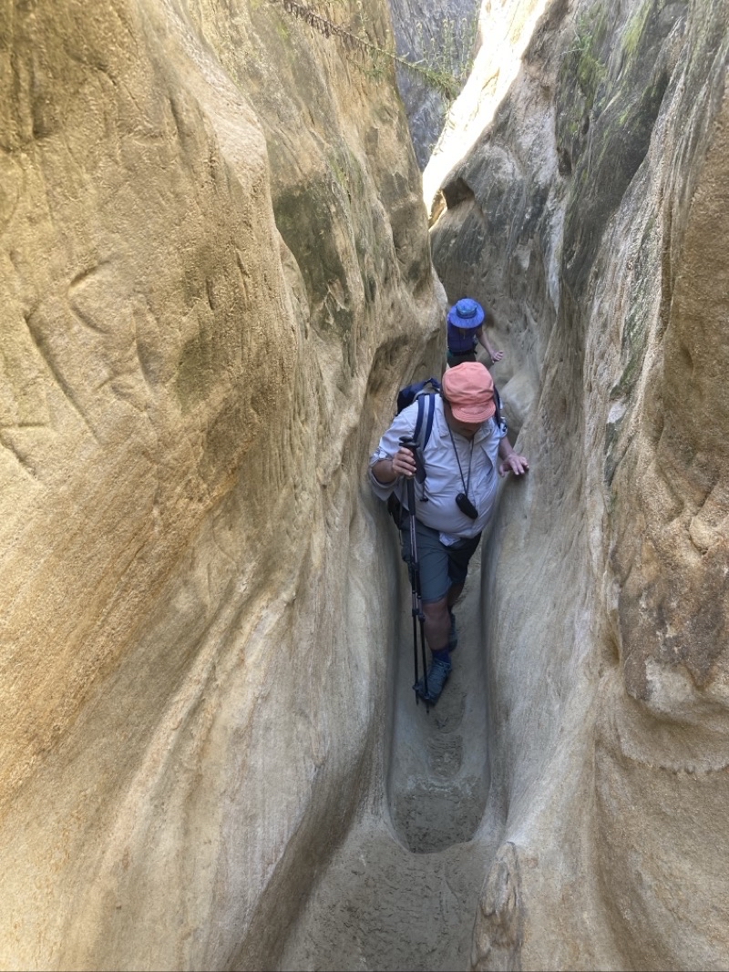
Squeeze and climb. Photo by Jonathan.
--February 25, 2026 at 11:09 AM.
Maps are centered on the photo: Google map, Apple map, CalTopo map

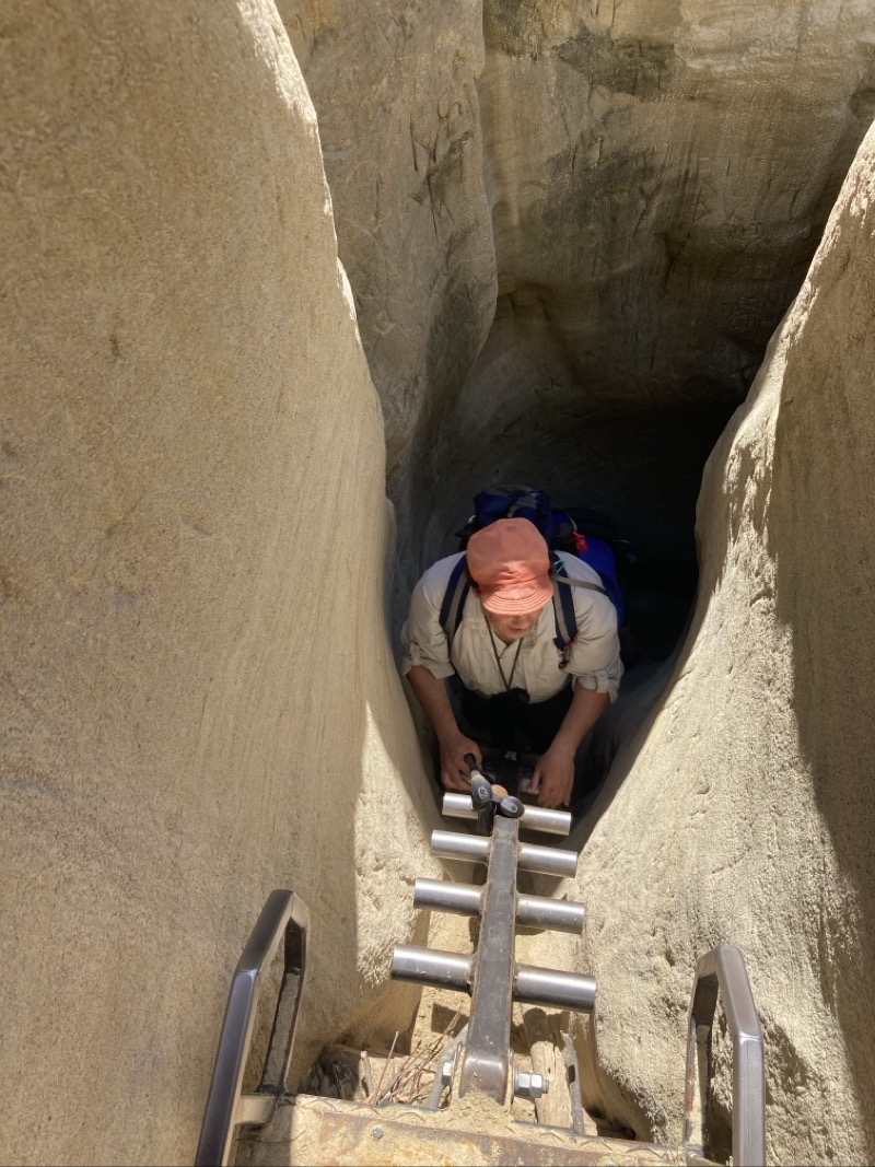
High steps, tight spaces, and ladders to surmount. These are what you will find as you ascend about 160 feet along a 1200-foot or so long slot canyon trail. Photo by Jonathan.
--February 25, 2026 at 11:14 AM.
Maps are centered on the photo: Google map, Apple map, CalTopo map
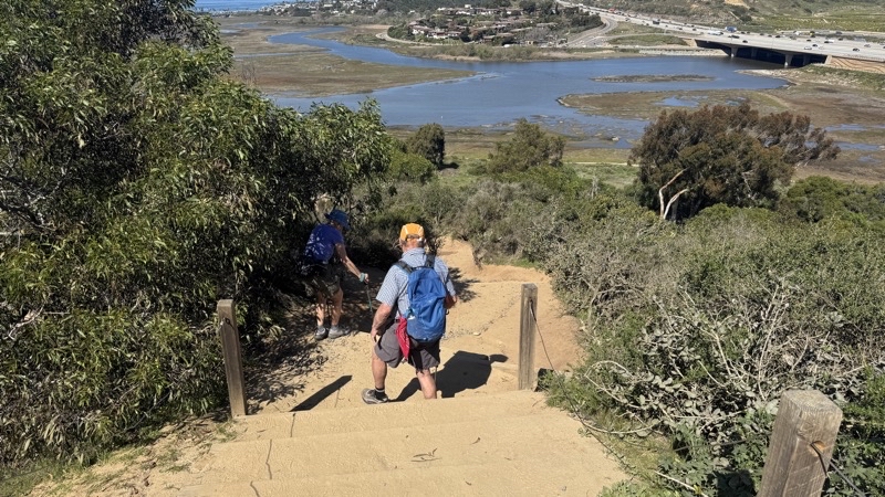
The top of Annie’s Canyon. We now will travel down this sandy trail full of steps of varying heights back to the bottom. You can go up or down this way. I think it only makes sense to go up Annie’s Canyon.
--February 25, 2026 at 11:21 AM.
Maps are centered on the photo: Google map, Apple map, CalTopo map
No comments:
Post a Comment