Thoughts mostly about travel and places I have been. While a lot of my travel is into the backcountry backpacking or paddling I do my share of trips to more traditional front-country locations too. From time to time other items of note will appear that definitely fall outside the realm of travel and associated things. It is also worth noting that I am legally blind.
Sunday, July 28, 2013
Saturday, July 20, 2013
A Storm Filled Walk

We made the straightforward drive to Mackinac City with just one large, needed our emergency lights on, type rain storm to hinder our drive. The ferry ride to Mackinac Island was smooth and soon we were leaving the very busy streets of the town that mixed modern era with Victorian flare behind. Avoiding hordes of cyclist and frequent horse-drawn carriages and dreys we were soon walking the lakeshore route around the southeastern end of the island. It is a road walk but still a pretty walk. As we walked the skies darkened and distant rumbling thunder could be heard. We were walking towards the storm and about 2.5 miles in to our walk the storm arrived. We ducked under trees and my poncho for some time to try and stay dry. We did manage rather well I think. Once the weather broke we continued our walk around and then via the Britush military landing site ( war of 1812) we returned through the forested middle of the island back to the bustling village. A fine afternoon.


We are back at our hotel on the mainland now. Full of decent dinner and very good ice cream.
Friday, July 19, 2013
Monday, July 15, 2013
Friday, July 12, 2013
Adelboden, Switzerland Choleren Gorge
 |
| In the Choleren Gorege is impressive. It is impressive because of the torrents of water rushing by, the overhanging massive cliffs, and the metal walkway that has been built to permit passage. |
Our free day was going to be a quiet one. Like many, though certainly not all, we decided to visit Choleren Gorge which HF leader Geoff had been praising for some time. The gorge is a bit more than 2 miles northeast of the town and it is an easy walk assuming you follow directions carefully. That is where the rub is; we goofed up a bit. We wondered through town for a while hewanderingkenknight@gmail.comading in the direction we thought we should go. We got some help from a local and had we properly followed his directions I think we would have found our way right to the gorge proper. We didn't quite manage that and instead found ourselves somewhere else but on a bus route that would take us where we wanted to go. We just had to catch a bus (walking the road was not an option as it was a fast road with no shoulder).
While we didn't do as well finding our way to the gorge once we got to the bottom of the gorge we found it to be a very fine place. You cross the river and then walk along a trail with some fine cliffs that clearly see rock climbing done. Then we got to the gorge and the metal grated walkways that climb through it. The water pours through the chasm to our left and the cliff walls close in and block off the sun. It is a remarkable place and would be inaccesible if not for the walkways and spiral staircase. I am sure I could have spent more time in there trying to get good pictures but you do feel a bit compelled to move on as the walkway is one-way and not that wide.
After our exploration of the gorge we walked down past the wood carver who has a wide assortment of wood scupltures and such for sale. Nothing caught my eye. The next building is a rather rustic cafe. You can get drinks and maybe some food there. I think they had chickens in back. The WC was more in the nature of a outdoor privvy than a fully plumbed bathroom. Hence, a very rustic cafe. After chatting with a couple ladies (Mother and daughter I think) who were traveling about Switzerland for fun and because the daughter is very involved, as an intern/volunteer (I think) with GIrl Guides (i.e., GIrl Scouts) we began the walk home. This is how we figured out what we did wrong and that if you are at all inclined to want a ride one way that ride should be the return as it is uphill all the way and mostly on roads. The roads aren't that busy but they do not have shoulders so when traffic does zip by you feel a bit crowded. At least the views of the farmsteads, cows, and valley below with the mountains in the distance are nice.
Sunday, July 7, 2013
Adelboden, Switzerland Day Hike 3
Dad and I were feeling a bit under the weather. My problem was my usual issue with my colon. I probably could have gone but felt it wise to stay nearer civilazation (i.e., access to bathrooms). Mom decided to join the easier hike and avoid the big climb and descent that the folks doing the tougher hike would have to deal with. The weather today was a bit better than the previous days with the sun actually making appearances and the air temperature somewhat warmer than it had been.
 |
| You can get a sense of the scale of the bridge now. A couple days later Mom would also get a photo from river level. |
We all piled into the bus and our first stop was at a very long pedestrian suspension bridge that crosses a river whose name I am not sure of. The far end of the bridge takes you to a cafe which we would stop at later on in the week. This bridge is well above the river, I can easily imagine 100 feet above, and wide enough for a single person to walk across the grated deck. If you don't have a head for heights the sway of the bridge is going to bother you. I don't know why it seems worse at the ends, especially the roadside end, but it does. Still most of us crossed the bridge to see what views could be seen. The bridge is privately owned and the owners ask for a donation if you cross. I suppose we gave something.
Our next stopping point was where the hike would start. We were in the town of Kandersteg (I think). People doing the tougher walk left the parking lot to climb and climb while the rest of us went to the gondola terminus to ride up to the upper terminus. The walk to Oescheinensee (Oeschinen Lake) is along a paved path that is just under a mile long and you descend about 350 feet. Dad and I walked down to the hotel, a big complex, that sits above the lake for a bite to eat. The lake is a rich green and surrounded by mountains on most sides. By us the shoreline seemed unusually wide and a bit rocky. I could easily imagine it underwater. In the distance, out of sight, we knew a nice waterfall was present. Mom would get some pictures later on. Dad and I enjoyed some strudel (the ice cream and whipped cream it came with were, I think, overkill). Mom's group came on by and left us to our own devices as they rounded the lake before ascending to a mountain cafe cum hut for their lunch. Dad and I returned to Kandersteg via the gondola and walked through the nice flowery fields to the town center to catch a bus back to Adelboden.
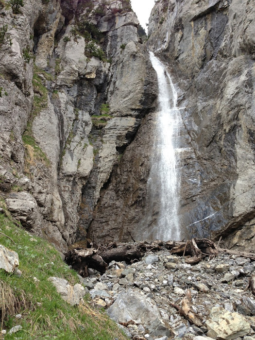 |
| You can't, well I don't think you could, see this waterfall from the hotel. Fortunately, Mom had a chance to walk near it. |
Here is what Mom had to say about the hike:
Anyway, after we left the coffee place where you and your father were sitting, we moseyed around the lake (don't know its name). There were clusters of young folk some with boom boxes, although they weren't too loud, and some folks were fishing. We found a place to cross the inflow/outflow of the lake and got on the trail that climbed along a slope of the hillside surrounding the lake. There were a few narrow passages where a member of the group who didn't like heights was helped, but for the most part it was just a lovely walk. We crossed a stream that broke up a waterfall's descent into two parts and had beautiful views of the lake (greenish colors) all the time. When the hut we were aiming for came more clearly in view we crossed a bridge over some raging water and started the final ascent over a hilly, rutted path way, with wonderful yellow flowers. I don't know how might we were above the lake, but it was considerable based on the size of the people fishing below. I took a photo of that so you could see how small the people were, but I'm not even sure where the people are in the photo. The woman who operates the hut offered a wonderful soup and sausage meal for 7 francs (half what we spent the previous day). She lives there with her dog during the season (which has just begun) and her husband commutes each day. I was walking with the easier hikers, but after about a half hour the harder walkers arrived. Having sat long enough I ventured downhill to the bridge where I waited for the first contingent to depart. I joined them at a quicker pace, but I had to let them leave me at the lake (they were going to walk all the way down, but I hadn't told Geoff that I was joining them). The wait for the rest of the group was lengthy, but we continued to follow the trail that the harder walkers had taken initially, and it was near the end (gondola) that we met up with Kate (leader) and the woman (with her husband) who had been injured while taking a "rest" stop. Always watch where your head is vis-a-vis the sharp branches of a tree when you rise from a sitting position.
The complete photo album which contains 45 photos chronicling the day hikes around Adelboden, Switzerland (no videos) can be found in two places. The real difference is in how they're presented. Pick as you prefer: the Flickr Album or the Google Album.
Saturday, July 6, 2013
Adelboden, Switzerland Day Hike 2
Adelboden Day Hike 2 at EveryTrail
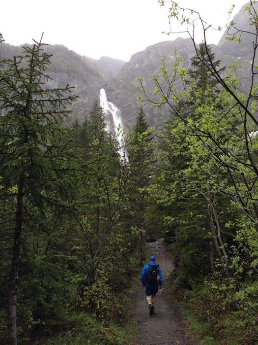
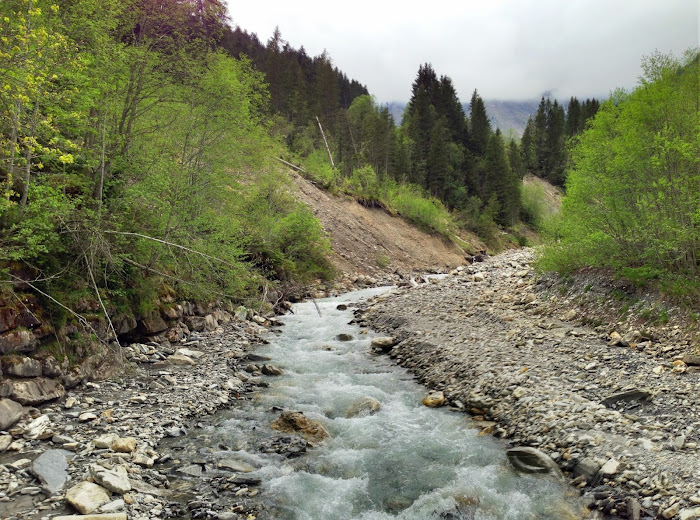
Both the shorter and longer hikes were to be in the same area but due to the heavy snow conditions the planned route for the longer hike could not be done. What ended up being described to us just did not really excite us so we decided to do the shorter hike (not that much shorter in truth but a lot less eelvation change). Our hike would end up around 7.5 miles long and have about 1,500 feet of ascent and 1,350 feet of descent (not quite an out-and-back).We spend the bulk of the hike walking alongside a roaring river. A small bit would lead us up to the base of the Engstligenalp waterfall which is, I think, the second tallest in Switzerland. A portion of the hike would be on roads that would get us to the river in the first place. The weather was once again overcast and cool. The hike would be about 7.5 miles long and have about 1,600 feet of ascent and 1,350 feet of descent. It was not a strict out-and-back hike as we started the return journey from the gondola terminus and walked a road until we reached the river and re-joined our original route out.
By far the best part of the walk is the stretch along the river. It is a path with fine footing and only one part that could bother people. Just after we left the road we had to walk along the top of a steep hill for a couple of minutes. The hill is very steep and if you were to slip and fall on it you would probably not be able to stop until you hit the bottom and the river. I doubt it would be fatal but a fall would hurt. We had a person in the group who found hieghts unsettling and had some trouble with that section but with a bit of help made it across. The single biggest key feature of the hike has to be walking close to Engstligenalp waterfall.
 |
| After riding the gondola to the top of the Engstligenalp and having a hearty lunch at the restaurant there we wandered about the snow-covered bowl a bit. |
We took the gondola to the top of Engstligenalp where we found the bowl fairly well covered in snow. The restaurant up there is quite nice. We all had plenty of hearty food. My barley (I think) soup and sausage was just right even if a tad pricy (par for the course in Switzerland).
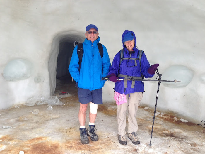 |
| I'm calling this an ice hotel but I rather doubt anyone sleeps in it even when it is not melting. |
 |
| Cows like this one are all over the place. They are to massive per se but certainly big enough. Personally I think they become much more adorable when they jingle their bells. |
This is an easy walk that anyone could do and quite pleasant when along the riverside path. sure the road walk from the hotel to the river is a bit of a chore but at least the roads are not too busy.
The complete photo album which contains 45 photos chronicling the day hikes around Adelboden, Switzerland (no videos) can be found in two places. The real difference is in how they're presented. Pick as you prefer: the Flickr Album or the Google Album.
Adelboden, Switzerland Day Hike 1
Adelboden Day Hike 1 at EveryTrail
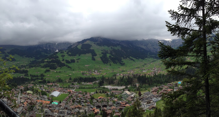
Our first hike, as seems to always be the case with HF Hoiday trips, would start and end at our hotel. We decided to do the longer walk which we expected to be a bit more than 9 miles long and have about 2,900 feet of ascent and descent. We started out by walking partially through town and then steadily ascending along a paved road. We did make one small wrong turn but with the help of a local we got ourselves sorted out quickly enough. the road climbs steadily and quickly and for a road is not bad. We had some forest mixed in with the buildings that snuggle up to the road. In time we came to a lookout point that provided a fine view of Adelboden. You could see the valley spread out below and hear the tolling of numerous church bells calling people to Sunday morning services.
We would leave the road for paths, I am not going to call them trails because they're bigger than that, and continue ascending. In time we came to the alpine garden at Horeli. I did not go check out the garden. My understanding is it is a garden, I think privately owned but open to the public, that shows off hundreds of species of alpine flora. For those interested in this type of thing it probably is special; I was happy to sit on a bit of stone wall and rest. After all, we had more ascending to do.
We climbed through some forest and up grassy slopes that I expect are used as pasture when the cows are brought up into the mountains. In time we found ourselves up on much more open ground and that meant chillier too with a stiff wind blowing. Patches of snow were everywhere along the dirt road we were now following that led past a gondola terminus and small restaurant. We were almost at the high point of the walk. To get there we had to plod through wet snow and mud. Mom, Dad and I din't quite go all the way to the top and instead retraced our steps down and then along the road contouring around the re-join the group who came down the backside of the summit. I think, in hindsight, they had an easier time of things. We should've just gone to the top and down the gentle grassy (no mud or snow) side. Oh well. We had lunch in the lee of a small barn (I think) and then kept going on down. We left the gravel road for paths that would have been nice except for the fact that they had some sort of rubber and stone mesh laid down. I suppose it slows erosion but it is slippery as all hell when even a little wet. I may have been the only one to actually fall but I suspect many found the footing pretty cruddy. Personally, I think this mesh is horrid and can't see any good rason to use it. In time as we worked our way through forest again and passed by some herds of jingling cows (love those cow bells) we got to our afternoon tea stop. I don't know the name of the place, I was told, but it was a good place for some apple strudel and coffee. We found the folks who had been doing the shorter walk happily there too.
At this point the group morphed somewhat. The vast majority of us went along the route the shorter walker would take along the river back into town. That group included Mom and me. A handful, including Dad, continued the official longer walk which meant re-tracing steps back up to a junction and then heading into town. I am sure Dad had a fine time on his slightly longer walk. We certainly enjoyed walking by the river again passing several placid (fortunately as they were quite close) cows. Sure the last 15 or so minutes of the walk are on the main road that runs by the hotel but that's the way it goes.
The weather had been crisp and a bit damp all day. It didn't rain but it wasn't a dry day as such. I expect the high temperature was only in the mid to upper 50s and with the wind on top that certainly felt quite chillier.
The complete photo album which contains 45 photos chronicling the day hikes around Adelboden, Switzerland (no videos) can be found in two places. The real difference is in how they're presented. Pick as you prefer: the Flickr Album or the Google Album.


