Our hike today was about as different from what we did the previous day as we could wish for without venturing into the mountains. Here we found an area mostly devoid of traffic sounds, thick with oaks and other trees, shade, ample water rarely far away. There are several forest roads and single-track trails in this nature preserve. We followed both.
It’s a dull hike on that you do follow a dirt road or the single-track trails. The latter provide more interest with more twists and turns and tiny dips. But in either case the footing is along hard packed dirt most of the time. It’s suitable for walking, biking, or horseback riding.
I’m not walking as fast as I used to walk. Hopefully this will change as everything recovers from the shoulder-fracturing fall last October. Most people will have no trouble walking well over 2 MPH; we were moving at just under 2 MPH. But it was a nice stroll through the lands that surround this old ranch and have been inhabited by people for 5,000 years. We eventually found our way to the cascades, just over 3 miles from the car, that the guidebook call a waterfall. Water is falling but if you’re looking forward to something substantial you’re going to be underwhelmed. Perhaps I just didn’t look in the right place.
This isn’t a hike to go on a bucket list. However, I can see it being popular if you live nearby and need a dose of nature and the chance perhaps to wave in a rushing creek. I’m glad we did it but I doubt I’ll remember it as much as the slot canyon that is Annie’s Canyon.
Photos and Video

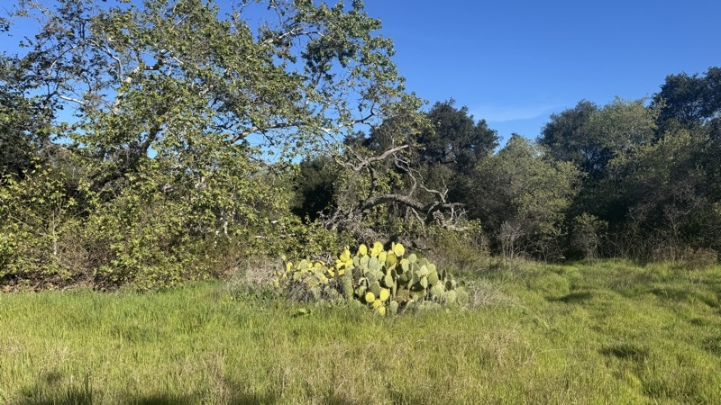
The road is lined with Coastal oak but now and then cactus like this prickly pear pop up. There is a single-track trail that is a nicer option to follow but we missed it on our way out.
--February 26, 2026 at 9:08 AM.
Maps are centered on the photo: Google map, Apple map, CalTopo map
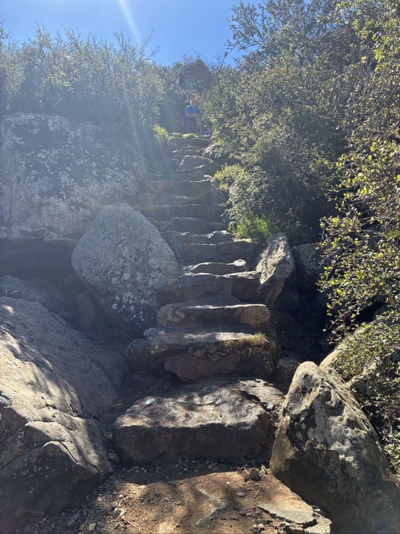
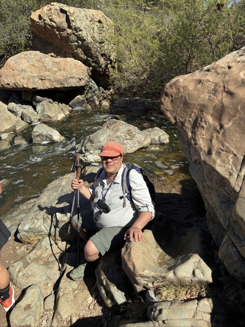
Ken had a bit of a struggle descending the dozen steps of varying heights. But these are almost certainly far easier to deal with going up or down than the rocks on the opposite shore of the rushing creek. Photo by Judy.
--February 26, 2026 at 10:29 AM.
Maps are centered on the photo: Google map, Apple map, CalTopo map
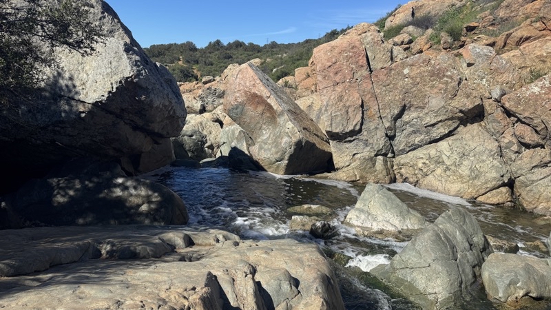
Looking across Peñasquitos Creek. We watched a lady carry her small dog through the knee-deep water. She first scrambled down from the area shown here. It looked tough.
--February 26, 2026 at 10:30 AM.
Maps are centered on the photo: Google map, Apple map, CalTopo map
I suppose it is a waterfall.
--February 26, 2026 at 10:30 AM.
Maps are centered on the photo: Google map, Apple map, CalTopo map
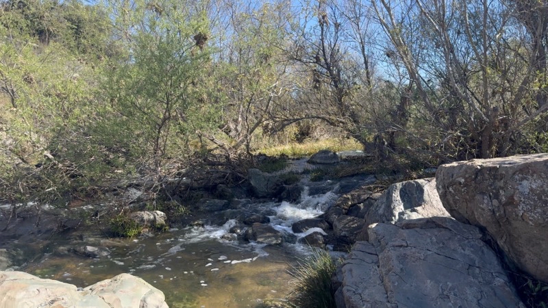
It took a bit of extra effort to descend the rough steps to these rocks at the water’s edge of Penasquitos Creek. Upstream is a tiny cascade of water but it’s barely a waterfall. Photo by Judy.
--February 26, 2026 at 10:32 AM.
Maps are centered on the photo: Google map, Apple map, CalTopo map
No comments:
Post a Comment