Saturday, June 28, 2014

#37: Ann Arbor Summer Festival Top of the Park, 2014


Untitled

There is about one week left before the Ann Arbor Summer Festival closes its doors for 2014. Top of the Park is in full swing and I've been a few times already to this basically free outdoor music festival. Their is quite a variety of music to be heard as well as the regularly scheduled movies. I do hope you can get out and enjoy what remains of this special event that takes place every year.

Music heard in this podcast includes

More photos can be found in this Flickr Album.


Check out this episode!

Friday, June 20, 2014

Top of the Park


Saturday, June 14, 2014

Sunset and Moonrise on the Huron River


Monday, June 9, 2014

Class of 1989 25th Year Reunion


On the weekend of June 7-8, 2014 the College of Wooster hosted its annual alumni class reunion weekend. This would be the 25th year reunion for my class of 1989. It would also be the first time I have attended a class reunion. I've never been endowed with a large amount of what you might call school spirit. Nor did I actually have that many close connections with much of the class. In fact, the people I know best all live here in Michigan and not necessarily that far away (hich doesn't mean I see them that often). My expectations were not set to high as I am not a good conversationalist as far as general chit-chat goes. But I hoped to get something positive out of the weekend and I think I did. I hope you enjoy this little audio postcard. I apologize for some of the audio quality being a bit rough. The bulk of the audio was recorded using my iPhone and a new microphone, the Zoom IQ5, and I am definitely still learning its quirks. While the field recording quality isn't up to top tier standards I think you'll get a sense of what the weekend was like. And if the audio doesn't do it for you perhaps the photos will. My thanks to Paul Potts for letting me share his photos.

Ken Knight at College of WoosterGood morning, Wooster. Ken Knight waiting for the parade of the classes. The parade will have classes dating back to 1949. lasses come every 5th year (1949, 1954, 1959, and so on through 1989 and ending with 2009).
Pipers Lead the ParadeThe parade for the classes is being lead by wooster bagpipers. At least I assume they're affiliated with the College of Wooster bagpipe band as they're wearing MacLeod tartan kilts. Wooster actually, as I understand it, doesn't really have Scottish roots but somehow that cultural identity got adopted by the college and it now certainly infuses sports as well as the band.
College of Wooster Mascots
I can't recall the name of the mascot on the left but the fellow on the right is Wooster's Fight Scot.

The photos can also be viewed in this Flickr photo album.

Check out this episode!

Friday, June 6, 2014

West Highland Way Day 8 - Kinlochleven to Fort William

Above Loch Leven.JPGYou leave Kinlochleven by a road and then trail that ascends almost as steeply as the Devil's Staircase to a ridge-line where an old Military Road remains. This view of Loch Leven is still 100 meters below that point but it's not a bad place to catch your breath as you have been climbing steadily through birch forest until this point.
Our last day hiking the West Highland Way has come to an end and in several ways this 16 mile day encapsulates much of what the Way has been like. Once again the wether gods smiled upon us and we started the hike from Kinlochleven under pretty clear and warm skies. The temperature would rise easily to 70 degrees and I am confident this was the warmest day of our 8 day journey. There was a breeze most of the day but while brisk at times it was anything but bothersome especially as we hiked the several miles of Military Road through the Lairigmor (the Great Pass). That's just part of what I meant by the day encapsulating the whole trail. We began with a walk through wooded park-like terrain as we left the confines of Kinlochleven. From there we hiked up a steep, though nowhere as steep as the Devil's Staircase, trail through birch woods to a ridge-line that looks down on Loch Leven some 250 meters below. Then it is onto the latest of the series of old military roads and start heading north west (more west early on with the wind at our backs and then turning northernly and still having a good deal of wind at our backs). The military road is wide, hard packed dirt and stone, and after several miles foot tiring. The going is technically easy but your feet ache for the softer tread-way of a mountain trail through forest where the dirt and leaf litter form a kinder path. We walked easily through Lairgmor admiring to open rolling hills with mountains so near that they seemed bigger than they actually are. It's a remote place but still some people have elected, well once did, to live here. We leapfrogged a group of fellow hikers at a rhine of a stone cottage where they were taking a break. While water is plentiful and I expect sheep could find plenty to graze even here it is a looney spot and no doubt a hard place to live. When we crossed one of the numerous streams to join a trail that ran through hills dotted with grazing sheep we breathed sighs of relief because the treadway had changed to a softer solid dirt. Suddenly it seemed a bit less lonely.
On the Military Road Again.JPGWe start our walk along the old Military Road through the Lairigmor (Great Pass). Soon the trees will vanish and we will be treated to expanses of rolling hills that quickly turn into greater hills and mountains of pretty barren land.
Lairigmor Waterfall.jpgOne of the many waterfalls we would pass. Maybe not as numerous as the pour-offs we strode by frequently when hiking the woods road above Loch Lomond on day 3 on our way to Ardlui but many streams would be forded as we trod the Military Road today.

The Great Pass 1.JPGWe had a late-morning snack near here. This view looks back from whence we came as as you can see we have been climbing a bit. The grade is gentle and the walking generally comfortable even though the path is rather hard. The land is bounded by tall hills and though there is grass here it's pretty empty of growth.
The Great Pass 2.JPGLooking to where we will be heading (more or less) near the same spot as the previous picture. Soon we will pas by an old stone cottage that has fallen into ruin. Why anyone would have settled up here to do sheep farming (I assume) is a bit of a mystery to me. This is not exactly a friendly spot with meager flora, plenty of wind, and lots of exposed land. Water is plentiful and I suppose if you want to be far from neighbors this is a good place.
Grazing the Great Pass.JPGAfter just about 7 miles of the old Military Road we would reach a small woods where we settled down for lunch (about 13:00). Other people passed us by as we ate (we had leapfrogged them earlier) as we were all on our way to Fort William. Now we're on a small path that is winding its way through these fairly grassy hills that are home to grazing sheep. It's a much nicer section of trail for the feet to trod - nowhere near as hard.
Me and Water.JPGSoon after this point we enter forest plantations. This starts out wonderful with lovely well grown forest to walk through but after we descend to another bridge and water crossing (descending pretty much the entire time) we come out on a truly ugly bit of land full of gnarly stumps and logs. We'd have our afternoon snack on a hill above that mess and just a little ways south of the woods road and Dun Deardail Fort (an Iron Age fort) which you may just be able to see through the trees if you were in the right place to look (not this picture which is miles south and the last I took before reaching the Original Way End).
As you might expect the views along the 6 odd miles of military road were quite good. Mountains rise a couple thousand feet above us and in time you got very good views of the snow capped Ben Nevis which is the highest mountain in the United Kingdom standing a bit over 4,400 feet. But we would also be treated to some wonderful forest walking later in the day. Passing through the dense pine forest, again softer trail, was a real treat. It's too bad that when we left the far side of the pine forest we entered a sizable area devoid of trees land strewn with left-behind stumps and logs. The wreckage of a logging operation. Far less pretty than the huge water pipes we could kind of ignore yesterday. Eventually we would leave the logging area for a forest road that would take us past a distant Iron Age fort called Dun Deardail, (barely visible) and down towards Fort William. A diversion, clearly well made but just as clearly needing switchbacks as it plummeted down the mountainside to rejoin the forest road. That road would take us to a paved road which would after about 4 miles take us past first the visitor center that I think supports Ben Nevis and then, oh so much later though likely less than 45 minutes walk, into Fort William. Not a pleasant walk really; just putting one foot down after the other and watching the traffic zip on by. We paused at the original end of the West Highland Way for some pictures and then trudged through town (so many shops seemed closed) to where the trail really ends. They moved the end to force hikers to go through town but I think that mercenary decision has not been that popular and it seems odd if you aren't going to have shops open even (it was just after 17:00 by this time). We had experienced much of everything the trail had to offer today including a tiny splash of rain as we got to the Visitor Center (hardly worth mentioning).
WestThe original end of the West Highland Way. They decided to move the current end another mile and a bit into the heart of Fort William. Perhaps they hoped people would stop and buy more goods. Personally I think this is a fine endpoint and that last mile just adds to the drag of the last 3 or so which you trod on paved road from just before the visitor center that supports Ben Nevis to the trail's end. Before that point you are walking a curving forestry road (with one helluva diversion that plummets down new well-made trail for some 400 meters).
The Group and the End.jpgOur group, all but two, at the official end of the West Highland Way.
We are Certified.JPGWe Are Certified
John the Piper.jpg
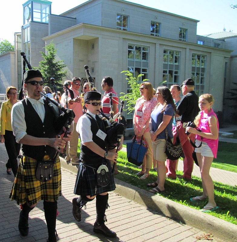
John the Piper playing us into our last dinner with the group.
IMG_6117.JPGThe famed and fabled haggis of Scotland. Quite tasty with tatties (potatoes) and jeeps (a yellow turnip-like plant).

We have completed the West Highland Way and are all quite happy. Ending the day at the hotel with John the Piper piping in the Haggis was an added special treat and something I don't think we will soon forget.


All 17 photos for day 8 (at much greater size) can be viewed in this Flickr photo album.

Thursday, June 5, 2014

West Highland Way Day 7 - Kingshouse to Kinlochleven

Leaving Kings House.jpgWe leaves Kings House Hotel (sometimes spelled "Kingshouse") heading northwest on a track that is sadly not far from the A82. It's easy walking with a few streams to cross for the next 3 miles to the foot of the Devil's Staircase.
Today included what is I think the literal high point of our 8-day trek of the West Highland Way. The morning dawned with a high overcast but by the time we disembarked from the bus at Kings House a bit before 10:00 the clouds had vanished leaving the sky a dusky blue with just some wisps of white. The walk starts on a hard-surfaced (paved?) path leaving Kings House but soon rejoins an old Military Road and winds towards some rather pointed mountains to the north. Sadly we are just a hop skip and a jump away from a busy motorway and the rumble of traffic rather detracts from the enjoyment of walking through the countryside. After about 3 miles you come to a sizable parking lot where people park to go do some Munro bagging of nearby peaks or perhaps to climb the Devil's Staircase to enjoy the 360 degree views from that 550 meter top. We would ascend the staircase, naturally not a single step is involved, to that 550 viewpoint. The path is good though a bit steeper than one might wish though it's hardly the steepest trail I have climbed. You gain about 850 feet of elevation in about 1.1 miles and although the people who designed this old Military Road don't know what a proper switch-back is they come closer than many and so the route does curve steadily up the slopes towards the top. You'll know you made an effort but you won't exhaust yourself doing it especially if you take a bit of time and do not rush.
Signs of Progress.jpgSigns of progress. This is the type of marker you are likely to find on the Way. I never saw anything akin to a trail blaze but except when crossing a road (or following a paved road) you really didn't have to many choices what route to follow. At the top of this hill we would pause for our elevenses before making the ascent of some 800 feet over just over one mile to the top of Devil's Staircase.
As we climbed the sky became overcast and the wind picked up so the views diminished a bit in their grandeur but the scene was still quite something. The land feels empty in so many respects with the mountains seeming bigger than they are perhaps because they're fairly close. The land isn't empty and although the traffic sound would fade other signs of human activity would replace that in due time as we would learn after leaving the highpoint.
On Top of Devils Staircase 1.JPGI guess it took about 40 minutes to ascend the curving trail, not quite switchbacks but it does zig and zag some as it climbs, to the top. The clouds rolled on in as we climbed but the views remain pretty clear from the wind-swept barren top.
On Top of Devils Staircase 2.JPGI think the road gilders gave up a bit on this backside descending trail. At first it isn't that bad but we would find segments later on that seemed rather stoney. As you can see the slopes are pretty barren and it would be a couple of hours before we even saw a puny stand of trees that could be sheltered behind for answer Nature's call.
If it's windy out you just have to deal with it. We found a spot for lunch a mile or so beyond the top and hunkered down to eat. Some of the best places for views of the surrounding area were also the windiest so our location was only alright as far as eye candy went. The descent off the top though gradual is, I feel, on track that is more rocky than the ascent to the south had been. It slowed me down anyway. In time we started to see those signs of people again and the most obvious one was the set of massive pipes slicing up a mountain slope. The several, at least four, very large diameter pipes carry water to the aluminum smelting facility located in Kinlochleven. Back around 1905 they started to make large amounts of the metal there and to do that requires plenty of water. The pipes slash through the scenery carrying that water to the factory. Later on we would see them from a different angle and figure out that the roar some of us had taken for very steady traffic was in fact a large geyser of a leak in one of the pipes. I don't know how much the aluminum plant helps the local economy but it is a blot on the scenery though I suppose it could be far worse.
Scottish Stream.JPGWe still have a ways to go to reach Kinlochleven. After crossing the Choire Odhair mhoir we would continue through this rather open terrain before coming to a minor road that winds through forest and beside the huge pipeline that provides water to the aluminum works that have been part of this town for over 100 years.
After the couple miles of descent on rocky strewn route towards Kinlochleven you leave the Military Road and enter the vicinity of the town following a minor paved road. While that could be a bad thing it isn't really as the road is quiet and winds through some nice forest on its way into the hamlet of Kinlochleven. The descending seems to go on for a rather long time and it is a shame you pass by more of the leaking (each leak screaming at its own pitch) pipeline. You descend some more and pass over several bridges which span gushing large streams and then you're in the well put together though small village. Once there it's a quick walk through town into a park-like woods area with a river flowing to your left and then you pop out right by the Tailrace Inn which was where we had ample time for a pleasant drink sitting outside under the once again pretty cloudless skies being warmed by a high sun. The bus would take us back to our hotel down in Glen Coe at 15:30. Another short day of about 10 miles with the bulk of the ascent happening on the climb of Devil's Staircase and the majority of the much greater descent taking place after reaching that top especially over the last 3 miles.

All 8 of the photos for day 7 can be viewed (at greater size) in this Flickr photo album.

West Highland Way Day 6 - Inveroran to Kingshouse

Camping along the Way.JPGA few days earlier we walked through an honest-to-goodness dedicated campsite where at least one person was settling down for the day. This morning, just a few minutes outside of Tyndrum central, we would pass this tent. I'm pretty sure no one was home (or they were asleep) as I didn't hear anything from it. For the most part you can camp pretty much anywhere you want as long as it's out of sight of people. There are some notable exceptions to this including a few kilometers by Ptarmigan Lodge where people abused the privilege despoiling the area with lots of trash.
West Highland Way Day 6 - Inveroran to Kingshouse I think these shorter days happen mostly due to the nature of the trip and where we can reasonably stop or start and have our bus service pick up or drop us off. This means that days 5 and 6 are both short days while day 8 will be the longest day of the trip. That's just the way it goes and though a 16 mile day will likely feel like a drag when it arrives I have no doubt everyone can do it especially if the weather forecast continues to improve as it suggests it may. But, let's not get ahead of ourselves. Day 6 would start out wet and it would stay rainy all day. The rain was a light one but persistent. While there was a breeze it was nowhere near as pushy as yesterday and I doubt it created much of a windchill. Air temperature was likely never more than 50F. All in all it seemed like it would be a better day than yesterday afternoon. Everyone had on waterproofs of their choice and as far as I know they worked as well or poorly as expected. For my part I managed to end up with quite soaked feet rather quickly. My Montrail shoes are definitely at the end of their life and combined with my ability to hit puddles I just got soaked feet fast. I still don't think switching to a waterproof boot makes sense as I always managed to soak them too though it took a bit longer (Mom has wetness in her fairly new Gortex-lined boots). I might have been happier wearing my Keen sandals perhaps with socks which would have still soaked but at least I'd not have had internal seas. We started the hiking just after 10:00. Collin, our bus driver today, gave us all something of a tour as we drove up towards Inveroran. He described some of the local mountains and the history around them much of which I can't now relate (maybe he'll tell us again today). I also learned a tiny bit of gaelic which I think will remain in my mind. "Inver," which you have seen used here often means river. So, "Invernes," is a place on the river Nes and Inversnaid is something located on the River Snaid (a hotel in this case as it was the Inversnaid Hotel). The term "kin" h means "head of" so kinlochleven is the head of Loch Leven which is where our hike will end tomorrow afternoon.
IMG_6029.JPGIMG 6029
We donned our waterproofs and packs and began our walk away from the Inveroran Hotel along a road that would quickly take us to another old Military Road. This road may have been built in the 1700s but it was improved in the early 1800s by civil engineer Thomas Telford who was responsible for quite a lot of road building in the Highlands. This road has a hard stony surface that was remarkably not too slick even though it was wet. Of course, the road was full of puddles along the edges (there are two not-quite-ruts on the sides where no doubt wheels of countless carriages rolled). Telford believed in keeping gradients down and providing a good surface for travel of both carriages and hooves so the roads he built apparently are a cut above many. We climbed slowly and steadily into the wide open spaces of Rannoch moor and when we let ourselves spread out it wasn't hard to get a sense of isolation as you moved along the road. Their is a rough stark beauty out here even under gray raining skies (with hints of a lightening now and then). Plants of numerous types provide an array of greens and in time heather will bloom purple and other plants no doubt will add their colors to the scene. For now the mosses of the boggy land predominate the floral scene. You keep walking passing by many small and somewhat larger streams that the old road spans with solid bridges. No jumping stones on this road. Water is not in short supply here. What is in short supply are sheltering trees. I think we passed by two copse over the 9 miles we hiked and we paused at both for quick breaks. No one wanted to linger over food or drink given the somewhat cruddy nature of the weather. It wasn't as bad as the day before but it did not invite one to dawdle.
IMG_6027.JPGI guess we're on the old drovers road. It's a bit unclear to me at this point. But what is clear is this is empty land. If you were to stray off the road, which in a white-out is certainly possible, you could be swallowed by the peat bogs and heather. Before even basic roads like this centuries old path came into existence (and some places didn't get much in the way of roads until the early 20th century) travel must have been quite a challenge indeed here in the Higlands.
By 14:20 we had left the military road, done the most dangerous part of the hike by crossing a high-speed trafficked paved road and within 20 minutes walked the path along the roadside to Kings House (sometimes "Kingshouse") hotel arriving around 14:40. The climbers bar, located at the back of what seems like a nice looking hotel, starts out a bit unprepossessing from the outside. But it's warm and cozy inside if a bit dim. Perhaps they have food there but all most everyone seemed to be having were drinks. We found the couple fellows from West Virginia settled in already and I bet they'd arrived well before we did as I'm sure they hike much more quickly than our group manages (we averaged about 2.8MPH today I believe). Having a hot chocolate was a nice way to end the day as we waited for Colllin to arrive and drive us back to our hotel. Too bad we had to step out into the chill rain to get on the bus. Stepping out of the lee of the building into the wind was a bit of a shock after having been inside for 45 minutes.
Aren't we a wet looking bunch here at Ba Bridge. The rain actually isn't that intense just persistent. I reckon I absorbed more water the day before on the descent to Inveroran hotel when the rain was heavier and the wind much stronger.

All 6 photos for this day can be viewed (at much greater size too) in this Flickr photo album.

Wednesday, June 4, 2014

West Highland Way Day 5 - Tyndrum to inveroran

IMG_5993.JPGLeaving Tydrum under a slight drizzle we would follow this stream (looking back the way we've come) for some time. A major road is nearby and cars zoom by often disturbing the quiet of the hills. It is a bit sullen but the going is easy as we contour around hills rising and falling pretty gently on our way to Bridge of Orchy.
After a night at Ardlui hotel that some would prefer to forget due to some other guests utterly horrid drunken behavior (not people from our group though the affected people were) we boarded the bus for the fast drive to Tyndrum where we would begin our hike of some 9 miles to the Inveroran Hotel. It was misting a bit when we began our hiking and we fully expected the mist to turn into something with a bit more bite as the day progressed. We would be hiking along old Military Roads first built in the 1700s to facilitate British Army movements as they tried to quells various uprisings by the Scottish people. These roads are often very good for foot travel though I've found some that can be rather rough. I think a lot depends on what type of land the military roads traverse. If, for example, they pass through farmland that has been in active use for the past couple centuries it's Likely they get some maintenance by farmers to make moving their herds a bit easier. Our hike would take us north out of Tyndrum paralelling a major road (A82) not that far away. But just to our right was a stream chuckling on by and standing in it were a couple of men dressed for the weather panning for gold. They would use a bilge style pump to suck up water and rock which they would sluice through a pan to shake out stones and hopefully gold. I gather some people put a strong magnet in the path of the water as it flows down a trough to the pan to pull out magnetic ore and aid in the separation = process. It is clearly slow tedious work to get what can only be a handful of grams of gold so it must be a hobby (I doubt they're doing it for the monetary reward) that requires much patence especially on a cooler drizzly day like this was turning into (with worse to come).
Gold Panning in Scotland.jpgThis is something I have not seen before. It's cooler today than it has been, probably not much more than 50 degrees F and I expect the stream is hardly warm but that isn't stopping these fellows from doing what they're doing: panning for gold. I've no idea how much gold they can gather but I suspect it's probably a tiny amount measured in grams. I think they must do it for reasons other than monetary reward rather like the reasons people do catch-and-release fishing hour after hour standing in a cold river. Their must be something about the work itself that is satisfying though I'm not quite sure what that is.
The walking remained easy as we marched along the military road across hills , across small fords of tiny streams, and eventually into Bridge of Orchy just as the rain was starting to pick up some steam. About half our group decided to have a quick hot drink and soup at the bar while the rest huddled under cover and ate their mediocre sandwhiches at the railway station. Personally I think us bar sitters made the right choice as I've no doubt my soup was vastly tastier than the sandwich fixed up by Ardlui hotel. I'm not quite sure why we had to rush things as much as we did as we were more than two thirds to Inveroran and had ample time but we hustled through our meal as per our leader's decision.
Misty Mountain.jpgMisty Mountain
From Bridge of Orchy it's not much more than 2 miles to Inveroran hotel but you do have a steady climb over Man Carraigh (sp) to get there. We passed by a tent set up and staffed by volunteers raising funds for mountain rescue and some sort of outdoor outreach program for kids. Most of us got little carrot cakes and made donations. We went up into the woods with the rain coming down more steadily now and the wind picking up too. It wasn't a downpour but it was a steady rain by this time. I believe the temeprature was hovering around 50F. Things got worse on the backside of the hill where there was no tree coverage and you were just exposed to the elements as you pounded down the wide military road the last mile or so to Inveroran Hotel. We weren't soaked, except perhaps our feet (well mine at least) but we certainly welcomed the tearoom at the Inveroran Hotel which we entered just before 15:0 - just before there closing time though I doubt they'd turn away a dozen people bound to order hot drinks and sweets. We would pile into a bus for the ride to our hotel located in Glen Coe (about 40 miles away) about a half hour or so later and this HF Holidays house we are at now for the next four nights should be exceptional. All in all an easy day with mediocre weather notably at the end of the hike but hardly the worst weather any of us has ever hiked in by a long shot. Bad weather is, of course, so much easier to tolerate when you know a warm room with a good shower awaits and you don't have to worry about setting up or taking down camp in the rain.

All 4 photos for this day can be viewed (at much greater size) in this Flick album. It really wasn't a day for photography especially when hiking down into Inveroran battling winds that wanted to push you around and the driving rain that came with those high winds.

Tuesday, June 3, 2014

West Highland Way Day 4 - Ardlui to Tyndrum

IMG_5943.JPGLast night, a couple hours after we ferried across the loch, fog rolled in and rain fell. This morning though the clouds were heavy in the sky hints of a sunny day could be seen.
Our fourth day marks the halfway point of the trip and more than hafl of the West Highland Way walked. And that's agood thing because day 4 was a long one. We were lulled into a false sense of ease by the booklet which was off in all respects. The day would end up being just a touch under 15 miles long and have nearly double the ascent the booklet suggested. But the paths, trail, dirt and paved and old military roads we followed were in very good shape so that was in our favor. We had a wonderfully sunny day for the bulk of the walk which often as not was above river courses that featured, though I never saw them, waterfalls to gaze at. On the minus side you could not help but hear the traffic roar from the major road not far off (maybe the A82). Everything happens in the river valleys and so while you may feel as though you are alone as you walk swaths of rolling hills you really aren't that far from human activity. But it was still a fine day to be out and we enjoyed ourselves even though the last couple of miles really did wear us out as we seemed to keep walking and walking into the village of Tydrum under skies that were once again clouding over (in fact during dinner it did rain a bit).
P1020023.pngOK, so that wasn't the last view before but this one truly i the lsat view northbound hikers will get of the loch and it makes a fine first view for people heading south.
We did have many fine views as you can see in the pictures. Mom and Dad look great with the snow-clad mountains behind them for example. The view across Loch Lomond with the sun bursting thorugh the clouds was taken just before we boarded the ferry to cross the half-mile wide loch to start our hike. The other view of the loch was the true last view we had and what a fine view it was. It was a tough day because it was far longer than expected and after a while the distance just gets to you. I am a bit achy as I type this the following morning (waiting for breakfast which is served at 08:00). The backs of my knees feel it. I'd have loved to get a foot massage yesterday after the hike. Fortunately the walk on day 5 should be much gentler. The map/guide and HF booklet agree that it's just 9 miles and follows good paths and such with the booklet giving an ascent of 975 feet and the guide suggesting it's more like 1,100 for ascent and descent but that's an easy day. Sadly we will have a rather long bus ride to the next hotel but that's the way things go.
IMG_5969.JPGThe skies cleard a while back as we walked this path that winds through farms of Glen Falloch. I suppose this is a two-track of sorts and the walking was certainly was easy. In time we would settle down for lunch by River Falloch waiting for the steam train that would pass on by. We've a couple train buff in the group.
P1020031.JPGThe mountain in the background is likely Ben More. This would be our last open view for some time as we would continue to climb through forests, mostly on wide tracks vergining on woods roads, before descending seemingly a very long way to Kirkton Bridge.
Into Kirkton Farm.jpgThe people running this estate, Kirkton Farm I believe, are attempting to keep alive the long standing practices of highland sheep farming. It really isn't economically viable, or at least not that viable these days, from what I gathered. I guess the market for lamb, mutton, and wool isn't what it once was but I hope they are making a good go of it. The walking here is on estate roads and thus easy.
Ardlui Food.jpgThe portions at the restaurant in the Ardlui hotel may not be the tastiest but they are big. I'm not sure what this was called now but it's a bit like a pasty though the dough is flakier and lacks the outer ridge.

You can view all 16 photos for this day (at a much greater size too) in this Flickr photo album.

Monday, June 2, 2014

West Highland Way Day 3 - Rowardennan to Ardlui

Bluebells AboundTHis would turn out to be the best bluebell covered hill we would pass though it was hardly the only one we would pass.
Phew. The mileage was less but the going was tougher. Even for people with normal vision I am sure care was taken and speed dropped especially on the 3 or so miles of trail after Inversnaid hotel. That stretch, a similar one exists south of the hotel though not as bad or long, was a definite pain for me. While it only rose and fell a bit as it hugged the shoreline of Loch Lomond it took us over innumerable rocks, man-made gaps for streams to gurgle through, over tree roots, and up and down rough steps (and not quite steps). I have to carefully pick my steps and that means lots of pauses and straining muscles. No way can I just move smoothly along the rough path like one fellow we met who was carrying a mountain bike (I don't quite know why though it had something to do with his travelling companion who sometimes just had to ride because his feet couldn't take walking). I've no doubt I slowed the group by a solid half hour. Certainly the views, when we could look at them as we struggled along, of Loch Lomond were quite nice but this was no cakewalk. The Way actually has two choices to follow for a few kilometers between Ptarmingan Lodge and a couple kilometers before Inversnaid hotel. The shoreline hugging route is reported to have splendid views of the loch as well as giving you access to Rob Roy's Prison (cave) but it is also exceedingly rocky and considered a bad choice if you are lugging a large backpack. The route we took follows a forest road considerably higher up and though the forest blocks views it isn't all that bad. You pass by countless streams pouring off the steep forested hillside as you go (and even more later on which cross the trail through man-made gaps that I have to pause at to judge distance to step across).
DSCN0981.jpg Perhaps 10 minutes earlier Steve hoisted the large orange ball on its flagpole to signal the ferry to come fetch us. At the time I didn't realize what that loud squeaking sound was but that was what it had to be. The ride doesn't take too long though I do wonder how rough the water is allowed to get before the ferry ceases to make the half-mile crossing.
Perhaps the most memorable sight will be the most ephemeral. We passed by many hills shrouded in bluebells. The first was the best as it had the fewest trees obstructing the spread of the flowers but over several kilometers before and after passing the Snaid Burn (a "burn" is the Scottish term for a stream and the Snaid is a roaring one). When we finally reached the ferry dock a bit before 18:00 we did not have long to wait for the ferryman. You hoist a large, though it seems small , orange ball on a flagpole to get the ferryman's attention and he motors across the loch to fetch you. I think Steve raised the ball just a few minutes before I arrived and it was only about 5 more minutes before the boat docked. Very prompt. A neat way to end the hiking day too I think. Most people have to hike on a bit farther to a different hotel or campsite but the ferry takes you to Ardlui marina which is just a couple minutes from our small hotel. I don't think it's hotel-only though if you aren't staying at the hotel you do have to pay a fee to cross. That seems fair to me. If I have a gripe with this section of 12.5 miles of trail besides the rough (for me especially) rocky going, it is that sound carries all too well across Loch Lomond. We often could easily hear the roar of car engines as we moved along. It sounded like a race course thundering by sometimes. Twice a train rolled on by carrying either freight or people (I think) to Fort Willikam. Those sounds are a bit intrusive and serve to point out that while the land here may be rugged it is hardly uninhabited. We even heard the PA of a tour boat blaring one time though I have no idea what was being said. Finally the obligatory weather note: it was overcast all day though a couple of times you felt as though the sun would burst through and shine upon us. Air temperature likely did not break 60 today though the wind was minimal. Though no rain fell. I at least managed to get muddy slogging along the rough path hitting mud puddles along the way. I also slipped off the path on an eroded bit and fell down the loch-side slope a few feet. I never left my feet but it could have been a Bad Thing.

Not that many photos today but you can see all 5 of them at a much greater size in this Flickr photo album.

Sunday, June 1, 2014

West Highland Way Day 2 - Drymen to Rowardennan Hotel

Loch Lomond FIrst View.jpgWe've been walking hard dirt and macadam roads pretty much all the way to this point marking our first view of Loch Lomond which is I believe the largest loch in Scotland. The loch will vanish from view as we continue to follow dirt road that turns into something more like a wide dirt trail winding through rolling valleys and a bit of woods before climbing Conic Hill.
Today we would hike from the Buchanan Arms hotel in Drymen to a small hotel in the small village of Rowardennan. The HF booklet suggests this is about 15 miles and has an ascent (and I suppose descent though the booklet never says) of 1,500 feet. Things would turn out rather differently even if we give the GPS receivers a big fudge factor. The official guide (at least I think it is official) has an ascent value of about 2,160 feet and descent over 2,600 feet. My GPS would come up with about 2,650 and 2,850 respectively. Suffice to say this would prove a challenging day but it was also a very worthwhile day. I'll note here and now that the weather continued to be gentle with us. Though the sun showed some signs of peaking through early on it really was a day for high overcast clouds and brisk winds. The air temperature though remained above 60 degrees F so no one had any real cause to complain. In fact, given how steep some of the climbs were I'm personally just as happy it was not warmer and sunnier. The trek starts out leading you across an active pasture with grazing cows but soon you come to a busy road that you sometimes must walk and sometimes are lucky to follow a path through quintessentially British (OK, Scottish here) hedge-rows. In some ways that encapsulates the nature of hiking here. You never are very far from serious signs of human habitation. To be sure there are places that feel very far away but though they may be hard to reach because the terrain is rugged they likely aren't really that far from a road or farmstead. This doesn't have to detract from the quality of the hike as long as you can come to terms with the fact that you aren't in what an American backpacker would consider wilderness. Rugged countryside is perhaps a better way to think of it. After all, even the climb up Conic Hill which rises some 1,000 feet above Loch Lomond is on good paths and the whole area is actually grazed by sheep. We left the paved road for dirt roads that would lead us into Queen Elizabeth Forest Park. Forest I think is a bit misleading as I certainly did not see much of one. However, most forests here are actively harvested and perhaps the trees were just gone and new ones hadn't been planted. It's nice enough though hardly memorable until you catch your first real glimpse of Loch Lomond as you begin to wind through rolling hills and moors towards Conic Hill in the distance. It took a bit less than half an hour to climb that hill and the views really are quite good. I've no doubt the 360° view from the summit, a side-trail leads steeply to it, is superb but I didn't climb up. It would have taken longer than I think we could have afforded given I was amongst the last to arrive and besides the wind was fierce enough just below the crest. The climb certainly gets the sweat flowing but the path was very good. I suppose I have to be fair and say the path was quite good heading down into Balmaha but I hate all those steps. Scores of them regular sometimes but just as often rough-hewn rock steps of varying widths and heights. For me that means slow going. No way I was going to tear down that trail like the 51 young Dutch school kids with their two chaperones (ugh). This is a popular spot and I can certainly see why (it's just a couple miles from Balmaha). From the fairly treeless but grassy upper slops of Conic Hill you descent into a dense conifer forest. This was a real treat to walk through. We followed more fine paths down towards the currently invisible lake to a huge parking lot for the little village of Balmaha. They boast a variety of shops, a hotel I think, visitor center, and bathrooms which you must pay 20p to use (bring small change when travelling in the United Kingdom: bathrooms cost). A quick pause to buy some homemade ice cream cones and we were off again starting out on or beside a minor paved road and then quickly back on to paths that usually though not always kept to the shoreline of Loch Lomond.
On Conic Hill.jpgYou can't really tell that Loch Lomond is nearly 300 meters below. I am standing just below a very windy summit of Conic Hill. It's windy enough here and I elected not to see the top of the hill. Perhaps had I been alone, at least not in a big group worrying about time, I'd have but really the view of the loch is quite good from this spot. The path remains good as it quickly drop down rough steps towards a forest and the hamlet of Balhama.
Climbing Conic Hill.jpg Nearing the top of Conic Hill. It's a steady climb of some 500 feet in about a mile. THe path, as you can see, is good rising steady above the moorlands.
Loch Lomond Beach.jpgHere is a view of a typical Loch Lomond beach. It isn't quite as threatening as this picture might suggest but the sun never did appear today.
The shoreline is dotted with beaches and the view across the loch is great. But now and then the trail would bend inland and when it would do this it would often climb a 100-200 feet just to quickly drop back down again. We were moving through forest this time and truly a forest with trees so the walking was quite nice. Along the way we passed by a very well put together campground with at least one person tenting. In due time and after several rather steep (no switchbacks here) climbs we hauled ourselves over that one last hill on to a final paved minor road to walk to a little hotel where the bus would pick us up. We arrived at about 17:25 making our day some 8 hours long though we definitely took some lengthy breaks along the way.
Mom Is Benched.jpg I must have been doing something to give Mom a chance to relax on this bench. I think I was changing a battery. This was one of the few open areas we would pass through during the second half of the hike. Mostly we were in forest that was sometimes on the shoreline and sometimes, sadly, not.
A tough but good day and with luck I'll feel fine tomorrow morning ready for the next dozen or so miles. Th section is reputedly one of the toughest bits of the trail from Rowardennan to Ardlui. NOTE: I know it sounds like I am knocking the HF provided booklet and to a degree I am. While I freely admit a GPS-generated elevation profile is likely to be off I suspect it's far closer to the truth and I'd rather be off high as I suspect is the case than so far off in the other direction. This state of affairs would recur in subsequent days but I do believe the leader had a good grasp of the trail from his Ordnance Survey maps and he acknowledge the little brochure, which is all it really is meant to be, could be better. I do wonder why they've not improved it though.

To see all 15 photo, at a much greater size, for this day visit the Flick photo album here.