This is our final walking day in ALesund. On our last day tomorrow we hope to do a cruise along the Hjørundfjord (“Jur-rund-fjord” sort of) . Today we will return to Sula and hike along the island’s northern coast. The weather is supposed to be pretty good with a chance of rain later in the day and generally moderately cloudy with a high temperature around 60 F. Fine weather for hiking. The notes call this a grade 1 hike which is the easiest level of hike. It is just over 10km long and should have about 80 meters of ascent and 80 meters of descent. Of course, as with all walks what matters most is the quality of the footing and how steep the ascents and descents are. If you just look at the profile you could be forgiven for thinking they’re very steep (when you look at an elevation profile it is best to remember that it is incredibly compressed. Something that appears vertical is, in fact, probably showing a grade that’s much less steep - it’s a shame the notes do not give the compression factor). On this walk, reported to take just under 4 hours of walking time, it is the former that really will play into things as we would eventually learn.
We began our leaving heading west out of the village of Langevag (population as of 2019, 758). We followed the gently ascending paved road through quiet neighborhoods for a couple kilometers before reaching a dirt road that would take us into the forest and away from the occasional views across the waters of Borgunfjorden towards Alesund. Eventually the road would come to an end and things would get more interesting.
Here is where some of our elevation appeared in a short steeper (not really that steep except when compared to the paved road) ascent from the current dry stream to what would quickly turn into boggy lands that once supported a farmstead centuries ago. Fortunately the people who built the trail placed boardwalks along the majority of the trail. Step off those planks and you will get sodden feet especially if you are, like me, hiking in trail runners. If the ground was like this when people were trying to farm I wonder what they managed to actually grow.
All that remains is a bit of ruins in the form of a foundation. There is an information board (with English text) describing the history of the place. I can’t tell you now the number of chickens, cows, and sheep (?) a peasant family owned here 1,000 years ago but I find it a bit remarkable that records from back then were still in existence when the sign was written.
The trail would treat us to one more quick climb and we would continue trending west along the edge of the cliffs. At times the trail snuggled right up to the edge. If you aren’t fond of heights take a few steps inland and walk there. The ground should be firm if it hasn’t rained much. Our views of the coast were back and this now was truly a coastal walk and would become more so soon.
When we reached the western end of our walk we dropped down to just a few meters above the breaking waves. There was, at times, rocky beach, but generally speaking the ground was covered in low plants and shrubs to the tideline. Toss in some boulders and a rivulet of freshwater and you have a challenging shoreline to navigate. The trail is present but it became quite clear to us that what keeps it a trail is the passage of people making it so. A game trail where humans are the game animals. It’s often faint, wet, hidden beneath shrubs, and rather twisty. If you can see it for more than a few feet in front of you then you have found a spot that is pretty obvious. Result: slow going. This is not a path you would want to try following in inclement weather. Over the next couple hours, including time for lunch and other pauses, we worked our way along this somewhat rugged coast towards the curving boardwalk we had seen when we first started along the gravel road.
With a sprinkle now and then to keep us company we marched forward. Mom led the way and we only lost the path a couple of times. I am sure we were not the only ones to make our own path through the low-growing springy plants (reminded me of pushing through heather on a Scottish moor). When we reached the picnic table just before the boardwalk we were quite pleased with how we did. From that point on it was a simple matter of regaining the road and heading back to Langevag and the welcome of coffee and desserts.
I’ll leave things off here with just a note that if you do visit Alesund it is probably best to make a reservation every night for dinner. Perhaps you will have better luck finding places to eat than we did but after failing to find a restaurant we had been told about the other places we checked out did not have seating for us even though they did not seem that busy. We ended up eating at the hotel lobby bar. The food provided energy but that is about all I think we can really say for it.
Stats: The hike to and from the ferry dock on Sula was 10.8km. There was 94 meters of ascent and 94 meters of descent (above half of that was probably on the road-walk and the rest was in short spurts - none particularly steep). The road-walk covered about 4.8km. The dirt track covers about 1.5km. The coast trail (upper and lower) traverses 4.5km. The lower coastal path is what will slow you down. We were out for 6 hours, taking 69 minutes in breaks.
Photos
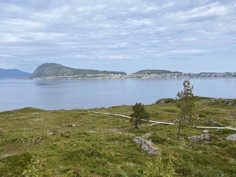
This boardwalk marks the end of the interesting part of the Sula Coastal walk. For now we have about 1.5km of dirt track to follow through a forest. The walk may be following the coast but it doesn’t feel like a coastal walk.
—June 21, 2023 at 10:53 AM.
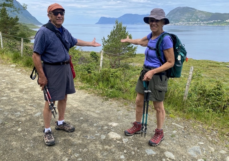
The first two kilometers of this coastal walk are on a gently ascending paved road that takes us west of Langevag. It’s a lovely view towards Alesund and we are walking through a quiet pleasant neighborhood.
—June 21, 2023 at 10:54 AM.
Standing by what remains of an ancient farmstead. Noone has farmed here for hundreds of years but there were times, measured in hundreds of years, where the place was inhabited. People farmed and fished but it must have been a marginal existence. When fishing became problematic, I believe in the early 1800s, the place was abandoned for good. When you come here expect to get your feet wet if you step off the boardwalk that has been placed. This ground is rather more like a highland moor than something more stable.
—June 21, 2023 at 11:53 AM.
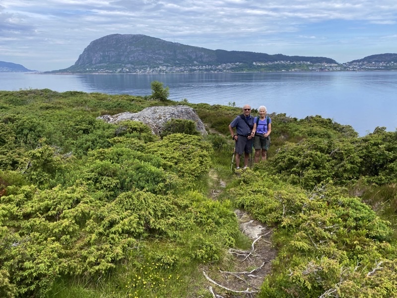
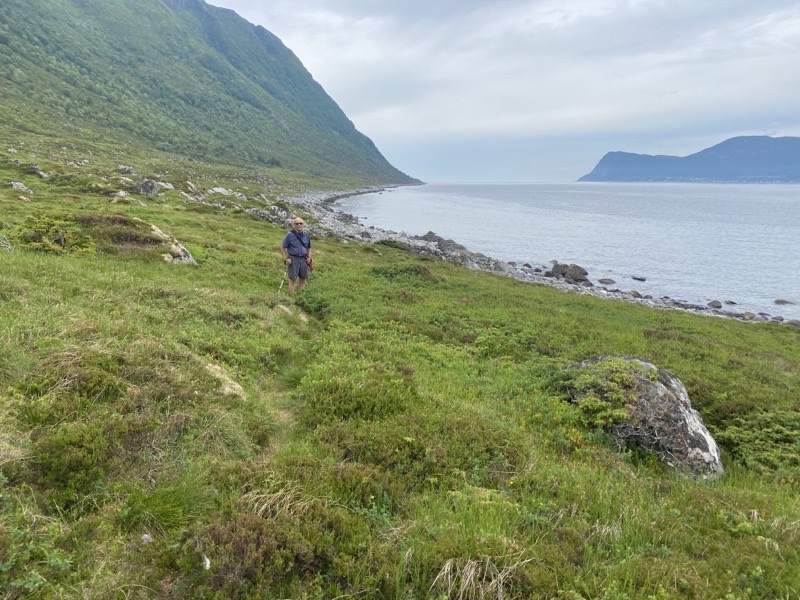
The sections of trail, and this really is trail, that feature sheer drops are thankfully short.
—June 21, 2023 at 12:04 PM.
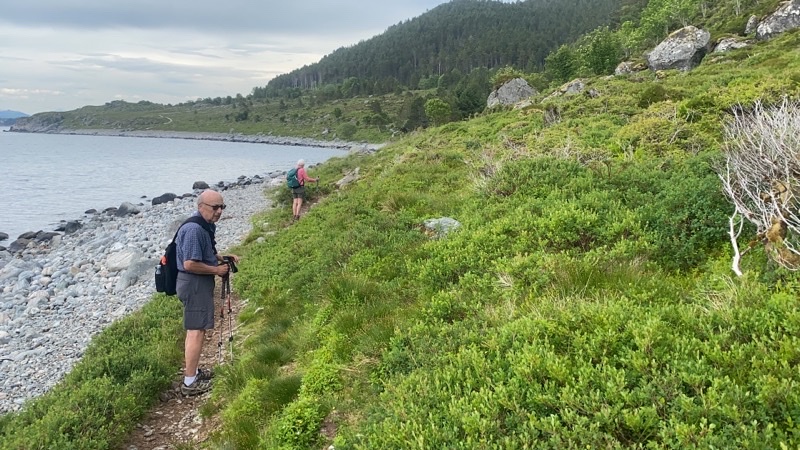
It isn’t really obvious in the photo but we are all standing on the edge of the clifftop here. It is a precipitous drop. The footing is actually good here and you could move inland a bit to avoid feeling so exposed. This is rough coast. Photo by Jonathan
—June 21, 2023 at 12:08 PM.
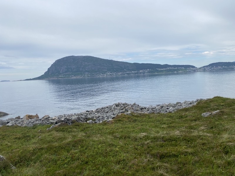
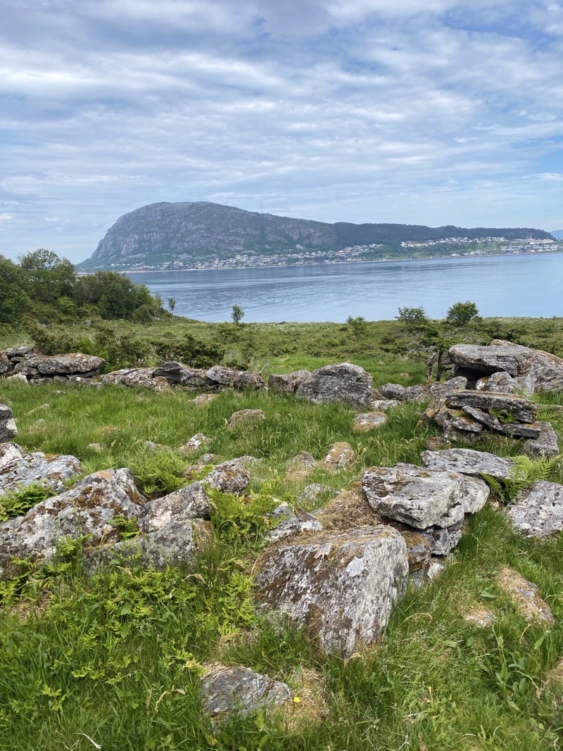
We have reached the westernmost point of our hike and are returning via the coastline. We are about 8 meters above sea level here. We are quickly learning that this coastal walk is going to be a challenge. Sukkertopen (Sugar Top) rises 317 meters. It doesn’t look as pointy from this vantage.
—June 21, 2023 at 12:40 PM.
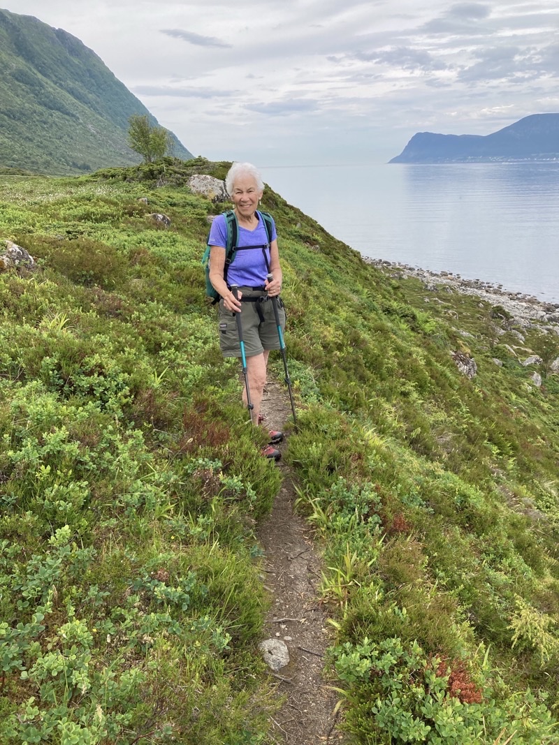
The trail is best thought of as a game trail where the game are the humans walking the trail. It is narrow, indistinct, and often vanishes. The ground is often wet. It is slow going. Mom is leading and doing a great job of it.
—June 21, 2023 at 1:01 PM.
Perhaps a thin ribbon of light colored curving structure can be seen on the headland ahead. That is a boardwalk we are going to climb to return to the paved road. It has been a challenge getting here but I think we all found it more satisfying and certainly less physically demanding than the descent into Alnes a couple of days ago.
—June 21, 2023 at 2:23 PM.
No comments:
Post a Comment