Today we decided to visit the island of Sula. There are two walks on this island and today we would tackle the one named Sula Blåfjell (a local highpoint). While it looked like the walk was a bit relentless as for as ascent and descent were concerned - first you go up all the time and then descend all the time - it somehow seemed like the better option for the day. Since we were going to do both I suppose it doesn’t really matter the order in which they are done. Just do the walk on a clear day so you can enjoy the views when you are above treeline and can see them. Because the bulk of the walk, along a gravel and dirt road (think forest-service road) isn’t that exciting.
We left the hotel with a light rain drifting down upon us. The weather report had that clearing out over the course of the morning so we felt good about that (and we exaggerated concerns, as it would turn out, about the rain affecting streams for the other walk but more on that in a later post). Once we boarded the very well appointed ferry it was a quick 10-minute ride over to Sula and the town of Lanvag. Leaving towns can sometimes be confusing and we were, briefly, confused. Once we got ourselves sorted out though things went pretty easily.
We passed by the Devold factory and museum (they make wool clothing). The rain eased off and we began the gradual ascent along the paved roads that were leading out of town towards the high ridge that dominates the view rising over 350 meters.
In time we veered off onto the forest road (dirt and gravel) and continued to climb. Generally the road wasn’t terribly steep but now and then, really more than you would want, a 50-100 meter stretch would come along that was considerably steeper. It wasn’t anywhere as steep as the steep trails but it was more than enough to notice the change. Up we went.
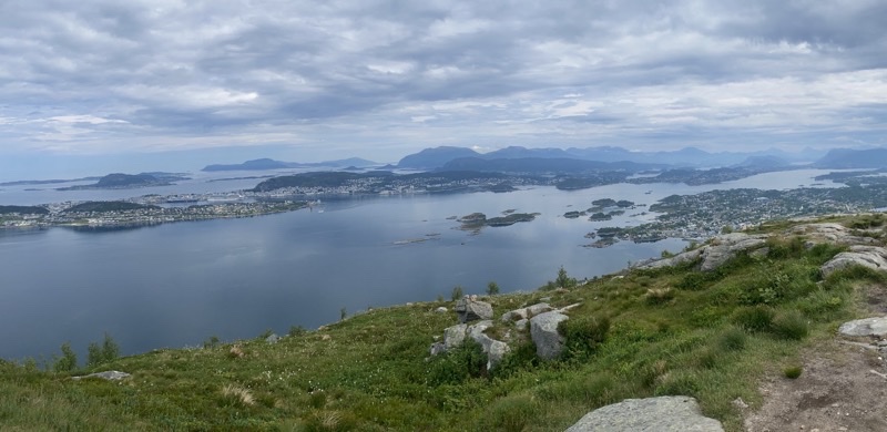
Now and then a treat like the troll and his (I suppose) family of goats minding the wooden bridge that spanned a rushing mountain stream would enliven our hiking experience. As we gained elevation the frequency of views across the water towards Alesund increased. The view got more expansive. That was nice. The clouds broke up somewhat too.
Lunch at the lookout point was enjoyed before we began retracing our steps down the mountain road. What had been a relentless ascent was now a relentless descent. That gets tiring after a while and even though the hike went back a slightly different way when we got to a certain point it wasn’t a particularly interesting way. We were quite ready to be done as we passed the 10km mark and approached a cafe that we are pretty confident serves people coming on tours to visit the Devold Fabriken Museum and outlet store. It was good to take a break there before walking the final 600-odd meters down to the ferry dock to catch the quick boat ride back to Alesund.
Stats: About 10.9km walked with an ascent of 350 meters and descent of 350 meters. We were out for 6 hours (the last 30-40 minutes were spent at the cafe and walking from there to the ferry dock) and spent just over 2 hours of that taking breaks.
Photos
Rain had been predicted for the day though we thought it would start a bit later than it did. We left the hotel under a light rain and that kept up for a time during our hike along the roads of Sula.
—June 20, 2023 at 9:23 AM.
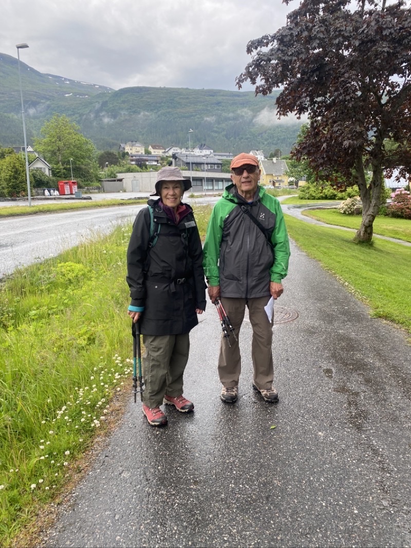
We begin our ascent on this reasonably quiet road walk out of Langevåg located on the island of Sula (I believe). We are going to climb to the top, or nearly so, of the moutain you see in the background. It’s a 360 meter ascent over about 4km of walking distance. We expect the walking to be on at “worst” two-track style routes once we leave the paved road.
—June 20, 2023 at 9:41 AM.
After perhaps the first kilometer of generally flat road walking we began to climb. We began to warm up. The rain had stopped so layers could come off.
—June 20, 2023 at 9:47 AM.
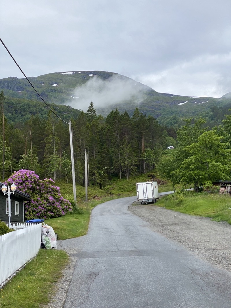
We have been ascending steadily along what is best thought of as a minor dirt road (think USFS Forest road). We are just under halfway up the ascent though we have, likely, more than half of the actual walking still to do. Views like this aren’t common yet as we are still below the treeline.
—June 20, 2023 at 10:15 AM.
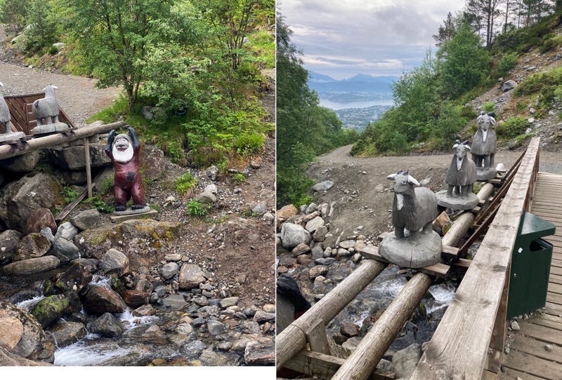
A troll and their goats are minding the bridge. I don’t think the troll is going to ask us to answer a devilish question before we can cross. The picnic table made for a fine place to take a break by the rushing stream.
—June 20, 2023 at 10:50 AM.
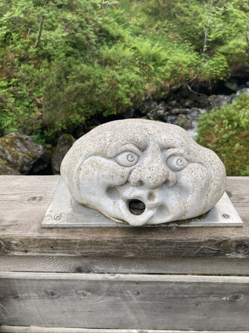
Not quite sure what this creature should be. Kinda cute though. Photo by Jonathan
—June 20, 2023 at 10:53 AM.
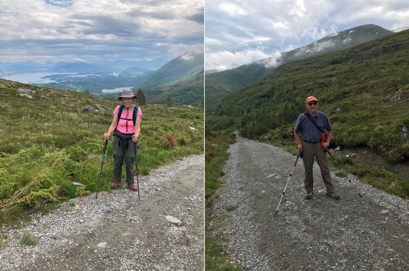
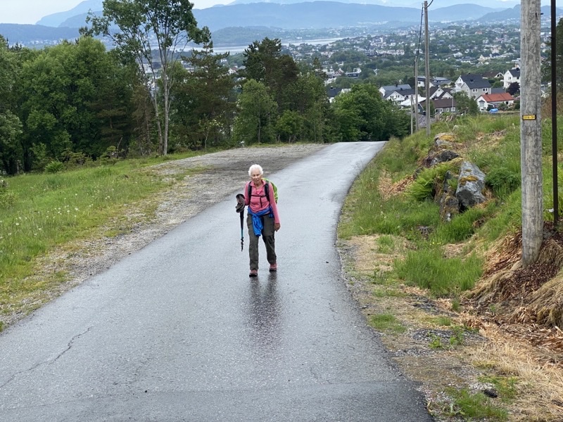
We are about to turn off this forest road and head to a lookout point. On the uphills I pull ahead and have to wait a bit. That is certainly offset on descents when I plod on down far slower than Mom and Dad. At least the views have been good. Photos by Jonathan
—June 20, 2023 at 11:25 AM.
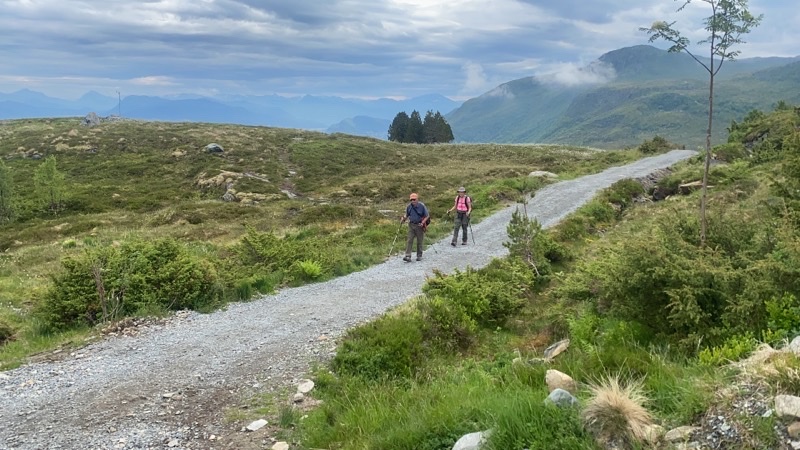
The previous photos were taken just before Mom and Dad came into view. The road is generally reasonably graded but now and then a rather steeper section, 50=100 meters long, appears to trouble our footsteps.
—June 20, 2023 at 11:28 AM.
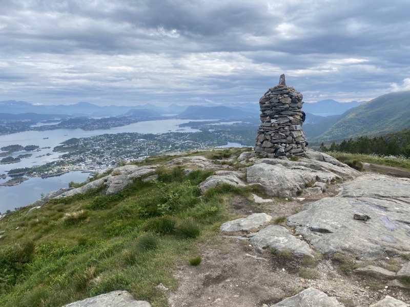
This is the tower or monument perhaps that marks the lookout point.
—June 20, 2023 at 11:47 AM.
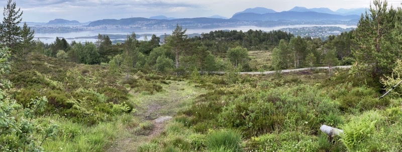
The view from the picnic table at the lookout point. The trail is made once again mostly with paving-like stones (though not as regular in surface contours) so you avoid mushy ground. One section, perhaps as much as a quarter of the 350 meter-long trail, is wonderful boardwalk. Too bad they didn’t use more of that or even just classic two-plank length boardwalk. It was a fine place for lunch.
—June 20, 2023 at 11:47 AM.
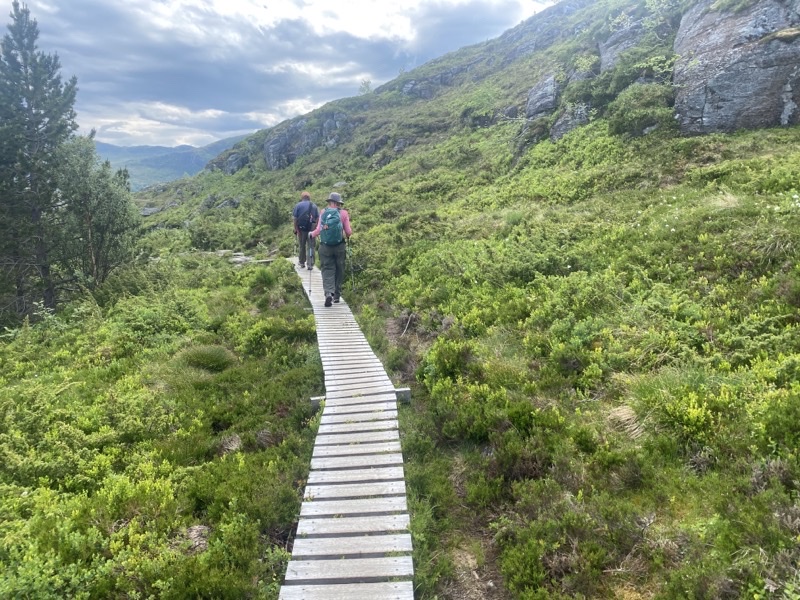
I’m really just putting this photo in to show the boardwalk. From this point on we petty much retrace our path down the gravel/dirt road until we take a slightly different (not sure why) route back on paved roads back to the ferry dock. It’s a tiring sort of descent over about 5.5km. We got to a cafe 2 hours later (took a couple breaks) and though the dessert wasn’t the best the coffee and a chance to sit down for a bit were welcome. It’s a shame the ferry ride is just 10 minutes because those seats would be fine for a nap.
—June 20, 2023 at 12:12 PM.
No comments:
Post a Comment