Canary Islanders will likely tell you that it was chilly this morning even at sea level (17°C) and certainly at our starting point around 5,100 feet above sea level in the Pinos de Galdar where it was hovering around 13 °C (55°F). Our bus ride, about an hour this time, took us through clouds and patches of clear sky but mostly clouds. If it had been less cloudy when we were at certain points of the journey we could have gazed down upon a lower level of cloud coverage which would have been stunning. However, the main feature of the weather this morning was clouds. At least that was the main noticeable feature as we drove into the mountains. When we stepped out of the bus into a white shrouded world we quickly became aware that the wind was going to be playing a starring role in how we felt too. People were definitely bundled up more than any other day we hiked. I was ok wearing shorts, a longsleeve shirt, and windshirt when the wind was too strong and we weren’t getting any precipitation. Others had far more on. If you were stuck out overnight in these conditions a warm hat and gloves wouldn’t be out of place.
At our dropoff point there should have been a superb view. There was a superb white-out covering the caldera below. Engulfing white but at least it was dry against the skin even though we were clearly within clouds. Since there was no view to see there was no reason to hang out at the viewpoint. We quickly entered the pine forest and that was a nice instant chnage. The trees aren’t densely packed but all pine forests are lovely. The ground is covered with needles and the colors of the trees and ground are pretty. The wind is blocked. It is quiet.
The hike today would be through the pine forest and then on roads towards Caideros. The hike would be pretty much all descending. We followed a trail of worn away pine needles down and down, switching back and forth fairly often to reduce the angle of descent. But it’s a constant descent. Now and then we would enter an open area with few trees and the wind would beat at us. Now and then strongly enough to shift a person a bit: a little extra nudge. The footing was actually quite good and generally you didn’t have exposure to deal with. Of course, since the views were mostly shrouded you might not have noticed exposure were it there to bother you.
I think we picked up an extra member around the one-mile mark. A dachshund had been following a group that was heading up the mountain. The dog decided to join us as we went down the mountain. Belinda, our local guide, gave the dog a name but I am not quite sure what it was. Nor am I sure how long the dog stayed with us though I am sure it was gone when we stopped for lunch. Maybe the dog figured out that being on a wet windy mountainside where the winds were increasing in stregth wasn’t really a good place to be and went home.
At the local cafe, just located in what seems like the middle of nowhere (though there were many cars) we stopped for lunch. I should have tried the lamb or pork. I did try some of the locally made cheese and it was vastly superior to whatever we are getting at the hotel. It had flavor. I can’t describe it but it was an enjoyable snack. It was not the Qesso de Flore (think that is right) which is a local cheese made using , I think, sheep’s milk (goat?) and a rennet made from a local flower. Not many make this anymore but it is supposedly renown.
We leave the pine forest for the roads at this piont. We’ve dropped aoubt 1,000 feet in elevation over the past two miles. The temperature was marginally warmer but the winds are strong enough and it is sprinkling, and some of us not already wearing rainwear quickly donned rain jackets. The descent would continue on a two lane tarmac road. Down we went. Now and then a tantalizing view would appear long enough to show us what we could truly see if only the clouds were not around. It would be stunning. We passed by pastures with goats and homes. We soon reached a part of the Camino de Santiago Gran Canaria which does end at a church I believe dedicated to Santiago in Galdar. It is a 66km long trail that starts in the south of the island and heads north between volcanoes. The trail is marked with the scallop shell like the Canimon de Santiago trails that meander through Europe to Santiago de Compostela in Spain. I suppose we followed a section of the trail all the way into town: perhaps 1.5 miles.
The wind never really let up but the skies did begin to clear as we approached the end of our walk. It was sunny in the plaza where we found our bus waiting for us. We settled down upon steps to wait for the people doing the harder walk to arrive. They arrived about 20 minutes after we settled down. Not long after we re-united, perhaps around 14:15 we boarded the coach for the journey back to the hotel. I am pretty sure we have never done a walk that ended as early as this walk did. We were back at the now sun-drenched hotel where the temperature is probablhy about 21°C in the shade.
Stats
Perhaps we started at a different spot than initially planned but I do not think so. We hiked 4.6 miles descending about 2,100 feet and ascending maybe 100 feet. The first 2.1 miles were through the lovely pine forest on good trail with fine footing of soil and pine needles. The next 2.5 miles were on tarmac roads for the most part with maybe a tiny break here and there but not enough to notice.
Photos
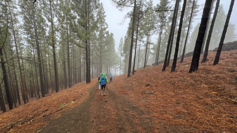
It’s good that pine forsts are as pretty as they are because I don’t think it will be long before we plunge into the cloud layer you see in the distance.
--February 25, 2024 at 10:18 AM.
Maps are centered on the photo: Google map, Apple map, OpenTopoMap map
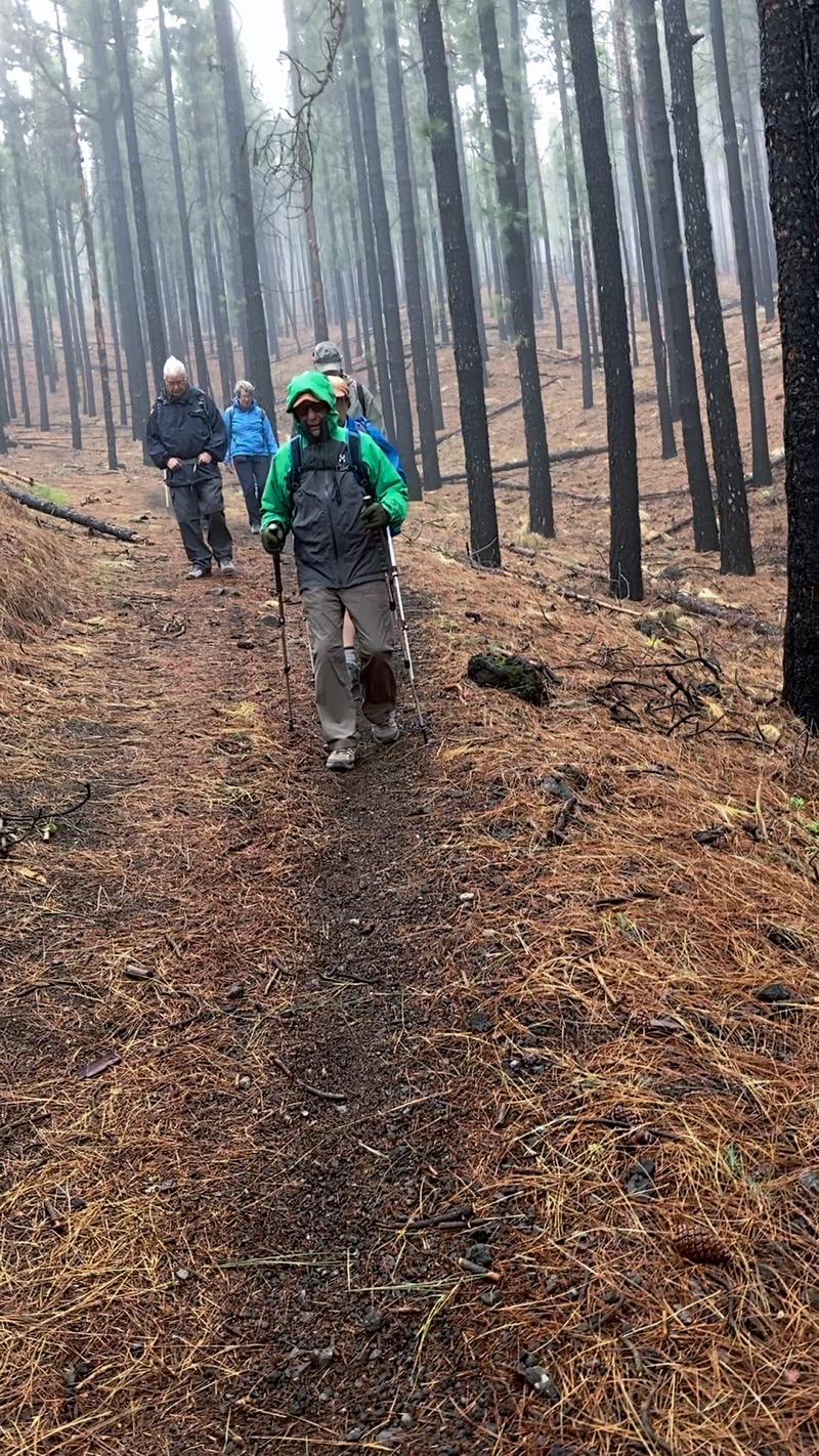
Groups always spread out a bit. This is a lovely pine tree forest: Pinos de Galdar. The footing on this pine-needle and dirt trail is quite good which is nice since it is a steady constant descent with a grade around 10%. Photo by Judy
--February 25, 2024 at 10:32 AM.
Maps are centered on the photo: Google map, Apple map, OpenTopoMap map
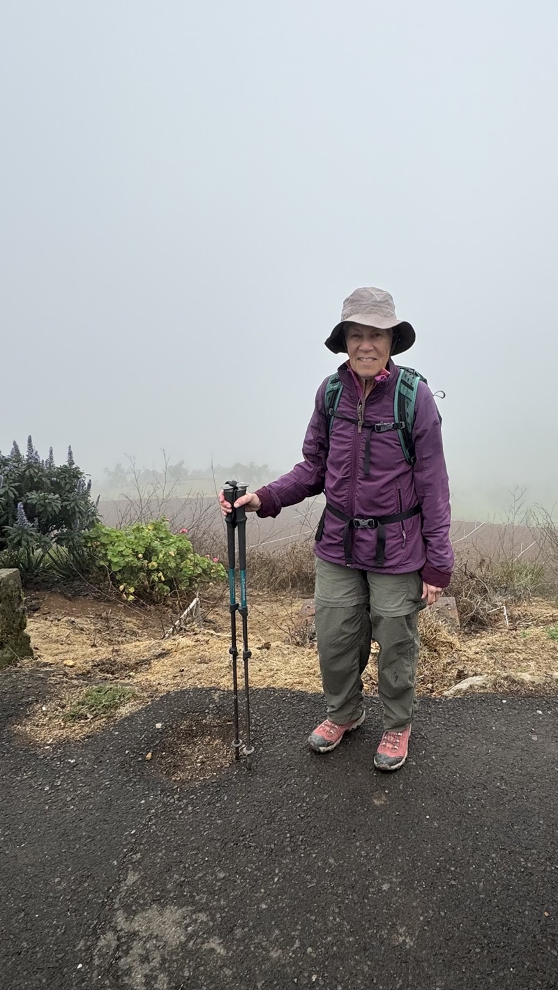
There probably is a fantastic view hiding behind that shroud of clouds behind Mom.
--February 25, 2024 at 12:11 PM.
Maps are centered on the photo: Google map, Apple map, OpenTopoMap map
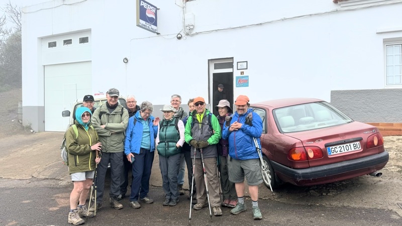
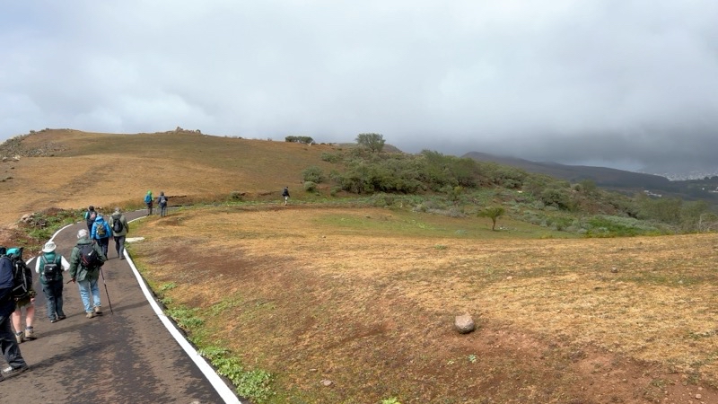
This is our groups of people tackling the easier walk. We had a nice little break at the roadside cafe. It’s all roadwalk downhill from here. Photo by Belinda (local guide).
--February 25, 2024 at 12:14 PM.
Maps are centered on the photo: Google map, Apple map, OpenTopoMap map
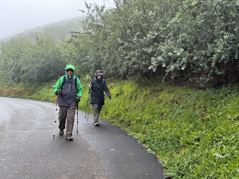
We left the comfort of the roadside cafe and were immediately pelted by enough rain which caused those of us not wearing rainjackets to put them on.
--February 25, 2024 at 12:24 PM.
Maps are centered on the photo: Google map, Apple map, OpenTopoMap map
Passing a scallop shell that is marking this as part of the Camino Santiago de Gran Canaria. Photo by Judy
--February 25, 2024 at 12:28 PM.
Maps are centered on the photo: Google map, Apple map, OpenTopoMap map
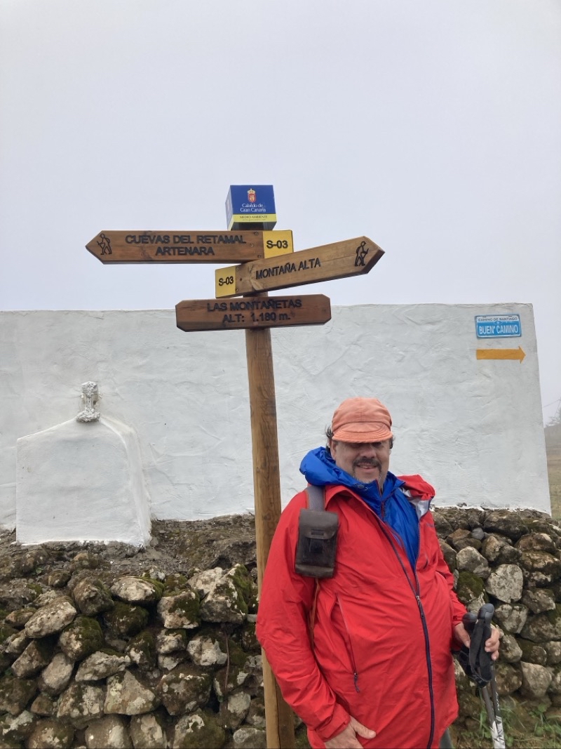
I had to be quick to get even this view. I just missed some sunshine shining off distant rocks.
--February 25, 2024 at 1:17 PM.
Maps are centered on the photo: Google map, Apple map, OpenTopoMap map
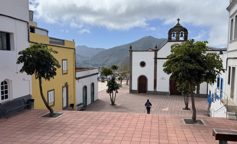
I am not entirely sure what the name of this village is. It may be Caideros which is what the booklet implies. It has a nice plaza but that is all we saw.
--February 25, 2024 at 1:45 PM.
Maps are centered on the photo: Google map, Apple map, OpenTopoMap map
No comments:
Post a Comment