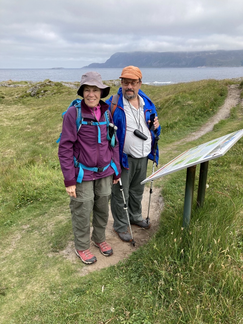
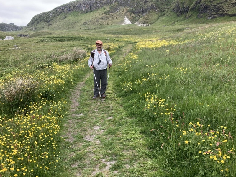
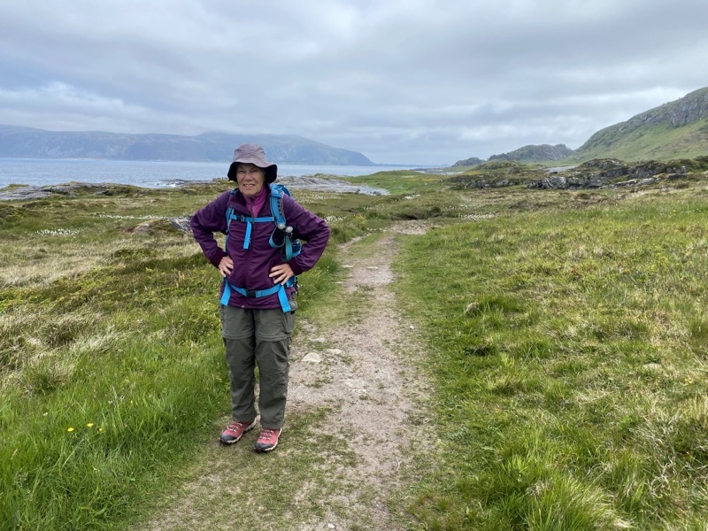
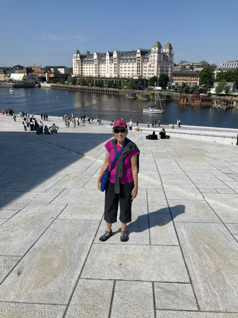
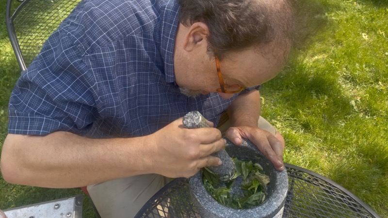
Tuesday, June 20, 2023

Norway & Finland: Day 4 in Alesund

Jump to Photos

We were joining the other early breakfasters at 07:00 and gathering up food before all the warming trays were full. The sun was up - actually that happened over 3 hours earlier - and the sky was clear of clouds. It promised to be a lovely day and we were looking forward to a good hike.

Today we would visit the island of Godøy. The notes say the hike is 6.5km in length and we would ascend 275 meters and desend 310 meters. Most of the climbing would be done over relatively short distances. We were sure in for something over the 5 hours we spent out and about.

To get to our hike we had to reach our island by taking 2 buses. The system is pretty efficient though that doesn’t mean you don’t have time to twiddle your thumbs waiting for your connection. In fact sometimes you end up waiting on the bus you are already riding for a few minutes at a stop, not your destination, before reaching your final goal. But the bus arrives and departs when the schedule says they will. It’s just a bit confusing sometimes what that schedule is. At least I have found different informaiton (perhaps I am misreading things) between Apple and Google maps. I’d use the Fram app but that requires I confirm I am me via a text message and I do not have a mobile number active here for the app to get a verification code. My eSIM is data-only which means I can access the Internet but not use SMS or make cellular-style voice calls. I think our outward bound journey took just over an hour from when we left the hotel to when we arrived at Juv Snuplass (“Yoov Snooplass” on the island of “Goo-day” or pretty close).The sun was shining, birds were singing, the water looked lovely. Too bad the sun and warm temperatures (we think) also brought out swarms of flies. We began our ascent. The trail quickly entered the wooded hillside and began a steady and rather steep climb. Now and then the good soil-based trail-bed would have rocks and roots that impeded our path.However, the footing was pretty decent - steep with a grade over 20% - but good. But this is definitely a trail that gives you a workout and we were feeling it as the flies continued to swarm around us.

Up and up. Swarming flies. An occassional opening in the trees presented us with a hazy view across the mouth of the fjord where so many of the island around here sit. We saw a few people coming down the trail. A couple passed us going up. We all complained about the flies.

After a bit more than an hour we reached treeline at about 260 meters elevation. I suppose the treeline is greatly influenced by what must be a rather short growing season. The wind picked up a little and knocked some of the flies back but that just left smaller swarms to bother us. I suppose that helped shorten our break at the rather nice picnic shelter.

In short order we climbed over the top of the hill and gazed out upon the alpine lake. Nearly mirror smooth, lovely blue, likely cold, and no swimming is allowed. I bet many people have finished the ascent and wanted nothing more than to take a cooling dip. I would. Over the next couple of kilometers we would work our way counter-clockwise along the trail with the lake mostly in view. We found a grand, clearly made, lunch spot at the water’s edge. That lunch spot of a semi-circular bench of stone and plenty of grave laid down to cover the boggy ground is a mark of the quality of the trail. The trail is made of thousands of paving stones. Step off those stones and you will sink into the ground. I think they must have shuttled the stones via helicopter up here. It’s an impressive amount of work and makes for a good trail.

It was enjoyable walking around the lake though you did have to pay some attention to where you stepped and that slowed me down some. But the afternoon was glorious and we had left the swarms of flies behind during our trek around the lake. The joy wouldn’t last.

At about 12:45 we reached the northern edge of the plateau and could look down upon the village of Alnes some 260 meters below us. The worst was about to begin but we still didn’t know how bad it would be. We found out quickly. I think the first 500 meters of trail were probably worse than the second 500 meters. Rock steps of all heights and surface contours, gravel, a slope with a grade of at least 20% all combined to make the descent just plain awful. It hard on the muscles and harder on the mind. Our speed plummeted to, at best, 0.75KPH. The views were exceptional but when you are concentrating on placing every footfall with exquisite care you cannot appreicate the views. The notes undersell the challenge of this descent. I’ve no doubt agile stronger hikers make the 1-kilometer long descent in the 80 minutes suggested. It took us around 120 minutes and it felt longer. Much longer. It is not something I would choose to repeat. The joy of achieving the goal of the road is fine and I can marvel at the work building the trail required but I find myself wondering if they could have made it easier albeit longer.

When we reached the road we were spent. It was now Dad’s turn to gripe about the remaining walk to the bus stop which we thought, because we hadn’t fully absorbed the notes, was 1.5km away. It turns out the bus stop was quite a bit closer at about only 800 meters. It was not much past 15:00 and we figured out that the cafe and lightouse accounted for the remaining 2km (and out-and-back) of hiking the notes suggest you do. We did not do that. It would have been nice to find a cafe for a drink and snack but we definitely wanted to catch the 15:55 bus which we weren’t entirely sure was coming. It arrived at 15:55.

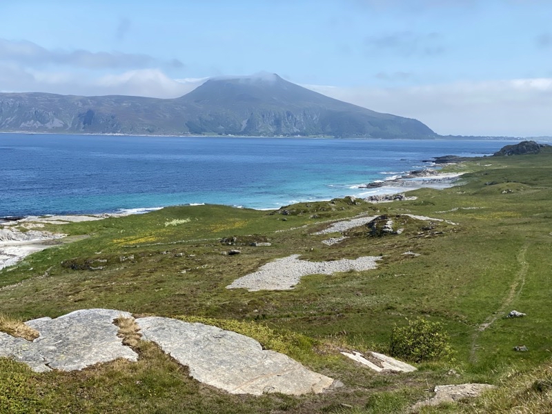
Our 85 minute journey back to the hotel began. One reason it takes as long as it does is that bus 32 takes a 20-odd minutes break at Juv Snuplass (where we began). I’m not sure why this is done. There doesn’t seem to be anything there. If the bus takes a break in Alnes I am not aware of it and that at least is a tiny village. But the break did give us a chance to get out and get some much-less-hazy pictures of the islands south of Godøy. This is when the bus driver told Dad that the extremely pointy peak was called something like Sugar Top. It’s an odd name as there is no snow capping the mountain peak providing the sugar.

I could go on and talk a bit about the lady who was waiting with us at Alnes for the bus while her husband tackled the walk we had just done going in the other direction. We had a modest conversation while we waited. Her husband would link up with her later in the bus ride though not at Juv Snuplass so he found a different route down which means his walk was a bit different from ours. I could talk about the chat Dad had with the bus driver too. If you’re willing to talk with people they talk back. Dad is good at that.

When we got back to the hotel it was 17:23 and we had an hour to get ourselves ready for dinner at restaurant Bro. This would be our first of three pre-planned by Inntravel meals. We were scheduled to have a 3-course meal and that is about all we knew. When we arrived we found the outside teaming with people having drinks and perhaps eating. Given the price of tonic water (about $5) to say nothing of beer ($12) your drinking budget could explode pretty quickly. Inside we found the place for less busy and we settled down at a waterside-view table for dinner. Over the next 90 minutes, an age for us, we ate our very enjoyable meal. My starter ws an asperagus in butter sauce with very small shrimps dish. Mom and Dad had some type of gin-cured mackerel also with plenty of herbs. The restaurant had to make a change for me on both the starter and main course as I definitely can’t eat chicken or fish. My flat iron steak was well presented, reasonably cooked, and flavored in a buttery herb sauce that was quite good. The hassleback (?) potato was nice if a bit salty but I think I’ve gotten spoiled by my smoked baked potatoes. Mom and Dad had Plaice Fish which they both enjoyed. The rhubard dessert was a donut like bun with rhubarb jam inside. Served alongside was a parfait of ice cream, nuts, and a local berry of some type. The combination was lovely. Maybe we will have to return to Bro just to enjoy a dessert on the remaining day we have to find our own dinner. It was good to end the day on this high note. Stats: The hike was 4.8km long with 235m ascent mostly in 1 kilometer; 280m descent mostly in 1 kilometer. The ascent and descent trails are quite steep and the descending trail is pretty much all rocks.

Photos
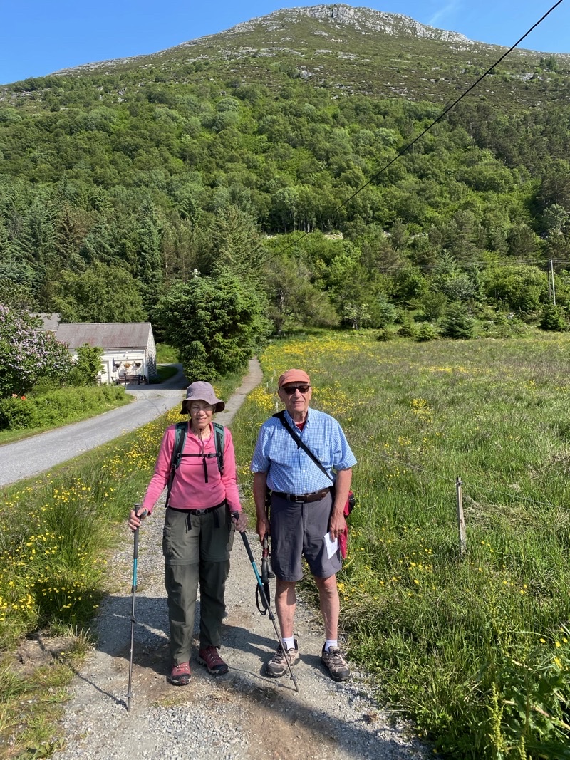
Photo taken Jun 19, 2023 at 9:54 AM

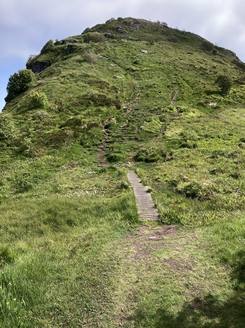
Our hike is going to start with this climb. The notes say it is a rocky and steep trail. It sure does look like it.

—June 19, 2023 at 9:54 AM.
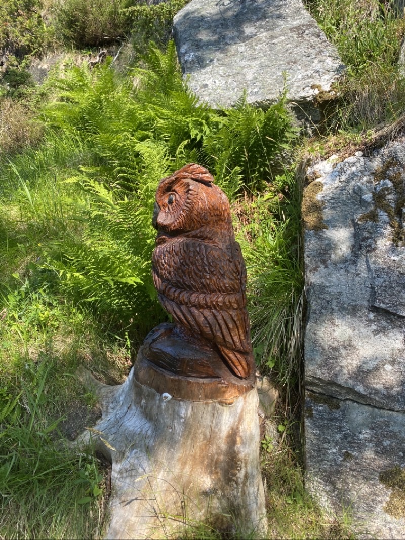
Photo taken Jun 19, 2023 at 10:12 AM

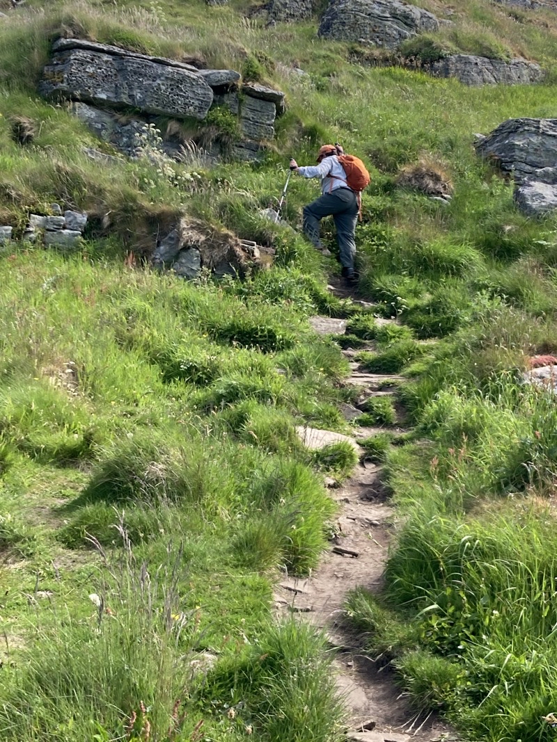
The flies are swarming and this owl is doing nothing to help us. We continue to plod up the somewhat rocky and steep trail. THe footing isn’t great but it isn’t awful either.

—June 19, 2023 at 10:12 AM.
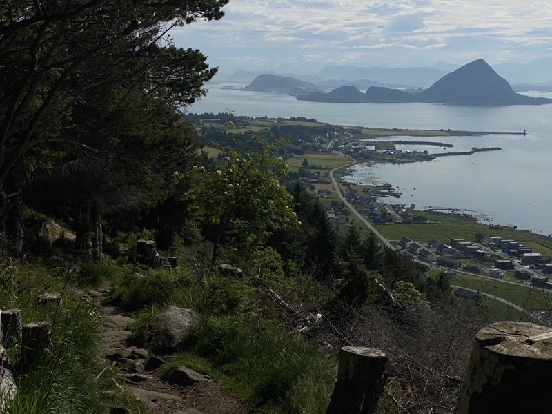
Photo taken Jun 19, 2023 at 10:27 AM

One of the few places with a view during our 1-kilometer long ascent. We have been climbing for almost 40 minutes and ascended about 155 meters over perhaps 750 meters of trail travelled. We have taken a few breaks. We might have taken more breaks to catch our breath than we did if it weren’t for the ever-present swarming, not biting, flies. Annoying, irksome, bothersome, but at least not eating-us flies.

—June 19, 2023 at 10:27 AM.
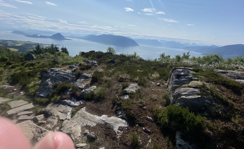
Photo taken Jun 19, 2023 at 10:51 AM

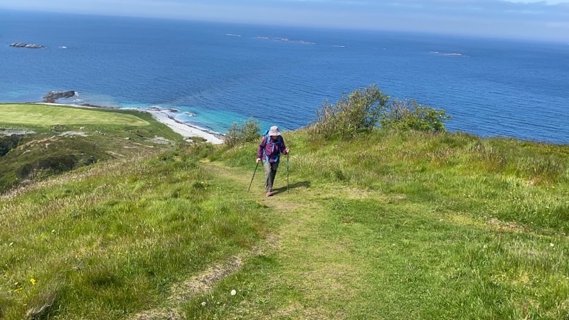
The trail opens up here and we still have a few hundred meters to go to reach a shelter. The wind was blowing a bit and that helped knock the flies back a little bit. A very little bit. Dad and I got to the top a couple minutes before Mom. I think we all felt the climb. We wondered what the descent would be like as it looked like it had a similar level of steepness. The views would have been spectacular except for the hazy sky. The pointy mountain on the left is called something like Sugar Top though it doesn’t have any snow sugaring the top. We have been ascending for an hour, hiked 230 or so meters over just over 1,000 meters of hiking from where the trail really got steep.

—June 19, 2023 at 10:51 AM.
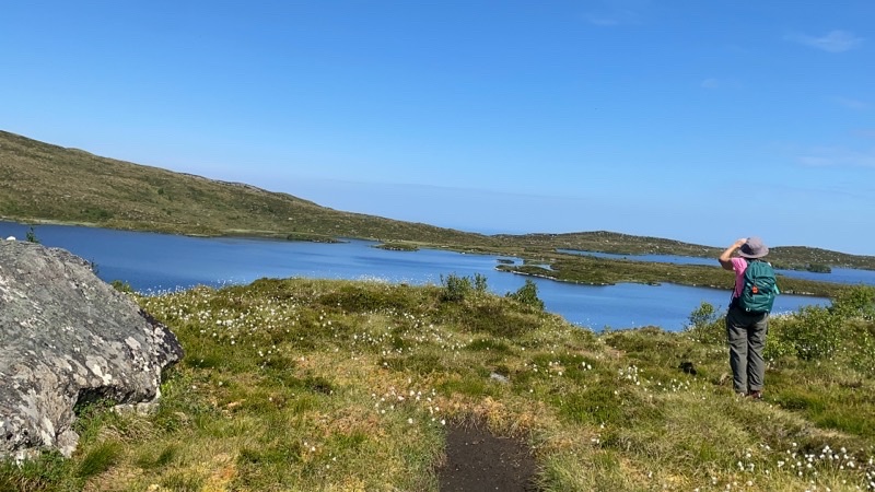
Photo taken Jun 19, 2023 at 11:10 AM

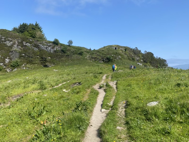
I am not sure if we should call this an alpine lake or not. We are now above treeline in this area. We are at 276 meters above sea level and I think we will navigate around the lake for the next 2 or so kilometers. I do not know why swimming is prohibited which is a little sad as taking a dip after sweating our way up here would be tempting. Under the bright sun it feels like the temperature has risen above 70 F.

—June 19, 2023 at 11:10 AM.
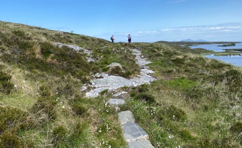
Photo taken Jun 19, 2023 at 12:08 PM

The trail around the lake sometimes moves away form the lake. What makes the trail remarkable is that it is made of flat (mostly) rocks that are placed like stepping stones to form the path on the boggy ground. I am confident that thousands of stones were placed to make the trail. How were they brought in? I think it must have been via helicopter.

—June 19, 2023 at 12:08 PM.
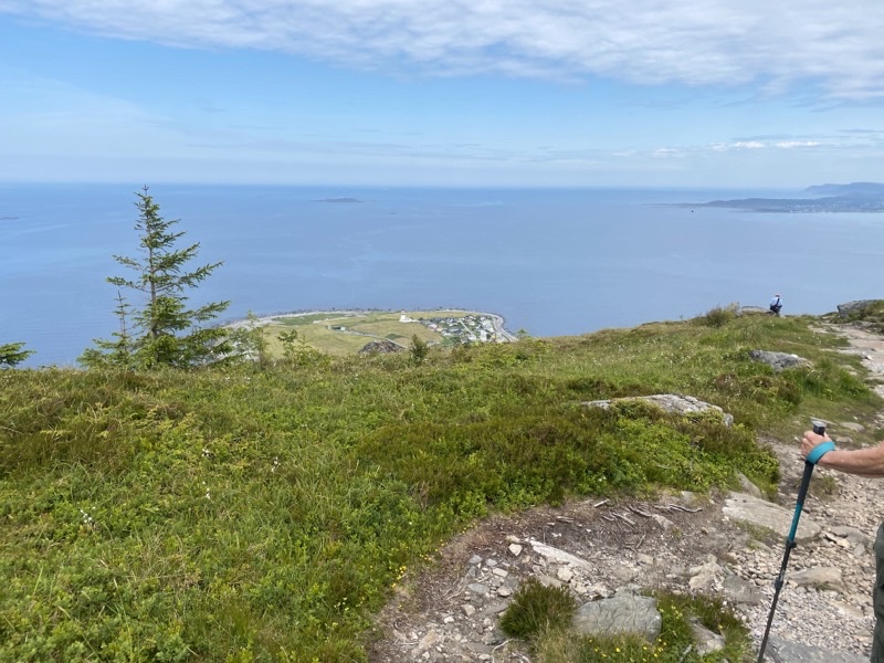
Photo taken Jun 19, 2023 at 12:44 PM

We are about to start our descent to the village of Alnes. It will be along a trail the notes say is rocky and sometimes steep and you need to be sure-footed. We expected to descend about 260 meters but hadn’t checked the distance. We actually thought it might be over 2km as we knew the walk ended (we thought) with a 1.5km roadwalk. Nope.

—June 19, 2023 at 12:44 PM.
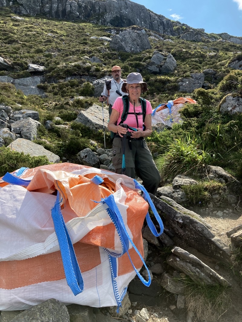
Photo taken Jun 19, 2023 at 1:26 PM

We have been creeping down this steep, rock strewn, real pain of a trail for a half hour. Mom is standing between two huge bags that contain stones that we figure will be laid on the trail to continue improving it. It is a slog. It is not fun. If we are moving faster than 0.75KPH I’d be surprised. Photo by Jonathan

—June 19, 2023 at 1:26 PM.
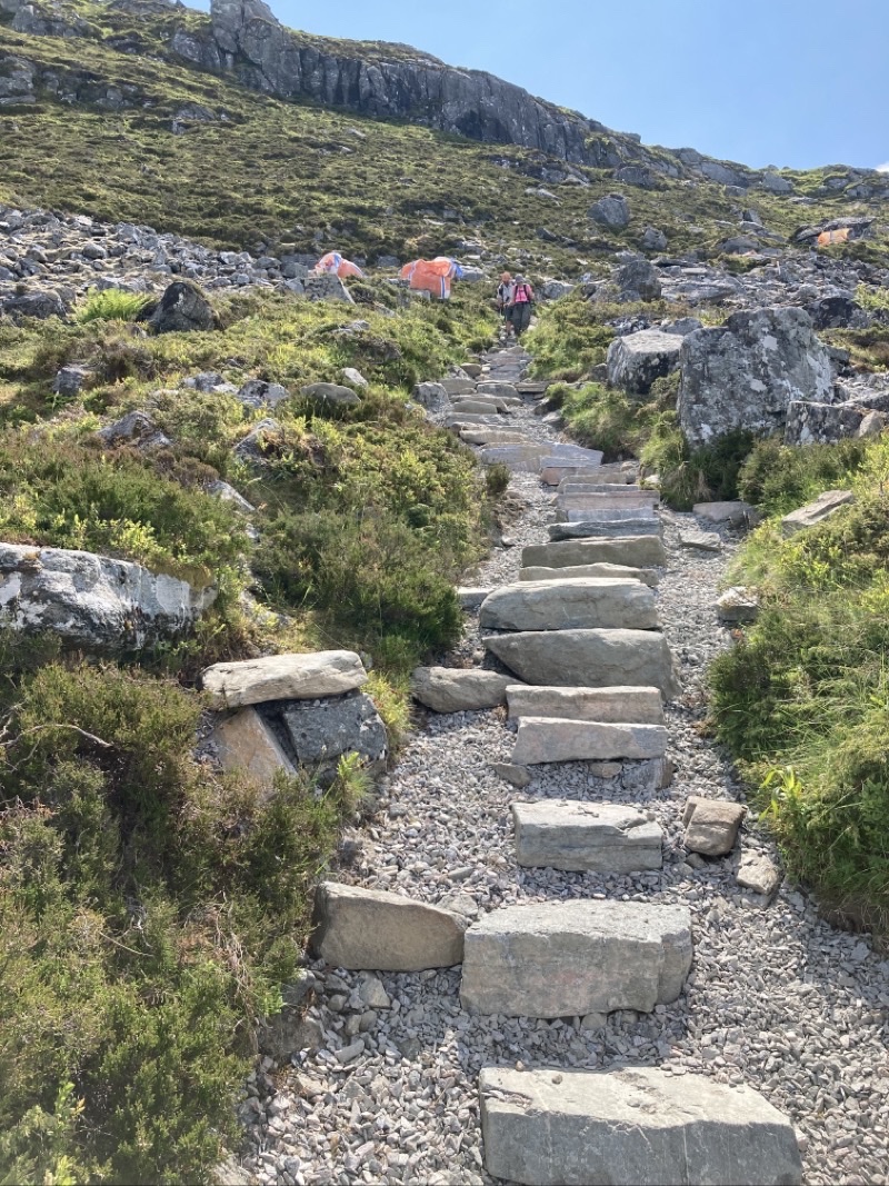
Photo taken Jun 19, 2023 at 1:31 PM

Looking back up the trail you can get a sense of what we have been dealing with. Ugh. Just ugh. Photo by Jonathan

—June 19, 2023 at 1:31 PM.
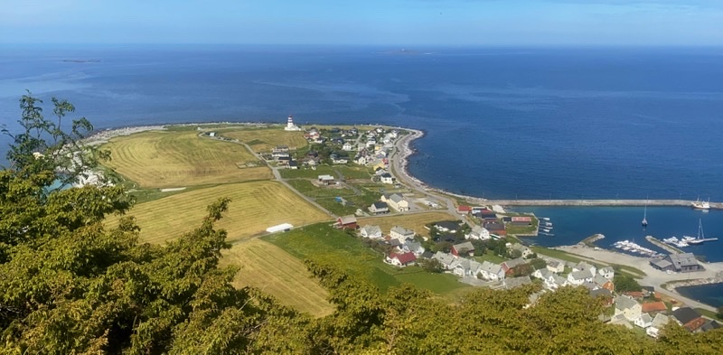
Photo taken Jun 19, 2023 at 2:01 PM

As you can see the views are wonderful but the grind is continuing. We are over an hour into the descent and still have probably 140 meters elevation to drop and closer to 500 meters of trail to contend with. Just awful. Many younger folks have been heading up to the top and some coming down: all so much more adroitly than I.

—June 19, 2023 at 2:01 PM.
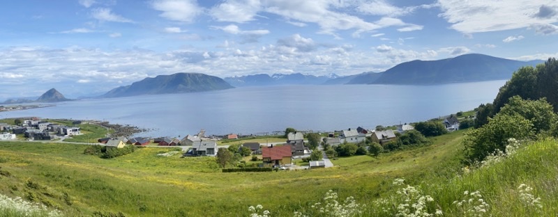
Photo taken Jun 19, 2023 at 4:13 PM

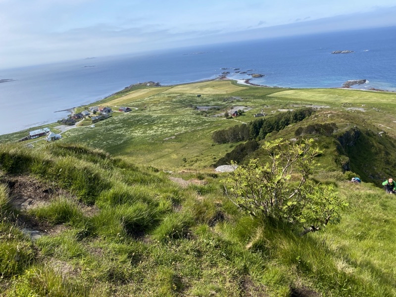
We finished the abolutely wretched descent probably two hours after starting it. We then walked the road to the bus stop. It was a bit past 15:00 and we were pretty sure a bus would come by at 15:55 so taking the time to go into Alnes and find the cafe and get a close look at the lighthouse wasn’t going to happen since we certainly didn’t want to wait for a 16:55 bus. We are riding bus 32 back towards the connection point at Ytterland. However, along the way we would pause at Juv Snuplass for 15-20 minutes (planned stop) and I was able to take this photo. The whole journey took about 85 minutes so you can see why we didn’t want to catch a later bus.

—June 19, 2023 at 4:13 PM.

Monday, June 19, 2023

Norway & Finland: Day 3 in Alesund

Jump to photos

We had to adjust our plans due to the limitations of the public transportation network. On Sundays your options become rather limited so we decided to tackle what we had been thinking of as a local city walk though it isn’t actually in the city proper but above it.

We left the hotel just before 10:00 and walked through town (with a peek into a shop or two) before winding our way up 50 steps and a steep ascending road to the entrance to the city park. That bit of steepness is a prelude to the climb to come: 418 concrete and stone carved steps. I’d not be surprised to learn the steps ascend close to 100 meters over certainly less than 400 meters of travel. It’s a workout. As we climbed,it sprinkled ever so gently. Just enough to notice. But the climbing is worth the effort for the views you have.

Once we arrived at the top we began the walk along a paved path that wound its way through forested hillside that would feature an occasional opening in the trees for more fine views. Over the next 3.5km we followed this cement-like path gradually descending and enjoy a break now and then on a bench to just rest our feet and absorb the scene. People come up here to get a workout, to use an outdoor gym, to gaze at the views, or even to fly drones. Everyone is on foot. This is not, it seems, a bike path. That makes me happy. As we walked and the morning changed to afternoon the clouds moved away and the temperature steadily rose. In direct sunshine I would not be surprised to learn it was edging into the upper 60s and even touching 70. In the shade I am sure it was registering the recorded temperatures we noted on our phones of around 64 F. Wonderful.

Eventually we would leave the woodland path for the sidewalks of a suburb and find our way to the Sunnmøre museum. This is a cultural museum, like the Norsk Folkemuseum in Oslo, but we felt no real desire to explore the grounds after walking about 7km and climbing 169 meters and descending as much. We actually ended up doing this walk faster than the notes suggested (they give times for walking without breaks). We took a lot of leisurely breaks to extend our time outside which made this walk a bit better. It’s not a bad walk but it probably won’t live in our memories too long either.

Photos

Photo taken Jun 18, 2023 at 10:18 AM

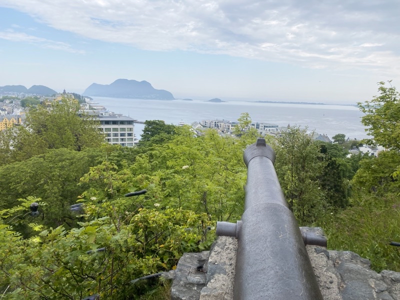
This cannon faces north about 62 meters above sea level. It’s probably a good 500 meters to the shoreline which seems like a fair bit of distance to me but I know nothing about artillery. For those wondering there is a metal rail fence here to ensure you don’t do something dangerously stupid. I thought it would be an interesting exorcize to remove it and present a view that the gunner would have seen.

—June 18, 2023 at 10:18 AM.

Photo taken Jun 18, 2023 at 10:23 AM

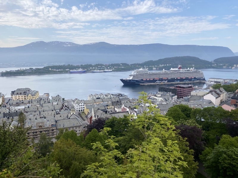
At this point we might be a bit over halfway up the 418 steps. This viewpoint is about 82 meters above sea level. It provides another fine view of the waters to the south of Alesund (I think). What is most notable here is the cruise ship. It really looks like a floating building but I doubt a typical building is home to as many people as a large (and this isn’t the biggest we have seen) cruise ship can hold.

—June 18, 2023 at 10:23 AM.

Photo taken Jun 18, 2023 at 10:31 AM

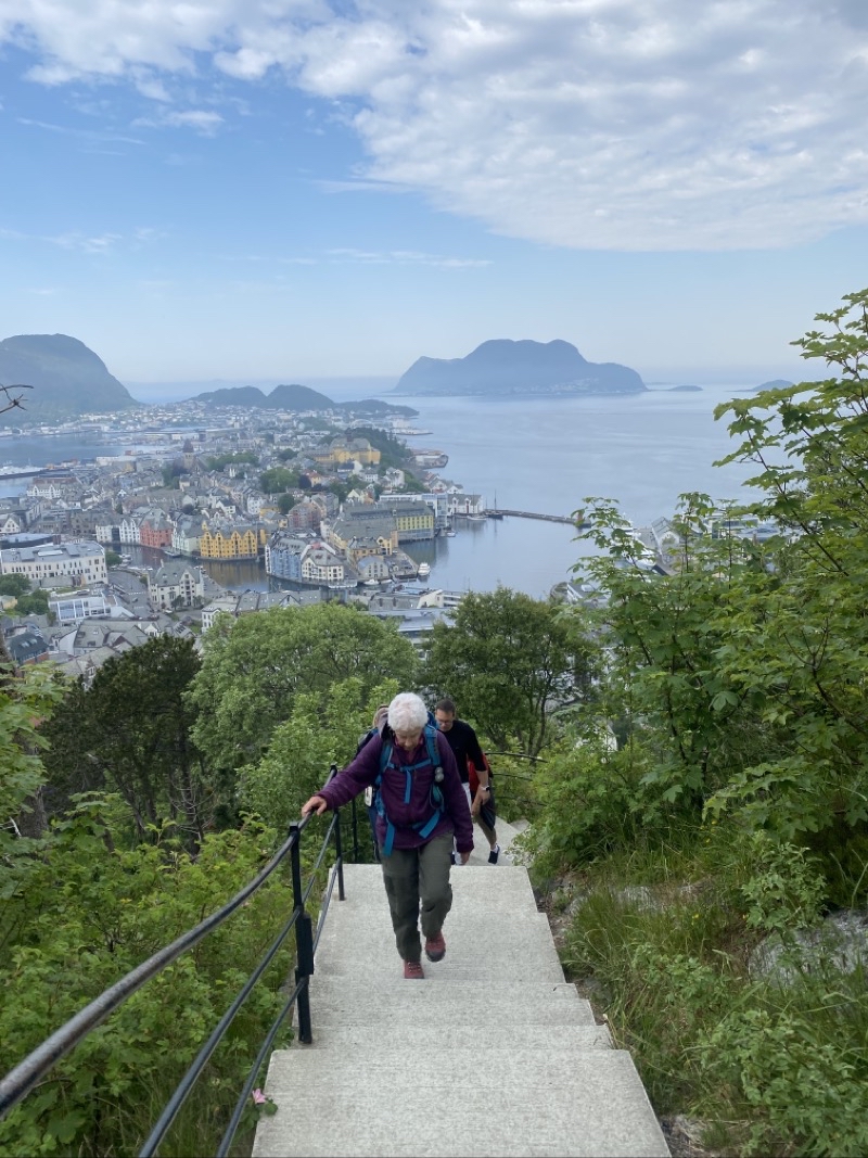
At this point I am sure there are fewer than 80 steps to climb. Mom is approaching the 117 meters above sealevel point where I am standing. The majority of the steps are concrete (cement?) and probably the standard height. Now and then stone-carved steps must be dealt with and they tend to have slightly greater rises. You get frequent breaks, which I expect are gently climbing, between sets of steps. It’s a workout and I am glad we were climbing not descending which might make me feel more nervous.

—June 18, 2023 at 10:31 AM.

Photo taken Jun 18, 2023 at 10:39 AM

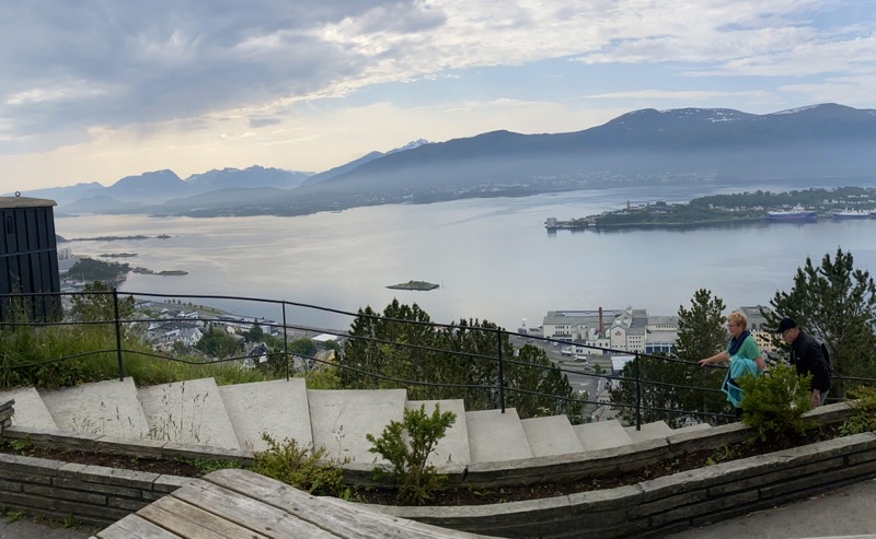
At the top, well at the end of the steps. I suppose the highpoint is on top of the building to my right. The road jsut beyond is also a bit higher but this is the top for practical purposes about 140 meters (454 feet) above sealevel. We made the ascent in probably about 20 minutes. We were hardly the only ones climbing. However, once we got to the top the crowds thinned out and I wonder where they all went since they clearly were not following us along the paved path. We would soon take to the edge of the park at Fagerlia.

—June 18, 2023 at 10:39 AM.

Photo taken Jun 18, 2023 at 10:51 AM

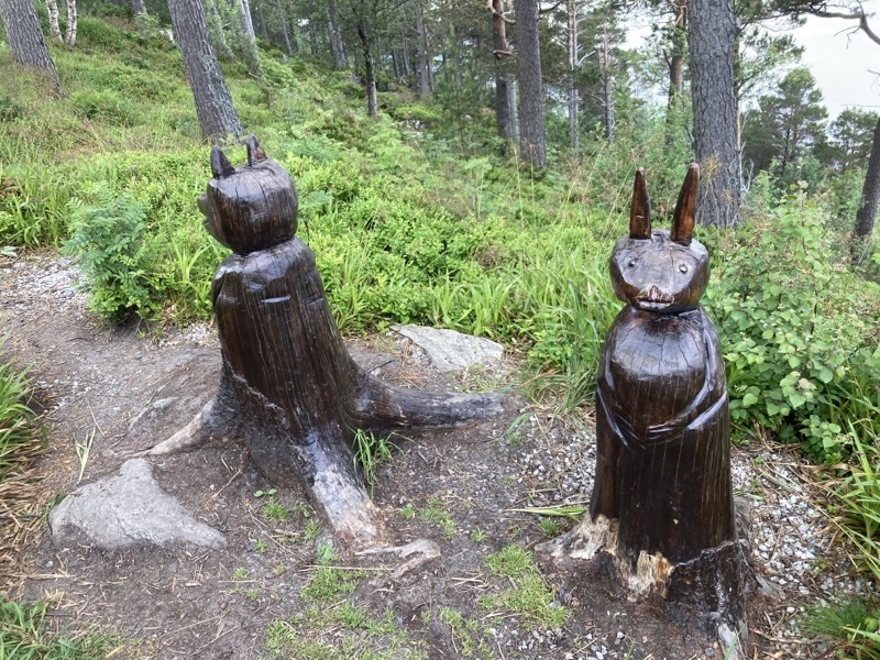
Not long after we started along the forested path we found these wooden sculptures off to our right. I am not at all sure what they are supposed to be: creatures. Anyone know? Photo by Jonathan

—June 18, 2023 at 10:51 AM.

Photo taken Jun 18, 2023 at 10:56 AM

We followed a forested paved path to the end of the park for, I think, about 3.5km. There were a couple places we had to follow a road but they were short. While on the forest path we would now and then, as we gradually descended, pass through an open space in the trees. Here is one such example. Photo by Jonathan

—June 18, 2023 at 10:56 AM.

Photo taken Jun 18, 2023 at 1:08 PM

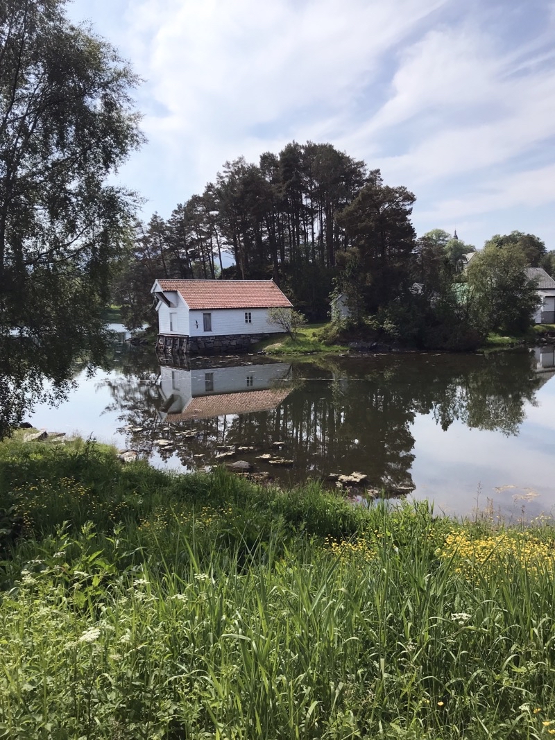
After leaving the forested path for the last time our last several hundred meters were on wide sidewalks and over a major highway to reach the Sunnmøre Museum. We saw this mirror-smooth body of water creating some fine reflections just before reaching the museum building. We didn’t explore the grounds. By this point we had walk about 7km on hard durable surfaces which is tiring on the feet. We were ready for the walk to be done. Photo by Judy

—June 18, 2023 at 1:08 PM.
Photo taken Jun 18, 2023 at 3:30 PM

—June 18, 2023 at 3:30 PM.
Sunday, June 18, 2023

Norway & Finland: Day 2 in Alesund

Jump to the photos

I went to sleep pretty quickly after returning from the ill-fated dinner and when I woke up somewhat after sunrise I felt much better. Here waking up somewhat after sunrise means I was moving about a bit before 05:00 as sunrise was just before 04:00. I wasn’t exactly thrilled to have 3 hours to kill before I could go get breakfast. I worked on these journals as the day brightened to reveal an overcast morning. That’s about all I could tell from the un-interesting view of this third floor room. City sounds drifted up and the cries of Herring gulls pierced the air as time dragged on by. Hotel Brosundet doesn’t have as extensive a breakfast buffet as the Thon Hotel Storo did but then this hotel probably is nowhere near as large. They certainly offer a grander variety than I think you’ll find in many places and we had little trouble finding enough to eat.

Most of the walks require getting to and from the terminus points of the walks via public transportation. The bus network here is clearly extensive though maybe not always frequent. Of course, you have to expect that on weekends, especially Sundays, that this would be true. For our first walk we had the option of a bus that ran on a mostly hourly schedule throughout the morning and early afternoon. That timing would stretch out later in the day to between once every 90-120 minutes. The bus station is about a five minute walk from the hotel and we arrived there with plenty of time to spare. If you want to buy some clothing, food, or who knows what else, you can do that while you wait for your bus. The number 3 bus arrived promptly at 10:10 and we were soon on our way to Vigra island and the Roald Nature Reserve located just north of Roald village. 35 minutes later we got off and thus would begin our first walk under overcast, mid-50s, skies.

One big point for doing this walk first was that at the end there is a highly recommended, at least by Inntravel, boulangerie. The Rykende Fersk Boulangerie is open just a few days (I think Wednesday, Friday, and Saturday) between 10:00-16:00.

This is essentially a circular walk of about 7.9km with an ascent of about 100 meters and, naturally, a descent of the same amount. That ascent and descent would happen in a pretty short stretch of linear trail but though we knew that from looking at the notes it wouldn’t sink in until we actually tackled the climbs which don’t appear until about kilometer 5. We expected a pleasant, reasonably easy, walk that would give us a nice introduction to the land and seas of the area.

We started out on minor roads that soon got smaller and within a few hundred meters left the small homes behind for a generally grassy path that would follow the coast. Now and then spots of mud and short stretches of rocks (nothing to bother you) would present themselves. Birds called to each other, the waves crashed against the shore off to our right, a smell - not wholly pleasant - of sea and rotting seaweed (and other stuff?) tickled our noses. We walked on through white flowers and swaths of buttercups. The only sunshine we saw was when we held buttercups under our chins to catch the little yellow glow.

As we moved westward we noted that the land rose up , and rather quickly at that, in a series of hills to our left. We would climb to the top of that landform in time. For now we continued on with the ocean to our right and, for a short time, a modest herd of brown cows to our left. The cows glanced at us and seemed to follow us but really I think they were just following the tasty grasses they were devouring. We continued on.

The notes say this is the Roald Nature Reserve but I do not know how big it is or really what that means. It’s land that can, obviously, be worked. It’s land that has been worked for a while. We would pass the remains of an old shelter at one point. A couple of rusting out large wagon wheels lay on the ground near the sea too. The path we were following was squishy enough to make me think of a wetland. There are beaches but you’ll not be tempted to bring a blanket and picnic on them (maybe at the lighthouse we did not visit). I can see and hear why this area would be favored by a variety of birds as it is lush. But it probably is also a bit harsh when the winds blow in from the north off the ocean. There isn’t much in the way of tree coverage.

In time our course would turn away from the northern shore and we would curl around a field (at least that is what it seemed like to us) that would take us near a lighthouse. Had we all agreed to go there I suspect it would have made a decent place for lunch. It was past noon and the clouds were clearing away. However, we continued on through a village (it may be called Molnes but I think that refers to a spot on the map not the name of the hamlet) that is clearly tiny before we turned to face those steep sided hills that are the prominent land feature here. We found a place to settle down for lunch; to fuel up for the steep climb.

The walking notes tell us the climb will be steep and they aren’t wrong. It looks like from where we had lunch to where the picnic tables (no we couldn’t wait to have lunch there) at the top of the hills are the path rises 100 meters over perhaps 600 meters of distance. It does this in two hill climbs and the second is far steeper than the first which is hardly gradual. I would not be surprised if the steeper portion had a grade over 25%. You’ll feel it as you climb. But the footing is actually quite good though I certainly am glad we were not descending the trail. In about half an hour we had all reached the picnic tables to settle down for a well-deserved rest. By this time the clouds were all but gone and a sun beamed down upon us making it feel warmer than the upper 50s it probably was. We relaxed and soaked in the 360° views from this local highpoint. Soon we saw a lady coming up the far gentler slope we would soon descend. She arrived, opened up the green metal box we had noticed, and signed the register book. Had she not done that I am pretty sure we would not have realized that was what the box was. In hindsight it’s obvious. She turned around and went back down the trail and we followed. At this point the walk has about 2.5km to go before reaching its end at the bus stop just beyond the Rykende Fersk Boulangerie and a large portion of that is along paved roads. The portion that isn’t on roads descends a pretty gradual trail that won’t bother anyone with full vision and normal agility. It’s a bit slower going for me but not really a problem. It doesn’t have much to remark upon as the World War II site, of some sort, is pretty much gone and not worth checking out. We reached the heart of Roald village just as the 14:55pm number 3 bus was picking up a couple of people. We could have boarded the bus and headed back to Alesund but the boulangerie was calling so we went there knowing we would have to wait 2 hours for the next bus to arrive. It was worth the wait.

Roald (pronounce “Row-al”) Is the largest village on Vigra. If there were any shops in the village besides the bakery we did not see them. The bakery has been there for a few years and is owned by a Russian emigre who moved here over 16 years ago from Siberia to work as an au pair. She met her eventual husband and settled here. The bakery seems to serve just local costumers and just for a few months per year.We thoroughly enjoyed our pastries and drinks.

When we left for the bus stop the wind was whipping up whitecaps on the sea and that chilled us right down. Wind makes such a difference in how you feel about the weather. We huddled against the breeze as we waited for the 16:55 number 3 bus. It arrived on time and we settled down for the 50 minute drive back to Alesund. It’s a shame I did not bring a USB-A-lightning cable because the bus is equipped with charging ports on every seatback. The transit system here is quite good. We got back to town and it was a quick walk back to the hotel. A good day for our first full day.

Photos

Photo taken Jun 17, 2023 at 10:47 AM

We spent about 35 minutes on bus 3 to reach the starting point of our walk in the Roald Nature Reserve located on Vigra Island. The walk should be a nice introduction to the region and we hope to find the Rykende Fersk Boulangerie.

—June 17, 2023 at 10:47 AM.

Photo taken Jun 17, 2023 at 10:59 AM

After a couple hundred meters on a road we turn onto grassy paths. It is an overcast morning and feels much cooler than it probably is because it isn’t sunny. The actual temperature is probably in the low-mid 50s.
—June 17, 2023 at 10:59 AM.

Photo taken Jun 17, 2023 at 11:08 AM

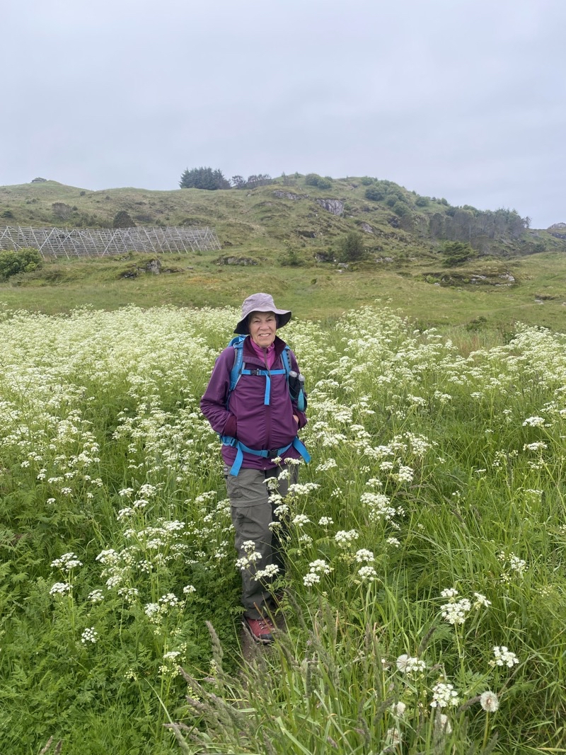
Mom is standing amongst these white flowers that we saw in great numbers.

—June 17, 2023 at 11:08 AM.

Photo taken Jun 17, 2023 at 11:30 AM

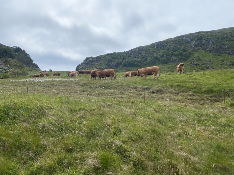
This herd of cows seemed to follow us a short way. But really I suspect they were just finding better spots to graze.
Photo by Judy

—June 17, 2023 at 11:30 AM.

Photo taken Jun 17, 2023 at 11:31 AM

This is part of a 1.8-kilometer long stretch of grassy, slightly muddy and now and then rocky, path that keeps pretty close to the shoreline. It isn’t much of a view right now with the overcast sky but it is nice to have the ocean nearby with all its sights, sounds, and even smells. Photo by Jonathan

—June 17, 2023 at 11:31 AM.

Photo taken Jun 17, 2023 at 11:56 AM

Not too visible but throughout this stretch we have seen an awful lot of buttercups. They add a touch of pleasure to this rich green area. Photo by Jonathan

—June 17, 2023 at 11:56 AM.

Photo taken Jun 17, 2023 at 12:04 PM

The people and the life upon the land are providing the majority of the color. The sky is gray and the sea and distant land are gray or shrouded in light gray mist. It’s still a fine day to be out for a hike.

—June 17, 2023 at 12:04 PM.

Photo taken Jun 17, 2023 at 12:24 PM

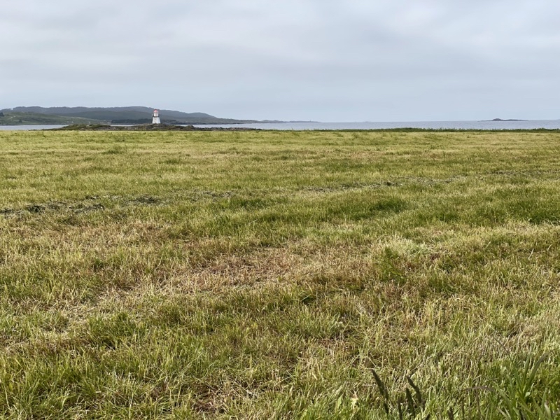
We are circumnavigating this field and in time get nearer to the lighthouse you can see in the background. Perhaps we should have detoured there for lunch but unless everyone agrees to go it doesn’t happen.

—June 17, 2023 at 12:24 PM.

Photo taken Jun 17, 2023 at 1:07 PM

After passing by the small village (name unknown) we turned towards the local hills we had kept to our left as we hiked along the coast. Those hills rise to peaks about 120 meters above sealevel. Before we tackled the climb we had lunch at this spot. The overcast has been steadily vanishing and it is turning into a brilliantly sunny afternoon.

—June 17, 2023 at 1:07 PM.

Photo taken Jun 17, 2023 at 1:11 PM

Perhaps about one third of the way to the top. This view takes in the shoreline and lands to our east which is back where we started.

—June 17, 2023 at 1:11 PM.

Photo taken Jun 17, 2023 at 1:18 PM

The notes for this walk state that there is a very steep section in this stretch. Here it is and I am very glad we ascended the path isntead of descending it. Photo by Jonathan

—June 17, 2023 at 1:18 PM.

Photo taken Jun 17, 2023 at 1:24 PM

I decided to pull ahead of Mom and Dad. Sometimes it is easier to just plug on ahead and get the climb done. It was as steep as it seemed but the footing was good. Photo by Jonathan

—June 17, 2023 at 1:24 PM.

Photo taken Jun 17, 2023 at 1:29 PM

I am at the top and looking to the southwest. At this point I am about 118 meters above sealevel and Mom and Dad are just a handful of minutes behind me. It is a wonderful afternoon. Sunny, upper 50s, little wind, fantastic views in all directions.

—June 17, 2023 at 1:29 PM.

Photo taken Jun 17, 2023 at 1:35 PM

Mom is approaching the top. If you just want to experience the grand views you could walk from Roald village up the gentler slopes (we are about to descend) the 2.5km to get to this area. But even though the climb was steep the whole walk is worth the effort.

--June 17, 2023 at 1:35 PM.

Photo taken Jun 17, 2023 at 2:26 PM

At this point there is probably still well over 2km to go. But this is the last photo of the hike. What goes up has to go back down and we did so on far gentler grades than we just contended with. In time we reached roads that took us the final several hundred meters into the village of Roald where we got to enjoy quite tasty pastries and cappuccinos at the Rykende Fersk Boulangerie. We could have caught the 14:55 #3 bus but we very much wanted to try out the boulangerie even though it meant hanging out for an extra 2 hours for the 16:55 bus. It was worth it as we not only had good food but interesting conversations between us and the shop’s owner.

—June 17, 2023 at 2:26 PM.

Saturday, June 17, 2023

Norway and Finland: Day 1 in Alesund (Ålesund)

We visited Ålesund aka Alesund briefly in 2015 as we cruised the Norwegian coast (surprisingly I can’t find any blog posts for that trip). On that trip we passed through on the Hurigruten MMS Vesterålen cruise cruising from Bergen to Kirkenes. This time we are going to spend 7 nights here exploring the area. The fun and interesting bits started almost from the outset.

Alesund can be best described as a collection of islands and, perhaps, a part of the mainland. Mountains, many still topped with snow, are not that far away. I suspect, from just looking at the town nearby, that the land quickly rises from sea level. There certainly are some notable hills nearby. This should hardly be a surprise in a land known for its numerous fjords. We landed on the island called Vigra. To get to our hotel it was a simple matter of boarding the Fb65 bus and riding it to near the Alesund city center. The ride takes about 30 minutes and you travel through two long tunnels, one easily requiring 4 minutes to traverse. It was a short walk from where we were dropped off to the Hotel Brosundet. Once we settled ourselves into our rooms we took a bit of time to explore the immediate surrounds. Perhaps we should have tackled the suggested city walk by Inntravel but we were not that ambitious. Parts of the town, especially by the waterfront, seemed to be bustling with activity. Other parts seemed rather dead, but we only walked a couple miles so obviously we only saw a tiny bit. It was a lovely afternoon under clear mild skies. There was a brisk wind but with the sun beating down upon us the upper 50s temperature was quite comfortable. It’s a startling change in weather conditions from what we were feeling in Oslo. Much of that is because the climate here is strongly influenced by the Atlantic Ocean. Oslo’s climate is considered continental and so is warmer in the summer and cooler in the winter than here (and I think Oslo was in the grip of a heat wave). If the weather holds we should be quite content.

Our walk took us past countless boats including a couple rather large yachts. I can be impressed and perhaps a bit appalled by vessels like these. I am pretty sure they were private craft. Not even small commercial cruise ships. I expect we will see more of the city some other time. After all, we have to find several restaurants for dinners.

Dinner would prove to be a minor adventure. We had decided to try Ammo. The pizzas caught our eye. Perhaps they are not traditional Norwegian fare but it is what we wanted. When we arrived we found that the power was out. Power was out in many parts of town. We settled in to wait for power to return. In short order power did return and we were able to eat. We were a bit surprised that the place was pretty empty as we had been lead to believe when we got a reservation by the skin of our teeth.Maybe people cancelled when they noticed the power outage. Dinner should have been great but something in my smoked ham, tomato sauce, cheese, fresh oregano pizza did not agree with me. I suppose I will never know what and fortunately the problem did not last long but it was disturbing nonetheless.

Our first few hours in Alesund have shown us that the town appears to be lively. I suspect if I wanted to find some local live music I probably could. I am pretty sure I heard a marching band from my hotel window just before we left for dinner. If we don’t run into any serious trouble getting to and from our walks and manage our time well I think we will have a good experience.

Photos

Photo taken Jun 16, 2023 at 4:21 PM

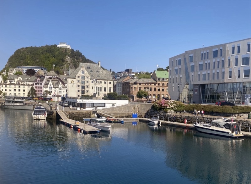
Hotel Brosindet does have a side facing the water. Our rooms don’t have water views. Here is a glimpse of nearby water.

—June 16, 2023 at 4:21 PM.

Photo taken Jun 16, 2023 at 5:02 PM

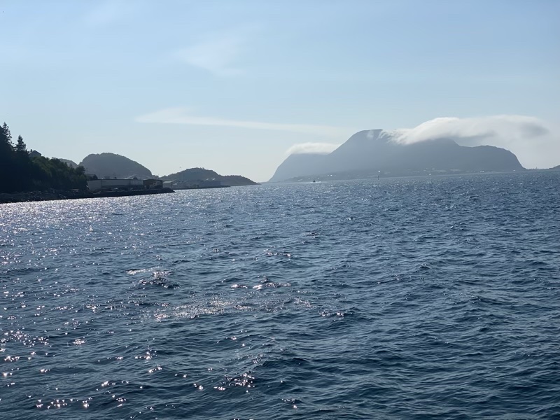
We took a short walk through a small part of Ålesund (pronounced a bit like Olesund with a short “O”). We found ourselves on a dock with a couple big yachts looking northwesterly out across the Atlantic Ocean towards several islands. It doesn’t show well but a lone cloud is shrouding one island in haze.

--June 16, 2023 at 5:02 PM.

Friday, June 16, 2023

Norway and Finland: Day 2 in Oslo

This would prove to be a much less eventful day. We really only had one place to visit. Perhaps we should have been more ambitious with our plans but I certainly didn’t really do any research into things to do beyond some pretty basic stuff and Mom and Dad did not do much more. We also seemed to be in something of a low-energy state.

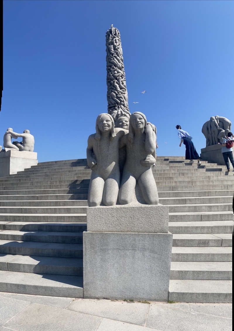
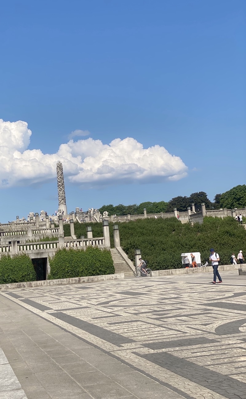
We wanted to visit the Vigeland Scuplture Park. It’s actually located in Frogner Park. The sculpture park is 80 acres in size and is home to the Vigeland Installation composed of 221 bronze and granite sculptures depicting home and social life from the very young to the old. The capstone is the Monolith which rises some 17 meters and is covered in what appear, from a distance, to be twisting curving carvings but are actually people climbing to reach the top.

It is a remarkable installation and you certainly get a sense of what Gustav Vigeland intended his people to be doing in each sculpture. It’s also just a pleasant place to walk through a nice city park.

We left the park just before noon. Dad had a store he wanted to visit and we decided to walk the couple of kilometers to where we thought it was. It wasn’t a terribly exciting walk from my point of view but it did expose us to a bit more of the city especially the park that surrounds the palace. Unfortunately we never did find the store. Perhaps it is closed and gone. We did eventually find ourselves having what will no doubt rank as one of the worst lunchtime dining experiences as far as the food goes we have endured in some time. It was a chain restraint and while it surely must have countless fans it was not good for us. To be fair they did their best to make things right.

We did see the ticketing system on the public transit system in action. While returning to the hotel on a tram a ticket inspector came down the aisle. I opened the Ruter app, tapped the Inspect Ticket button, he scanned the ticket and that was that.

Photos

Photo taken Jun 15, 2023 at 10:35 AM

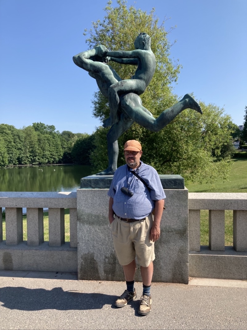
There are 212 bronze and granite sculptures all created by Gustav Vigeland in this park. This bronze is just one example of a glimpse into a human activity (granted not something you would expect to do). Photo by Jonathan.

—June 15, 2023 at 10:35 AM.

Photo taken Jun 15, 2023 at 10:43 AM

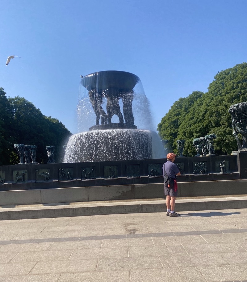
Along the main promonade you slowly ascend level by level until you reach the top. On every level you find fountains. This is, I believe, the grandest of all of them. Photo by Jonathan.

—June 15, 2023 at 10:43 AM.

Photo taken Jun 15, 2023 at 10:54 AM

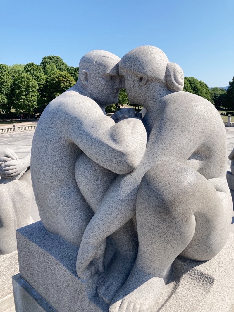
One of the perhaps 39 sculptures (all granite), that surround the Monolith. These range from younger adults, sometimes with children, to considerably older adults. We think this might be the quintessential couple enjoying each other’s company.

—June 15, 2023 at 10:54 AM.

Photo taken Jun 15, 2023 at 10:59 AM

The Monolith depicts people scrambling to reach the top. I actually do not see it but then I am hardly the best judge of visual arts.

—June 15, 2023 at 10:59 AM.

Photo taken Jun 15, 2023 at 11:19 AM

The morning has been warming up and we fully expect the temperature to creep well above 80F again. These few clouds likely did not hang around all that long. Later in the mid-afternoon the sky would cloud over and we actually felt a drop or two of rain but those would clear out too. Here you can get a sense for the several level you climb to reach the 17-meter high Monolith.

—June 15, 2023 at 11:19 AM.

Thursday, June 15, 2023

Norway and Finland: Day 1 in Oslo

Our flights from Rhode Island to Oslo, Norway were in retrospect about as good as I suppose you can ask for. We spent an annoying amount of time sitting in planes not moving until we were moving. We spent an annoying amount of time in airports, especially in Stockholm, waiting in lines or sitting around. We had surprisingly limited success finding decent food especially in Stockholm. However, with all that said we got to Oslo when we expected to and our luggage arrived with us.

Our first afternoon we just settled into our sparsely furnished (it’s the style) hotel rooms and then went in search of food. There is a good sized shopping center, rather densely packed with all sorts of stores from an adequate grocery store, to several eateries, to shops selling higher end kitchen-ware. After sating our need for something tastier than poor airplane food we returned to the hotel and pretty much called it a day. Our first full day would start after we all caught up, hopefully, on sleep.

For my part that sleep was not all that good. This happens to me often it seems on first days of trips. But this was a seemingly bad case. I hoped I would keep busy enough throughout the day to be able to push back feeling low. I pretty much succeeded. We started our day with a good varied breakfast from the incredibly varied breakfast buffet here at Thon Hotel Storo. While some of the food may not be of premium quality, e.g., the scrambled eggs were more liquidy than they should’ve been and the fruit is nothing special, there was plenty that was more than good enough.We would leave the hotel a bit after 09:00 under clear blue, and warming quickly, skies. Our first goal was to get tickets for the public transit system. That didn’t work out as well as it should have. We went to a little shop, sells all sorts of things from SIM card that only Norwegians can use (we still haven’t found a SIM card so can’t really text or make voice calls; I have a data-only eSIM) to snacks and sundries to transit passes. Except that they were out of passes. How do you run out of day passes? I found an app that lets you purchase tickets and I did so but we have no real idea how you confirm the purchase. At every train station we have seen so far there doesn’t seem an obvious way to confirm your purchase. We think they must realy be on an honor system here because there is no obvious reason a person couldn’t just board a train and go wherever they want without paying.

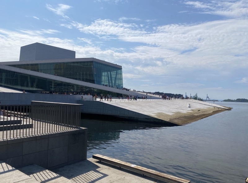
Eventually we got ourselves to central Oslo (Oslo-S or Oslo Sentrum) where our first highlight of the day: a few hundred meters away snuggled up against the waterfront, part of the Oslofjord (the Oslofjord is not an actual fjord in the geological sense. In Norwegian a “fjord” can refer to all sorts of waterways), the Opera House. The building is remarkable. The standout feature is the exterior ramp that climbs up and around the building to reach the roof. From there you have decent, though not really jaw dropping, views of the waterfront.It’s worth the climb just because how often do you get to do something like that. Besides the views of waterfront buildings and big boats you can get a glimpse of some local beaches. More grassy and/or pebbly beaches than stretches of fine sandy beaches. Beaches nonetheless that people could stretch out on, soaking up sun, and enjoy perhaps jumping in the water. The interior of the opera house is spacious and rather interesting to look at. Perhaps we should have, as I think Dad wanted, settled down inside for a snack and coffee.

We left the opera house and strolled along the waterfront towards Astrup Fearnley Museum. It’s an easy stroll but not actually a particularly pretty one for much of it. You move away from the water for a time and though the views of an old extensive, no longer used as such, fortress are kind of always visible (it’s been redone to be used for different stuff now), it’s along a noisy busy road. Once you regain the waterfront you pass by all manner of boats including some interesting refurbished craft including an old mine sweeper. You come to a slew of restaurants and it gets lively. The Astrup Fearnley,among others, comes up and we found an interesting, if not large, lunch there at the cafe. We also learned a bit more about the people taking time at the local beach. All young, seemingly young adults, and pretty much all the women in bikinis and men in shorts, lounging about, chatting, listening to music, enjoying a sunny day with temperatures edging towards 80F. Some of those people were jumping off into what must be fairly deep water and climbing back out via the many ladders along the seawall. Surely that was a chilly dip.

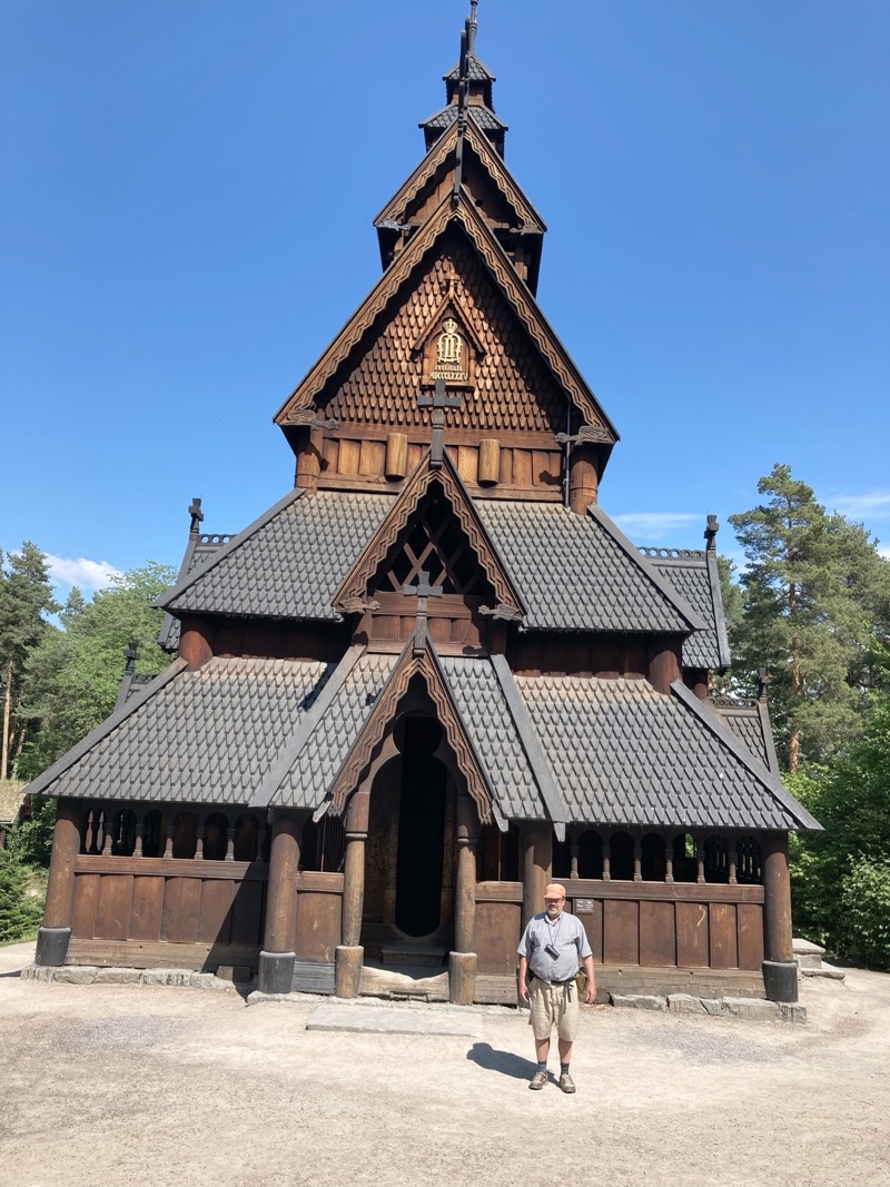
After some trials and tribulations, eased somewhat by Dad’s total willingness to ask anyone for help, we found our way to the ferry dock to catch a boat to the island that is home for the Norsk Folke Museum. This is an open-air museum dedicated to the Norwegian culture. We particularly wanted to see the 12-century stave church. There are, I believe, actually well over 100 buildings in the complex but we were focused on the church. The Gol Stave Church was originally built in the latter half of the 12-century in Gol. The term, stave church, refers to the type of constructions using staves (wooden pilars) and lintels to provide the support for the structure. The church is really special to look at from the outside though you won’t see it in the photo too well. THe triangular and curved roofs stack wonderfully atop each other. They are crowned by spirals that curve out like the prow of a ship. Inside it is remarkably open but dark. Imagine yourself as a parishioner standing for well over four hours listening to a service presented in Latin. Keep in mind that the only person likely to know what is being said is the priest. If you are fortunate you are a man who can at least stand farther from the north-facing door that is letting chill air in. That chill breeze is being blocked by the women. Men and women are all standing but in segregated groups.

The Folke Museum is located on one of many islands in the area of the Oslo harbor. I believe this island is called Bygdøy. Our walk from the ferry dock to the museum and then farther to the dock by the Fram Museum took us through seemingly upscale neighborhoods. Big house, nice cars, clearly plenty of families with children. It didn’t feel like we were in a big city. We caught the ferry back to the mainland and after working our way through the increasing throngs of people found our way onto the packed train, it was rush hour after all, that would take us back to our hotel. A good day featuring some nice highlights over perhaps 7 miles of walking and nearly 8 hours of time. If I could say we ended our first day with a lovely dinner that would be great. I can’t say that. It’s probably not ideal to form an impression of a restaurant after just one meal but the food at Sumo was not well served and the staff were not as attentive as they should have been.

Photos

Photo taken Jun 14, 2023 at 10:48 AM

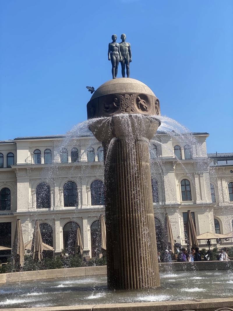
The sculpture is distinctive. It’s called Earth and Sun .

—June 14, 2023 at 10:48 AM.

Photo taken Jun 14, 2023 at 10:54 AM

Look at the sloping ramp that curls around the Oslo Opera House. You can climb the ramp to the roof of the building and see some nice, though perhaps not as awe-inspiring as some would hope, views of the Oslofjord.

—June 14, 2023 at 10:54 AM.

Photo taken Jun 14, 2023 at 10:58 AM

It’s a steady moderate climb up to the top of the Oslo Opera House. Mom is making progress. Photo by Jonathan.

—June 14, 2023 at 10:58 AM.

Photo taken Jun 14, 2023 at 1:55 PM

—June 14, 2023 at 1:55 PM.

Photo taken Jun 14, 2023 at 2:35 PM

Ken standing in front of this restored 12th-century stave church that was restored in 1885 and moved to the Norwegian Museum of Culture History. Photo by Jonathan.

—June 14, 2023 at 2:35 PM.

Thursday, June 8, 2023

Dinner Outside: Pesto and Smoked Cheddar on Baguettes, Brisket, and Smoked Potatoes

Play video Dinner Outsidr: Brisket, Potatoes, and More
▶️ Play Dinner Outsidr: Brisket, Potatoes, and More

Quick Pickles

Homemade quick cucumber pickles

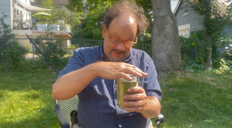
Home quick cucumber pickles.

These should be kept in the refrigerator. They are a quick pickle recipe that uses vinegar to create the pickles. Dissolve the sugar and salt in the vinegar (you can do this faster by bringing the vinegar to a boil), add the water and other spices. I filled my jars with the cucumbers and placed slices of garlic in the jars at the same time. After tightly filling the jars with your vegetables pour the vinegar-water mixture. Completely over the vegetables. Let the jars, I was using 2 16-ounce mason jars, cool and place them in your refrigerator. You’ll have pickles in a few hours but the flavor improves with age so it’s best to wait.

  • 6 mini cucumbers
  • 2/3 cups Distilled White Vinegar
  • 1 Cup water
  • 1 TBSP Kosher Salt
  • 2 TBSP Sugar
  • 1 tsp Mustard Seeds
  • 2 tsp dill weed
  • 2 Garlic Cloves, peeled and sliced
  • 1 tsp peppercorns

Enough for 1 1-quart jar

Rustic (chunky) Pesto:

making the pesto

Smashing and shushing the ingredients to make the pesto.

There are, like the quick pickles, numerous recipes for making pesto. By far the easiest way to do this is to use a food processor. You certainly will get something much more puree-like. But I like wielding my pestle inside my mortar. We really should have gone much farther than we did and probably used more basil to make it a nice green color but what we made was quite good.

This creates a more nut-heavy pesto. I’ve seen many recipes that use triple or more the amount of basil.

  • 4 garlic cloves, peeled
  • 1 ounce basil
  • 1/4 cup olive oil (a bit less)
  • 1/2 cup pecans (toasted)
  • 1 ounce parmesan cheese, grated
  • Big pinch of salt

This is enough for one typical size baguette.

In the video we doubled, except for the oil which we admittedly uses too little, this recipe.