Sometimes it is the small things that you appreciate in the place you are staying. The hotel here is very modern. For example, some of the light fixtures are indirect behind sculpted metal but direct where it is appropriate. Very nice. Having two-ply toilet paper (the Hilton used single-ply) is a nice touch. The shower head sits embedded in the ceiling and pours water down like a torrent from the sky in a shower stall that will definitely not produce a flood. If only the choices for food matched the quality of the rooms the Occidental Hotel Roca Negra would be a true treat.
Once again we elected to do the easy walk. The walk would take us through new and old Agaeate and then through the archeological park of Maipes which is the site of some 700 tombs built out of the 3,000 year-old lava by the original inhabitants of the island. From there we’d pass through a wide ravine to our final destination: a coffee and wine plantation. The people doing the harder walk would end up at the same place but get there via a totally different route involving considerably more ascent and descent than our 700 feet ascent and 100 feeet descent (according to the notes). Our walking distance is supposed to be 5 miles.
We sallied forth along the slab-paved curving path that curls down the cliffs from the hotel to the coast. This morning the pavers had a touch of dampness upon them. Just enough to let your feet know that it could be a bit slippery underfoot. As we proceeded down to the sea I began to think the waves were crashing against the shore with more vigor. This feeling grew as we ambled along the slightly damp promenade that leads into the town proper. There seemed to be a bit of a mist or haze hanging over the town. It obscured the arriving ferry from Tenerife but was clearly dissipating. It was going to be a bright sunny and overly warm day.
We paused at the site where you could see what remains of God’s Finger. Tropical Storm Delta (November 2005) shattered the stone finger. It’s now more of a knuckle and not really visible at least from our vantage point. We continued on through the town eventually leaving the bustling streets by the sea to slowely ascend through an older part of Agaete. Nice enough I suppose. But the main attraction of the walk was still to come.
From there we walked across some lava fields, nothing hard, to enter a wide ravine that we would follow for easily 1.5 miles. The footing here is generally easy even though the soil footbed is littered with rocks. There is one short section where more care must be taken and ropes are provided to give you an extra bit of support should you need it. It sounds worse than it actually is. I was surprised at how lush the area seemed. Cactus are present but so are a lot of other plants. A few hundred meters to either side houses set atop the cliff walls that make the ravine but it was rather quiet as we walked along with little road noise or other non-nature sounds intruding upon our experience. The thing that most prominently intruded upon our enjoyment was the increasing temperature: surely well over 80 °F under the pounding sunlight. It was always a pleassure to step into shaded areas. Too bad those were few and far between. It isn’t a particularly scenic ravine.
We left the ravine, passing under a small refreshing water leak, to walk the final kilometer along a town road that quickly rose a couple hundred feet to the road that leads into the coffee plantation in San Pedro. We got a tour that was notably for the exuberance of the woman informing us about various facts about the coffee plantation. To say she had a wildly distinctive, annoying, shrill laugh and presentation style is understating the case. Perhaps the laugh can’t be changed (and it would drive me nuts) but toning down the drama would be welcome. After the tour (which though I don’t recall details now of what we experienced in Costa Rica wasn’t anywhere near as good) we sat down for a tasting of some of the wines this plantation also makes along with thimble-sized amounts of coffee. I suppose a nice touch but it really didn’t thrill the foodie in me.
Stats
The walk actually came pretty close to the booklet stats we had available. It was 5 miles long and had 800 feet of ascent and 100 feet of descent. The vast majority of the descent was from the hotel to the sea. We ascended on roads and some short lava beds with the last couple hundred feet of ascent at the end of the Agaete Ravine and then on sidewalks along a road into the coffee plantation. The highlight of the walk is the cemetery.
Photos
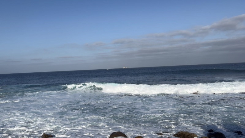
It seems like the waves crashing against the lava flow are doing so with more vigor this morning. We expect it to be warm and clear though there seems to be a bit of haze over part of Agaete (not seen here).
--February 22, 2024 at 9:15 AM.
Maps are centered on the photo: Google map, Apple map, OpenTopoMap map
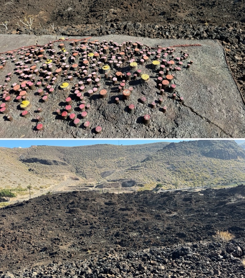
The top photo is a map representing where tombs of the original inhabitants of this area are located. The botom photo shows a part of the cemetery and you can see the lava rock mounds that are the above-ground portions of the tombs.
--February 22, 2024 at 10:47 AM.
Maps are centered on the photo: Google map, Apple map, OpenTopoMap map
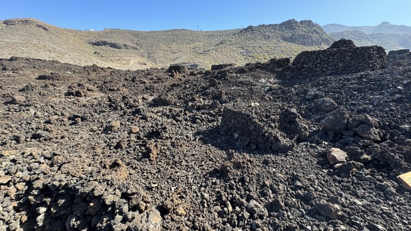
The mound you see in the foreground and some of the others further away mark some of the 700 tombs of the people who lived on this island before the Spanish came. I believe people were buried here from the first through the eight century. They stopped when the necropolis got too full.
--February 22, 2024 at 11:05 AM.
Maps are centered on the photo: Google map, Apple map, OpenTopoMap map
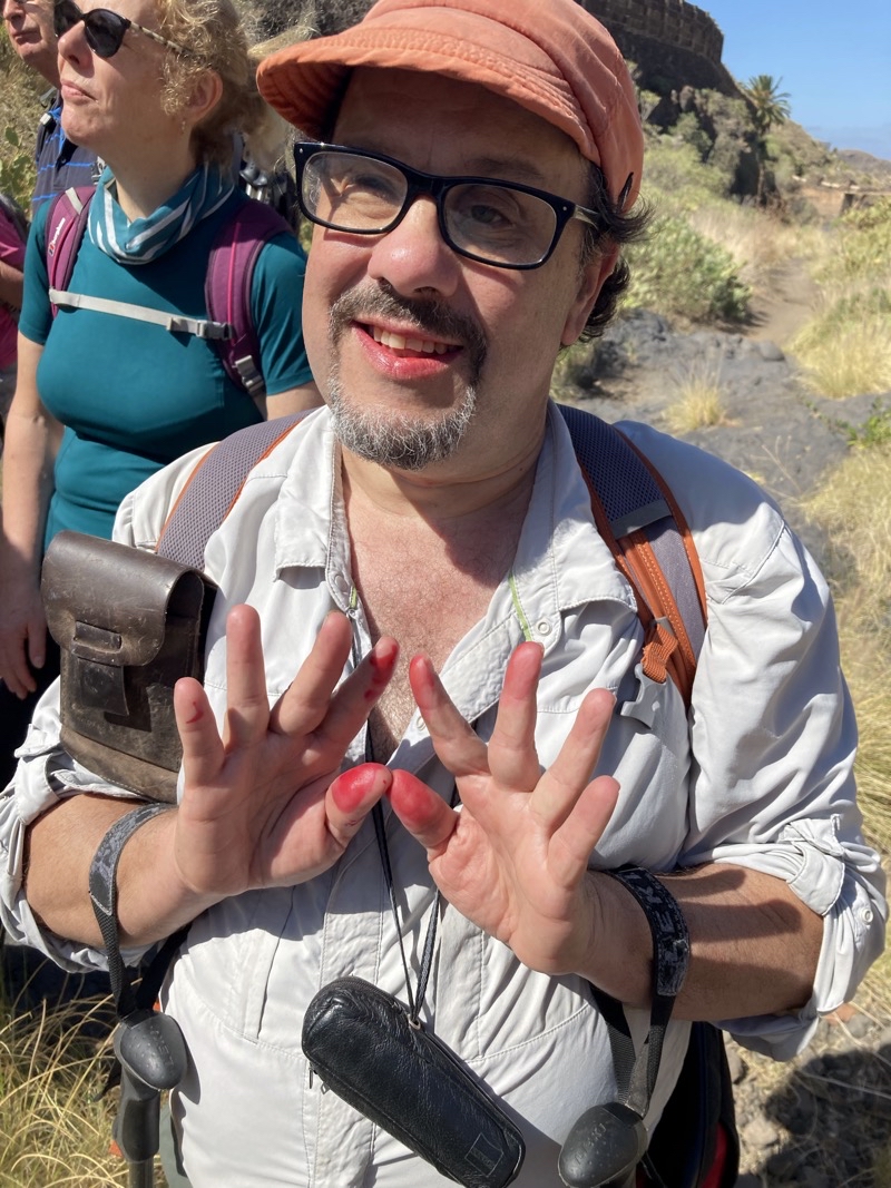
If you know how to extract the fruit from and Indian Prickly Pear you will find something that has an interesting flavor and certainly is edible. Belinda showed us how to get at the fruit (if you do it wrong you’ll have lots of spines in the fruit and then in your tongue). One extra side-effect is the rather colorful drippings the fruit leaves behind. Photo by Jonathan A
--February 22, 2024 at 12:12 PM.
Maps are centered on the photo: Google map, Apple map, OpenTopoMap map
No comments:
Post a Comment