Wednesday, February 28, 2024

Porto, Portugal, 2024: OUr Days in Porto

We piled into our first of two taxis (what they had to do as our initial ride got a flat tire) for the ride to the surprisingly large airport for Gran Canaria at 07:00. It was a straightforward ride to the airport and we got through ticketing and security in short order. We found a adequate bite to eat and settled down to wait for our first flight of the day. It’s a straightforward trip to Porto even though it does require two flights that go somewhat out of their way. About ten hours after we left Agaete and an absolutely lousy ham and cheese (sort of) sandwich on our flights we arrived in Porto, Portugal. We settled into our rooms at the Four Points Sheraton in Matosinhos. We are a couple blocks from the beach which turns out to be surprisingly wide white sand beach. We found a Napalese-style cuisine restaurant which served us rather good dinner which was a refreshing change from the dinners of the past week.

One nice feature of this hotel is the rooms are quite inexpensive at €75/night. You pay an extra €12.50 per person per day (and it must be every day) for a buffet-style breakfast. It’s money we might be able to better spend elsewhere given the quality of the breakfasts but we’ve bitten the bullet and that is that. The hotel in Las Palmas was easily twice as much. I’ve no idea what the Occidental Roca Negra in Agaete charged. The rooms here are exceptionally nice and goodness knows you aren’t going to find a hotel room in a city with a quarter million people living in it back home that is comparably priced. It’s probably this cheap because we aren’t really in the heart of the city where the historic center and far more touristy bits are located. The Ribeira by the River Douro is probably about 8km away: call it is 20 minute Uber/taxi ride. We decided to play things by ear as Dad was under the weather but we had at least one place to visit: Serralves Contemporary Museum of Art. From the hotel it’s a couple miles walk.

The walk Apple Maps took us on, chosen because it was the “fastest” was alright but not really exciting. We passed by a large park that we suspect was quite nice. We also suspected that going along a major avenue that we would later drive down would have been the better choice for city-seeing. Our route was residential and a bit dull. But the morning was sunny and warming towards the upper 50s so it was enjoyable enough. Fortified with a pastry of some sort or other and small cappuccinos (how else in Europe) we enter the Serralves Foundation complex. The buildings that house the museum and other things are massive. I think the architecture is a bit stark and rigid. The intereors are massive volumes that I think could eaisly contains 2 or 3 of homes of the size we have back home. Those volumes seem terribly empty. And the art just didn’t do anything for me. The space with the hanging ropes and patterned tiles around the walls that featured a ramp leading down to a tiled expanse that seemed to slope further down in front of a window that framed some wonderful trees was the best space. Too bad a photograph couldn’t capture the sense of the space.

However, the grounds were a very nice surprise. We ambled through the paper birch glade to an allee that had at its entry a sculpture by Claes Odenburg: a giant spade. I suppose it honors people who work the soil. While it’s impressive I preferred the vortex-like twisting metal that came up next as we strolled along the sweet gum tree lined allee. We had to watch where we placed our feet lest we trod upon seedpods from the trees. Those pesky pods can easily roll under your foot and were everywhere. The allee eventually took us to a set of connected pools. Everything is wonderfully maintained and landscaped. It is formal in its style but lovely.

Our walk through the grounds closed with our exploration along a boardwalk that runs easily a few hundred feet through the canopy tops of the trees in a portion of the complex. I’ve no idea what trees we walked through but it was an enjoyable stroll giving us a chance to look down from upon high. It also really marked the end of our time in the complex since after we returned to the main building we found that the restaurant served lunch but it was a €17-per-person buffet and we have had enough buffets for a while. Since Dad was flagging we got an Uber back to the hotel and tried the little place we had seen earlier for lunch. Arcadia was surprisingly good.

Mom and I did a bit more exploring of the beach/promenade later in the day while Dad worked on conquering his cold. We had a very light-style pizza: light crust, minimal cheese and sauce, decent toppings though not hot enough pizza at Pizzaria Luzzo’s. We suspect they do a brisk business even though, like many places, they don’t open until 19:00 (7:00PM). The spaghetti bolognese we got for Dad as carry-out was actually a better choice.

The Last Day

It’s too bad we didn’t find this walking tour before coming to Porto. Mom found what looks like a lovely walking tour if you have only one day (though they suggest 2 is better) in Porto. But with Dad still contending with his cold a 6-hour tour spanning several kilometers of possibly hilly walking and at least some rides on public transportation just wasn’t going to happen. We settled on a little exploring at the queyside where the bridges tour boats moored near Ribeira Square and Pont Dom Luis 1 (Dom Luis 1 Bridge). I’m sure we would have liked to do more but you do what you can or are willing to do. It’s a lively area. Tourists, locals, groups of school-aged children going places, all moving about in a fairly small region. That would become more noticeable later in the day when we climbed 200-odd steps and some ramps to get to the upper level of the Dom Luis 1 Bridge passing through areas that seemed rather devoid of life. The sun shone down in an essentially clear sky. Little wind blew. It felt considerably warmer than the day before though I supect the actualy air temperature was barely any higher. The boat pulled away from the dock on time and we were treated to a gentle ride up and then down the River Douro under half a dozen bridges. I wish I oculd tell you about the places we passed but it was a trial to get the app to work. Bad design: light gray text on a white background to select the langauge of choice. Hard for me to read; hard for people not really comfortable with technology to use. By the time we had it working properly I am not at all sure it was synced with the boat’s movements. It was then the descriptions were not up to the locations we passed. I’ve no doubt there is a vast amount of history here but I absorbed none of it. Mom and Dad didn’t gather much informaiton either. However, it was a pretty ride on a nice late morning.

When we climbed away from the river to find the entry point on our side of the river we had to contend with about 200 steps of various heights and some sloping streets. It seemed to pass through pretty dead bits of city for a time before popping out on a bustling street where I suspect a lot of things were going on. I was able to go out on to the bridge and the views are pretty good though I am pretty sure they won’t remain in memory for long. While I did that Mom and Dad found some shops to explore. But in time it was time to get an Uber and ride back to the area of the hotel: Dad was ready to be done. We settled on a second lunch at Arcadia and I am sad to report our second meal selections were nowhere near as good as our prevous ones had been. In fact, they were pretty mediocre if not donwright poor. Don’t get the stuffed crepes. My gelato from the ice cream place down the street was far more enjoyable.

I am quite sure there is a lot to do in Porto. Two or three days would be plenty for us under normal conditions I think. It’s hard to get explore when someone is really under the weather. If I were adventurous I suppose I could have gone out on my own but I’m not willing to do that. Maybe in an English-speaking city. That’s not really a given here. We will find a nearby place for dinner. Maybe one of the hole-in-the-wall seafood (maybe some meat) places Mom and I saw yesterday or the Nepalese place again. Tomorrow we get what we all fully epect not much from box breakfasts from the hotel at 06:30 and get a taxi to the aiport to start our flights (around 09:00) back to Rhode Island. Is it wrong of me to say I am looking forward to picking up dinner at Dave’s or perhaps Picasso’s Pizza? I think we all are.

Photos
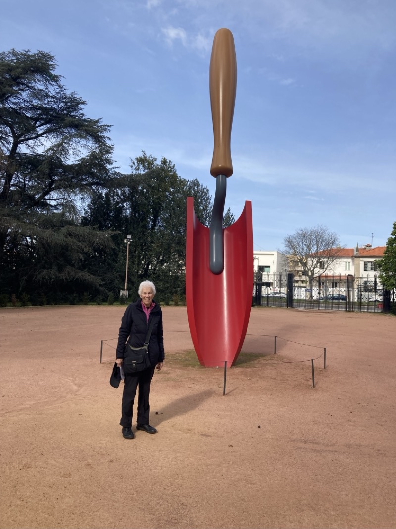
Photo taken Feb 27, 2024 at 11:35 AM

Claes Oldenburg’s spade marks the entrance, close enough, to the formal gardens here at the Serralves Contemporary Museum of MOdern Art. I suppose it is a salute to the people who work the soil like master gardeners like Mom here. Photo by Jonathan

—February 27, 2024 at 11:35 AM.

Maps are centered on the photo: Google map, Apple map, OpenTopoMap map
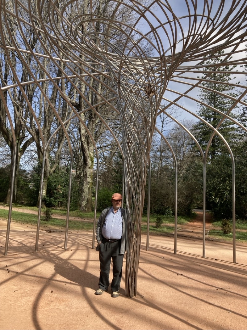
Photo taken Feb 27, 2024 at 11:38 AM

I am not sure who created this vortex of a sculpture. We have passed thorugh a blade of birch white birch trees and entered an allee lined with sweet gum trees that are already dropping their seedpods all over the ground waiting for someone to step on them. Photo by Jonathan

—February 27, 2024 at 11:38 AM.

Maps are centered on the photo: Google map, Apple map, OpenTopoMap map
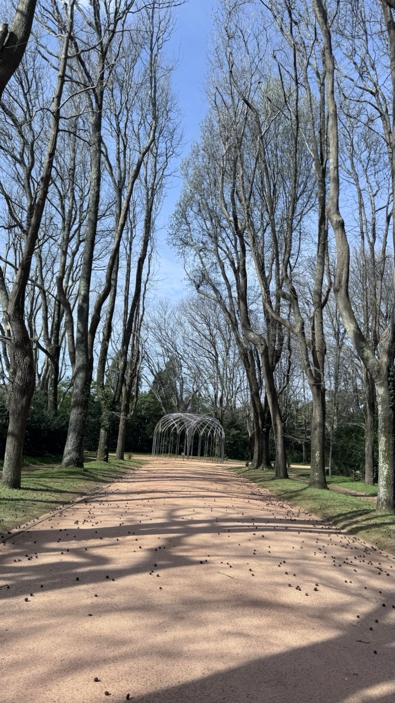
Photo taken Feb 27, 2024 at 11:40 AM

Looking back along the sweet gum tree allee. It’s a cool sunny day.

—February 27, 2024 at 11:40 AM.

Maps are centered on the photo: Google map, Apple map, OpenTopoMap map
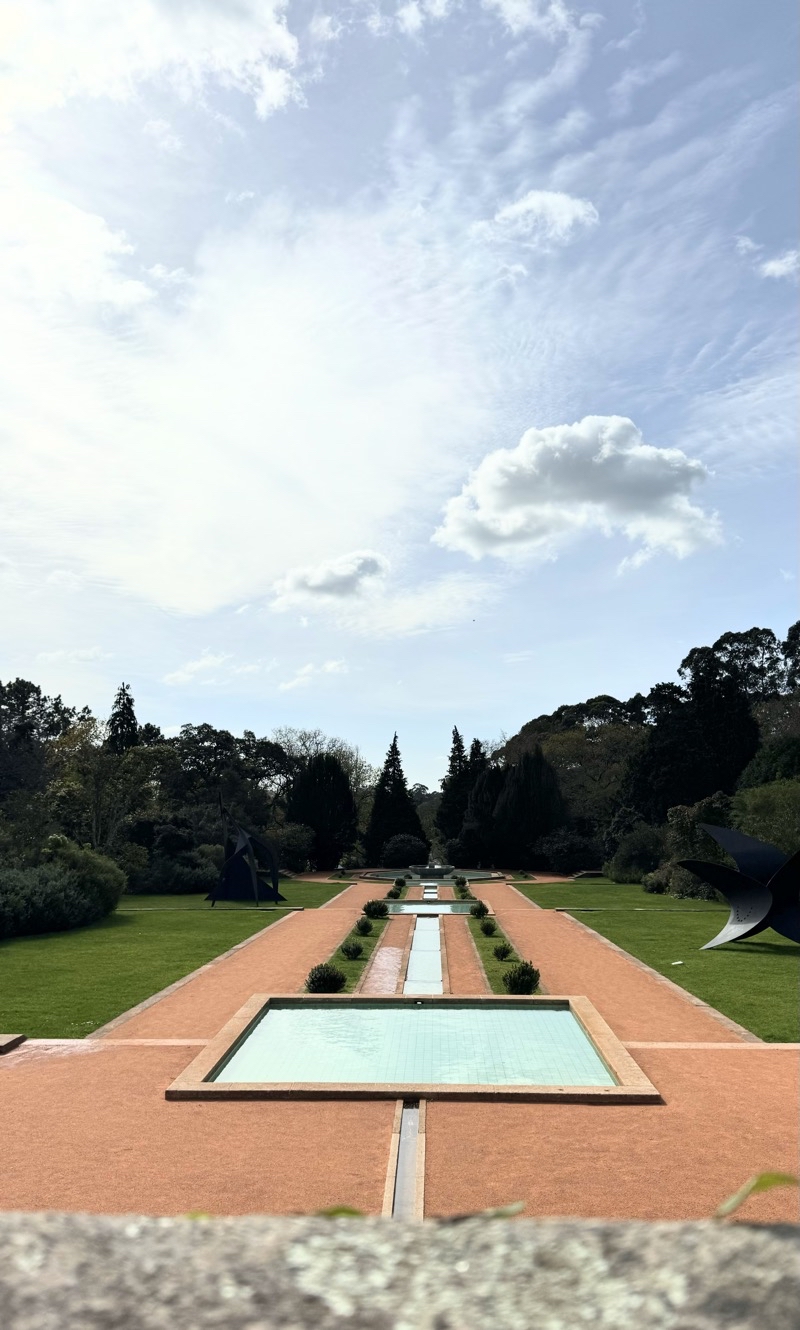
Photo taken Feb 27, 2024 at 11:50 AM

The lands around the buildings are landscaped in a formal style. This set of connected pools is just one example of the lovely grounds.

—February 27, 2024 at 11:50 AM.

Maps are centered on the photo: Google map, Apple map, OpenTopoMap map
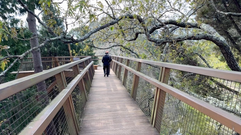
Photo taken Feb 27, 2024 at 11:58 AM

I do not know what types of trees we are walking through as we walk along this boardwalk amongst the treetops. It is a lovely stroll.

—February 27, 2024 at 11:58 AM.

Maps are centered on the photo: Google map, Apple map, OpenTopoMap map
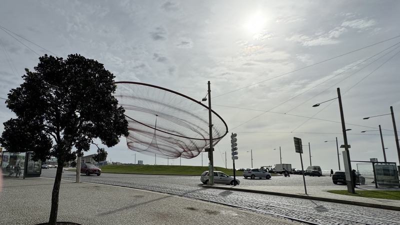
Photo taken Feb 27, 2024 at 2:33 PM

This is a remarkable sculpture by American artist Janet Echelman. It’s called Sea Moves or Sea Changes. The net moves.

—February 27, 2024 at 2:33 PM.

Maps are centered on the photo: Google map, Apple map, OpenTopoMap map
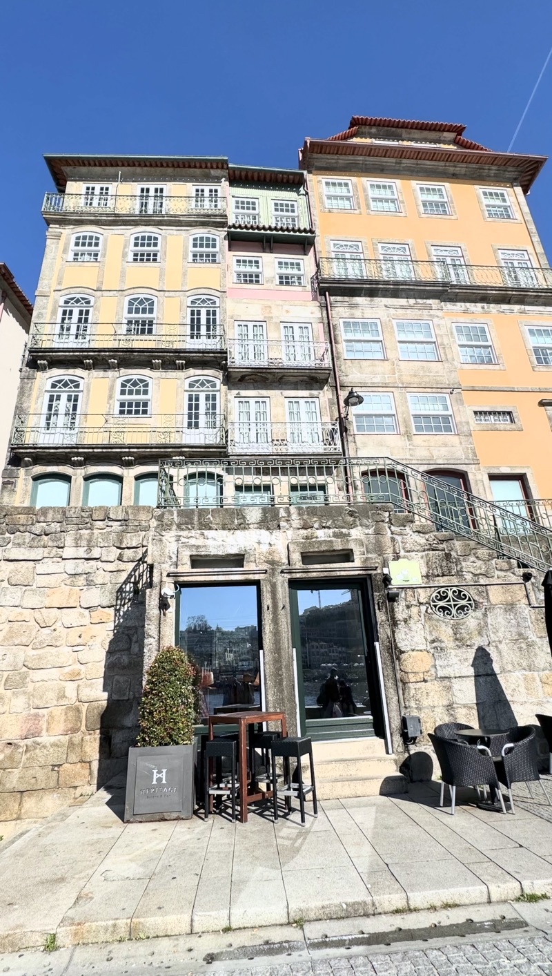
Photo taken Feb 28, 2024 at 10:51 AM

We think many of the buildings here along the River Douro are residential. I expect they go for a pretty hefty sum. The colorful facades are created by extensive tile mosaics.

—February 28, 2024 at 10:51 AM.

Maps are centered on the photo: Google map, Apple map, OpenTopoMap map
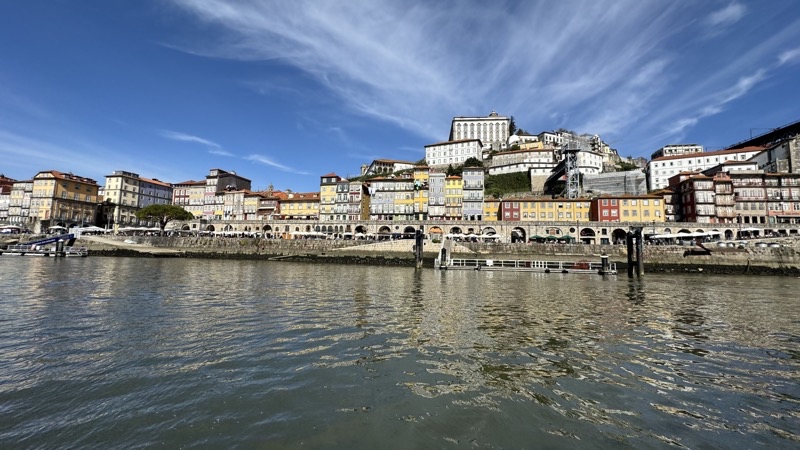
Photo taken Feb 28, 2024 at 11:44 AM

—February 28, 2024 at 11:44 AM.

Maps are centered on the photo: Google map, Apple map, OpenTopoMap map

Photo taken Feb 28, 2024 at 11:44 AM

—February 28, 2024 at 11:44 AM.

Maps are centered on the photo: Google map, Apple map, OpenTopoMap map
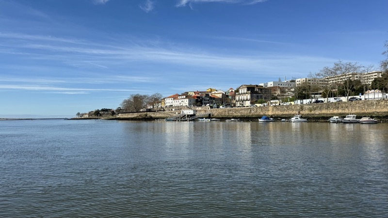
Photo taken Feb 28, 2024 at 11:55 AM

I think we are nearing the downstream end of our cruise. The river is lined with all sorts of biuldings. Not really visible from here are the intricate tilework facades.

—February 28, 2024 at 11:55 AM.

Maps are centered on the photo: Google map, Apple map, OpenTopoMap map

Photo taken Feb 28, 2024 at 12:11 PM

—February 28, 2024 at 12:11 PM.

Maps are centered on the photo: Google map, Apple map, OpenTopoMap map
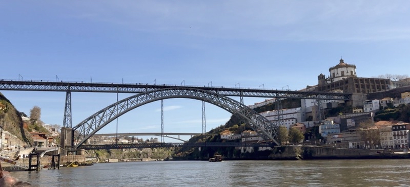
Photo taken Feb 28, 2024 at 12:13 PM

Near the dock, though at the end of the ride, for our cruise. I do not know what the church on the Villa Nova de Gaia side of the RIver Douro is. The bridge is the Dom Luis 1 bridge. Perhaps you can see people walking on the upper level. Trams run across the central section of that level.

—February 28, 2024 at 12:13 PM.

Maps are centered on the photo: Google map, Apple map, OpenTopoMap map

Photo taken Feb 28, 2024 at 12:52 PM

Views from the center of the upper level of Pont Dom Luis 1 (Dom Luis 1 Bridge) looking upstream (top) and downstream (bottom ) from a couple hundred feet above the River Douro.

--February 28, 2024 at 12:52 PM.

Maps are centered on the photo: Google map, Apple map, OpenTopoMap map

Sunday, February 25, 2024

Gran Canaria, February 2024: Pinos de Galdar to Caideros - In the Cool Cloud

Canary Islanders will likely tell you that it was chilly this morning even at sea level (17°C) and certainly at our starting point around 5,100 feet above sea level in the Pinos de Galdar where it was hovering around 13 °C (55°F). Our bus ride, about an hour this time, took us through clouds and patches of clear sky but mostly clouds. If it had been less cloudy when we were at certain points of the journey we could have gazed down upon a lower level of cloud coverage which would have been stunning. However, the main feature of the weather this morning was clouds. At least that was the main noticeable feature as we drove into the mountains. When we stepped out of the bus into a white shrouded world we quickly became aware that the wind was going to be playing a starring role in how we felt too. People were definitely bundled up more than any other day we hiked. I was ok wearing shorts, a longsleeve shirt, and windshirt when the wind was too strong and we weren’t getting any precipitation. Others had far more on. If you were stuck out overnight in these conditions a warm hat and gloves wouldn’t be out of place.

At our dropoff point there should have been a superb view. There was a superb white-out covering the caldera below. Engulfing white but at least it was dry against the skin even though we were clearly within clouds. Since there was no view to see there was no reason to hang out at the viewpoint. We quickly entered the pine forest and that was a nice instant chnage. The trees aren’t densely packed but all pine forests are lovely. The ground is covered with needles and the colors of the trees and ground are pretty. The wind is blocked. It is quiet.

The hike today would be through the pine forest and then on roads towards Caideros. The hike would be pretty much all descending. We followed a trail of worn away pine needles down and down, switching back and forth fairly often to reduce the angle of descent. But it’s a constant descent. Now and then we would enter an open area with few trees and the wind would beat at us. Now and then strongly enough to shift a person a bit: a little extra nudge. The footing was actually quite good and generally you didn’t have exposure to deal with. Of course, since the views were mostly shrouded you might not have noticed exposure were it there to bother you.

I think we picked up an extra member around the one-mile mark. A dachshund had been following a group that was heading up the mountain. The dog decided to join us as we went down the mountain. Belinda, our local guide, gave the dog a name but I am not quite sure what it was. Nor am I sure how long the dog stayed with us though I am sure it was gone when we stopped for lunch. Maybe the dog figured out that being on a wet windy mountainside where the winds were increasing in stregth wasn’t really a good place to be and went home.

At the local cafe, just located in what seems like the middle of nowhere (though there were many cars) we stopped for lunch. I should have tried the lamb or pork. I did try some of the locally made cheese and it was vastly superior to whatever we are getting at the hotel. It had flavor. I can’t describe it but it was an enjoyable snack. It was not the Qesso de Flore (think that is right) which is a local cheese made using , I think, sheep’s milk (goat?) and a rennet made from a local flower. Not many make this anymore but it is supposedly renown.

We leave the pine forest for the roads at this piont. We’ve dropped aoubt 1,000 feet in elevation over the past two miles. The temperature was marginally warmer but the winds are strong enough and it is sprinkling, and some of us not already wearing rainwear quickly donned rain jackets. The descent would continue on a two lane tarmac road. Down we went. Now and then a tantalizing view would appear long enough to show us what we could truly see if only the clouds were not around. It would be stunning. We passed by pastures with goats and homes. We soon reached a part of the Camino de Santiago Gran Canaria which does end at a church I believe dedicated to Santiago in Galdar. It is a 66km long trail that starts in the south of the island and heads north between volcanoes. The trail is marked with the scallop shell like the Canimon de Santiago trails that meander through Europe to Santiago de Compostela in Spain. I suppose we followed a section of the trail all the way into town: perhaps 1.5 miles.

The wind never really let up but the skies did begin to clear as we approached the end of our walk. It was sunny in the plaza where we found our bus waiting for us. We settled down upon steps to wait for the people doing the harder walk to arrive. They arrived about 20 minutes after we settled down. Not long after we re-united, perhaps around 14:15 we boarded the coach for the journey back to the hotel. I am pretty sure we have never done a walk that ended as early as this walk did. We were back at the now sun-drenched hotel where the temperature is probablhy about 21°C in the shade.

Stats

Perhaps we started at a different spot than initially planned but I do not think so. We hiked 4.6 miles descending about 2,100 feet and ascending maybe 100 feet. The first 2.1 miles were through the lovely pine forest on good trail with fine footing of soil and pine needles. The next 2.5 miles were on tarmac roads for the most part with maybe a tiny break here and there but not enough to notice.

Photos

Photo taken Feb 25, 2024 at 10:18 AM

It’s good that pine forsts are as pretty as they are because I don’t think it will be long before we plunge into the cloud layer you see in the distance.

--February 25, 2024 at 10:18 AM.

Maps are centered on the photo: Google map, Apple map, OpenTopoMap map

Photo taken Feb 25, 2024 at 10:32 AM

Groups always spread out a bit. This is a lovely pine tree forest: Pinos de Galdar. The footing on this pine-needle and dirt trail is quite good which is nice since it is a steady constant descent with a grade around 10%. Photo by Judy

--February 25, 2024 at 10:32 AM.

Maps are centered on the photo: Google map, Apple map, OpenTopoMap map

Photo taken Feb 25, 2024 at 12:11 PM

There probably is a fantastic view hiding behind that shroud of clouds behind Mom.

--February 25, 2024 at 12:11 PM.

Maps are centered on the photo: Google map, Apple map, OpenTopoMap map

Photo taken Feb 25, 2024 at 12:14 PM

This is our groups of people tackling the easier walk. We had a nice little break at the roadside cafe. It’s all roadwalk downhill from here. Photo by Belinda (local guide).

--February 25, 2024 at 12:14 PM.

Maps are centered on the photo: Google map, Apple map, OpenTopoMap map

Photo taken Feb 25, 2024 at 12:24 PM

We left the comfort of the roadside cafe and were immediately pelted by enough rain which caused those of us not wearing rainjackets to put them on.

--February 25, 2024 at 12:24 PM.

Maps are centered on the photo: Google map, Apple map, OpenTopoMap map

Photo taken Feb 25, 2024 at 12:28 PM

Passing a scallop shell that is marking this as part of the Camino Santiago de Gran Canaria. Photo by Judy

--February 25, 2024 at 12:28 PM.

Maps are centered on the photo: Google map, Apple map, OpenTopoMap map

Photo taken Feb 25, 2024 at 1:17 PM

I had to be quick to get even this view. I just missed some sunshine shining off distant rocks.

--February 25, 2024 at 1:17 PM.

Maps are centered on the photo: Google map, Apple map, OpenTopoMap map

Photo taken Feb 25, 2024 at 1:45 PM

I am not entirely sure what the name of this village is. It may be Caideros which is what the booklet implies. It has a nice plaza but that is all we saw.

--February 25, 2024 at 1:45 PM.

Maps are centered on the photo: Google map, Apple map, OpenTopoMap map

Saturday, February 24, 2024

Gran Canaria, February 2024: Free Day Plus One

Photo taken Feb 23, 2024 at 12:15 PM

I believe they get about 320 sunny days a year. This is one of the 45 cloudy days. With a 15-20 MPH wind it’s almost brisk outside. The trees attest to the strength of the wind and down by the sea you will feel spray. The Occidental Roca Negra Hotel is well above any spray.

--February 23, 2024 at 12:15 PM.

Maps are centered on the photo: Google map, Apple map, OpenTopoMap map

Today is oging to be one of the 45 or so cloudy days they have here. At least that seems to be what various information sources suggest. The free day has come at a good time as it will give Mom a chance to beat back the cold she is hosting. Hopefully by Saturday she will feel up to tackling the 4th walk. We just spent our time at the hotel with a couple quick jaunts down to the sea to see the salt water pools get blasted by the 4 to 5 meter waves, according to a coastal weather event warning though surely the spray was that high but I’m not sure about the waves. We also had to get some more lunch and snack food. No doubt others in the group did a variety of things on their day off. Also perhaps there is more we could have done but it’s just not easy getting about or so it feels.

Photo taken Feb 23, 2024 at 10:51 AM

This is just a small spray. I wasn’t ever able to catch the larger ones that actually sent a bit of water to land on my skin.

--February 23, 2024 at 10:51 AM.

Maps are centered on the photo: Google map, Apple map, OpenTopoMap map

* * * * *

We are taking a second day off. Perhaps I could have done the walk but I didn’t want to feel like a burden on the group. I know physically I can do the walk but I might well move more slowly than the others and they’d feel put-upon (whether I think that is reasonable or not). Mom is still under the weather and that means she wasn’t going to go regardless. I am unhappy with this turn of events but suppose it is for the best even if it feels less than fair. That’s an indictment of my own state of mind. We will do something in town. More than yesterday. I hope so. Boy am I lousy at figuring out what that should be on short notice.

Time passes...

Dad and I took a round-about stroll into Agaete. Round-about because I always seem to have trouble getting started on either Apple or Google Maps walking directions. Once I find the route I do well enough. Mom is definitely better at getting oriented than Dad or I am. It’s an overcast blustery morning as we work our way down the bustling roads down into the heart of the town. Our goal is to find the Huerto de las Flores (Botanical Garden). It took us a bit longer than it probably should have but we found it. It is well worth the €1 per person entry fee (cash not accepted). WIthin the small confines is a dense forest of all types of plants. Neither Dad or I have any idea what we were seeing but it is well laid out and maintained. It’s also surprisingly quiet within the garden. While I am doubtfult that you could take a family and spend hours inside as some websites suggest you certainly can get a nice respite. There are some truly spectacular trees like the Spotted Fig shown in the photo.

After leaving the garden and getting a couple coffee-drinks and a muffin (about €3.60 - that might get you a tiny cappuccino back home) we slowly worked our way back to the hotel. That was done with a little confusion along the way but we found ourselves retracing some of the walk we had done two days ago as we headed down towards the ocean. Once there it became clear that it was indeed sprinkling a bit and with winds blowing easily over 20MPH and gusting considerably more forcefully that sprinkle seemed much more intense. We were not soaked but we did get damp as we climbed the winding pavers path up to the hotel.

As I type this patches of blue sky are drifting by and the sun has appeared for for a few minutes at a time now and then. A person is swimming in the oddly shaped pool; another is in the jacuzzi - should I go? - probably not. The temperature is in the mid-60s (upper teens centigrade) but as the lady tending the ppol-side bar said as she served me some (mediocre) french fries, “muy frio.” That is more proof that how we feel about the weather is subjective.

With luck we will be able to do the walk tomorrow. It’s supposedly 5 miles with 200 feet ascent and something like 2,900 feet of descent. Must be mostly downhill though we have no real idea what the trail/paths might be like. I don’t even really have enough information to figure out where the walk will be let alone where it is going (maybe others are smarter about that). I wish they’d provide at least basic map information. We’ve heard it stated by one guide that they don’t want to spoil the surprises of the walks but I think that’s a lame argument. Time will, as always, tell.

Photo taken Feb 24, 2024 at 11:01 AM

Dad is standing in front of this remarkable Spotted Fig tree. The bark is particularly striking. The tree sits inside this lovely little botanical gardens located in the center of Agaete.

--February 24, 2024 at 11:01 AM.

Maps are centered on the photo: Google map, Apple map, OpenTopoMap map

Friday, February 23, 2024

Gran Canaria, February 2024: Day 5 - Maipes Parque Arqueoloogo

Sometimes it is the small things that you appreciate in the place you are staying. The hotel here is very modern. For example, some of the light fixtures are indirect behind sculpted metal but direct where it is appropriate. Very nice. Having two-ply toilet paper (the Hilton used single-ply) is a nice touch. The shower head sits embedded in the ceiling and pours water down like a torrent from the sky in a shower stall that will definitely not produce a flood. If only the choices for food matched the quality of the rooms the Occidental Hotel Roca Negra would be a true treat.

Once again we elected to do the easy walk. The walk would take us through new and old Agaeate and then through the archeological park of Maipes which is the site of some 700 tombs built out of the 3,000 year-old lava by the original inhabitants of the island. From there we’d pass through a wide ravine to our final destination: a coffee and wine plantation. The people doing the harder walk would end up at the same place but get there via a totally different route involving considerably more ascent and descent than our 700 feet ascent and 100 feeet descent (according to the notes). Our walking distance is supposed to be 5 miles.

We sallied forth along the slab-paved curving path that curls down the cliffs from the hotel to the coast. This morning the pavers had a touch of dampness upon them. Just enough to let your feet know that it could be a bit slippery underfoot. As we proceeded down to the sea I began to think the waves were crashing against the shore with more vigor. This feeling grew as we ambled along the slightly damp promenade that leads into the town proper. There seemed to be a bit of a mist or haze hanging over the town. It obscured the arriving ferry from Tenerife but was clearly dissipating. It was going to be a bright sunny and overly warm day.

We paused at the site where you could see what remains of God’s Finger. Tropical Storm Delta (November 2005) shattered the stone finger. It’s now more of a knuckle and not really visible at least from our vantage point. We continued on through the town eventually leaving the bustling streets by the sea to slowely ascend through an older part of Agaete. Nice enough I suppose. But the main attraction of the walk was still to come.

  • Maipes Archeological Park
  • is a necropolis containing about 700 tombs of various sizes up to 8 meters in diameter and 3 meters high. Within the tombs bodies are stored in “jars.” As I understand it no extra objects or relics were put in with the bodies. When the site, made of lava that flowed out 3,000 years ago, was deemed full around the 9th century C.E., the people living here simply moved on to a new locale. Today you can walk amongst the tombs on a metal boardwalk that prevents you from dealing with sharp lava and wrecking the ground you are walking on. But the curators of the park have provided a stretch of bare lava, about 2 meters long,you can walk to get a sense of how it feels. Overall the place is clearly well taken care of. It’s a site both severe and beautiful.

    From there we walked across some lava fields, nothing hard, to enter a wide ravine that we would follow for easily 1.5 miles. The footing here is generally easy even though the soil footbed is littered with rocks. There is one short section where more care must be taken and ropes are provided to give you an extra bit of support should you need it. It sounds worse than it actually is. I was surprised at how lush the area seemed. Cactus are present but so are a lot of other plants. A few hundred meters to either side houses set atop the cliff walls that make the ravine but it was rather quiet as we walked along with little road noise or other non-nature sounds intruding upon our experience. The thing that most prominently intruded upon our enjoyment was the increasing temperature: surely well over 80 °F under the pounding sunlight. It was always a pleassure to step into shaded areas. Too bad those were few and far between. It isn’t a particularly scenic ravine.

    We left the ravine, passing under a small refreshing water leak, to walk the final kilometer along a town road that quickly rose a couple hundred feet to the road that leads into the coffee plantation in San Pedro. We got a tour that was notably for the exuberance of the woman informing us about various facts about the coffee plantation. To say she had a wildly distinctive, annoying, shrill laugh and presentation style is understating the case. Perhaps the laugh can’t be changed (and it would drive me nuts) but toning down the drama would be welcome. After the tour (which though I don’t recall details now of what we experienced in Costa Rica wasn’t anywhere near as good) we sat down for a tasting of some of the wines this plantation also makes along with thimble-sized amounts of coffee. I suppose a nice touch but it really didn’t thrill the foodie in me.

    Stats

    The walk actually came pretty close to the booklet stats we had available. It was 5 miles long and had 800 feet of ascent and 100 feet of descent. The vast majority of the descent was from the hotel to the sea. We ascended on roads and some short lava beds with the last couple hundred feet of ascent at the end of the Agaete Ravine and then on sidewalks along a road into the coffee plantation. The highlight of the walk is the cemetery.

    Photos

    Photo taken Feb 22, 2024 at 9:15 AM

    It seems like the waves crashing against the lava flow are doing so with more vigor this morning. We expect it to be warm and clear though there seems to be a bit of haze over part of Agaete (not seen here).

    --February 22, 2024 at 9:15 AM.

    Maps are centered on the photo: Google map, Apple map, OpenTopoMap map

    Photo taken Feb 22, 2024 at 10:47 AM

    The top photo is a map representing where tombs of the original inhabitants of this area are located. The botom photo shows a part of the cemetery and you can see the lava rock mounds that are the above-ground portions of the tombs.

    --February 22, 2024 at 10:47 AM.

    Maps are centered on the photo: Google map, Apple map, OpenTopoMap map

    Photo taken Feb 22, 2024 at 11:05 AM

    The mound you see in the foreground and some of the others further away mark some of the 700 tombs of the people who lived on this island before the Spanish came. I believe people were buried here from the first through the eight century. They stopped when the necropolis got too full.

    --February 22, 2024 at 11:05 AM.

    Maps are centered on the photo: Google map, Apple map, OpenTopoMap map

    Photo taken Feb 22, 2024 at 12:12 PM

    If you know how to extract the fruit from and Indian Prickly Pear you will find something that has an interesting flavor and certainly is edible. Belinda showed us how to get at the fruit (if you do it wrong you’ll have lots of spines in the fruit and then in your tongue). One extra side-effect is the rather colorful drippings the fruit leaves behind. Photo by Jonathan A

    --February 22, 2024 at 12:12 PM.

    Maps are centered on the photo: Google map, Apple map, OpenTopoMap map

    Thursday, February 22, 2024

    Gran Canaria, February 2024: Day 4 Roque Nublo and Caldera de Tejeda

    Wind. I stepped out of my modern spacious room into the hotel hallway that was acting like a superb breezeway. Dad would exclaim that it was “freezing outside” though I personally think he exaggerates for effect here. The temperature is probably no lower than 60 °F (15 °C). Breakfast starts promptly at 07:30. The hotel has a rope blocking entry until a staff person comes at 07:30 on the dot to remove it and let people in. You’ll find a buffet with an assortment of food that will certainly meet the caloric needs of the body even if it doesn’t excite the taste buds. You aren’t staying here for a quality foodie experience.

    Today we would take our nearly full bus into the center of the island. Roque Nublo is about 26 miles from here and that requires about 80 minutes to drive the twisting two-lane mountain roads. Vehicles, certainly larger ones like our bus, have to take care making some turns. It is not a fast drive. With a stop along the way to use bathrooms (and I should have taken a photo of the pony/donkey that ambled into the sidewalk that led to the bathrooms and blocked our path and didn’t seem to care) we reached the drop off point at about 10:35. The sky was clear and the temperature had warmed up nicely even though we were at about 5,200 feet above sea level. We elected to do the easier walk. The harder walk added an extra two miles that, if I understand things right, we would skip by driving to a second starting point.

    The path to Roque Nublo sits on basalt and ash. It is a stone path that is quite wide: easily 6 feet oftentimes. The stone underfoot is stable and rough providing good purchase for shoes with grippy soles. If it were wet it would likely be awful. Over the about the next 0.9 miles we would ascend 500 feet. Sometimes that climb would be steep. No section was particularly long but you would have to step from rock to rock. For people with good balance this isn’t likely too big a concern but for me it is slower going especially on the way back down.

    It’s a very popular trail. Easily scores of people from the very young to elderly were out on it. That would force pauses in our travel as one group of people would have to yield to another (the ascending one if rules of the road are being observered). Up and up we went. We passed through a stand of trees as views of the caldera spread out before us. In time we could look ahead and up and see Roque Nublo rising above the summit in its monolithic glory.

    We lost a few people along the ascent up. They turned back and waited for us at the bus. For some the climb was steeper than they wanted to deal with; for one the issue was the yawning expanse of the caldera dropping off on one side. Mom and Dad decided to not forge ahead up the last couple of short ascents to the mesa where Roque Nublo and The Frog sit. I pushed on with the group the last 0.1 or so miles up some steeper, have to step-up (down) rocks, that took me the better part of 10 minutes to deal with. But Roque Nublo beckoned. The monolith rises 80 meters from the base though it doesn’t look like it is that tall. Of course, you are easily 250 meters from its base when you enter the mesa. We spread out and marveled at the rock formations and then drifted to the western edge of the mesa to gaze across a caldera and far out into the hazy distance where Mount Teide rose up claiming the honor of Spain’s highest point rising above the island of Tenerife. From the eastern edge Caldera de Tejeda (I think) falls away. From that vantage point The Frog looked more frog-like (toad-like). Though if you don’t see the bulbous protrusions you could think The Frog is a sitting dog in maybe the bulldog family with the squished face.

    Going back down seemed to take longer than climbing up. It probably didn’t but it is, for me, more work. Sure we had to pause now and then to let an ascending group go by and the number of people on the path seemed to have increased but I don’t think that lengthened the time of our descent too much. We found Mom and Dad at the base of the last descent where Roque Nublo was easily visible. They’d grown tired of waiting for us. We had after all lingered at a couple places to get a short talk from our guide each time.

    Within 40 minutes we had clamored down the steep-step-down-rocky bits plus the more common steady descent dropping back down 500 feet over the 0.9 miles back to the bus. Time enough to buy a Fanta at the mobile food stand and pile in for the short drive to the drop-off point for the second part of the walking today.

    We had something like 4 miles to go with 600 feet of ascent and 1,100 feet of descent. Of course, those are the stats in the booklet and the booklet doesn’t seem to hold precisely to the reality on the ground (assuming my GPS tracks are accurate and I’ve no reason to believe they are not). We struck out on a wide dirt path, almost a road, that wound through a forest of various trees that were growing nowhere near as densely as the laurel forest we explored the previous day. I am sure some of the tree were pine trees or at least evergreen as we did trod upon some nice needle-covered ground. It was a fine afternoon as we passed by a “camp” for groups to rent. I think it might be similar to a place a group like the Scouts might use for overnight type activities that engage people in outside events including sports. There were basketball courts, an empty swimming pool, and many buildings. But that was just a place we would pass on our way to the rim (they say balcony) trail that winds around Caldera de Tejeda. We would spend the bulk of the walk working our way counter-clockwise along this gentle dirt path that is well maintained. It’s easy walking. The views across the caldera are spectacular. Now and then you can look out to the west and see Tenerife. I think the rock formation we sat across from at lunch may have been the one Belinda, our guide, called The Monk which we saw climbing to Roque Nublo.

    Around we went, generally descending, passing through stands of trees now and then. We eventually came to a road but we were going to take a path that would contour around, up and down, several hills that the road passed by. Once again the footing was generally excellent with just an occasional bit of less good trail. The ascents were a bit steeper but not really steep especially compared to the Roque Nublo path. Descents were similar in quality though they were a bit longer. The last descent into Cruz de Tejeda was probably about 0.5 miles long but not really a challenge. We arrived in the village where the group doing the harder walk was waiting at about 15:30. That gave us enough time to visit bathrooms and have a drink. We had walked 3.75 miles over the last 2 hours and 45 minutes (including breaks). This time the booklet overstated the numbers. We enjoyed our walk around the caldera and if it wasn’t for the well over an hour drive each way I would give both walks a big thumbs up. If you do them just know you will have a lot of time on a bus.

    Stats Rock Nublo: 1.8 miles out-and-back (if you go to the base it’s probably 2 miles). 500 feet of ascent and 500 feet of descent. Har d rock surface with sections of rough rock and uneven large step-up/down that will slow you down (well slowed me down). If the rock is wet it would be awful.

    Caldera de Tejeda: 3.75 miles with 400 feet of ascent and 820 feet of descent. The bulk of the descent happens after you leave the rim trail. Ascents are mostly on the hills after the rim trail though there is some at the start. Dirt trails with excellent footing. Spectacular views.

    Photos

    Photo taken Feb 21, 2024 at 10:49 AM

    Near the start of the about 0.9 miles hike up a trail built atop the basalt mountainside that leads to Roque Nublo.

    --February 21, 2024 at 10:49 AM.

    Maps are centered on the photo: Google map, Apple map, OpenTopoMap map

    Photo taken Feb 21, 2024 at 11:07 AM

    The trail remains quite wide and has occassional steeper bits but for the most part is a steady climb up rock that is, at least when dry, providing pretty good footing. There have been spots where you have to step up more than I like. This little stretch of forest seems a bit odd in that it is here at all.

    --February 21, 2024 at 11:07 AM.

    Maps are centered on the photo: Google map, Apple map, OpenTopoMap map

    Photo taken Feb 21, 2024 at 11:39 AM

    In the hazy distance you can see the highest peak in Spain rising up. Mount Teide is on the island of Tenerife which is about 35 miles west of me.

    --February 21, 2024 at 11:39 AM.

    Maps are centered on the photo: Google map, Apple map, OpenTopoMap map

    Photo taken Feb 21, 2024 at 11:46 AM

    Roque Nublo is on the right perhaps 500 feet away from where I am standing. It rises 80 meters though it doesn’t look like it. I don’t know if the rock on the left has an official name but Belinda says the locals refer to it as The Frog and I suppose I can see that. The last couple ascents while not long are a bit more challenging since the rocks are uneven and there are many larger steps to deal with. Normal people will still not have too much trouble. I think it took me about 7 minutes to make the last climb (and descent) of perhaps 300 trail feet that rose 40 feet.

    --February 21, 2024 at 11:46 AM.

    Maps are centered on the photo: Google map, Apple map, OpenTopoMap map

    Photo taken Feb 21, 2024 at 1:22 PM

    It is hard to get a sense from the photo of how deep and wide this caldera is. We are walking counter-clockwise around a portion of the rim of Caldera de Tejeda.

    --February 21, 2024 at 1:22 PM.

    Maps are centered on the photo: Google map, Apple map, OpenTopoMap map

    Photo taken Feb 21, 2024 at 1:51 PM

    We had a nice lunch break at this spot. If we were really pushed for time I bet we could have left in 20 minutes instead of the half-hour we got to spend here.

    --February 21, 2024 at 1:51 PM.

    Maps are centered on the photo: Google map, Apple map, OpenTopoMap map

    Photo taken Feb 21, 2024 at 2:20 PM

    We have been descending down towards the road. I think this may be the primary road that leads to our endpoint at Cruz de Tejeda.

    --February 21, 2024 at 2:20 PM.

    Maps are centered on the photo: Google map, Apple map, OpenTopoMap map

    Photo taken Feb 21, 2024 at 2:58 PM

    Looking back towards Mom and Dad as they come into view along this path that is contouring around several hills above a busy road. We have a couple short ascents on good paths and then a gentle half-mile-long descent into Cruz de Tejeda.

    --February 21, 2024 at 2:58 PM.

    Maps are centered on the photo: Google map, Apple map, OpenTopoMap map

    Photo taken Feb 21, 2024 at 6:48 PM

    In just a few miniutes the sun will set and the colors will have faded from the cliffs that plunge down into the Atlatic Ocean.

    --February 21, 2024 at 6:48 PM.

    Maps are centered on the photo: Google map, Apple map, OpenTopoMap map

    Photo taken Feb 21, 2024 at 6:51 PM

    Down Sol goes. Less than 5 minutes but the colors have faded from the rocks leaving just the sky around the Sun colorful shades of orange and dusky blue.

    --February 21, 2024 at 6:51 PM.

    Maps are centered on the photo: Google map, Apple map, OpenTopoMap map

    Wednesday, February 21, 2024

    Gran Canaria, February 2024: The First Days

    While we have been here since Sunday I am going to gloss over our brief time in Las Palmas and the extra-long time it took to reach the Gran Caneria. Suffice to say that our trip did not get off to a smooth start as our flight from Frankfurt, Germany to Las Palmas, Gran Canaria was cancelled. We were stuck spending a day twiddling our thumbs in Boston either in the hotel that Lufthansa put us up at (the Airport Hilton which was rather impressive though the food was only mediocre) or in Logan Airport. We lost a day of our trip to this delay and ended up also eating the cost of our rooms at the hotel in Las Palmas. Sometimes life hands you lemons and there is no way to turn them into something even close to lemonade.

    When we arrived in Las Palmas we were tired in spirit if less so in body. Did the drive under seemingly smoggy skies through a less=pretty part of Las Palmas influence that? Maybe. We got settled into our tiny rooms with no views and then did some minimal exploration of the historical center of the capitol. We saw enough to know there is more to see and we got a glimpse of the cathedral every guide says you should enter and climb to the roof and spire. We did not do this. We found a small cafe and had a pretty tasty meal of vegetable samosas, a goat-meat stew with potatoes and chickpeas (largest I’ve ever seen), and a similar stew with chicken. It was surprisingly good. A short stroll down part of the Tirana pedestrian way showed us that you can’t go even a full block without passing by a coffe shop that features wonderful looking and no doubt sumptuous baked goods. We need these places back home. We found some ice cream (those shops are almost as common) before calling it a night as the sun dipped below the horizon and twilight was quickly coming to its end.

    After a good night’s sleep in our very modern-inspired designed rooms and a nice breakfast we had a few hours before we would take a taxi to Agaete and the Occidental Roca Negra Hotel. The morning was if not quite clear than sunny and warm. The sky appears laden with smog but it is actually dust that is blowing across the ocean from the Sahara Desert. We had a nice breakfast and then did a little more exploring of the main shopping area which is close to the hotel. Besides the many shops and such we saw I think we will remember Las Palmas for the number of small and very small dogs we saw. Generally very well behaved, non-yippy, dogs. Dogs of various breeds in miniature form including one that was being held in the palms of one man’s hands. What is smaller than a lapdog? That one sure was.

    * * * ** * * ** * * *

    We arrived at the Occidental Roca Negra Hotel in Agaete around 12:30. We had a few hours to relax before the rest of the HF group would arrive. We spent that time settling in, having a bite to eat (the couscous salad was good; the hot ham and cheese sandwich lacked substance, the french fries hot and good enough), and relaxing at the pool. A little exploration down the paved path that curls down to the sea from the top of the bluff the hotel sits upon to a black sand lava-rock strewn beach below capped our last few hours by ourselves. It was a good way to get into a nice mindset for the upcoming days. That might have been a bit harder to do when the other 26 (I think) people showed up in two waves between 16:00 and 17:00 (4:00 and 5:00PM). We took a walk down into the village of Agaete to a nearby grocery store. It will certainly have more than enough options for our lunch and snack needs. After climbing back out of the sea-side village we had just enough time to sort things out before the first real meet and greet of the trip (sure we all walked down to the store together but that doesn’t count). That ended with our first meal together: buffet dinner. I hope the food gets better.

    Breakfast was better. We will just quietly ignore the fact that you probably have to work hard to mess up scrambled and fried eggs, yogurt, hot and cold cereal, a selection of breads and croissant’s, fruit, and other stuff including some remarkably tasty donuts. We got ready to join the group and completely fill our bus. At 08:40 we met one of our local guides: Paco. An interesting effect of Brexit has been that HF no longer can use their own volunteers to lead walks in EU countries. You can make a good arguement that employing local people to lead the walk will give superior results as they are local but some of the charm has now been leached away. More proof, it seems to me, that Brexit was a bad idea. The other downside of local guides, conquering their accents, will eventually be dealt with. Certainly Belinda’s accent is easier to contend with but we got to hear her in better environments (the easier walk) while Paco was talking to us on a noisy bus and in the hotel lobby.

    After a 40 minute bus ride along minor roads that twisted through the mountains of northern Gran Canaria we reached our dropoff point near the village of Teror and the nature reserve/working farms of Finco Osorio. The group divided up almost evenly in half and Mom, Dad, and I joined the easier walk. The reported stats were a 5.5 mile hike with 300 feet of ascent and 400 feet of descent along trails, country lanes (more akin to two-tracks or small mountain roads), and sidewalks along busy roads leading into the village of Teror. The people doing the longer walk would some of what we would do and add a summit climb over the local mountain Osorio Pico de Rayo (another 0.75 miles and extra 700 feet of ascent and descent I think). The morning was much clearer and the temperature pleasant.

    It really was an easy walk. The bulk of the ascent (the number appear to be somewhat off) happened within the first mile along well-maintained and used mountain paths that wound through a lovely dense and dark forest. This is a laurel forest. Prior to the arrival and conquest of the people already here by the Spanish in the late 15th century these forest were far larger. What remains may be about 1% the size of what once was. It is a lovely forest. The ravine that Belinda took us into was definitely the highpoint of the morning. Give yourself even a minute of silence to inhale fragrances, listen to the call of various birds, gaze up and up and up along the nearly 80 meter high walls of the ravine. It’s a wonderful spot that I can well understand why Paco makes sure he visits whether leading the easier or harder walk.

    We left the trails to wokr our way through working farm fields that I think are part of the nature reserve that is Finco Osorio. This is a 220 hectares (about 500 acres) plot that is being allowed to re-wild I think. However, farmer who lived here before it was acquired by the government can still farm. We passed by several potato fields. Our walk along small forest roads was interrupted by the frequent cries of roosters, the jingling of cowbells in the distance, and a few dogs that were probably a bit too eager to see us (and certainly let us know they were boss of the land). By the time we we stopped for lunch it was clear to me that we either were going to do a shorter walk than we were told or that we had better speed up considerably. We didn’t really speed up and the walk was shorter. I don’t know if Belinda shortened it or not though I am not sure, after we left the trails, that she could have. The gentle road walk was nice enough and even the walk on pavement sidewalks along a busy road into Teror proper was not bad.

    Stats Distance: 4.4 miles. Acent: 470 feet. Descent 650 feet. Clear and sunny. A perfect day for a walk. Footing was excellent throughout. The majority of the ascent would be in the first 2 miles and most of that within the first 0.5 miles (roughly). The bulk of the descent was in the last 2.4 miles and pretty consistently gradual throughout.

    Photos

    Photo taken Feb 19, 2024 at 10:05 AM

    Walking down Triana which is a lengthy pedestrian street full of cafes, coffee shops, and stores. It is at the heart of Las Palmas, Gran Canaria.

    --February 19, 2024 at 10:05 AM.

    Maps are centered on the photo: Google map, Apple map, OpenTopoMap map

    Photo taken Feb 19, 2024 at 2:20 PM

    Standing on top of the cliffs just north of our hotel in Agaete, Gran Canaria. The sunsets should be wonderful here.

    --February 19, 2024 at 2:20 PM.

    Maps are centered on the photo: Google map, Apple map, OpenTopoMap map

    Photo taken Feb 20, 2024 at 10:35 AM

    The photo doesn’t do the ravine justice. The upcoming video does show the depth of the ravine a bit more clearly. It’s a love spot that if you give yourself even a half-minute of silence will reward you with feast for the senses.

    --February 20, 2024 at 10:35 AM.

    Maps are centered on the photo: Google map, Apple map, OpenTopoMap map

    Photo taken Feb 20, 2024 at 2:38 PM

    An Indian Laurel tree is the true centerpiece of the plaza here in the village of Teror. I suppose the church is nice (we did not go in) but this tree is remarkable.

    --February 20, 2024 at 2:38 PM.

    Maps are centered on the photo: Google map, Apple map, OpenTopoMap map

    Photo taken Feb 20, 2024 at 2:12 PM

    I don’t know how they got the tree to grow into each other but it a pretty sight. This is in the village of Teror which is the endpoint of our first day’s hike.

    --February 20, 2024 at 2:12 PM.

    Maps are centered on the photo: Google map, Apple map, OpenTopoMap map

    Photo taken Feb 20, 2024 at 2:13 PM

    We had a snack at a cafe - nothing compared to the love coffee shops we saw in Las Palmas - and then had some time to kill. Watching the antics of this red junglefowl helped pass the time before we re-joined the group to walk the couple hundred meters to the bus for the 40 minute ride back to the hotel.

    --February 20, 2024 at 2:13 PM.

    Maps are centered on the photo: Google map, Apple map, OpenTopoMap map

    Photo taken Feb 20, 2024 at 6:57 PM

    I just missed sunset. Looking to the north in the top photo;looking northwest at where the sun was moments ago.

    --February 20, 2024 at 6:57 PM.

    Maps are centered on the photo: Google map, Apple map, OpenTopoMap map