Day 6: Pictured Rocks National Lakeshore, May 2021
Mosquito River to Sand Point
▶️ Play Backpacking Pictured Rocks National Lakeshore - May 31, 2021
I know Tim and Nancy were up well before sunrise. They left around 06:30. No one heard Nancy trying to find her way back to camp after using the privy. The trails there seem to encourage one to go out one way and back another. I certainly wasn’t the only one to do that and I wasn’t the only one to head compley away from camp towards Mosquito Falls for a few dozen steps before realizing the error. But despite Nancy’s pre-dawn minor misplacement they were on their way in their usual fashion. The rest of us were packed up, fed, and ready to depart just after 08:00 which is what we had been shooting for.
The birds serenaded us out. Again all sorts of birds including ravens for a decidedly rougher abrupt sort of note. The birds seem to be nicely distributed throughout the forest here. I’m sure Rick managed to spy a few with his new 10x50 monocular. I enjoyed listening to them as we walked. It was a pleasant morning. The trail is pretty much flat between Mosquito River and Potato Patch. It veers by the bluffs that drop down to the lake now and then but for the most part is more inland. At times it felt quite like we were walking through a temperate jungle: the plants were growing so thick blocking views of the trail as we pushed through. Mostly ferns. It is an easy walk if not exactly an exciting one. The waterfall off the side trail of the NCT was barely flowing.
The hill from Potato Patch to the eastern end of Miners Beach is steep and sometimes slick with mud. It seems to take longer than it probably actually does to descend (or ascend). I am always happy to be done with it. Later we learned that Tim and Nancy watched a fleet of kayakers get underway from the beach on their journey for the day. I can see that being a worthwhile trip as long as you have a group to do it with that are reasonably competent and a calm Lake Superior (with no real chance of it changing) to paddle. We found a few dayhikers out and about at this end of the beach as we settled down not far from Little Miners Falls for a mid-morning snack break and to say goodbye to Rick and Gail.
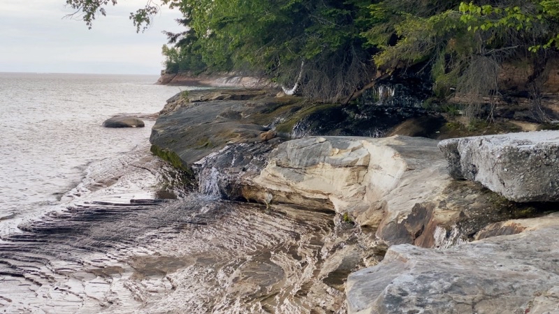
Little Miners Falls. From either direction taking a break at this small waterfall is always worthwhile. If you are coming from the west you just finished walking along Miners Beach (assuming you chose the beach) and so need a rest. If you came from the east you just scampered down the steep though short hill from Potato Patch and a moment to relax will be enjoyable before you stride west on the beach or official trail.
--May 31, 2021 at 10:19 AM. Grand Marais, MI, United States
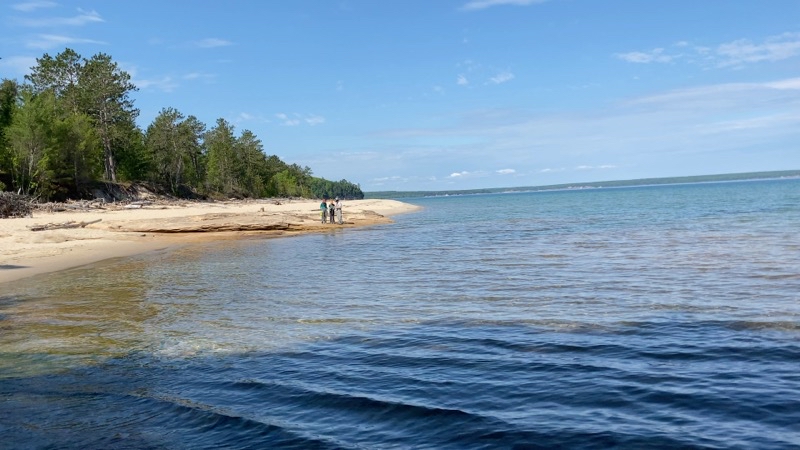
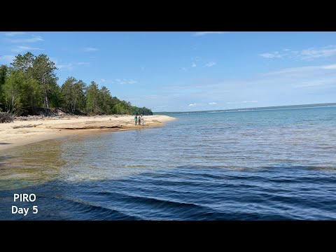
Miners beach stretchs about 0.75 miles and is always a popular spot. Kayakers launch from here and most day hikers have likley come down from Miners Visitor Center which is a bit of a walk in its own right if you aren’t expecting one. If the beach could be kept free of trash it would be perfect.
--May 31, 2021 at 10:22 AM. Grand Marais, MI, United States
Miners Beach stretches about 0.75 miles from east to west. Not very long unless you are choosing to walk through the deep, soft, energy absorbing sand or by the ever-lapping waves on firmer but slightly angle sand with the chance of a water invasion at most any time. Andy went high; I went low; El was moving between us. The beach should be lovley at all times but the charm is marred by humans who just have to leave trash including biological waste behind. Some people are truly rude and uncaring about others. Once you reach the western end and find the steps (slightly out of view as you stand by the outflow of the Red River) that take you up and inland you still have a bit more than a mile to go to reach the visitor center. The trail works its way through the forest along and across the Red River before steeply ascending to the bluff upon which Miners Castle Visitor Center sits. We found a few dayhikers out and about and somewhat confused about where Lake Superior should be. Go figure. Andy pulled ahead and El and I trailed behind. The morning had really warmed up into the 60s by this time so pausing to shed layers made sense.
I tend to forget how much trail there is after the steep climb before you reach the visitor center. It always seems like more than it should be. But just after noon I found Andy and El settled down at a picnic table for lunch. We weren’t exactly hurrying but we were not going to linger too long either. We were expecting stormy weather to arrive sometime after 15:00 though admittedly you could be excused for not knowing that if you just had your senses to go on during the morning. I left just before 13:00 to tackle the last 4.5 or so (could be 4.9) miles of trail. This section can be notoriously muddy and wet. The park service has installed quite a bit more boardwalk (puncheon) over the worst places but you never know with these shifting grounds and weather-ravaged trees what you might find. I found it was actually quite enjoyable easy going for the first couple of miles. Andy and El caught up to me and we continued on more or less together for a short time before Andy zoomed ahead. I totally missed the sign for Cliffs Group Site and Andy said he would have missed Cliffs individual site if he had not been checking his map. The etched tree that marks where the totally hidden due to tree blow-downs.
On we went. Andy again zooming ahead and El catching up to me. The temperature was starting to drop so we knew the weather was changing. But I still wanted to take a short break. I did so not long before the trail crosses a stream via some floating logs (spent time looking for a better way and was about ready to just cross and get wet feet when El haled me and showed me the best way across). On we went. We hoped we would beat the storm. We hoped the backpacking couple we had met would find a place to shelter from the impending high winds though that seemed unlikley as Cliffs is certainly in the forest. We encouraged the older fellow with a feather in his hat to turn around at the cliffside waterfall (no pictures this year) that a few years ago Gail, El, and Andy took shelter under its overhanging rock as ANdy and Joni tried to get to us before a different storm hit (didn’t make it). Down the steps , so many steps, El and I went down to the forest floor now pretty much on a level with Lake Superior though we couldn’t see the lake at this point. It was certainly cooler and windier. That storm was closing in upon us and we had about a mile to go. Hustle. Hustle. No real time to snap a picture or capture of video as a bouy bell tolled. Soon we reached the trail junction that would take us to Sand Point. Hurry along and watch out for ankle twisting roots. Don’t want to trip now. Did, but not badly just loudly. At 15:50 it started to spit and 5 minutes later El and I reached the parking lot and the rest of the crew. The wind and rain started to pelt the area just after we all piled into Tim and Nancy’s car to drive into Munising and settle down in the Air B&B.
Well all of us except Andy and Tim who had to drive Tim’s car back to our starting point to fetch Andy’s car. That shuttle took about 2 hours but when they came back carrying the pizzas that had been ordered our trip could officially be said to have reached its proper end.
No comments:
Post a Comment