Sevenmile Beach to Coves Group Site
▶️ Play Backpacking Pictured Rocks National Lakeshore - May 29, 2021
It was supposed to be warmer during our second night than our first. The thermometer sitting inside my single-wall original ZPacks Solplex read 37°F for a low; Andy’s read, I think, 33°F from within his tent vestibule. My legs got chilly and I had to toss my Enlightened Equipment Torrid Apex vest over them. Definite proof it was chilly. I am not sure if my improvised space-blanket outer tent wall (a partial one anyway) made a difference but I am inclined to think it helped a tiny bit. I suspect Tim and Nancy had the warmest sleeping quarters of us all snug inside their Stephenson 3-person tent with its heat reflecting walls. Too bad we didn’t have a campfire to stand around as we did morning chores but then morning chores can’t be done by the fire for the most part anyway.
Tim and Nancy were on the trail well over an hour before the rest of us. There was no rush. We only had to trek 8.8 miles to Coves Group site and we knew we’d spend a fair bit of time at places like Beaver Creek so as not to get to Coves Group too early. Andy, El, and I had our packs on around 09:15.
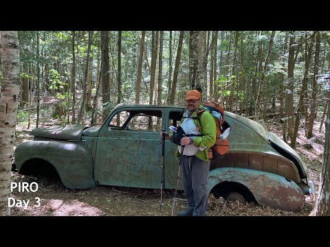
You could just walk along the beach west of Sevenmile Creek to the mouth of Beaver Creek. I’ve done that before. But instead, like yesterday, I took the official trail. Winding through the forest along a generally pretty flat trail enjoying the trees and birds as I went. In time I caught up with Andy and El at the anceint hulk of a 40s-era Plymouth sadan that has been mouldering away here for decades though we’ve no way of knowing exactly how many. Any graffiti that had been written on the paint vanished as the paint fell away. Now you see writitng scratched into the bare metal with dates going back to the early 80s. It’s a shame that people mar objects like this. I suppose after enough time passes those marks will be considered art instead of defacement but that time is certainly not now or any time in the coming years. Like the large rusted wheel hub El found you wonder why the car is here. In the case of the solitary wheel hub why just the one wheel. We will never know. Make up a story it’s probably as good as any other.
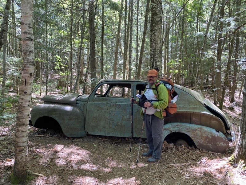
Andy thinks this is a 1940s-era Plymouth. It is a shame people feel compelled to graffiti the car. To be sure I’d rather the car not be here at all even though it does make you wonder why it is here. But having people scrawl junk over it for no better reason than that they can is sad. Photo by Andy
--May 29, 2021 at 11:48 AM. Grand Marais, MI, United States
Leaving the car behind we continued on down the trail and took the route that leads to the bluffs high above Lake Superior and eventually Pine Bluff campsite. I can’t tell you how long it has been since I took this path but it is easily more than 10 years. We were not going to Trappers Lake and though the high bluffs can be an energy sapping stretch of deep sand we didn’t have far to go and we would be treated to views of Superior as we skirted the edge of the bluffs heading towards Beaver Creek.
In Pine Bluff Campsites El found a staggering amount of trash left behind. We had already retrieved a long cooking fork suitable for marsh-mellows or hots dogs cooked over a fire at Masse Campground (tossed in a trash bin at Log Slide). A mylar balloon or two had been fetched down from hanging branches. But at Pine Bluff El found 3 mason jars and a daypack. The jars were in a fire-ring. The daypack jsut left. What are people thinking when they leave this stuff behind for others to find. At least the ketchup bottle El found by Beaver Creek looked like it had been around for quite some time (though maybe not). People are such slobs and seem to not think at times about the fact that other people might want to enjoy the place as much as an earlier group did. The trash-leavers are in the same category as people who bring their dogs into wilderness areas even though that is absolutely not allowed. And both groups are related to the people who figure it’s fine to climb across aerial roots of the tree on Chapel Rock because they can even though a safety fence is there to prevent that sort of thing. Those are a different class of person from the ones who figure they need to do careful yoga poses right at the edge of a 100-foot and more sheer drop to Lake Superior to prove something or other but certainly not how smart they are.
At least those annoying people who don’t seem to care that others exist are counterbalanced by people like the family, or families I was never sure, at Beaver Creek who had thir youngers (about 5) with them and were clearly enjoying the area and being respectful of the other people around. Hurray for them. Our leisurely hour and more sitting on the warm sandy bluff overlooking the mouth of Beaver Creek and Lake Superior was quite fine indeed. Should have taken a nap.
Coves Group site is almost 1.5 miles beyond Coves individual sites. There was a time when you could scamper down into the coves, well the westernmost, and stand right at the edge of the lake. Now there is a 6-foot drop and you still aren’t quite there and would have no easy way (if any) to get back up as the climb would be up sheer-faced sand. This is the problem with Coves in general: getting to the water. The trail climbs up and down across headlands that abutt the lake and at times does so rather steeply. The new section that quickly climbs up and over and down a rock face (having been eroded away to that point) is just one case in point. There is no real room for groups to pass here. One final climb up steps that are often at times uncomfortably tall (no made for short legs) and you are nearing Coves Group site. But you’ll be going down those steps again to find a cleft that gives you access to Superior to fetch water. Oh joy. Fortunately I was spared that task.
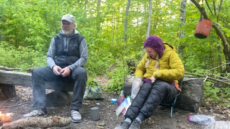
Rick and Gail have joined us now. They hiked in from the western end of Miners Beach (about 10 miles) to join us here at Coves Group Site. Sitting by this fire, again built by Tim and Nancy, we are all enjoying a much warmer evening than the first two nights.
--May 29, 2021 at 8:07 PM. Grand Marais, MI, United States
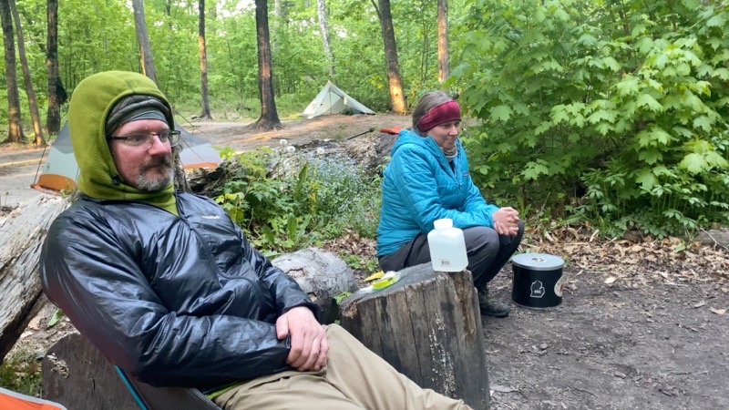
Andy and Elwira.
--May 29, 2021 at 8:45 PM. Grand Marais, MI, United States
Gail and Rick joined our group at Coves Group having come in from the western access point along Miners Beach. Once again Nancy and Tim scrounged up material (especially birch bark) to get a campfire going. It’s definitely such a treat to sit around a crackling fire chatting with friends and enjoying (hopefully) a good meal. While Andy awed everyone with the things he was crafting for himself and El I think I did pretty well myself. More work than a mere Mountain House or similar meal requires but I want to believe better for me and tastier too.
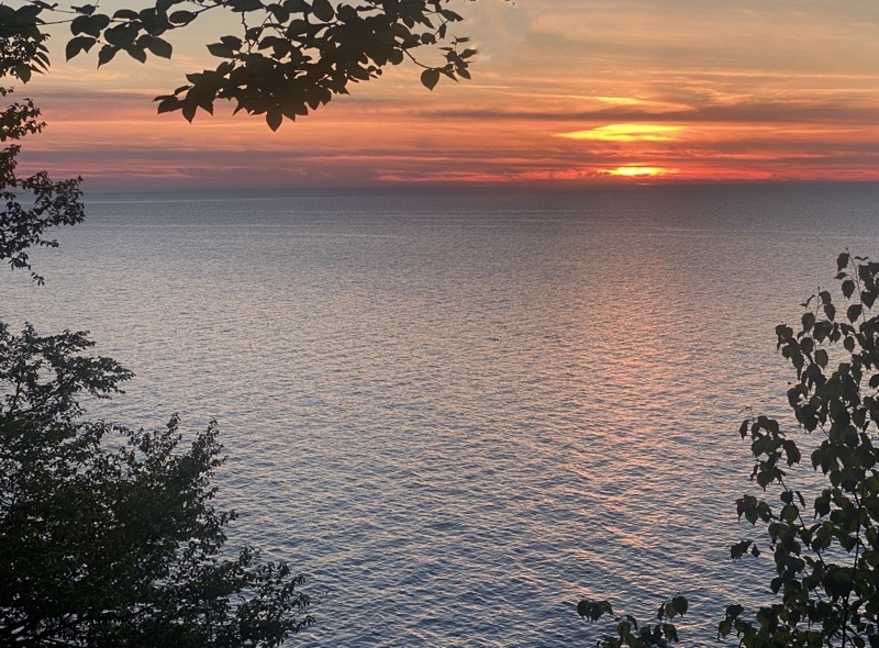
Take care when you come to this spot to view a sunset by Coves Group Campsite. This was once the North Country Trail but erosion has brought the at least 80 foot tall cliff not much more than a foot (30cm) from the trail thus forcing the re-route. Youll have to push through brush to get to this spot for a reasonably open view of the sun diving into Lake Superior.
--May 29, 2021 at 9:27 PM. Grand Marais, MI, United States
If you push through the trees to where the NCT used to be you can get a decent view of the sun as it sinks below the horizon. It’s not a sweeping view as you get at say Sevenmile let alone Mosquito River but it has its charm as the view you do have is easily 80 feet above Lake Superior. We watched the sun go down and birds of early evening sang to each other and us as we did so. It was a fine way to end the day before at the end, under a properly dark sky, Andy poured the un-needed water from my bucket over the bed of hot coals to douse their heat and everyone left sauntered off to bed.
No comments:
Post a Comment