The First Days - April 29 and 30
A small red light blinks up high by the ceiling, generators purr not far away, a confused Killdeer chirps even though it is almost midnight, our headlamps cast some light into the completely dark hotel room, water fails to refill the toilet or flow into the sink: the power is out. I think this has to be a first for starting out on a backpacking trip. Fortunately, we don’t really need power to get into bed or for Andy to do a bit of improvising to make a pack cover for his pack since he left his rain cover at home. We will get what sleep we can.
During the night the power was restored. We were able to get ourselves ready around 5:40 AM with proper lighting and running water. The hotel provided a nice basic breakfast (who doesn’t enjoy waffles) and we were pulling out of the parking lot in good order under clear sunny skies for the remaining drive to Slate Run, Pennsilvania where we would park the car by Pine Creek and set out on our hike of the Black Forest Trail.

Good morning. Crossing Pine Creek. Sure seems rather wide and brisk to be just a creek.
—April 30, 2025 at 8:41 AM.
Maps are centered on the photo: Google map, Apple map, OpenTopoMap map

It’s time to start our hike. Ken with his gear on. Photo by Andy.
—April 30, 2025 at 8:45 AM.
Maps are centered on the photo: Google map, Apple map, OpenTopoMap map

Andy is all set to hike too.
—April 30, 2025 at 8:45 AM.
Maps are centered on the photo: Google map, Apple map, OpenTopoMap map
The trail, in Tiadaghton State Forest, is a 43-or-so mile loop. It’s known for great views, very steep and lengthy ascents and descents, and numerous water crossings. I was expecting it to be a tough challenge. I was also ready to accept that I might have to make adjustments to my hike depending on how slow - and I thought it coupd be very slow - I was travelling. If that happened I would hike portions of the trail by myself while Andy forged ahead along the official trail by himself. We hoisted our packs, about 28 and 30 pounds for me and Andy respectively, and started out in a clockwise direction along the Black Forest Trail (BFT) around 8:40 AM with clear sunny skies and steadily warming temperatures.
The first couple of miles are deceptive as you trod along a good footbed through wonderful forest with Pine Creek rushing off to one side. Now and then we would step over a blowdown but if the trail stayed like this it would be a gentle walk through dense forest with ample access to water. This can’t last. Shortly after crossing Slate Run Road, which had never been that far away, our first big ascent of the day arrived. Up and up. The footing is not bad with just occasional big step-ups. But it is steep. The map suggests the trail gains nearly 1,000 feet in about 1.0 mile. The map is certainly right. Andy slowed down; I slowed down even more. It was hard to appreciate the splendor that was around us because I was working so hard. Andy did better (granted he sees more anyway). Up and up we went. We rose and the temperature rose too: internally and externally. It took the better part of two hours to complete that climb though that did include a snack break about halfway up. Two slow moving, hard working, hours. More was yet to come.
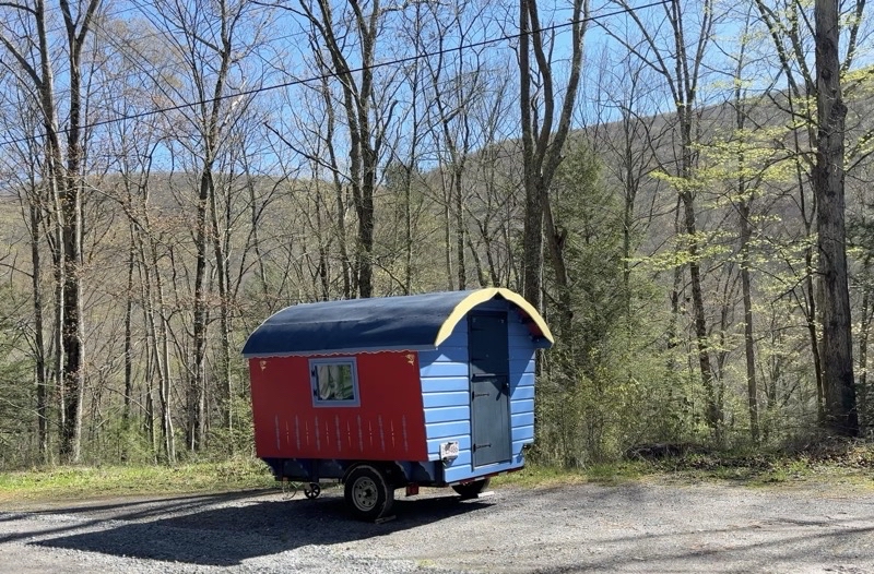
Not your typical camper. Soon our first really big ascent will begin.
—April 30, 2025 at 9:59 AM.
Maps are centered on the photo: Google map, Apple map, OpenTopoMap map

I am quite sure I never saw these brilliant red columbine Andy has paused to photograph. Look for signs of charming life as you toil up (or down) the mountainside. Photo by Andy.
—April 30, 2025 at 10:39 AM.
Maps are centered on the photo: Google map, Apple map, OpenTopoMap map

While Ken inches up the mountain Andy can catch his breath. The footing is actually pretty good but it is quite steep. Photo by Andy.
—April 30, 2025 at 10:43 AM.
Maps are centered on the photo: Google map, Apple map, OpenTopoMap map

I am pretty sure we aren’t halfway through this big ascent. I think it gains nearly 1,000 feet over maybe a trail mile. We’ve risen about 400 feet from the start of the climb. Gorgeous hard work.
—April 30, 2025 at 10:45 AM.
Maps are centered on the photo: Google map, Apple map, OpenTopoMap map

2 hours. That is how long it took me to gain some 900 feet over the past not-quite one mile of trail. It is lovely up here but it’s hard to appreciate when your body is letting you know what you just achieved was really tough going. But still a lovely day.
—April 30, 2025 at 12:06 PM.
Maps are centered on the photo: Google map, Apple map, OpenTopoMap map
Around 2:30 PM, at a road crossing perhaps 4.5 miles from the start, it was clear I wasn’t going to manage the 12.5 miles we had to go to get to the campsite for that night. Could I have done it? Yes, but it would have been dark when I got there - likely well past dark. When the trail joined Manor Fork Road, about mile 6, Andy would go his way and I would go mine. We would link back up the following evening. For me, taking the Manor Fork Road Bypass lopped off 14 miles of trail with a few big ascents and descents. I would find a campsite sourthwest of Route 44 (or maybe at the Pump Station Camp on Manor Fork Road) while Andy pushed on to Naval Run.
Pump Station Camp might have water but if it does it was not obvious. The most obvious thing, besides a big open area, were the huge cement pipes clearly there for some sort of water project. I continued down Manor Fork Road completing the 2-miles long bypass when I found the BFT again just south of the intersection with Route 44 heading southwest. Eventually I found a reasonably flat area not far past a rivulet that provided ample water. It turned out not to be the site Andy was thinking of which was another 0.3 mies distant but it was sufficient for my needs even though not as pretty as it could have been. I had made it, got things set up, not gotten lost - a good end to the day.

I am going too slowly. Barely more than 1.0 MPH and the miles to the camp Andy picked have more tough climbs. It’s time to be prudent and take the bypass route. It runs along Manor Fork Road basically between trail mile 6 and 20 (located just southwest on Route 44) for about 2 miles. Andy will hike the Black Forest Trail. I’ll find a camp and we will meet up tomorrow farther down the BFT.
—April 30, 2025 at 3:25 PM.
Maps are centered on the photo: Google map, Apple map, OpenTopoMap map

Andy is closing on his camp. I think he has just under 2 (descending 800 feet over a mile or so) miles to go to his camp by Naval Run. Photo by Andy.
—April 30, 2025 at 7:27 PM.
Maps are centered on the photo: Google map, Apple map, OpenTopoMap map
As I settled in the life of the forest became a bit more notable. The drumming of wood grouse, a sound I always enjoy, was heard. A woodpecker or maybe some other bird pecked at a tree searching for food or calling for a mate. As the sun set a whip-poor-will trilled in the distance and I hoped it would stay far off. I wondered how Andy was doing. I knew I’d eventually get a satellite message but that technology has limitations: a message might not get out until the sender has a very clear view of the sky; a satellite receiver might not get a message until it has a very clear view of the sky. A clear view really does mean that; foliage can severly impact the signal which I always find surprising given the distances the radio signals must travel. Andy’s “in camp” message was sent at 8:40 PM (though he might have pressed “send” earlier) but I didn’t get it until much later. Time to listen to the world and sleep the sleep of the tired.

I found this camping spot. It turns out I should have gone another 0.3 miles (and down a couple hundred feet in elevation) to a truly lovely creek but I didn’t realize it was there. This site was pretty enough.
—April 30, 2025 at 8:25 PM.
Maps are centered on the photo: Google map, Apple map, OpenTopoMap map
Day 2 - May 1
I did not feel any reason to get up before the sun and its light brought me to wakefulness. I did not have that far to go to reach our campsite for the second day. If Andy caught up to me before I got there that would be grand but I wasn’t going to wait for him because if I travelled as slowly as yesterday it was going to take 5 hours to get there. Not to much before 09:00 I was packed up and ready to go. I’d heard from Andy but still saw no reason to wait twiddling my thumbs. Off I went. And soon I found the great descent, about 200 feet down over a tenth or so of a mile down to a far lovelier and substantial creek and place to camp than I had just been. Oh well. The BFT follows this creek, right at the edge at times, for the next mile and change. Since it is the BFT and the land is what it is the trail crossings through the creek several times. I paused to take off my Darn Tough wool socks and slip into the waterproof socks. My feet might get chilly, though I doubted that, but they would stay dry even if the creek flooded my boots: which it did. Along the creek I went, sometimes veering up and away from it, but returning back and across more than once. Over the next 1.5 miles I think I crossed 7 times. It was a lovely area and I was pleased that I was making my way through it even if it wasn’t at a speedy pace. I had plenty of time. I had a gorgeous day. The trail had no big ascents or descents for several miles to come. Life was good.

Talk about running along the edge of a stream. The
—May 1, 2025 at 9:38 AM.
Maps are centered on the photo: Google map, Apple map, OpenTopoMap map

This is some sort of old pump house. I suppose if you got caught in a heavy rain storm it could serve as emergency shelter too though I think it might be iffy. I have been following this stream for about 2 hours (with breaks) and I believe I’m going to leave it soon after six water crossings. My waterproof socks have worked out well.
—May 1, 2025 at 11:31 AM.
Maps are centered on the photo: Google map, Apple map, OpenTopoMap map

Andy is walking trail I skipped. Along the way he finds critters like this porcupine. Photo by Andy.
—May 1, 2025 at 12:37 PM.
Maps are centered on the photo: Google map, Apple map, OpenTopoMap map
In time the BFT would leave the stream and follow cross-country ski trails through glades and forested areas for a few miles. About as easy going as you could probably ask for. I even had good views now and then and was enticed to stop and rest and enjoy the scenery around me. Andy was toiling behind me. His ETA to near where I had camped had slipped back a few times confirming that my decision to not wait was certainly the right choice. I am confidnet that while he was expending more effort than I was that he was having a fine time too.

When a spot is marked on the map as a lookout you should stop and look. I took my shoes off and relaxed for a while. The campsite for tonight is certainly less than 2 miles from here.
—May 1, 2025 at 1:01 PM.
Maps are centered on the photo: Google map, Apple map, OpenTopoMap map
In time the BFT had to leave its gentle pathway for a 200-foot elevation loss over a modest distance. Maybe not as steep as some before but not a gentle grade. The trail opened up on a lovely rushing stream at trail mile (going clockwise) 25 where we would set up camp for the night. It was about 3:30 PM and though skies were clouding over the air temperature was certainly over 70°F.I whiled away my time waiitng for Andy to arrive. I was pretty sure this was the right place, especially when I found the stone chairs around the fire ring, but not positive. That , in hindsight, was silly. I should’ve set up my shelter regardless of whether I was right or wrong immediately. Always have a shelter ready to go if the option is available. Instead I relaxed and ate an early dinner. It wasn’t quite as good as the PackIt Gourmet pasta bolognese I had the night before but it was, especially for a thrown-together homemade meal, good enough.
Andy strode into camp just after 6:00 PM; the rains started striking the ground not long after he arrived. We got our shelters up in short order. I got a little more damp than I should have because I did not set up right away when I arrived. Oh well. Hardly wet; just damp. I suspect it was a greater annoyance for Andy because he didn’t get to cook a hot meal. I suspect he could have used a good solid meal instead of the snacks he ate: calories yes; as morale-boosting as a nice dinner: no. We both snuggled down into our shelters and waited for the next day to begin.

A good source of water, a fire ring with some stone chairs, and flat-ish spots for shelters. Home for the night. I arrived around 3:30 PM and Andy walked in a bit past 6:00 PM. The on-and-off rain started not long after Andy arrived.
—May 1, 2025 at 7:43 PM.
Maps are centered on the photo: Google map, Apple map, OpenTopoMap map
Day 3 - May 2

A better view of our camp. It’s drizzling a bit. The trail is going to be a mess.
—May 2, 2025 at 6:15 AM.
Maps are centered on the photo: Google map, Apple map, OpenTopoMap map
On-and-off light rain for a good part of the night. When we started moving at 5:30 AM drops from the leaves above were pretty much all that was striking the ground. Our goal was to be on the trail by 7:30 AM since today was going to be at least 11 miles long, feature something like 20 creek crossings, and have one nasty rocky descent that while not long was going to be wretched. I hoisted my pack and set out just before 7:30 AM as Andy finished up dealing with his morning camp chores. We had no doubt he would catch up.
Up and out along an actual switchback I left the creek valley for higher ground. As I walked I passed by, or through, small pour-offs of water flowing downhill to the creek below.The trail was flooded but the footing was good. The morning had that quieter feel that comes just after a rain but before everything alive decides its really time to come out for the day. I continued on at a modest rate of speed. I am sure I would have been moving faster if following someone else but I was happy with my pace. I remained pretty happy as I entered an open glade and the trail seemed to vanish in the soggy grassy ground. Perhaps there was an orange blaze (I had not seen any so far the whole trip) on the far side but I just had to figure out where the trail seemed to be and put one foot in front of the other. That’s what I did. I always wonder what causes these open areas to develop and not fill in with trees.

The trail and water run-off intermingle.
—May 2, 2025 at 7:52 AM.
Maps are centered on the photo: Google map, Apple map, OpenTopoMap map

It’s a soggy mess in this open area. I was still solo as Andy had more packing to do when I was done: he would catch up. This section was a bit slower going because I needed to stay on the trail. A trail that was not particularly obvious here.
—May 2, 2025 at 7:59 AM.
Maps are centered on the photo: Google map, Apple map, OpenTopoMap map
Andy would catch up to me just after I reached a forest road - not much more than a two-track - and not long after we had both negotiated a big blowdown. There have been occasional blowdowns along the trail: some you can push straight through; others it is best to navigate around them going off trail to get to the other side. That last one was of the latter sort and so took a bit longer. We were together again with likely about 10 miles to go.
Even if Andy had not caught up to me where he did I would have been forced to wait soon enough. The nasty stretch was almost upon us. You can’t tell how bad it is - just that it is bad. It is, in fact, worse. Big rocks that you have to scramble down. Your trekking poles are apt to get in your way too. One huge rock made me really uncomfortable as I squirmed around it. SLow, very slow, steady progress. One foot in front of the other but not until I am sure I have secure points of contact with the ground and rocks. Andy claimed it was considerably easier last fall when he ascended through this stretch. Over the next half-hour we travelled perhaps 500 feet descending 55 feet. It was a section I would not characterize as precisely fun but you will feel satisfied when you reach the end. That feeling will not last all that long as the BFT has more to throw at you before you even reach County Line Branch and all the water crossing you could want.

You get views even on overcast mornings like this.
—May 2, 2025 at 8:53 AM.
Maps are centered on the photo: Google map, Apple map, OpenTopoMap map

I think I am in the middle of this nasty section of rocks. It’s a slog. Nerve-wracking. Photo by Andy.
—May 2, 2025 at 9:11 AM.
Maps are centered on the photo: Google map, Apple map, OpenTopoMap map

After perhaps 500 linear trail feet which dropped us 55 feet could the rocks be ending? It’s taken nearly 30 minutes to get through this stuff. Photo by Andy.
—May 2, 2025 at 9:21 AM.
Maps are centered on the photo: Google map, Apple map, OpenTopoMap map
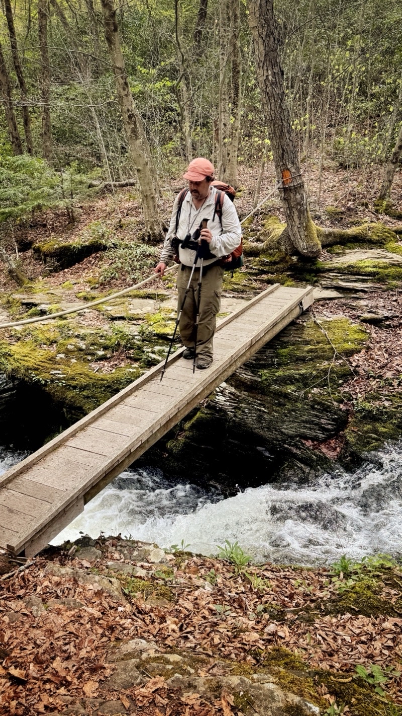
The morning was dry. Overcast but dry. The trail zipped up a bit, got fainter in a dense patch of rhododendron. We almost got ourselves confused looking at the map and thinking it was oriented on our screens opposiite to what it was (yes, an argument for a paper map; though had either of us looked at the compass display, which is present, we’d have noticed right away instead of making a tiny error). We descended through the rhododendron tunnel, found mountain laurel (I’d not have known except when Andy told me) and kept going. We reached the valley floor with the sound of rushing water in our ears. The 2-miles of following a big creek with numerous water crossing was upon us. It was a pleassant morning: temperature in the mid-60s though it felt cooler. We were ready for what the trail had to offer. What it had to offer was a small river valley. County Line Branch was rushing downstream as we walked upstream. The creek is reasonably wide and clearly had deep spots everywhere. Our shoes would certainly flood and I fully expected the water to reach above my knees at some point. Over the next couple miles we walked along the creek, crossing through it 21 times, as we went. I was right there were many places where the water was above my knees and the current did its best to push me off balance. Slow and careful are the watch words when you work your way through surging water. Neither of us fell and we only got as wet as we expected we would. It was a lovely morning. However, I can understand the value of having a high-water bypass option available. County Line Branch could easily get considerably more powerful after a substantial rainstorm.

If you aren’t climbing or descending you are likely by a roaring creek. County Line Branch is off to our right. We have already crossed through it at least once.
—May 2, 2025 at 10:22 AM.
Maps are centered on the photo: Google map, Apple map, OpenTopoMap map

An early crossing of County Line Branch. The waterproof socks are keeping our feet dry if not toasty warm. Dry is enough. Photo by Andy.
—May 2, 2025 at 10:35 AM.
Maps are centered on the photo: Google map, Apple map, OpenTopoMap map

I think this was the 14th crossing of County Line Branch. 21 crossings through the waters of the creek; one small bridge.
—May 2, 2025 at 11:40 AM.
Maps are centered on the photo: Google map, Apple map, OpenTopoMap map
By the time we came to a nice campsite by another creek, not far from Route 44, we had dried out. Here we ran into our third set of people. Earlier in the day we encountered a trail runner who Andy had met the previous morning. He was running the entire BFT over two days (1 night). The fastest-known-time record was not in danger but even doing what he was is hard to imagine. It’s not something I could do even if I was in peak physical condition. He admitted that his legs were, “cooked.” Later, perhaps around creek crossing 16 we met a couple coming the other way. I think they must have started not too far away from where we met them. We could still smell soap on them; clearly fresh from town. Finally, at this pretty site around trail mile 30 we found a trio of Canadians who were out doing the whole loop in a counter-clockwise direction. They’d started at Slate Run, like us, and for some this was their first really tough backpacking trip. I think they were having a good time; but they had some really tough trail to come (though many options for bail-outs if needed). By this point the sun was breaking through the dispersing clouds and morning was coming to an end. We had about 6 miles to go and it was supposed to be easier going all the way. Well...
You take the good with the bad. The afternoon was warm but not overly hot. A sun-shower or two happened. Just enough to make us ponder putting pack rain covers on the backpacks. We continued through the forest. The trail meandered through slightly rolling terrain but was trending gently down. We were having a good time. It couldn’t last. When the trail reached what was clearly an old forest road it began descending that road. It kept descending. It descended more. The footing was good but the descent was relentless. Over the next couple of miles we dropped down about 900 feet. For the BFT that means the grade was quite reasonable. But it was turning into a tiring day. I was starting to feel it. I was starting to wonder when it would end and where was camp. When we reached Francis Road, not that I knew the name at the time, I was very happy. I thought camp was amost here. It wasn’t: quite. We traipsed down the dirt road, found the BFT dropping down a hillside, and found another dirt road. That road would take us into the area of Little Morris Runk and eventually across a narrow swaying bridge to the trail that would, after a long half-mile or so, reach widely spaced campsites. I was so ready to be done. I expect Andy was too but he surged ahead. He had to. We were caught up to, and passed, by two younger fellows carrying huge packs who were intent on finding a campsite too. I doubt they were doing the whole trail but they were out doing something. I lagged behind. I found the first campsite with a couple big tents. I found the next site. I kept going. I hoped Andy would spot me as I passed by because otherwise I might miss the campsite. He did. By the time I got there he had his shelter set up. I was bushed. The hiking portion of the day was done. Setting up camp, never a speedy process, was about to begin: a 10 hour hiking day.

This view showed up just after leaving an old forest road for Francis Road. That old road was not super steep, dropping about 900 feet over 2 miles, but it was relentless.
—May 2, 2025 at 4:39 PM.
Maps are centered on the photo: Google map, Apple map, OpenTopoMap map
I am really slowing down. We left Francis Road, slowly descended a hillside, joined a dirt road (Morris Run road I think) that took us to this bridge over Little Morris Run. I am very tired. I am more than ready to be done hiking. Camp is somewhere downstream.
—May 2, 2025 at 5:14 PM.
Maps are centered on the photo: Google map, Apple map, OpenTopoMap map
You have to do your camp chores. It might be a lovely afternoon or a cruddy one but the chores have to be done. Today was a lovely late-afternoon with a creek rushing just out of effective view. I was ready for a hot meal and tonight I was hoping to enjoy my dehydrated faux jambalaya. Andy was going to enjoy his Asian-inspired sticky noodles. Two different approaches to our meals tonight. I just had to re-hydrate and heat my meal, add some extra spices and some olive oil. Andy had a bucnh of prep work to do while some of his food soaked up water rehydrating. He had noodles to cook, items to lightly sauté (maybe), and eggs to cook before creating something like a stir-fry. When it works it results in wonderful food. My food was pretty good too but I can’t help but be more impressed by what Andy routinely does on backpacking trips. I sometimes do it too but I think Andy does more. He is certainly more organized which is possibly the single biggest key to success.

Campsites often don’t look like much. I got here 40 minutes ago. I was so happy to dump my pack. Though not visible my shelter is set up and I am getting ready for a dinner of faux jambalaya. Andy is set up by the rushing creek. I am sure he is ready for a hearty dinner too. That last 0.7 miles sure felt longer; the end to an eleven plus miles day.
—May 2, 2025 at 6:27 PM.
Maps are centered on the photo: Google map, Apple map, OpenTopoMap map
Day 4 - May 3
Prelude
As night fell we settled into our shelters and it began to rain. At this point we were still hoping to get up very early and be done with the steep rocky segment before the mid-morning rains arrived and soaked the truly nasty rocky third-of-a-mile very steep big rocks ascent about 0.3 miles away. The rain that we thought shouldn’t have really been here intensified. I started wondering about the prudence of tackling this upcoming ascent. Andy said it was worse trail than the shorter descent we cotended with earlier. We would be going uphill but if the rocks were slick we would be asking for greater risk and possible trouble. The rain continued. Sometime during the night, during an “on” portion of the rain, I decided that I was going to follow the trail back to the roads and follow them back to the car. The mountains aren’t going anywhere.
* * * *
At 6:00 AM Andy came on by and told me he wanted to take a “safety hike” and not tackle the last few miles of the BFT including the awful ascent. We were in agreement and life was good if a bit damp.

We had on-and-off and sometimes heavy rain through the night. It’s drizzling now as we slowly pack up camp in preparation to depart. We have decided to take the safer route out since the very steep and rocky climb is now slick with water. I think it will be about 7 miles of mostly road walking along Francis Road and Slate Run Road.
—May 3, 2025 at 7:34 AM.
Maps are centered on the photo: Google map, Apple map, OpenTopoMap map
Bundled up in our rain gear with our pack covers protecting our packs we began to retrace our steps. Soon we passed by the two fellows who hustled past us yesterday afternoon. Andy noted that their approach to breaking down camp was far from ideal as the inner mesh tent of a double-wall tent was being rained into because they had taken down the fly and stowed it. Maybe they were just spending one night out and did not care if the tent got soaked. But, still... We continued on. We both felt sure that the trail back to the brdge across Little Run now had more blowdowns for us to step over than had been present the previous afternoon. We were too tired or too focused to notice yesterday. Over the bridge and up the stupidly steep short climb to the dirt road that takes you out of this small state park. We continued on. The aroma of bacon tickled our noses. The aroma drew us, like moths to a flame, to a car camp site. We found two guys clearly out for some trout fishing cooking under a canopy. Our hopes of some free bacon vanished; where was the bacon? Had they digested the evidence already or were they just cooking with bacon grease? Disappointment. We continued on and up the hillside we had come down the day before. Ugh. Then we were at Francis Road and standing by an overlook gazing across the valley where Morris Run was flowing. Trying to gaze across as the mist shrouded us. From this point we figured we had about 6 miles to go: one foot in front of the other. At least the footing is sure and any grade is gentle. But it is still a dirt road.

I think it isn’t quite as misty as this photo at the same general lookout point as yesterday’s photo suggests. It is misty though and spitting rain. We are both happy to wear our rain gear. Photo by Andy.
—May 3, 2025 at 8:39 AM.
Maps are centered on the photo: Google map, Apple map, OpenTopoMap map

A bit more than 3 miles down; and 4 miles to go. A couple trucks have passed by including, we think, the fellows whose camp enticed us to it with the aroma of bacon and let us down with no bacon to be found.
—May 3, 2025 at 9:13 AM.
Maps are centered on the photo: Google map, Apple map, OpenTopoMap map

I think it’s going to take 2 hours to reach the car as we plod down Slate Run Road. Andy thinks it’ll be less.
—May 3, 2025 at 9:13 AM.
Maps are centered on the photo: Google map, Apple map, OpenTopoMap map
We plodded forward. Now and then a pickup truck would pass by. Light rain fell now and then. At this point it’s more about getting to where you want to be than enjoying being outside. There wasn’t much to see. In time we turned on to Slate Run Road: 4 miles to go; 2 hours though Andy thought it would be less. We plodded forward. At one point I passed Andy and did not notice: one foot in front of the other. He passed by and moved ahead: his feet moving more quickly than mine. He was right it took me about 100 minutes to cover the distance which he covered somewhat more quickly. I crossed over the fast-flowing Pine Creek, which really looks more like a small river, just before 11:00 AM. I found Andy well into the process of shedding trail clothing and gear for more comfortable duds. That was something I was looking forward to doing as well. Our journey along the Black Forest Trail might have ended with maybe more of a whimper than a bang but it was a good trip and by many measures, and the ones that count, a successful trip. It was time to be done and to pack up and head home.

The car is in the parking lot a couple hundred yards away. Andy is surely there. It is going to be less than 2 hours after all. The hike is done. We achieved a lot but I am glad to be crossing Pine Creek and arriving at the car.
—May 3, 2025 at 10:52 AM.
Maps are centered on the photo: Google map, Apple map, OpenTopoMap map