Sunday, October 15, 2017

Spanish Pyrenese Walk 5: Finestra Sanctuary


What a day. We would tackle a circuit-hike today that would start and end at our hotel (Cal Sastre) in the village of Santa Pau. The hike was reported by the Inntravel guide to be about 12km long and have elevation gain and loss of 675m. Those numbers would turn out to be off if the GPS track is correct. The distance was 12.77km and we had a gain and loss of just under 500m (call it 490). That is a larger difference than we have been seeing but I am here to say it was more than enough for us.
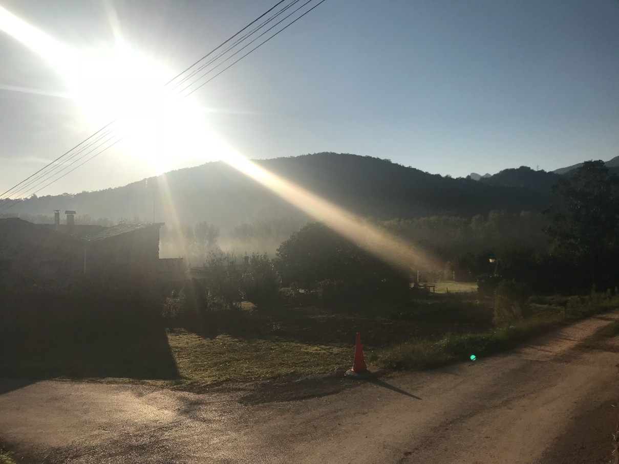
misty morning

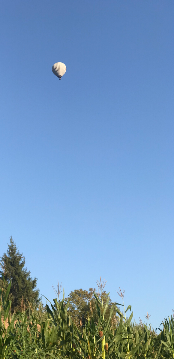
hot air balloon rising

Like the last several days the morning temperature was probably about 60F when we set off under clear blue skies. A handful of hot air balloons drifted above us as we left the village. They look so peaceful. A mist was clinging to some areas we could see but it would clear away in short order. We strolled along concrete and dirt roads that wound past small farms and homes and took us over dry streams or streams with so little water you couldn’t tell.

Soon our gentle ascent on roads and later mountain paths would steepen and get more rugged. In fact, the terrain became quite a bit more challenging after the first couple kilometers. We were climbing narrow and steep, sometimes rocky, trails that wound upwards through dense and dark thick forest. It was definitely tough going for all of us. I think we were all quite happy not to have sun beating down upon us even though you could be forgiven for thinking you were entering into a realm of some dark fantasy story as the forest blotted out the light.
view From Finestra

It is hard to judge from the altitude profile but I reckon the bulk of the 440 or so meters we gained to reach the sanctuary probably happened in less than 3km.  I am glad we were ascending that rough trail. It would be far worse descending. Why people would set up charcooal burning ovens here is beyond me. Just moving the wood and then charcoal would be a wretched chore. For that matter why anyone would build the Finestra sanctuary just below the top of the mountain we were climbing is something of a myterdy too. It is certainly a tough place to reach and so I guess a good place for contemplation but building it must have been very difficult. Today it seems all but abandonded. We thought we were alone when we reached it about 3 hours into the hike. It turned out a Catalonian couple (and dog)  were there. They had a key so maybe they’re caretakers or perhaps the place is now rented out for couples or other people like them to use. They left us and hiked down a small trail to where a road must be as we heard a car pull away.

The descent followed a trail that wasn’t nearly as rugged but , for me, wasn’t all that easily dealt with. This hike was proving to be a tough one indeed. Down and down we went through forest that seemed only a bit less impenetrable than before.  We crossed more dry streams and took great pleasure in sitting on the edge of a long grassy field a third of the way down. We still had considerable trail to descend before reaching concrete roads that gradually took us back towards Snta Pau.


Even when we got to that point the tough bits weren’t done. We passed through another church (church or maybe now school: Santa Maria dels Arcs) with several yowling cats in attendance and for  the next couple hundred meters climbined up a forest path once again more than merely gradually before picking up a narrow path that wound through farm fields  down and towards the village. A cruel joke as we were still not back to the hotel and had walked more than 12km. The final hill climb along the road that had taken us out of town hours earlier was just a pain even if it was only a couple hundred meters long. Just under 7 hours after setting out and we were back sitting down for well deserved drinks. 

This walk is certainly a tough one even if you have normal vision. The views, when you have them, are quite good. You will be out for many hours and you will certainly have a sense of accomplishment especially as you finish the ascent. But be warned though not as long as some walks it is tough.

Postscript: We did the walk in 5:18 with 2:52 in vreaks. It felt harder than it was because some sections were steep. However, realistically speaking I bet walk 1 was tougher where descending was concerned. 

Photos
1. I know it is hard to tell but mist is rising. My guess is that it is coming from the area of a rather tiny stream in a hollow where the temperature is definitely cooler than the surrounding land. We would be quite happy that the majority of the climbing we would do, up and down, would be in forest as even by mid-morning under cover the temperature was over 70F.

2. Hot air balloon rides are popular here. Every morning here in Santa Pau we saw balloons rising over the countryside. 

3. The views from the Finestra Sancuary don’t photograph well at just past noon but you certainly have them. Had we pushed on the fairly short way to the summit we would have had 360 degree views showing the mountains and the sea. But, we had climbed enough already.

4. Just a grassy field. A nice place to sit and have an afternoon snack. 

Saturday, October 14, 2017

Spanish Pyrenese Walk 4: Garrotxa Volcanic Zone Natural Park

I suppose I should be calling these walks now something more like Catalonia Walks as we are certainly still in that particular region of Spain. We are certainly moving away from the Pyrenees mountains. The walk today continued the trend of moving us from one town to another. We left our hotel in Olot to hike through Garrotxa Volcanic Zone Natural Parker and the seemingly older Santa Pau which appears to have the feel of a much older village.

We got a small sense of what parts of Olot might be like as we walked along a busy street and then past many small gardens, what Inntravel call “allotments,” and past small and slightly bigger homes. It was easy walking. So easy we made a mistake. I think we just skipped a direction in the guide and so kept walking along the path we were on. That path gently curved around for nearly a kilometer. We popped out on a busy major set of roads, clearly still in Olot and could not find the field or major monument to people who died in the Spanish Civil War on the Republican side. We wandered around and saw nothing. We found a path that looked promising and followed it. Mom and Dad recognized the place. We had seen it before. We just walked a near 2km circle. The GPS track confirmed that.  Mom had felt we were making a circle before that confirmation. I had no clue.  We still weren’t quite sure what had gone wrong but with the help of a local we found a way back to where we should have been all along. Her way may have been an alternate route to get us back on walking route 3 (as signposted). What a joy to see the big field with the cross memorial standing tall in it. The goof cost us likely almost an hour but at least it was easy walking.
memorial cross

For the next 1.4km we ascended a paved quiet road past small farms and homes before turning down a woods path that seemed to have plenty of people on it. Families were out and about. Maybe hunting for mushrooms. We were working our way towards the visitor center  in Garrotxa Volcanic Zone Natural Park. It got more crowded as we got closer. When we walked through a parking lot it was clearly full. Walkers everywhere. A couple of horse drawn wagons carrying people went by. Families with numerous dogs were all over the place. 

Our walk took us along single-track dirt paths that gradually ascended through thick forest towards a mountain road and a hot air balloon center (we saw balloons in the early morning; sure looks like fun but I guess we will never do that). The mountain road would open up and take us through a wide open space bounded by fields and volcanic cones rising in the distance. Vil Crascot rises and people do walk the slopes to the summit. We ambled down the road along with scores of other people. The views are decent but there was something missing when I think of this bit of walk as compared to the between-the-peaks walk along a mountain high road in Sao Jorge in the Azores.I can’t put my finger on what that something missing is but the Azores walk had it and this stretch doesn’t really. I am not knocking the walk just saying it lacked something.
crater and church Santa Margarida

We had a leisurely lunch at a roadside picnic/park area. The scores, if not hundreds, of people were still about. It is a national holiday of some type and that accounts for the crowds. We decided to climb up Volcano Margarida and down into its crater. It’s a steep-ish climb covering some 500 meters on a woods road. You’ll know you worked. Then you drop down along a 300 or so meter descending path into the crater of Vol Margarida.  The volcano last erupted ages ago. The crater floor is covered by grass and shrubs and is probably a couple hundred meters across. The church Santa Margarida sits in the middle of the crater. An odd spot for a church by itself. Margarida is, according to legend, to have slain the dragon that lived in the volcano. Today the crater hosted hundreds of people (and numerous dogs ; they abound in this region of Spain) picnicking, running about, playing soccer. You have to work to get to the crater so I imagine people make a several-hour day of it. We left by another route ascending back to the rim before joining another mountain almost-road to descend down the mountainside towards Santa Pau. 
Mom and Dad entering Santa Pau

You walk through forests again before stepping out onto a paved road that winds through farmland towards the old village of Santa Pau.   Once again  a small village has a centuries-old feel about the buildings. This time though it is clear that more people hustle through the village. Perhaps that is because it’s a holiday today but I think we will see more people about tomorrow too.  

Photos
1. The crosss in the field that we were so happy to find. This cross is a memorial to republicans who died during the Spanish Civil War that brought Franco to power.

2. The church Santa Margarida in Volcano Margarida. (Olot to Santa Pau)

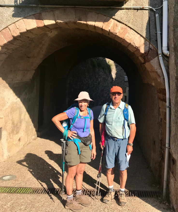
3. Entering the village of Santa Pau. Mom and Dad standing under an arch that leads to the heart of the village. Certainly larger than a place like Beget and a lot busier too. Beget still has the best “old feel” about it.

Friday, October 13, 2017

Spanish Pyrenese Walk 3: Oix to Castellfollit de la Roca


Some  breakfasts are more “continental” than others. Our breakfast at Can Pei was very continental. We had a tiny selection of bread, ham (very pale), two cheeses, a hard salami, donuts that made us all think of Dunkin Donuts, and that was about it. Perhaps we should have seen that coming as dinner was limited in its way too. However, we enjoyed dinner with its good bacon and potato starter, hearty though hard to pierce with a fork sausages, well seasoned potatoes, and chicken. They also provided a nice dry red wine. If you stay at Can Pei it helps to think of it as a farmstead, though not a farm anymore as far as I can tell, that happens to host guests. We were out the door and on our walk by 09:20 on yet another clear blue morning. The temperature at this point was creeping towards 60F but it was not there yet and we started the walk along the road into Oix (Osh) along the quiet road past working farms wearing some xtra clothing. 
Mom and village of Oix

Oix River valley from Mas Peneda

We goofed a bit and so did not walk through the heart of Oix. I doubt we missed much as the goof was slight and had us go one block beyond the “Main Street.” Maybe I am doing Oix a dis-service as a quick check of Wikipedia suggests the population is 970 and that suggests to me a decent sized village based on what we have seen thus far. However, we will never know as we quickly left the buildings behind and began climbing a dirt road past numerous sheep grazing along the forested road.

We were passing mountain farmsteads I suppose though the amount of farming that they can do must be limited as the slopes are hardly ones you could sew with crops. I guess that is why they have scores of sheep grazing here as they can get by in this type of terrain. Up and around we went. In time we actually had some views of the River Oix valley below (about 4.5km into the walk). I suppose the most exciting bit was when we had to slow down to let a momma goat her newborn  pull ahead and move off the dirt road. We didn’t want to disturb them more than we had too.

After reaching the high point of the walk we began descending on more mountain road and then a rock-strewn path that got rockier as it went. For most people it would be merely irksome. I slowed down somewhat.

What views we had earlier were all but gone by now. We gradually lost elevation as we walked more woods roads down into another valley. No views. No animals. Plenty of heat as the temperature soared to about 80F.
super Catalan flag on cliffs of Castellfollit

bridge over River Fluvia

In due time we approached the cliffs that Castellfollit de la Roca sits atop. It’s too bad we were walking and looking into the sun as the stupendously large Catalan flag that is hanging from the cliff top is certainly quite a sight. CastellFollit itself is impressive in its way too. We were in the most densely packed bit of civilian action (as it is) that we had seen since disembarking the train in Ripoll. The streets are clean and there is a mix of the old and new in this town of just over 1,000 people. Not that we saw many people out and about but maybe that was because it was just edging past 15:00 when we settled down for a snack in a cafe before walking the final 100 or so meters to where we would catch our taxi to the hotel we are staying at tonight.
CastellFollit de lac Roca

This is a walk that I would not really recommend. Perhaps we missed something special but I am not sure what it would have been. Spending a bit more time in CastellFollit might be alright but otherwise this walk was mediocre at best.

Once again the GPS reported ascent and descent numbers that were about 120 meters less than the numbers Inntravel cites in their notes. The distance is pretty likely correct since I stopped the track before reaching the “end” of the walk and given we made a couple hundred meter goof walking down the dual carriage way before a turn off to the River Fluvia.

Distance 13.5km. Ascent:  335m. Descent: 431m. Average speed 2.7KPH. We did the walk  in 5:40 with about 42 minutes in breaks.

Photos
1.  Looking back towards the village of Oix (pronounced “Osh”). 

2. We have climbed most of the way to the top. The house, called Mas Pineda, is clearly a sheep farm. You can see the river Oix valley below. Photo by Judy. 

3.   Has n the center of the picture hanging off the cliffs upon which CastellFollit de la Roca sits is a staggeringly large Catalan flag.  Phito by Judy. 

4. Ken walking across a bridge that has undulations built in. The bridge crosses the river Fluvia. Photo by Judy. 

5. A street in zcastellfollit de la Roca. 

Wednesday, October 11, 2017

Spanish Pyrenese walk 2: Beget to Oix (Osh)

The night was quiet, still and not as dark as I would have expected it to be. Perhaps the nearly full moon accounts for that but I am not convinced. After a fitful sleep morning came with clear skies and crisp early temperatures. I expected it to warm up considerably though it turned out that it would warm up a lot more than I thought it would (that’s what you get for not checking the weather report - Dark Skies is a great app).  We had nice hot breakfasts of eggs and bacon (of a sort; not cooked well and gristly) before hoisting our packs and heading out on our second walk starting at about 09:20. Today we would hike to the outskirts of the village of Oix (pronounced “Osh”). The book says this is a 12km walk and gave ascent and descent numbers that were substantially less than the day before: an easier walk perhaps. 

We left Beget without company. Shep and Panter did not re-appear. We walked down steep cobblestone streets past more aged buildings to the river where we picked up a concrete path that took us quickly to a modern paved single lane road that connects Beget with Oix. We would follow the road, a very quiet one, for about 1km before turning onto another concrete path. These paths are interesting. The concrete is rippled which must make for an interestingly bumpy bike ride or , I suppose, drive. This path lead us through extensive corn fields with mountains rising quickly not far away. It’s a pretty scene. A quiet one too. Some bird calls, squirrels, and bugs buzzing but not much else. Certainly few, if any, mechanical sounds. This gives you a sense of remoteness even though you are clearly walking through lands worked by people. We followed our gentle path to a stream crossing. In spring and early summer perhaps this water rages and represents a major water crossing but now the water was just a couple inches deep. 
parents in corn field

We had been making excellent time. The sun was steadily rising and the temperature in direct sunshine was already well into the 60s. . We were heading towards a place called Talaxia. By this time we were once again following the GR11. We would leave the path for the major climb of the walk at his point. We climbed through forest up a mountainside for 1.5km gaining perhaps 200m in the process. The footing was good so we made good time. It was warm going but not stressful. It also was not particularly eye catching as the forest blocked any views. Throughout the morning remains virtually free of man made sounds. When someone started up an internal combustion engine to do something (cutting fields, slowly driving) it ruined the feeling somewhat. We kept climbing.

At the top is a ruin of a house and a decent view. It would have been better if we’d not been gazing into the sun but it is a spot that shows off how long people have lived here as the stone house is just bits and pieces now with roof tiles scattered on the ground.  There were several trails at this point. We turned to the right and began descending a woods road. We heard voices in the distance and soon came across a man and woman wearing full backpacks heading up the road we were descending. We’ve no idea where they are going. They would be the only people we would see.

The mountain road wound down and down the mountain. Over 2km we probably dropped nearly 200m to a pasture with some more old stone buildings and our lunch spot.  By now it was midday and the temperature was pushing 80F. It was still a lovely day if suprisingly warm.  Our mountain road would plunge us further down through forests taking us past a small church which I suppose we should have checked out. I suspect it is quite nice. But we didn’t make the detour and just kept going. For several kilometers the road continued down towards a dry river and we stuck with it and the GR11. However, eventually we would leave the GR11 for a different route that continued on more hard packed dirt mountain roads through limestone gorges over bridges that seems to spin dry rivers. Some impressive cliffs can be seen here but once again if you have a yen for big vistas that will take your breath away this walk really doesn’t provide those. It provides an enjoyable walk through peaceful conuntryside that sometimes has good views.

We walked steadily on and at about 14:20 we came to the easy-to-miss gate that marked the entrance to Can Pei (no idea what that means) which is the collection of stone farm buildings that is now a family home and site for 7 guest rooms and other rooms for travelers like us. The predominant feature of these buildings is stone: exterior walls, interior walls, steps, floors, everything. Small windows let in some light. But the rooms are good enough if quirky. Mom and Dad are in a room with 3 single beds; I’m in one with 2 singles and one bunk bed. If you stay here make sure you arrive before 14:00 to be shown where you will stay. At 16:00 the owner, and I think Mother of kids, departs to do other things and though nothing is locked you’d not know where your room is.  We just hung out for the rest of the day. Our impression is Oix is very small and since we will walk through it  on the next walk we elected to stay put. I kind of wish we’d looked to see if Oix had a place to get a snack. You won’t find anything in Can Pei.

It was a nice walk. My only complaint is that my quads really hurt. Walking down steps is a real chore now. The Inntravel guide suggest the walk is 12km with something like (going from memory) 360m ascent and 495 descent. The GPS track recorded 12.2km distances; 242  ascent and 380m descent). we arrived at 14:20 averaging about 2.8KPH taking about 4 hours 17 minutes to walk and 48 minutes of breaks.

Photos
1. Parents in the corn fields. 


Tuesday, October 10, 2017

Spanish Pyrenees Walk 1: Mollo to Beget

Let’s start with a final look into Mollo. It was certainly a tiny place made of stone buildings snuggled into the foothills of the Pyrenees not far from the border with France. In fact that closeness meant that somewhere between 85,000 and 95,000 people fled through there in March of 1939 during the Spanish Civil War on their way to France. Signs abounds describing the retreat of the locals from the nationalist forces. Other signs describe some of the very old or newly rebuilt (new is a relative term here)  buildings. People have been making Mollo home for over 1,100 years. Our Swiss chalet style hotel is likely rather newer than most but still has a great old European feel about it. Even at this late date in the year we saw one tour bus present, Thoughwe never did see lots of people at dinner or breakfast. Dinner was, as expected, excellent. Breakfast was adequate.


The morning dawned clear and crisp. When we hoisted our day packs and left the hotel at 09:30 I suspect the temperature was in the low 50s but even at that it felt pleasant enough as the sun was shining on us and there was little if any wind. We would be hiking through the valleys to the village of Beget some 12km distant. The Inntravel guide informed us that we would gain about 250m and loose 900m. That’s quite a bit of ascent and descent over the 12km walk. Signage suggested that most people hike the paths, mostly the GR11, in not much more than 3 hours. 

We left Mollo and were slogging down a stony descending; the guide says cobblestones but that suggests something more regular than it is. I found it stressful going. We popped out at the Rive XX  As we passed a water purification building we picked up  our hiking companions for the day. Two dogs, we named them Shep and Panther, came down the cement path happily barking to greet us. We figured they lived nearby and were just checking us out. That may well be true but they did more than just check us out. As we climbed up and away from the river on a now dirt single track that steadily climbed away from the river the two dogs stayed with us. Shep would move ahead and settle down and waiting gazing at us. Panter stuck to Mom and Dad like glue and now and then would trot back to me if I had fallen behind to check on my progress. They’re either well trained to stay with whoever they adopt or maybe that is just how they are. They stuck with us over hill and dale. We left the river behind leaving the dirt single track for a grassy path that would up and down through pastures. The dogs kept us company. We passed through electrified fences and they stuck with us. We walked one-person wide paths that clung to the edge of hillsides descending towards streams and they stayed with us. For something like 10.5km Shep and Panther stayed with us all the way into the village of Beget. Remarkable but we understand they adopt walkers who make this hike routinely which means they trot easily 20km each time they do it if the place they picked us up is their home base.

It was a lovely day. The walking , for  people with good vision, is easy going. Even the steep narrow descending path that drops you into a dense forest is not too bad  as the trail bed footing is pretty consistent. For me it is somewhat slower going especially on some bits but  as long as it wasn’t stony I did alright. We certainly were not moving at anything close to the suggest speed the signage posted (about 2-2.5MPH we were likely  moving around 1.5MPH).   Now and then views of the valleys would open up but this isn’t a walk that will sate your desire for grand eye candy. It is a walk through history in some ways especially near the start. It is also a walk that reminds you how close things can be here. We passed several groups of cows grazing. 

There may be an alternate path into Beget for the last 1.5km instead of walking down the modern quiet paved road.  We certainly saw waymarks that implied that. But we walked the road and when we caught our first glimpse of the village we knew we were in for a treat. Beget is tiny. Today it has a population of 17 people. Still it has at least one restaurant and hotel and I suspect more than that. During the tourist season it supposedly sees plenty of visitors and that must be so otherwise how could places like that survive. But what make the place special are the clearly very old stone buildings. It is a medieval village that doesn’t allow car traffic except for certain special purposes. The cluster of buildings including the lovely Romanesque church at the heart of town set on a hillside connected by cobblestone roads that once must have seen their share of horse drawn carts and the like. Mollo had a bit of old European flair but Beget takes that to a whole other level. It is really special and certainly made the walk worthwhile.


Our home for the night is quite nice and the rooms are well appointed. We settled in for a snack in the afternoon.  We arrived just after 15:10 and the skies had clouded over by now though hardly a threatening overcast. Shep and Panter plopped down to rest but when we would get up to explore more of the village they were up and trotting alongside once again. In fact, it would be several hours before they finally left us to go wherever they go (we think a couple of loud ladies might have scared them off).   A lovely first day.

The walk ended up being 12km but the ascent and descent number, according to the GPS, were a bit les than the guide suggested. 135 meters ascent; 770 descent. Our speed was typically about 2.3KPH. We took just over 5 hours to do the hike with about 45 minutes worth of breaks. That makes the whole day of just under 6 hours. 


Photos
1. St Cecilia church in Mollo. 
2. Mom in Mollo by St. Cecilia. 
3. Dad bonded with Panter, the blond collie-lije dog, and Shep. Here on the bench in front of Beget’s church. 
4. A good view of the church in Beget. 

Friday, September 15, 2017

44th Annual Wheatland Music Festival


Wheatland Music Festival Main StageI don't know how many Wheatland Music Festivals I have attended. I know many who have been going for decades. It is a a festival full of music, workshops, dance, and good times. You might not enjoy all the music that you can find but chances are good you will find something you will like. In this episode you will hear music from Bruce Moksly and the Mountain Drifters, Don Julen's Mr. Natural Project, Ruthie Foster, Session Americana, Lunasa, and Jayme Stone'sLomax Project. There was considerably more than just this.


Check out this episode

Monday, August 21, 2017

3 Days and 2 Nights: Sea Kayaking in the San Juan Islands - July 2017

As part of a celebration of my 50th birthday my parents and I decided to take a return trip to Vancouver, British Columbia. When we went there 20 years ago we also visited Victoria Island. I think Mom and Dad recall more of what we did and saw in Vancouver than I do. However, that is grist for an upcoming blog post. In addition to the visit to Canada we also decided to go sea kayaking in the San Juan Islands which are just a couple hours drive from Vancouver. It has been more than 15 years since I did a professionally guided sea kayaking trip (I am not counting trips with Fortune Bay Expedition Team because those while certainly organized by people that know their stuff are certainly not commercial). Mom and Dad probably haven’t camped since before I was born. The closest they’ve come would be the lodge-to-lodge trek of the Milford Track which while definitely physically demanding had the massive plus of a proper bed, hot showers, and superb food every day. It is certainly true that on a kayaking trip you can cook far more extravagantly than you can on a typical backpacking trip it still pales in comparison to what we ate in the lodges. But we all were looking forward to the trip and it was just going to be 3 days and, more importantly perhaps, 2 nights. I think, and I hope you can tell from the upcoming photos and video,  that the trip went off splendidly.

The company that ran the trip was Sea Quest Kayaking Exeditions. Our guide was Adam Oken. The trip guests were me, Judy (Mom), Jonathan (Dad), and Rebecca Smith. Ada proved to be a very good guide. . He managed our trip quite well. He was attentive and certainly did a very good job of getting us where we needed to go and in our care and feeding. The gear Sea Quest provided was certainly adequate for the needs of the trip even though it makes me cringe from a technical point of view. However, being sturdy and able to stand up to use and abuse from people that may have little to no experience with camping gear is certainly an asset. My only real complaint is I think they should replace their tent stakes a bit more frequently. You shouldn’t send people out with bent stakes or ones missing their heads. But this is a minor quibble as they  did work to hold tents down just fine. Rebecca, our fourth trip participant, had never done any camping before. She is an avid runner and clearly enjoys being outdoors but this was going to be a wholly new experience for her. I think, overall, she also had a very good time. 

I will stop here and let the photos and especially the 16-minute video speak for themselves. I will just say that personally I would return to kayak more of the San Juan Islands. While we did not see everything we  could have wished to see we had plenty of experiences to enjoy.

You will also see interactive maps that show each day’s travels. The pin marks where we were that day. You will have to zoom in to see the actual track. Use the +/- buttons on the map or your mouse/trackpad to do this.

If you want to view the photos in albums you can view them here at Apple (no obviousmetadata) or here on Google (with metadata).

<div >

Click this link to play the video.

July 28, 2017 - Day 1

We would leave Friday Harbor around 08:30. The morning was foggy and even a tad cool. We piled into a van towing all our kayaks and drove to South Beach. Once there we unpacked everything, shifted it all to the beach,  packed the kayaks with all the gear that we would need, had a cursory talk from Adam about paddling and safety, and then were off. We would paddle about 19.2km.  When we left, at 10:00, the fog had lifted  leaving a clear blue sky and pretty calm waters behind. That would remain the case throughout the day. We would reach our campsite around 18:00. We took two breaks and that certainly consumed over 2 hours and when on the water we were not paddling the entire time. It was relaxing. A good first day.

Eagle_Point.jpg

Eagle Point

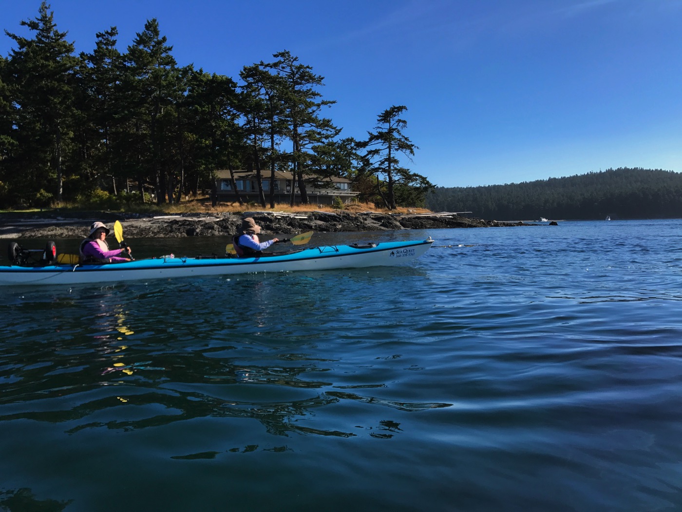
We had to kill time before starting south and around San Juan Island waiting for the tides to change. So we paddled along the coast northward to Eagle Point. It was an easy paddle on calm waters. The morning which had started out rather foggy had cleared up completely by this time. Adam, our guide from Sea Question Kayak Expeditions, is paddling a single-person kayak. Today I am in the bow of a two-person kayak with Dad (Jonathan). Mom (Judy) is in the stern of the second two-person kayak with Rebecca.

Bald_Eagle_1.jpg

Bald Eagle 1

We have had lunch, not far from South Beach, and are continuing south. I couldn’t see this bald eagle from where Dad and I floated but everyone else could. This was just the first bald eagle of the day.

Cattle_Point_Lighthouse_and_Adam.jpg

Cattle Point Lighthouse and Adam

We tried to find a minke whale, paddling out a couple kilometers before heading back towards this lighthouse. Our quest did not succeed though we certainly saw and heard numerous birds and saw a few whale watching boats.

Eagle_at_the_American_Camp.jpg

Eagle at the American Camp

This beach is part of the American Camp. However, I think it might be better to think of it is Eagle Beach. I did get to see this bald eagle. Fantastic. 

Homes_on_San_Juan_Island.jpg

Homes on San Juan Island

We are about a mile from our eventual campsite: one more bay to cross. Homes like this one infrequently dot the rocky coastline.

Mom_at_Camp.jpg

Mom at Camp

At camp. Adam is cooking up a bunch of food for us to consume. Way more food than we can possibly eat. Our tents are set up and Mom is relaxing for a moment. We paddled just over 19km to get here. It’s a good spot for a camp with views of the sea and Mount Baker way off in the distant east. But it is also about as far from the privy.

as you can get: 280 yards.

July 29, 2017 - Day 2'

Most everyone slept well on our first night. Rebecca ended up being a bit cold because she didn’t quite inflate her sleeping pad.  But I think she must have slept well enough because she showed no signs of tiredness during the day that I saw. Mom and Dad were up at sunrise and though I could have gotten up earlier I resolved to not really get moving until 07:00. I almost made it. A lazy morning with a good hot breakfast put together by Adam (dinner had been pasta, mountains of it). We were in no hurry. The sun rose, warmed our camp, and it was obvious we were going to have another fine day to explore. Today we would paddle 19.3km with again two easily hour-long breaks on land. The break on the dismiss of Long Island for lunch wasn’t as comfortable as the rocky beach at american Point but maybe that’s just because the rocks hadn’t warmed up  under the sun. The sandy beach with its huge driftwood logs on Lopez Island was definitely more comfy.

Rebecca,_Jonathan_and_Adam_at_Sea_1.jpg

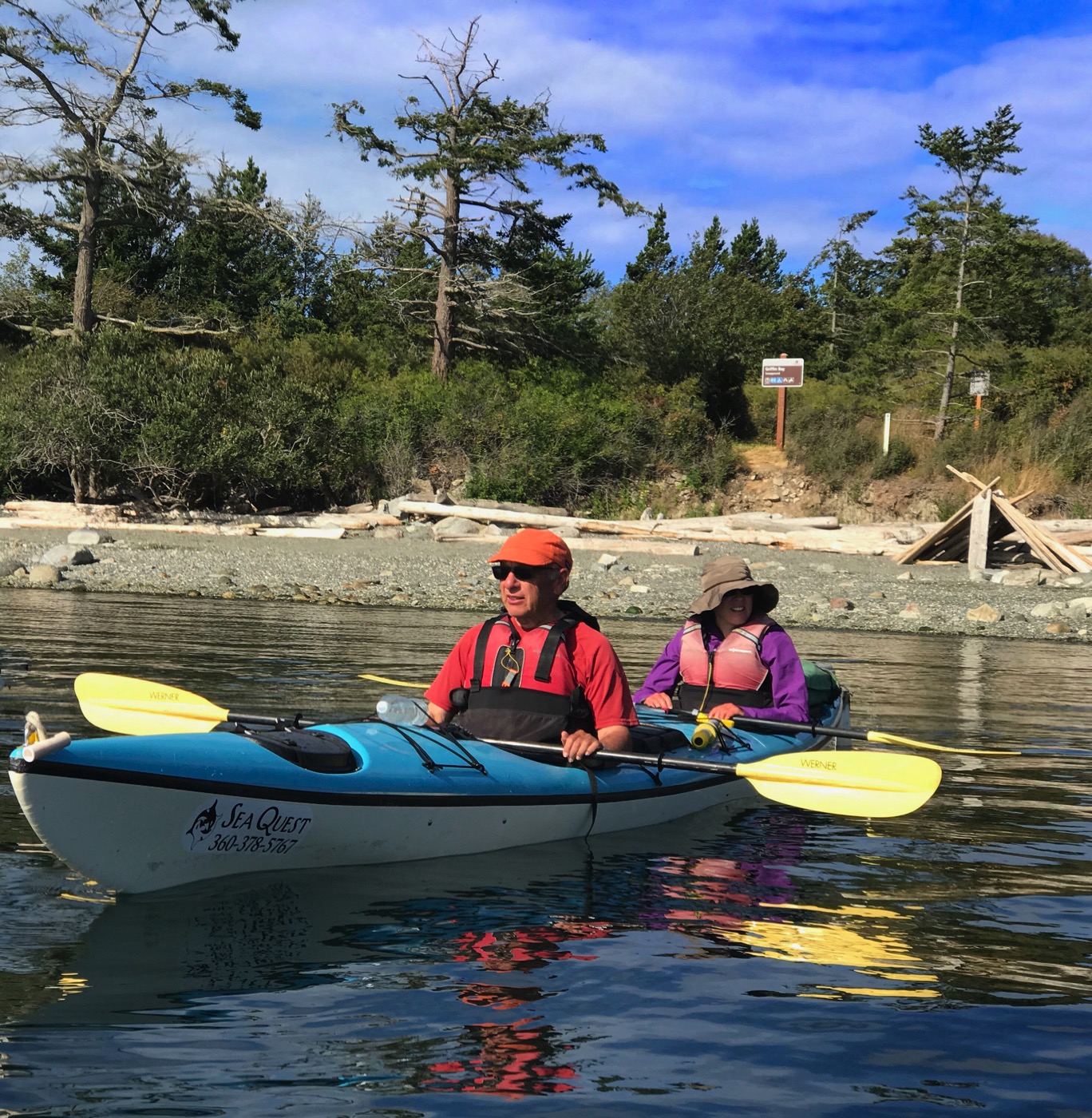
Rebecca Jonathan and Adam at Sea 1

We have had a very good day so far. We paddled out towards Lopez Island’s rocky shore western shore. There we found harbor seals and substantial beds of bull kelp. We continued on to Long Island for lunch. While not the most comfortable rocky beach it was still a good spot. Now we are making our way out searching for whales. You see Adam, Jonathan and Rebecca. Later we return to Lopez Island and a sheltered sandy beach for the afternoon break before returning to camp. Like our first day we would paddle just over 19km.

Eagles_of_Lopez_Island_1.jpg
Eagles_of_Lopez_Island_2.jpg

Eagles of Lopez Island 1 & 2

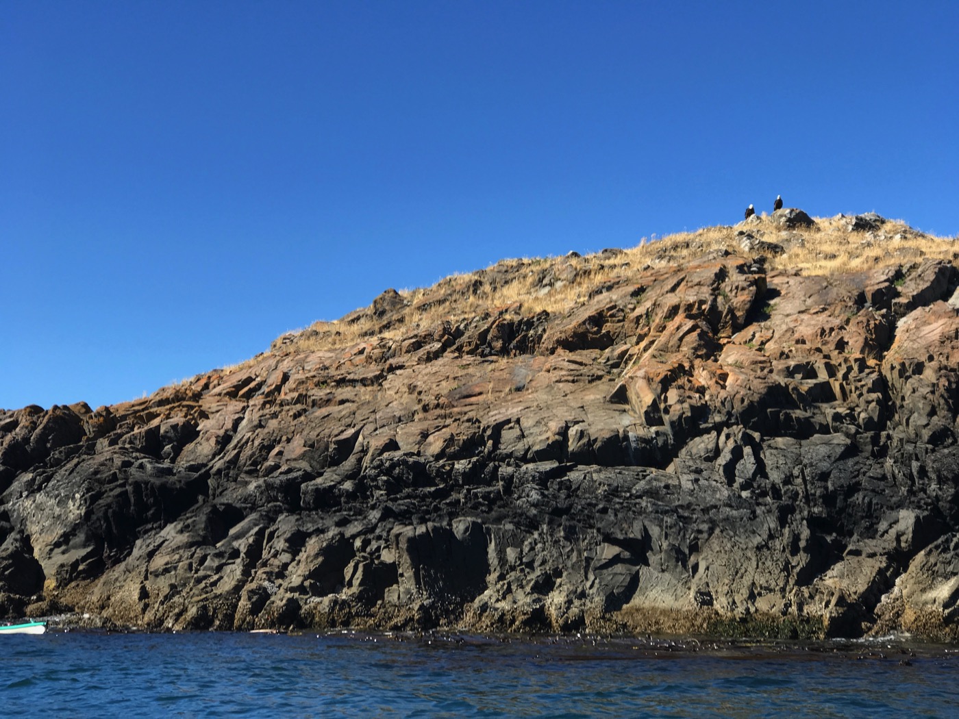
Eagles of Lopez Island

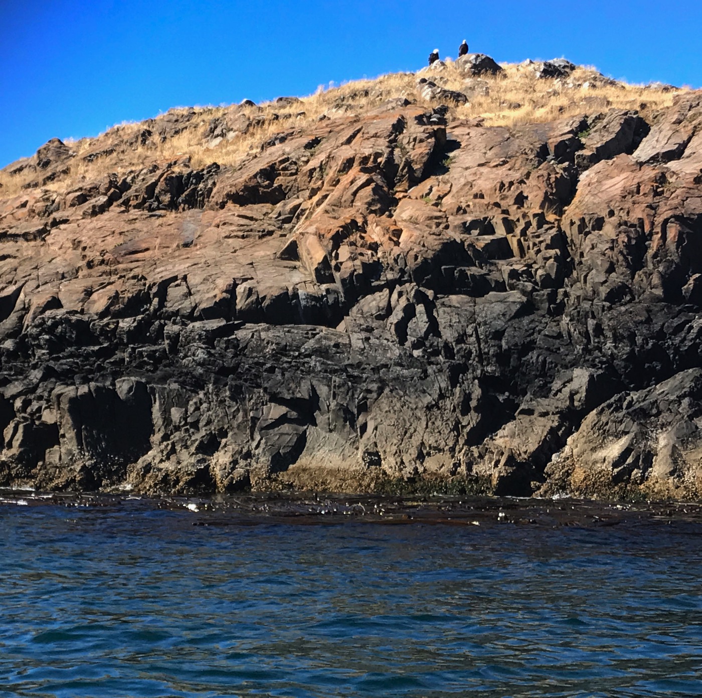
I suppose these bald eagles, that makes 3 I have seen (though not nearly as well as the one yesterday), are either taking a rest or looking out to sea for schools of fish. Maybe they spot the fish by looking for seabirds gathered together. That’s a trick people use to find whales. Soon we will reach a sandy beach on Lopez Island where we take a long afternoon break. The tides figure into where, when and for how long a break will be.

Adam_and_Dad_Make_Fire.jpg

Adam and Dad Make Fire

After another fine day on the way we returned to camp for a second tasty dinner. Yesterday was pasta; today burritos. I think the pasta dinner was better. We picked up driftwood this afternoon for a fire. We didn’t need it for warmth or to really keep bugs at bay but there is still something nice about a campfire. Adam and Dad got it going.


July 30, 2017 - Day 3 

Everyone slept well on our second night. Today people had to be up by 07:00. Mom and Dad were up again at sunrise and I wasn’t far behind. Rebecca managed to sleep in a little bit which she had told us she would do. I’m guessing she isn’t a morning person when she doesn’t have to be. A hot breakfast of eggs got us ready for our short paddling day. Today we would return toSOuth Beach which is about 9.5km from Griffin Bay. The morning was actually partly cloudy. Plenty of puffy cumulus (I think) clouds dotted the rich blue sky. The water was a bit choppier though that didn’t really become apparent until we rounded the tip of San Juan Island and eventually encountered consistent swells of 1-1.5 feet. That added a bit of spice to the paddling but certainly nothing to worry about. We had lunch at the American Camp again but this time instead of staying on the beach most of us took some time to climb to the top of the bluffs and see the old naval radio station up there. After the relaxing lunch break we paddled the last couple of miles to South Beach which we found swarming with people. On Friday when we left there was no one on the beach. On Sunday afternoon around 13:30 the parking lot had quite a few cars in it and several families spending time picnicking and playing on the beach. 

Leaving_Camp.jpg


Leaving Camp

It’s time to leave. We have 9.5-10km to paddle on this final day. The plan is to stop for lunch at the American Camp, where I saw my first bald eagle on day 1, and then continue to the take-out point at South Beach. Since we have a bit of time pressure as Rebecca needs to catch the 3:40 ferry we got up and going a bit earlier on this partly cloudy morning.Adam_at_sea.jpg

Adam at sea

Adam,_Judy_and_Rebecca_at_Sea_2.jpg

Adam Jonathan and Rebecca at Sea 2 

Adam on the left; Dad and Rebecca on the right. The waters are a tiny bit rougher than the day before and the swells would eventually grow to consistently 1-1.5 feet in height sometimes breaking over the bows of our kayaks.

 
Adam Judy and Rebecca at Sea 2Adam,_Judy_and_Rebecca_at_Sea_2.jpg

Adam Jonathan and Rebecca at Sea 2

Working our way through the 1 to 1.5 foot swells that now and then washed over the bows of our kayaks.

Adam,_Judy_and_Rebecca_at_Sea_3.jpg

Adam Jonathan and Rebecca at Sea 3

After an hour-long break at Cattle Point which included a chance to climb up to the top of the bluffs and see the old naval radio station (couldn’t see the lighthouse) we got back in our boats for the final handful of kilometers. The clouds of earlier had pretty much all drifted away. The waters remained a bit rougher but nothing really bothersome. Dad and Rebecca are powering through them with ease and Adam is coming into view.

The_Group-_Ken,_Jonathan,_Judy,_Adam_(guide),_and_Rebecca.jpg

The Group Ken Jonathan Judy Adam guide and Rebecca

Track_Day_3_Griffin_Bay_to_South_Beach.jpg

Track Day 3 Griffin Bay to South Beach (interactive map)