The weekend before rifle deer season and usually right around the birthday of a close friend people would gather at the old Schoolhouse in White Cloud, Michigan for a weekend of conviviality and outdoor fun. We started this tradition November 1999 and up until this year even though the Western Michigan Chapter of the NCTA sold the Schoolhouse we thought we would have our usual Gathering. COVID-19 has thrown those plans out. Paul and Julie took their family (Julie is the birthday girl) up north for a car-camping weekend of fun and one person joined them (Steve) but the Gathering was a non-event this year. Andy Mytys suggested a backpacking trip for the traditional weekend of the Gathering and along with Mike Fogarty and Doug Wood I joined in for this trek of the Waterloo-Pinckney Trail.
This would be a new hike for me. I’ve certainly walked the entire trail in sections before but never backpacked the whole thing. I don’t think I have even set foot on the trail since Andy, John, Dennis, and I set out on a winter solstice at dawn to hike from Big Portage Lake to Lyndon Park probably about 15 years ago. The trail has changed some over the years. While the trail has changed the information about it may not have. You can find sources that give different lengths such as 36 miles long1 and 33.9 miles 2. You will find different distances cited for campgrounds on the trail too. Take this all with a big grain of salt. While I am fully willing to admit that a GPS track has inherent errors in it I do not think my record track is that far off from the actual feet-on-the-ground experience. when you plan a trip keep in mind that the map is only a model of the reality on the ground and that model may be out of date. Over the course of the weekend I logged just over 42 miles. That does include hiking to and from Green Lake and Blind Lake. It includes no doubt some cumulative error though I think that is likley very small. It also includes the unintentional detour Doug and I took on day 1 which likely added about 1.0 mile to our hike. If I had to say what the most likely distance of just the Waterloo-Pinckney Trail is I would suggest 38.5 miles with the biggest discrepancies from other sources being found between BIg Portage Lake and Pines Campground and from Green Lake to Silver Lake. For those that want to dive into the nitty-gritty of how my feet trod the Waterloo and Pinckney Recreation Areas you can view the GPS tracks:
- Big Portage Lake to Pines Campground (November 7, 2020)
- Pines Campground to Green Lake (November 8, 2020)
- Green Lake to Silver Lake (November 9, 2020)
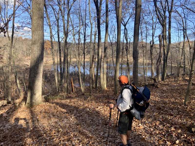
Day 1: Portage Lake to Pines Campground
We hoped to be on the trail by 09:30 and earlier would have been lovely. But no plan survives contact with reality it seems. Andy’s ETA slipped but that hardly mattered because so did everyone else’s ETA. Toss in confusion on how to get to Portage Lake for some and we all were there a little before 10:00. Of course, by this time the already sunny morning had warmed up considerably and Doug proved to be the smartest of us all in that he was already down to pretty minimal layers of clothing. We hoisted our packs, probably all weighing in between, 21-23 pounds with all our stuff and plenty of waternote on water sources, and struck out on the trail at 10:01.
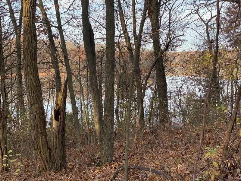
Under the ever-present sound of crunching oak leaves we quickly left the parking lot and some traffic sounds. Now and then we would be treated to the eerie honking calls of Sandhill Cranes flying past. The lake was soon left behind for the rolling hills of the Waterloo Recreation Area. It is easy walking at this point. Navigation is also straightforward early on which is nice. We could relax into the hiking and enjoyment of the unusually warm sunny day. That’s what we did as our gorup spread out into distinct sub-groups with Andy and Mike in the far lead.
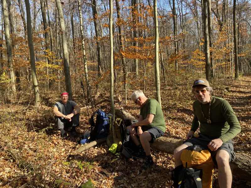
Left to right: Mike, Doug, Andy. Time for a late-morning break.
--November 7, 2020 at 11:17 AM. Grass Lake, MI, United States
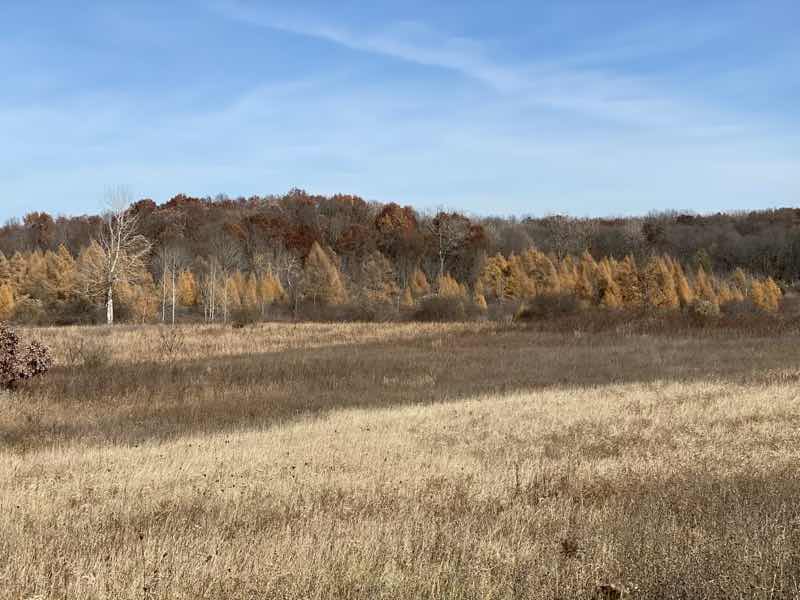
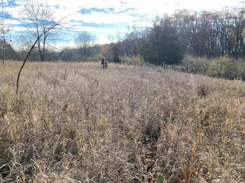
Now and then we will come up on one of these grassy open expenses. They never last long Brar a nice change of scenery.--November 7, 2020 at 1:37 PM. Grass Lake, MI, United States
It was a lovely day and even though the climb up Sackrider Hill seemed to take more out of me than it should have I was enjoying myself quite a bit. Just being outside in these conditions was more than enough reward for a bit of harder work. I am sure everyone else felt the same way. But it couldn’t really last: at least the ease of hiking couldn’t last. Doug and I got into such a nice groove that we failed to make an important turn near Baldwin Flooding. We figured it out, we had suspicions already, when we came to a stream with well over a dozen horsemen and horsewomen with their horses all getting ready to trot through the water. We were completely off the Waterloo-Pinckney Trail. Should we retrace our steps or ford the stream and figure out where Pines Campground was from this point. Doug didn’t want to cross and get his shoes wet. I figured mine would dry and I could just either go barefoot or take my socks off and let the shoes quickly dry. The horse-people had another idea: give us rides across. We took them up on that notion. I made something of a hash of it just getting on the horse. What a stretch. I’m clearly not limber enough to swing my right leg up and over while wearing my pack. I needed a shove. Doug manned the whole affair, actually riding alone on a horse (I sat behind a fellow), far more adroitly than I. I’m grateful for the short ride but I must also say that it was a bit nerve-wracking being up there swaying back and forth.
After that we made fine time until I belatedly realized my glasses had fallen off. Doug scampered on back to the stream where the horse-people still were and they had found my glasses. What a surprise. But with our navigational goof and this final mishap we still hauled ourselves and our gear into camp around 16:30. What a day: and we still had camp chores including dinner to contend with.
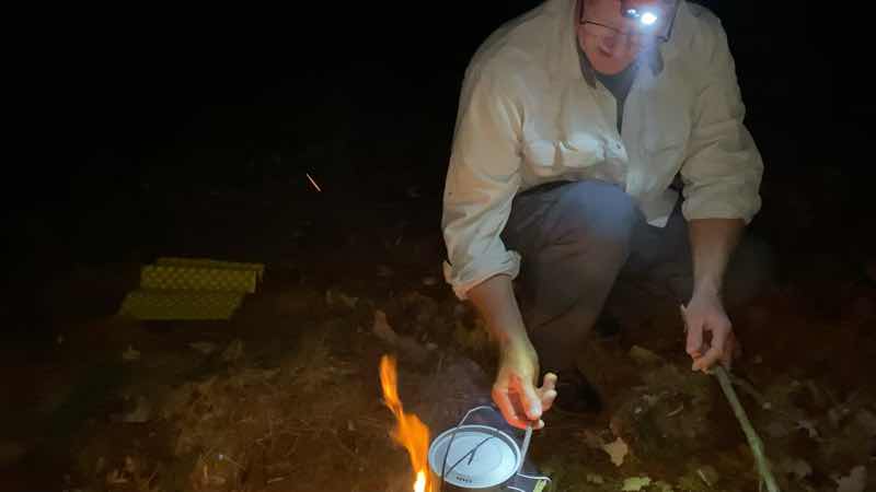
We all fiddled with the fire in my Firebox G2 Titanium 5” stove (Mike’s going at it ) . It’s always a bit surprising how quickly it burns out. I think to really use it well it requires wood of much greater thickness than we used. Obviously you can cook with the stove but you need to provide lots of TLC to do it properly. We are nowhere, especially me, as competent with fire as say the stove’s creator is. But it did work.
--November 7, 2020 at 6:50 PM. 12891 Trist Rd, Grass Lake, MI, United States
I brought the 5-inch titanium Firebox stove on this trip to play with. This is not normally how I would cook. Making a wood-burning fire that you can cook on takes a lot of work. I broke up sticks into various sizes and it was not enough. Andy broke up more. We fiddled with the fire and it burned hot and too fast. Maybe if we had used much larger chunks of wood, akin to a fire torch approach, we could have done better. But my faux-quessedillas came out pretty well. My apple crisp-like dessert got burnt but the parts that did’t burn were quite tasty. Doug shared a lovely turmeric tea (think that’s right) with all of us. But by about 20:00, as we listened to the church group in the other campsites repeatedly pray to Mary, we crawled into our various shelters and sleeping bags to go to sleep.
Day 2: Pines Campground to Green Lake
Doug’s ankle had been bothering him the pervious day and he decided to play things safe and bail out. He would hike minor roads (maybe hitch) back to his car. He declined any offers to keep him company and no one pushed it. He was off pretty early on and Andy not far behind. Mike and I took a bit longer but we set out on the trail at 09:00 which was pretty good and could have been quicker had MIke and I not elected to have hot breakfasts (oatmeal takes forever to eat it seems).
During the night the temperature dropped down to the low-mid 40s. I slept well in my Enlightened Equipment 50F quilt within my silk liner. Andy was probably wearing his usual sleeping clothing, long johns, and maybe a bit more under his tarp within a Serenity bug bivvy and he said he was comfortable too. That’s high praise given he sleep colder than I do. throughout the night we heard coyote yip and bark in the distance. I suppose they caught something. Some type of owl hooted but I couldn’t tell what it was. When the sun rose we heard Sandhill Crane cry as they flew south.
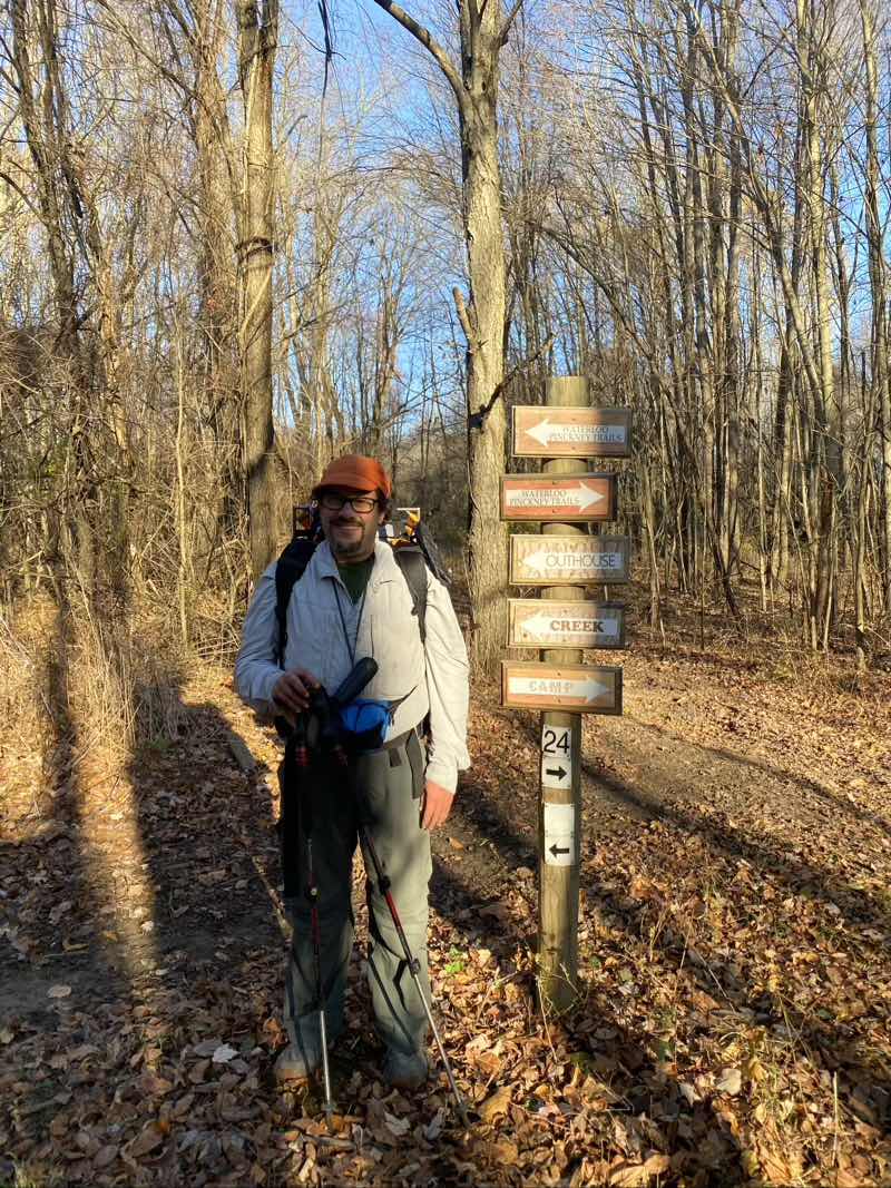
We could certainly wish for more signs like this later on. There are numerous side trails that connect to the Waterloo Pinckney Trail. In this area they are predominantly horse trails and with signage is present and maintenance done is typically done by the local Horsemens Association. It can get quite confusing. Photo by Mike Fogarty
--November 8, 2020 at 9:08 AM. Grass Lake, MI, United States
The hiking in the vicinity of Pines Campground and for quite a few miles around is upon sandy trail. Numerous trails form loops that intersect with the Waterloo-Pinckney Trail. It’s something of a mess. If you don’t have a decent map and ability to locate yourself either with solid knowledge of the area, a GPS, or both you can easily got confused. The footing on the trails just adds to the irritating nature of the hiking here. Horses just beat trails up.Mike and I were up to the task and did not get confused. We were very happy when the horse-riding trails subsided as we slowly approached Clear Lake and the Waterloo Recreation Area headquarters: lunch spot.
We didn’t meet quite as many people on horseback during the morning as we hiked but that’s probably only because we were hiking out of the domain of the horse and rider. At our lunch spot we settled in for a time to relax and eat what we had. A few people came on by and asked what we were doing. Quick chats. A fine way to spend time outside. But after probably more than enough time had elapsed we gathered up our packs and struck out once more towards Green Lake. For time time we kept company with a young lady and her new puppy. That was a nice bit of conversation. But she was going to turn off in time, as her pup was flagging just a bit, and we would keep on heading towards camp.
The trail footing is so much better once you leave the domain of the horse. No ruts. No sand. The trail rises and falls through many small hills which you notice as you climb them (more descend as you worry about slipping). The literature suggests that the trail mileage between Pines and Green Lake is 12.5 miles. That’s likely a bit short but probably not by more than 0.5 miles. But it’s a tough 13.5 miles even though none of the hills is really much to write home about. Andy was at camp well before me. Mike wasn’t far behind Andy. I arrived at 16:30. By the time I showed up it was cooling down a litle bit. Our sunny day was still going pretty strong and the high was well into the mid-70s. It was nice to relax and get ready for our second night. I fully planned on eating my pasta dinner, using the alcohol stove, but Andy had other ideas. Chelsea is only about 5 miles away and surely a pizza place would deliver to the campground. Well our first place we called doesn’t do delivery but Jets did and so a large Detroit-style pizza was ordered. Took something like an hour to reach us but we enjoyed the special treat - pizza was OK not great - of ordered food. I suppose we stayed up later because of the late dinner but we had nowhere we needed to be. A fine way to end the day.
Day 3: Green Lake to Silver Lake
This is as gooda view of Green Lake as I would get.
--November 9, 2020 at 8:32 AM. 18347–18505 M-52, Chelsea, MI, United States
Our final day and it was going to be the longest day even by the data we gleamed from the literature. That suggested a distance of 13 trail miles so 13.5 miles from our campsite. I had my doubts. We planned to be on the trail bight eyed and early and have breakfast at the pavilion in Lyndon Park which the literature suggests was only 2.0 trail miles distant. There is what the map presents and then what the feet trod. Their was a great difference this morning. The map didn’t show the re-route that was made to avoid having to cross M-52 and then walk up a private drive. That re-route takes you down a paved bike path about 0.5 miles to a tunnel which then if you are paying close attention as you walk the continuing paved path has an unmarked trail leading east into the woods. That’s the trail you want to take and it will link up with the “old” Waterloo-Pinckney Trail in 0.5 miles. We missed that turning. Andy and I decided to strike out for new territory and find the trail via bushwhacking. Mike wasn’t keen on that idea as he was worried about marshy ground so turned back to find what we clearly missed.
We have climbed Stofet Hill and are making our way along deer trails towards the Waterloo-Pinckney Trail. Andy braves a path through the tall grass. Here we avoid slipping on leaves though the grass does hide branches to trip over.
--November 9, 2020 at 9:10 AM. Chelsea, MI, United States
Andy and I soon found a trail that would climb through rasberry bushes and other brush slowly gaining the near-top of Stofer Hill. As we climbed we learned Mike had found the trail and was making good time. We held out a faint hope that we’d be faster than him and could get to Lyndon Park first but I suppose that was foolish. Our semi-maintained trail faded away to be replaced by game trails that we managed to follow pretty well. No marsh. We came into a meadow and knew that the Waterloo-Pinckney was not too far away. Just keep heading the way we were going and we would hit the trail. We did. Our extra exploration certainly added distance to our day; Mike’s did too. The re-route had we found it straight off would have as well though a bit less. Everyone had fun and we all reached Lyndon Park eventually though Mike was well ahead of us.

Our warmest if not quite clearest day. But I think the clouds make the sky stand out more above this wet grassy area.
--November 9, 2020 at 11:00 AM. Chelsea, MI, United States
We spent too long at Lyndon Park. It’s not as though we had big deal breakfasts we just dawdled. Over the course of the entire day we would take 2 hours and 16 minutes of breaks (that’s my breaks; bet Andy and MIke got more). Breakfast and lunch took up the bulk of those pauses and while they probably were worth it (lunch for more so as it was prettier) we probably should have taken those breaks in more even chunks. The strategy of taking a short break every hour or so instead of a couple huge breaks and several short ones now and then really does have a lot to recommend it.
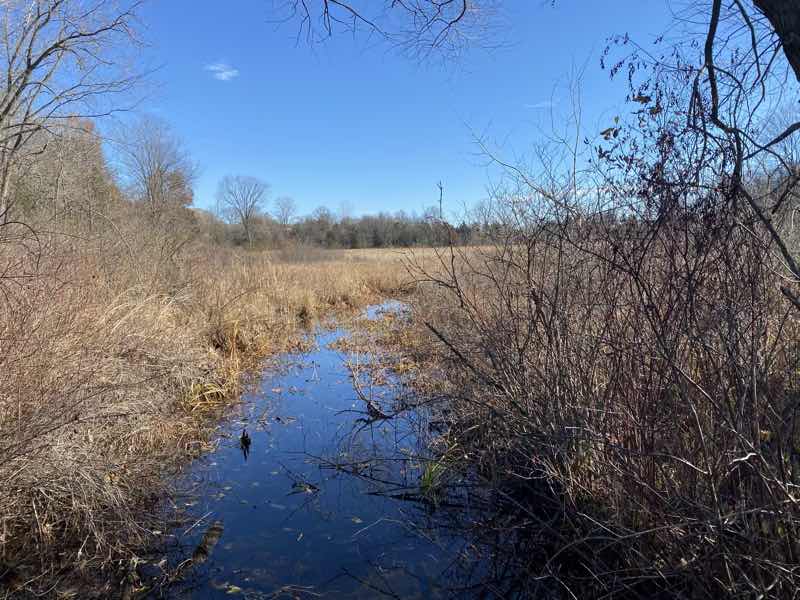
Carry a bucket or other water carrier you can attach a line to ( or has a long enough strap already as my Sea to summit bucket does) to fetch water from spots like this.
--November 9, 2020 at 12:04 PM. Gregory, MI, United States
It was our warmest day yet and I suspect we all felt the need for water. I know I certainly did. Too bad treating water, using my Sawyer Mini in this case, seems to always take longer than you would wish. I should’ve brought the Katadyn BeFree instead and I certainly can see the appeal of UV-light purification systems that take only a minute. I’m just not sure I trust them as I saw them break in the past. However, that past is a decade ago and I know the technology has improved since then and people whose outdoor expertise I trust use them.
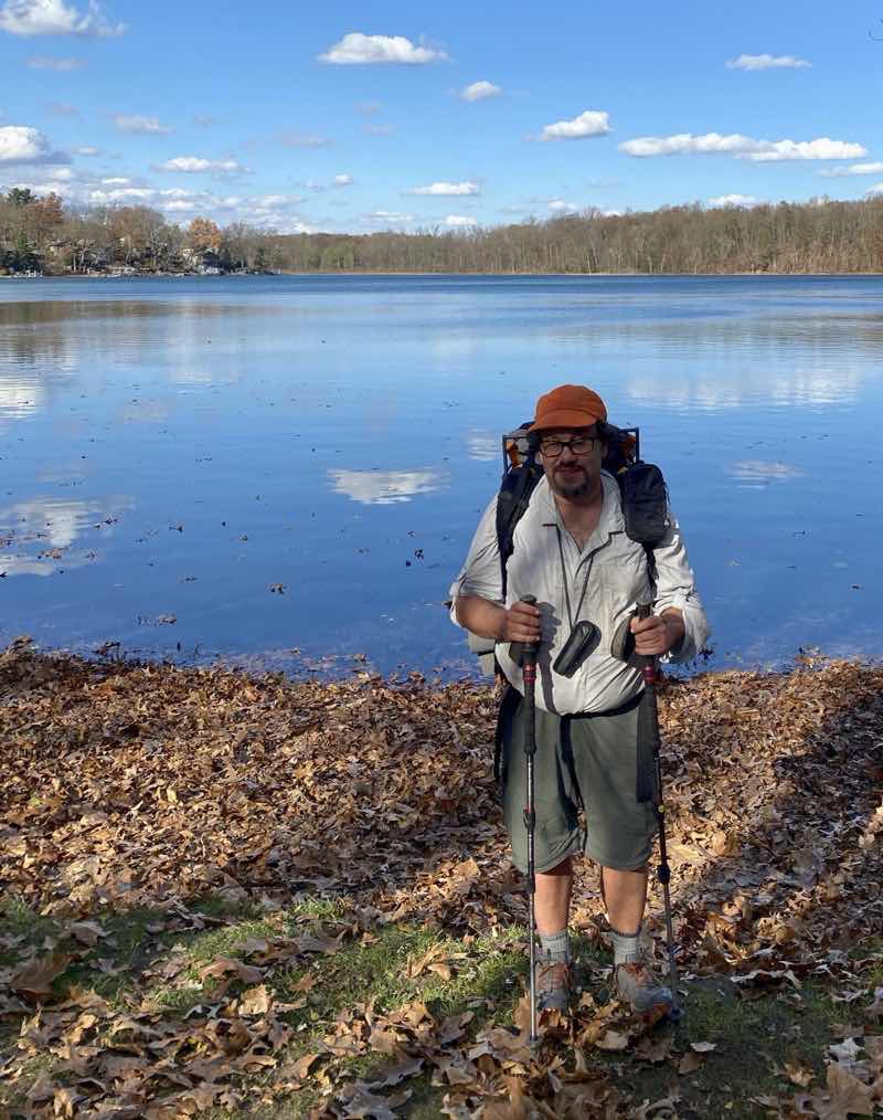
Ken after lunch at Blind Lake. It’s worth the 0.25-mile walk down to the lake for a relaxing break. If you’re lucky you will spot bullfrogs and leopard frogs as Mike and Andy did. Photo by by Mike.
--November 9, 2020 at 1:53 PM. Gregory, MI, United States
I believe this is Dead Lake. Does that mean we shouldn’t get water from it? We just walked on by. Photo by Mike.--November 9, 2020 at 2:32 PM. Gregory, MI, United States
We marched on and on. Andy and Mike pulling ahead and waiting for me to catch up. Blind Lake, Dead Lake, Pickerel Lake. They slowly came and went and we plodded on. Had we wanted to not walk the whole Waterloo-Pinckney (OK, we already blew that) Trail we could have shaved at least a couple miles off the hike by not following the Potowatomi Trail all the way. But that wasn’t the choice we made. With little fanfare we worked our way past the last unnamed lake, through a lovely pine grove, and then to the rocky bit that lasts at most a tenth of a mile before ending at the parking lot for Silver Lake. You don’t even see the lake. Sunset was just past and twilight was settling in as we quenched our thrist with iron-tasting water at the Silver Lake pump. The hike was complete.
Gear List
This was put together a bit haphazardly but is substantially complete and accurate. As you can see the wood-burning stove is a huge weight. An alcohol stove, like my Evernew titanium Trangia-style burner with Trangia simmer ring (carried but I forgot to put in the list) with fuel weighed 120 grams. Had I gone solely alcohol I’d have carried more fuel but the total would likely have been only a third as heavy at most.
| Gear | weight(grams) |
| ZPacks Solplex with 8 stakes | 500 |
| NeoAir xtherm | 455 |
| Enlighten Rquipment 50 | 290 |
| Design Salt Silk Liner | 115 |
| Vargo ExoTi 50 Backpack | 1465 |
| Kitchen | |
| Firebox G2 titanium 5” with 4 firrsticks and Cordura Pouch | 580 |
| Self Reliance 1L Titanium Pot | 160 |
| Kieth Titanium Mug | 55 |
| frypan (no handle) not sure if it’s an MSR or Trangia | 125 |
| Pot lifter | 20 |
| Trimmed Fat Daddio 4x2” baking dish from Flatcat Gear | 60 |
| Stuff Sack | 20 |
| Fork/spoon | 5 |
| Firebox leather gloves | 95 |
| smart wool t shirt | 80 |
| 2 pairs socks | 120 |
| Underwear | 70 |
| Buff | 35 |
| Packa rain jacket | 255 |
| Kuiu Peleton 97 L hoodie | 140 |
| 10,000 Anker battery | 215 |
| Petzle bindi lamp | 34 |
| Garmin inReach | 130 |
| Microphone | 68 |
| Tripod | 194 |
| Phone mount | 96 |
| Compass, knife, fire starter | 120 |
| Wallet baggie (cash, ID, credit card, insurance card, emergency info) estimate | 92 |
| Toiletries , first aid | 205 |
| Trowel, tp, sanitizer, body glide | 140 |
| CNOC 2L bladder | 90 |
| Sawyer mini and back flush syringe | 80 |
| Sea to Summit bucket | 65 |
| Gear weight (g) | 6174 |
| Food bag (Sea to Summit waterproof with OP sack and bear hang kit) | 100 |
| Food estimate | 2100 |
| Starting water | 2000 |
| total estimate (g) | 10374 |
| Wearing | |
| Hiking pants, undies | 390 |
| REI long sleeve shirt | 230 |
| T shirt | 70 |
| Socks | 60 |
| Altra Lone Peak 4 | |
| Wintergreen hat | 34 |
| Monocular | 98 |
| Worn total | 882 |
-
just really two reliable sources of water. One is at a decommissioned dam just east of Willis Road about 3 miles from the trailhead. The second about 0.5 miles west of Pines Campground ↩︎
No comments:
Post a Comment