Wednesday, February 19, 2025

The First Half of Our February 2025 Arizona Trip

The Musical Instruments Museum
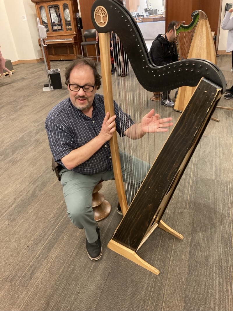
Photo taken Feb 15, 2025 at 11:43 AM

Probably the only time Ken will ever pluck a harp string. Experience Gsllery of the Musical Instruments Museum. Photo by Jonathan

--February 15, 2025 at 11:43 AM.

Maps are centered on the photo: Google map, Apple map, OpenTopoMap map

Tucson

Pink Hills Area

Our first, but probably not last, hike in the Pink Hills area.
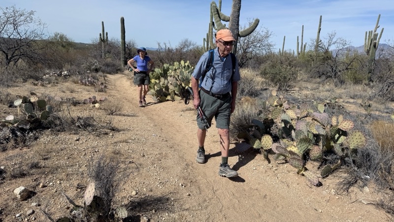
Photo taken Feb 16, 2025 at 11:21 AM

About 2.3 miles into our loop hike. There are many ways to enlarge or shrink the loop since the trails are numerous and interconnected. Our hike would span 5.6 miles. Vistas of desert brush, 4 horses with their riders, and at least a dozen hikers mostly seen in the later portion of the hike, added spice to a lightly hazy but eventually near 80 F day.

--February 16, 2025 at 11:21 AM.

Maps are centered on the photo: Google map, Apple map, OpenTopoMap map

The Bowen Stone House

Parking at the Camino de Oeste Trailhead we could go as far along this trail as we wished. There are several trails in this area so options for a variety of hikes abound. Today we expected we would keep it short and easy with Sherry and Ruby Bowen’s stone house remains as the goal.

An animated map view of what we did is here.
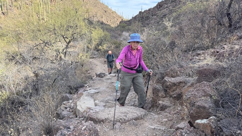
Photo taken Feb 17, 2025 at 9:21 AM

The trail lays next to a wash that I think could be easier to walk than these short sets of rocky steps we find now and then.

--February 17, 2025 at 9:21 AM.

Maps are centered on the photo: Google map, Apple map, OpenTopoMap map
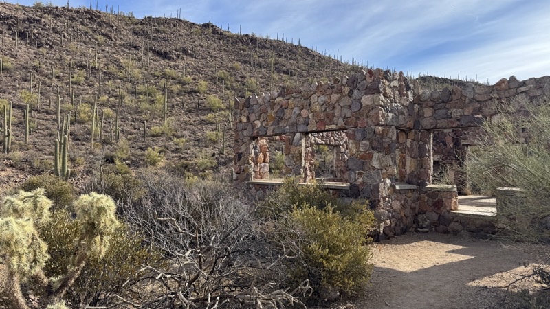
Photo taken Feb 17, 2025 at 9:54 AM

Sherry and Ruby Bowen lived here from 1931 to 1943. Their homestead grew to cover 2,000 acres. I’ve no idea where they got water for the house.

--February 17, 2025 at 9:54 AM.

Maps are centered on the photo: Google map, Apple map, OpenTopoMap map
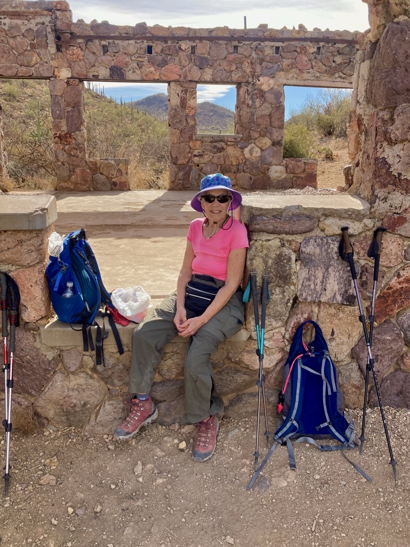
Photo taken Feb 17, 2025 at 10:00 AM

Mom is feeling less than perfect so a chance to sit down at what turns out was the entrance to the house was welcome. Photo by Jonathan

--February 17, 2025 at 10:00 AM.

Maps are centered on the photo: Google map, Apple map, OpenTopoMap map
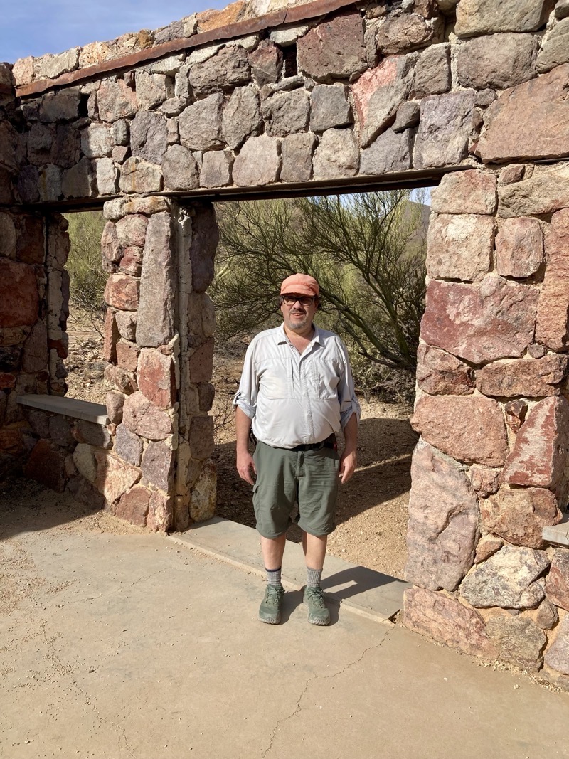
Photo taken Feb 17, 2025 at 10:04 AM

Ken. Inside the just over 1,000 square foot home. Photo by Jonathan

--February 17, 2025 at 10:04 AM.

Maps are centered on the photo: Google map, Apple map, OpenTopoMap map

Painted Hills Trails Park

This city park is very close, especially considering how things sprawl here,to where we are staying. We didn’t know of this park until now. We wanted a short hike and we achieved that goal. However, we ended up not doing what we had planned doing. But this little park is still a nice place to visit.

The animated map view is here.
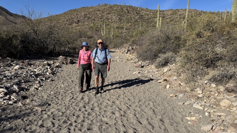
Photo taken Feb 18, 2025 at 9:21 AM

Hiking along a wash in Painted Hills Trails Park. It’s greener, which is not saying much, here than the other places we have been this trip.

--February 18, 2025 at 9:21 AM.

Maps are centered on the photo: Google map, Apple map, OpenTopoMap map
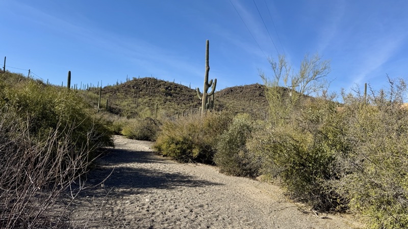
Photo taken Feb 18, 2025 at 9:43 AM

We definitely missed the trail intersection and followed this deep sandy wash for 0.3 to 0.5 miles. This view is on our return journey just after it began.

--February 18, 2025 at 9:43 AM.

Maps are centered on the photo: Google map, Apple map, OpenTopoMap map

Agua Caliente

We have been here before but I don’t recall the place. The stand-out feature is the not-quite-hot spring-fed pond that flows into two other ponds. The spring is reportedly 87 °F. Back at the start of the 1900s people came here to soak in the warm waters for their health. Today just fish, ducks, and turtles use the ponds. Other fauna, including venomous creatures some signs warn about, make this 101-acre park home.
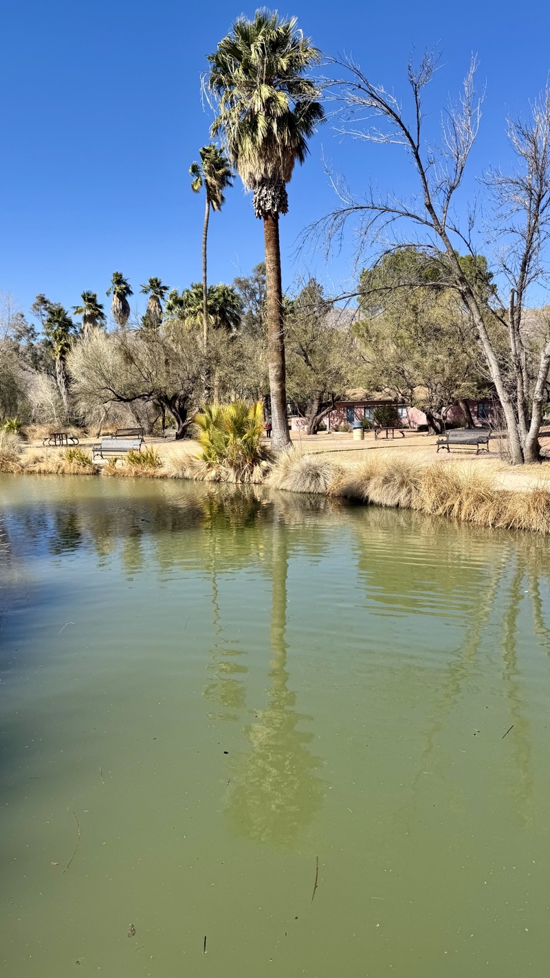
Photo taken Feb 18, 2025 at 2:31 PM

Agua Caliente is a 101-acre park. The spring pups out warm water, about 87 °F I believe, into Pond One. There is water flow to the two other ponds: Pond Two and Pond Three.

--February 18, 2025 at 2:31 PM.

Maps are centered on the photo: Google map, Apple map, OpenTopoMap map
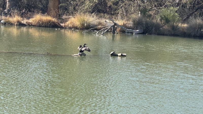
Photo taken Feb 18, 2025 at 2:34 PM

I am fairly sure this bird drying its wings is a duck of some type. Besides several ducks Pond One hosts turtles and fish. I am pretty sure everything is non-native.

--February 18, 2025 at 2:34 PM.

Maps are centered on the photo: Google map, Apple map, OpenTopoMap map
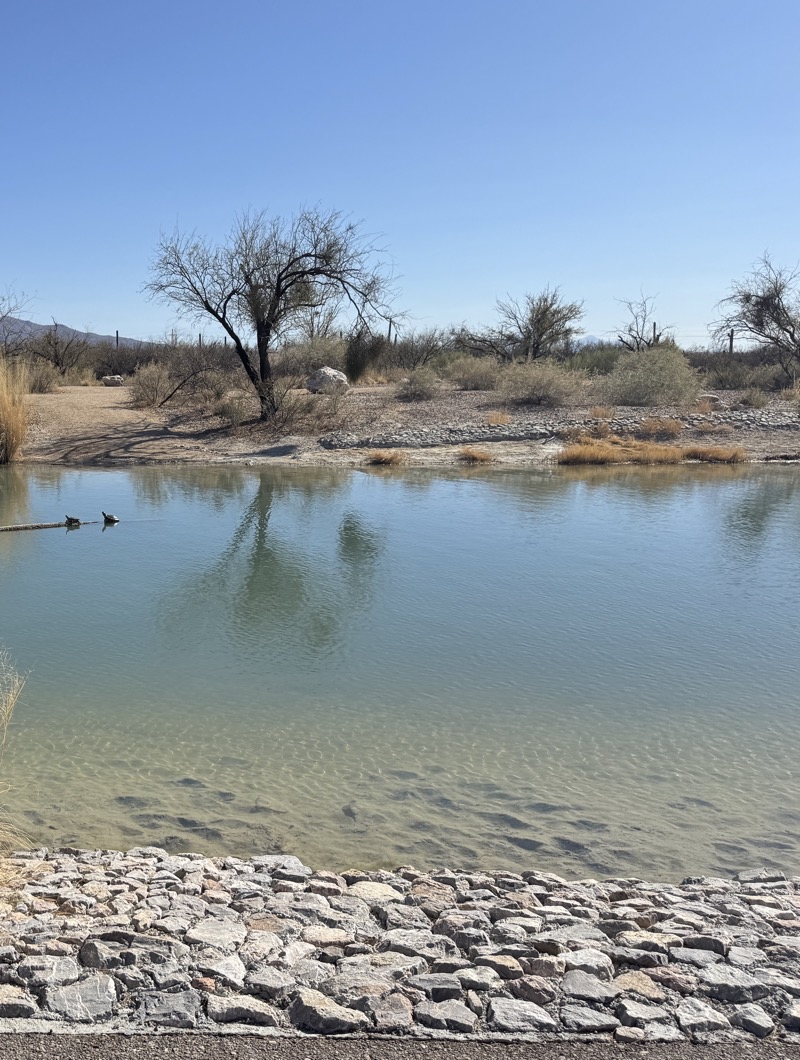
Photo taken Feb 18, 2025 at 2:51 PM

There are a few logs placed in the ponds. Clearly a perfect place to warm yourself under clear blue skies especially if you happen to be a turtle.

--February 18, 2025 at 2:51 PM.

Maps are centered on the photo: Google map, Apple map, OpenTopoMap map
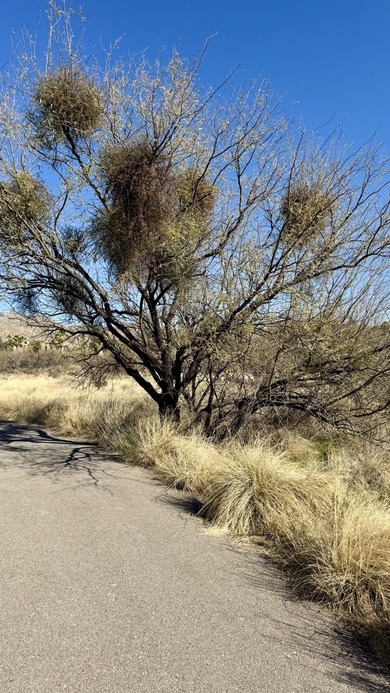
Photo taken Feb 18, 2025 at 2:56 PM

The fuzzy parts of this palm tree are, I believe, mistletoe. Apparently mistletoe grows into the bark of the tree, causing stress and eventually killing the tree according to the horseback lady we met a couple days ago because it has been so dry there’s actually been more mistletoe growingon trees causing damage.

--February 18, 2025 at 2:56 PM.

Maps are centered on the photo: Google map, Apple map, OpenTopoMap map

Sunday, January 12, 2025

Mangrove Tunnels of Lido Key

This is our final day in Sarasota and it is a lovely day of sunshine and warmth. The previous 3 days have been quite cool, chilly by Florida standards, and overcast. Today is bright, clear, and steadily warming towards a high around 71°F. Our only concern is that it is a bit windy and that could make kayaking the mangrove tunnels of Lido Key less fun. However, we decided to to drive over there and hope that by late-morning conditions would improve and be more than suitable for our self-guided paddle in the shallow waters that make up these bays dotted with islets and the tunnels of mangroves.

When we arrived at the kayak rental point it was still a bit blustery and not quite as warm as we wanted so Mom and I took a short walk while Dad waited at the car. Most of the trails in the Ted Sperling Nature Park are currently closed this short trail that follows a dandy path and crosses several bridges took us out to an overlook near tunnel number 2. A pleasant walk that used up enough time that by the time we returned it was clear that this was going to be a fine day for our paddle. We set off with Mom and Dad in two-person sit-on-top kayak and I had a single of the same style boat.

On busier, probably warmer, days there are several kayak companies that rent boats for self-guided paddles or guided tours. When we we getting our boat just one company was there. We wondered how they decide when to rent boats. We never did find out. However, we did learn that hurricane Milton did indeed thoroughly swamp the key with wanter and deposited sand all over the place where sand shouldn’t be. Considering the amount of damange done I think it is remarkable they’ve cleaned so much up in the 3 months since the storm. Perhaps that is why many trails are curretnly closed. However, for our purposes of paddling you would not know a major storm had wrought so much destruction.

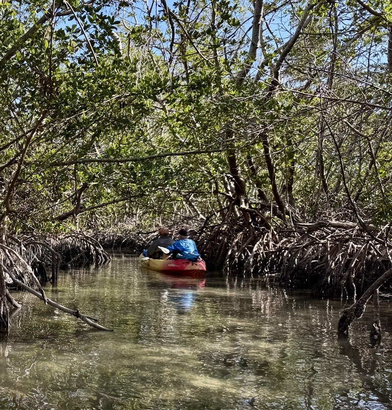
I’ll let the photos tell the story of our paddle. This is an easy paddle of about 3 miles if you just choose to pass through most of the tunnels, pause for lunch on the beach, and return. You could extend the paddle by venturing out into Sarasota Bay as the guided tours do but it’s not what we wanted to do. I’ll just add that you should wear shoes, if you do, that you are willing to soak. You’ll get your feet wet entering and exiting your kayak at places you want to do so. And you could always find yourself unexpectedly stuck on a sandbar or shoal as the waters are frequently quite shallow. This happened to me after we made a wrong turn in tunnel 4 that took us to a bridge and then out into the bay where I hit a too-shallow spot as we paddled back to tunnel 3. I had to get out and walk my boat off the shoal, just a few yards, before getting back in. At least the water at that spot was quite a bit warmer, probably because it was so shallow and in full sunlight, than the water at the put-in point.

Photos

Photo taken Jan 10, 2025 at 10:57 AM

There are five mangrove tunnels. I think this was the first.

—January 10, 2025 at 10:57 AM.

Maps are centered on the photo: Google map, Apple map, OpenTopoMap map

Photo taken Jan 10, 2025 at 11:01 AM

Exiting a mangrove tunnel. For some reason the tunnels are marked with much more visible buoys than at the boat launch site.

—January 10, 2025 at 11:01 AM.

Maps are centered on the photo: Google map, Apple map, OpenTopoMap map
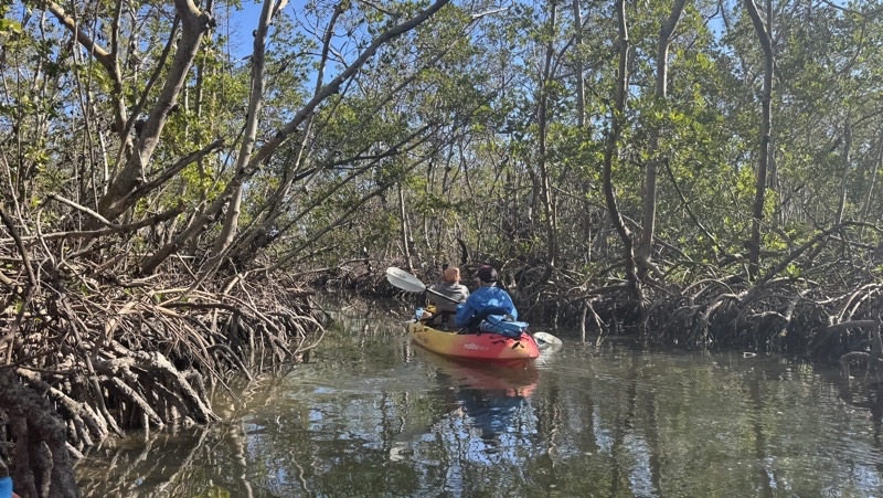
Photo taken Jan 10, 2025 at 11:06 AM

Ken. The water here is quite shallow. In fact, there are places where it is possible to run aground. That would happen later on to Ken after exiting tunnel 4 route to the beach lunch spot. Photo by Jonathan.

—January 10, 2025 at 11:06 AM.

Maps are centered on the photo: Google map, Apple map, OpenTopoMap map
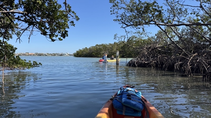
Photo taken Jan 10, 2025 at 11:24 AM

Mom and Dad lead the way into one of the mangrove tunnels. There is a current in them so if you’re going with the flow you really need only steer. This time we had to actively paddle. The tunnels can be quite narrow and it’s unlikely you can get through without bumping foliage with your paddle or boat: at least I find it so.

—January 10, 2025 at 11:24 AM.

Maps are centered on the photo: Google map, Apple map, OpenTopoMap map
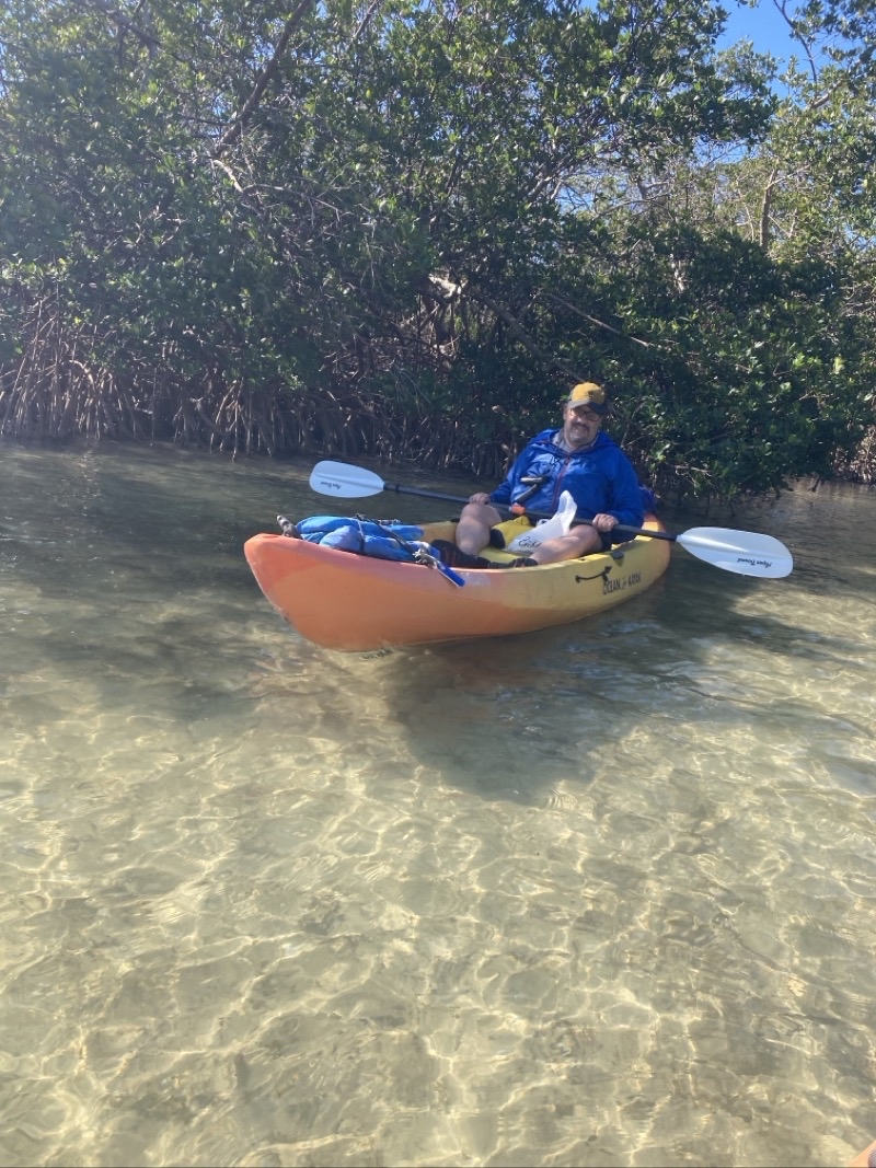
Photo taken Jan 10, 2025 at 2:59 PM

It’s time to get back in the kayaks and paddle back to the boat launch point. The water feels warmer here.

--January 10, 2025 at 2:59 PM.

Maps are centered on the photo: Google map, Apple map, OpenTopoMap map
Thursday, January 9, 2025

Deep Hole - Myakka River State Park

Our week here in Sarasota is coming to a close. A couple of the days have been decidedly cool, even chilly by Florida standards, and cloudy. Those days were certainly less than welcomed by us. We have taken a few walks along the beach and done some other little exploration. However, today was our first foray into new territory: The Deep Hole of Myakka River State Park.

This is just above a 5-mile roundtrip hike thorough prairie in a 7,500 acre nature preserve that includes Lower Myakka Lake. It’s certainly a different kind of area than anything I have seen before in Florida. It isn’t beach, urban sidewalks or parks, certainly not wetlands. The greatest amount of sound was probably, sadly, the rumble of traffic which grew fainter as we traveled farther from the trailhead. Now and then I heard birds but they were few and far between. Perhaps that’s because trees were few and far between too. At the shore of Lower Myakka Lake I certainly heard more. If the alligators made any sound it went unnoticed.

There were certainly quite a few alligators soaking up warmth from the sun as it rose through a clear blue sky and the air temperature steadily increased throughout the upper 50s. People have counted upwards of 200 alligators but the number we saw was considerably less. If you hope to capture photos of them bring a good really long zoom lens. I count myself lucky my snapshots are as good as they are with the 5x zoom on my iPhone 15 Pro Max. Viewing them with my 10x monocular was certainly more impressive.

This is a hike I recommend taking. But you should arrive at the park as early as you can manage because they limit access to 30 people per day. You are provided with a permit and instructions on how to enter the nature preserve. They appear to be serious about this and do require you return your permit so they can be sure everyone that goes in comes out again. I was a bit surprised they didn’t have a ranger checking out permits along the way but perhaps they do just not all the time.

I hope you enjoy the photos and 3D “fly over” you will find below.

A 3D flyover of our hike through the prairie which lead us to Lower Myakka Lake and its Deep Hole.

Photos

Photo taken Jan 9, 2025 at 10:21 AM

I think there have been on average 7 alligator attacks per year on humans throughout Florida since records have been kept by the Florida Fish and Wildlife Conservation Commission since 1948. Over that time 26 fatalities were counted. Here in Myakka River State Park has had none and only a small number of incidents.

--January 9, 2025 at 10:21 AM.

Maps are centered on the photo: Google map, Apple map, OpenTopoMap map
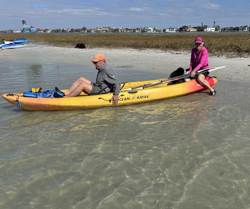
Photo taken Jan 9, 2025 at 10:27 AM

The trail to Deep Hole travels through prairie. It’s a dry prairie that I think they burn every couple years. The park limits access to Deep Hole to 30 people per day on a first-come-first-served basis.

--January 9, 2025 at 10:27 AM.

Maps are centered on the photo: Google map, Apple map, OpenTopoMap map
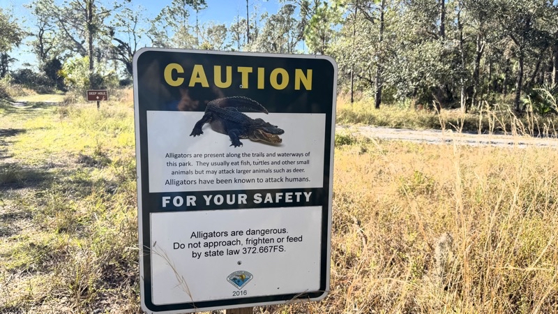
Photo taken Jan 9, 2025 at 10:33 AM

We have walked about a half mile. The trail is generally made of packed sand though soft spots like incomplete beach sand pop up now and then. Now and then a tree pops up too.

--January 9, 2025 at 10:33 AM.

Maps are centered on the photo: Google map, Apple map, OpenTopoMap map
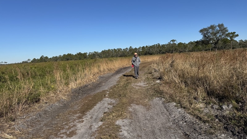
Photo taken Jan 9, 2025 at 11:22 AM

We were all expecting a deep hole with some water at the bottom. If I had looked at a map perhaps I would not have been misled. The deep hole is a 130 feet deep section of Lower Myakka Lake. Here, looking south, we see alligators.

--January 9, 2025 at 11:22 AM.

Maps are centered on the photo: Google map, Apple map, OpenTopoMap map
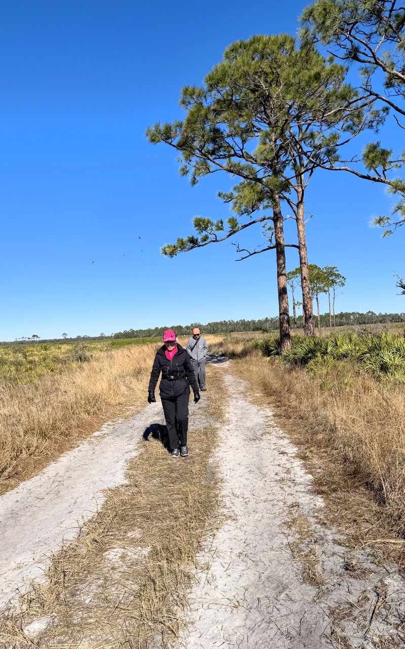
Photo taken Jan 9, 2025 at 11:22 AM

Looking to the east a couple hundred feet away are numerous alligators warming up in the sun.

--January 9, 2025 at 11:22 AM.

Maps are centered on the photo: Google map, Apple map, OpenTopoMap map
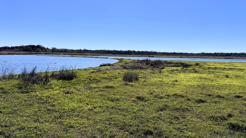
Photo taken Jan 9, 2025 at 11:22 AM

Look closely for the white bird standing at the water’s edge in front of all those alligators.

--January 9, 2025 at 11:22 AM.

Maps are centered on the photo: Google map, Apple map, OpenTopoMap map
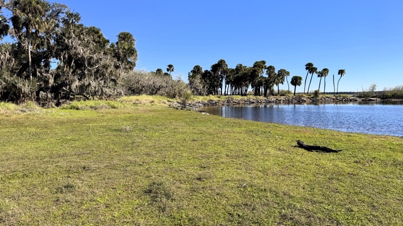
Photo taken Jan 9, 2025 at 11:22 AM

A close-up view.

--January 9, 2025 at 11:22 AM.

Maps are centered on the photo: Google map, Apple map, OpenTopoMap map
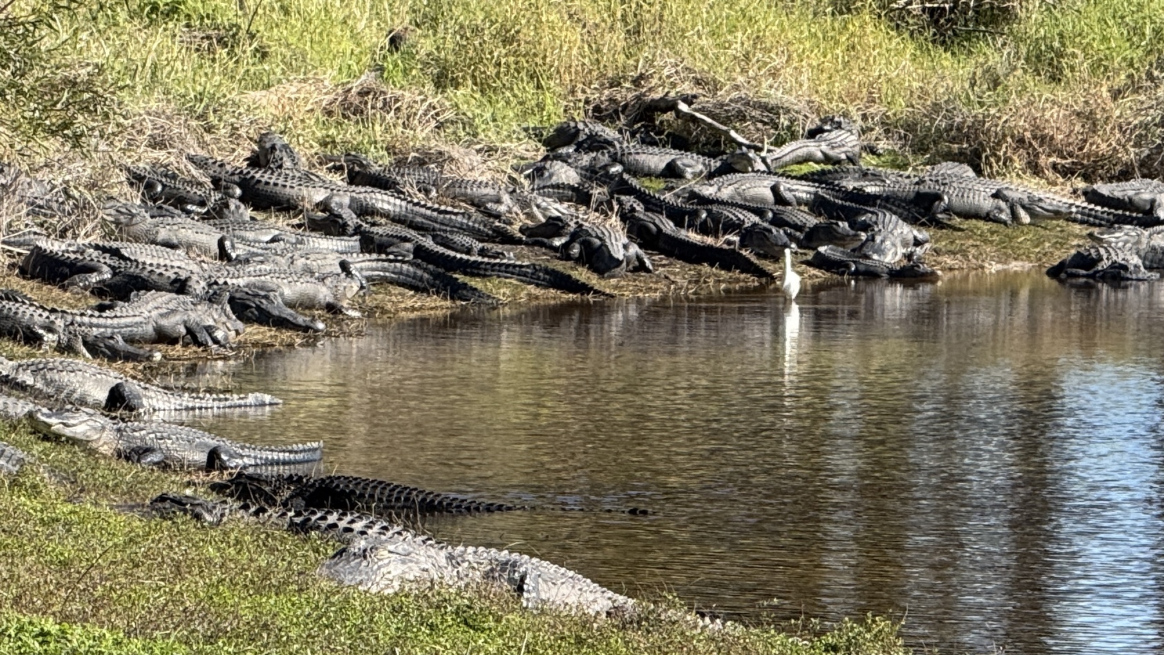
Photo taken Jan 9, 2025 at 11:33 AM

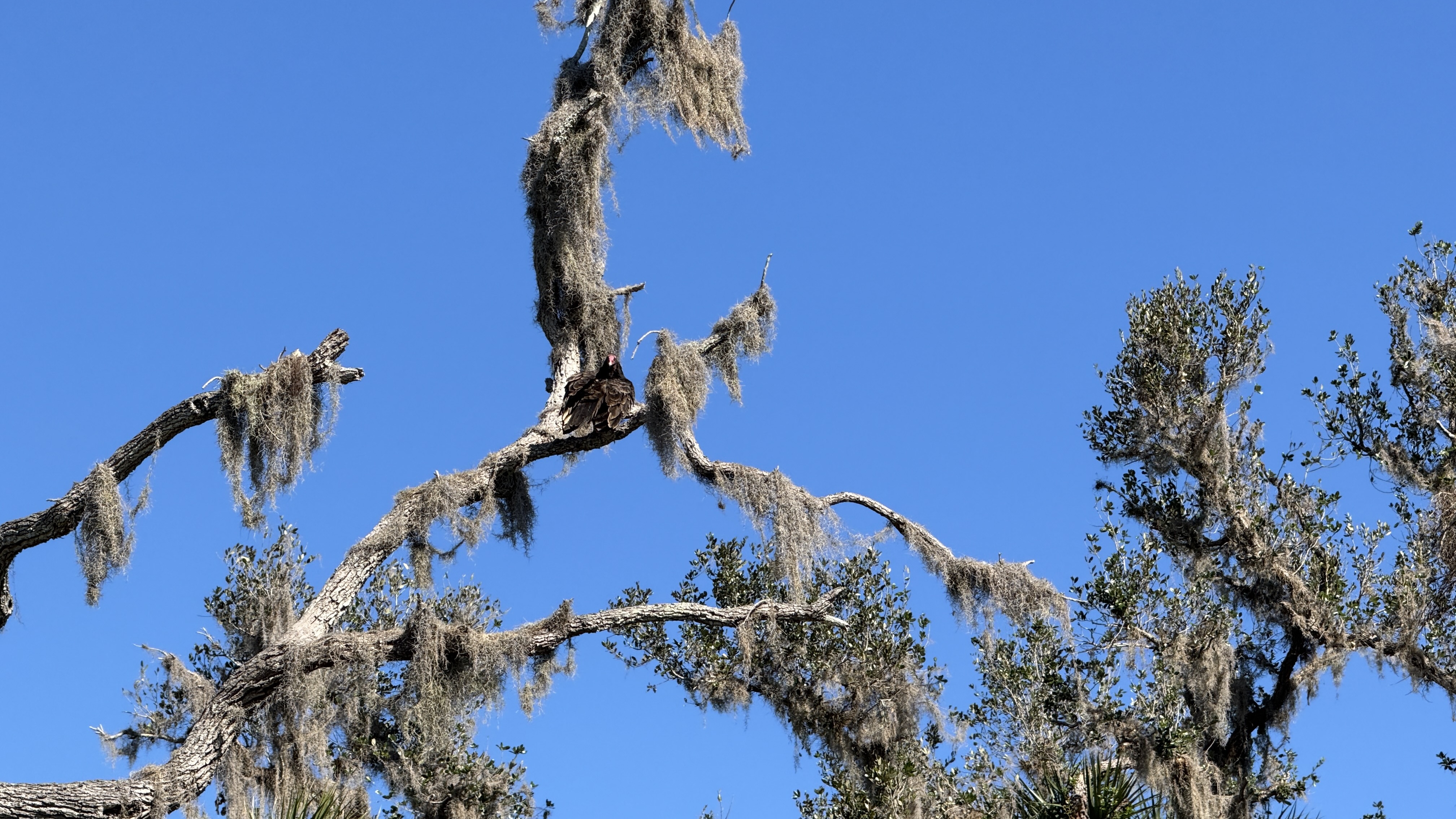
Alligators aren’t the only critters here. These vultures aren’t moving much. In fact, until one did we did not notice them.

--January 9, 2025 at 11:33 AM.

Maps are centered on the photo: Google map, Apple map, OpenTopoMap map
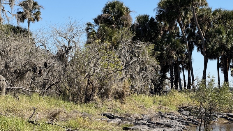
Photo taken Jan 9, 2025 at 11:33 AM

Vultures might not be as exciting as the alligators but they’re important too.

--January 9, 2025 at 11:33 AM.

Maps are centered on the photo: Google map, Apple map, OpenTopoMap map
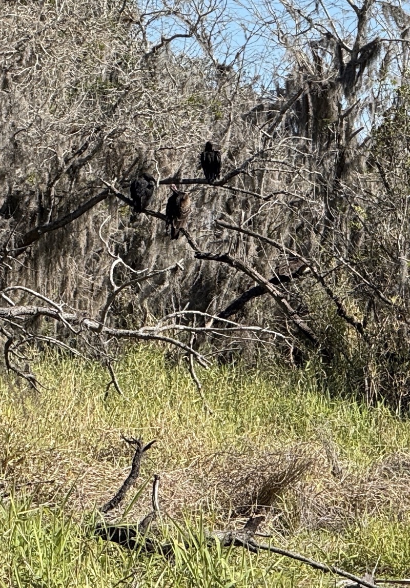
Photo taken Jan 9, 2025 at 11:34 AM

No idea what this bird in the tree next to the vultures is.

--January 9, 2025 at 11:34 AM.

Maps are centered on the photo: Google map, Apple map, OpenTopoMap map
Wednesday, January 1, 2025

Winter Solstice 2024 Hike

Not quite a “death match” hike

It has been several years since I did a winter solstice hike of any length. I wasn’t going to tackle the much longer, tougher trail, version that Andy and his companions would take on. I couldn’t, I suspected, keep up the required speed throughout the day. I would be left to sally forth, solo, along the Waterloo-Pinckney Trail to find my way to the endpoint about 14.5 miles east of my starting point.

I was dropped off at Loveland Road at 7:30AM. Perhaps I could have started walking right away. It was alreay beginning to lighten as we moved towards sunrise. However, I elected to wait a little while - getting colder - for more light. At this time of day it is pretty quiet. The snow absorbs some sound but when it is 16°F not much is moving to quickly at this pre-dawn hour. At least not much that I heard. When I began my hike at 7:47AM I am confident I was making the most noise in the immediate vicinity. Over the next 10 hours I would work my way along trail, making mistakes here and there, towards Goodband Road. The video and photos will give you a glimpse of what my journey was like.

This visualization of my route will give you an idea where I was.

Play video Winter Solstice 2024 (not quite) Death March
▶️ Play Winter Solstice 2024 (not quite) Death March

Photos

Photo taken Dec 21, 2024 at 7:47 AM

Starting my version of the Winter Solstice 2024 death march. My version starts at Loveland Road. The planned hike is about 14.5 miles long. Sunrise will be in a few minutes but there is enough light to start my hike.

--December 21, 2024 at 7:47 AM.

Maps are centered on the photo: Google map, Apple map, OpenTopoMap map
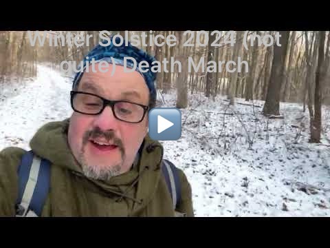
Photo taken Dec 21, 2024 at 9:31 AM

Passing through the area of the Waterloo Recreation Area headquarters. The sun has been brightening the sky making it feel warmer. I’m actually a bit overdressed.

--December 21, 2024 at 9:31 AM.

Maps are centered on the photo: Google map, Apple map, OpenTopoMap map
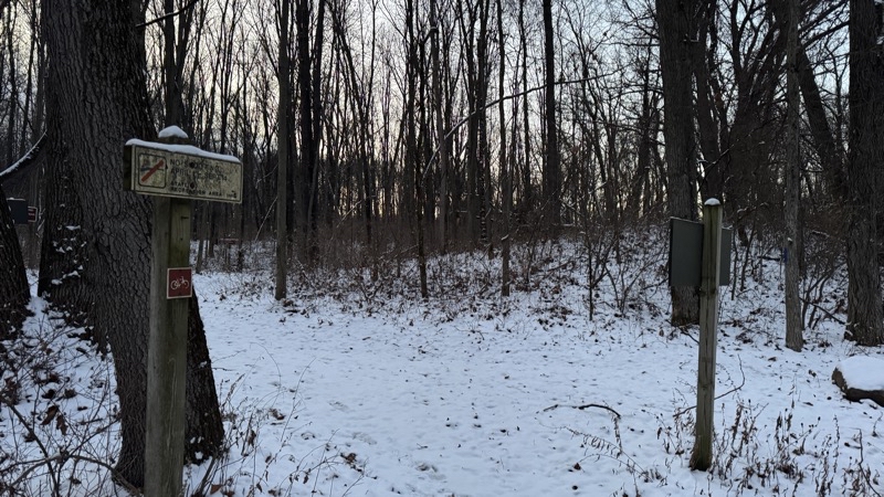
Photo taken Dec 21, 2024 at 1:07 PM

I’ve made a few mistakes along the way. I think I’ve trod about 9 miles by this point along the bike path that leads to the underpass below M-52. This would be an easy fast walk except for the black ice.

--December 21, 2024 at 1:07 PM.

Maps are centered on the photo: Google map, Apple map, OpenTopoMap map
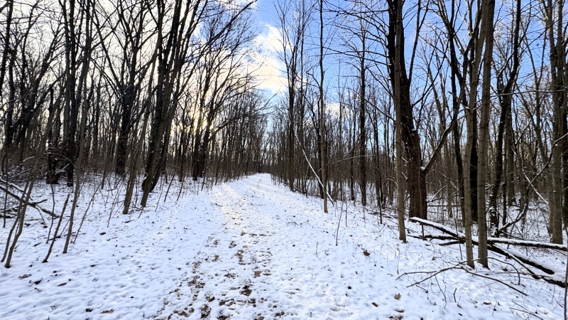
Photo taken Dec 21, 2024 at 1:23 PM

It’s been a lovely day so far. Temperature has been in the mid 20s with on and off sunshine. Now and then the honking of Canadian geese flying overhead can be heard, now and again sandhill cranes cut loose with their slightly unnerving calls, other things chitter about, and the ever present sound of my feet crunching against the snow.

--December 21, 2024 at 1:23 PM.

Maps are centered on the photo: Google map, Apple map, OpenTopoMap map
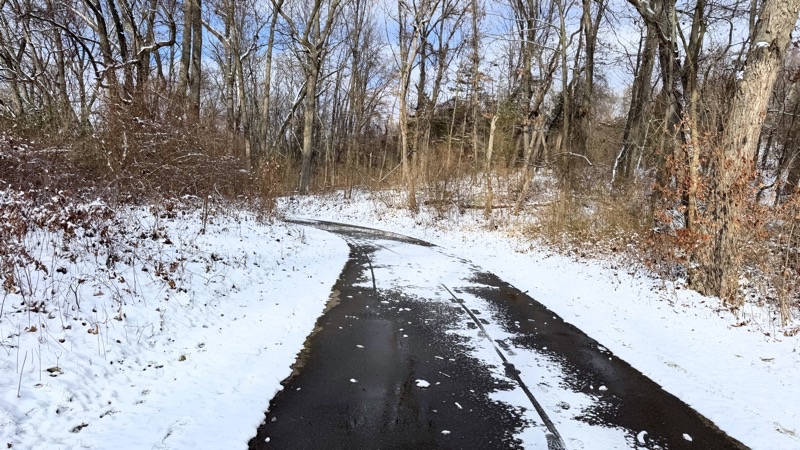
Photo taken Dec 21, 2024 at 4:56 PM

Sunset is just a few minutes away. I believe I have hiked just over 15 miles and have a bit over a mile to go. I wonder if I will have to use my headlamp before I reach the end at Goodband Road.

--December 21, 2024 at 4:56 PM.

Maps are centered on the photo: Google map, Apple map, OpenTopoMap map
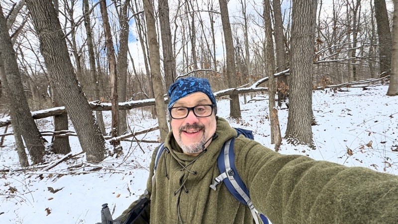
Photo taken Dec 21, 2024 at 5:36 PM

The end. 16.5 miles of hiking, including 2 miles of detours, to complete my hike. Hurray. Now I have to wait for the others, doing a 25-mile hike, to arrive. I figure they will arrive in 45 to 60 minutes.

--December 21, 2024 at 5:36 PM.

Maps are centered on the photo: Google map, Apple map, OpenTopoMap map
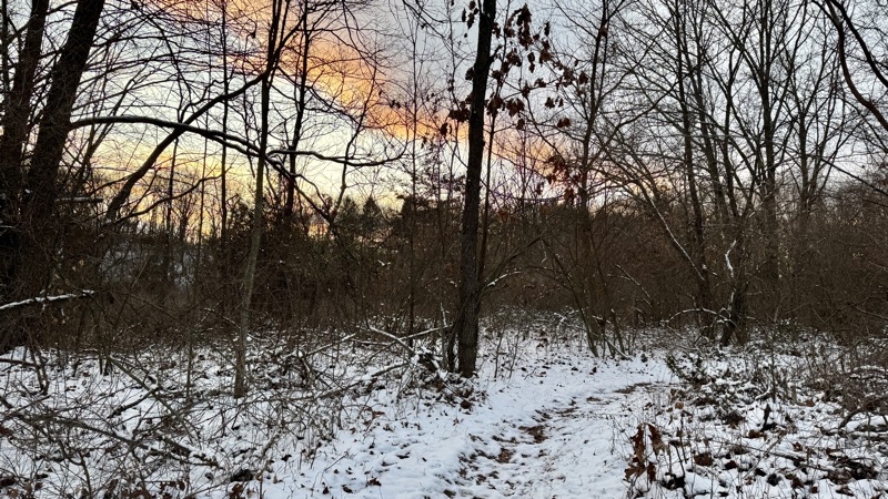
Monday, October 28, 2024

Days Out In Autumn

Photo taken Oct 17, 2024 at 6:10 PM

Gazing out across Blind Lake. The leaves are starting to properly change color. There is a bit of a chill to the air.

--October 17, 2024 at 6:10 PM.

Maps are centered on the photo: Google map, Apple map, OpenTopoMap map
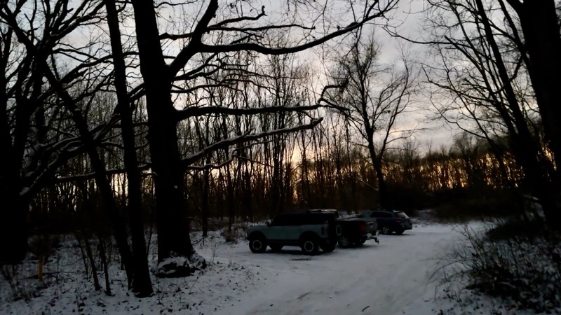
10 days ago when I hiked into Blind Lake the leaves were just starting to show colors. Here and there red, tan, brown, yellow were visible but the vast majority of leaves were still green and clinging to their branches. Fall was in the air but it didn’t feel like it had really settled in. We had a series of very warm days - an Indian Summer of sorts. But you could tell it wouldn’t last.

Photo taken Oct 18, 2024 at 12:13 PM

The previous day I backpacked about 4.5 miles into Blind Lake Campground. On this steadily warming early afternoon under totally clear blue sky on a nearly glass-smooth Blind Lake I paddle back to my starting point on Halfmoon Lake: about 1.7 miles. Photo taken by Richard.

--October 18, 2024 at 12:13 PM.

Maps are centered on the photo: Google map, Apple map, OpenTopoMap map
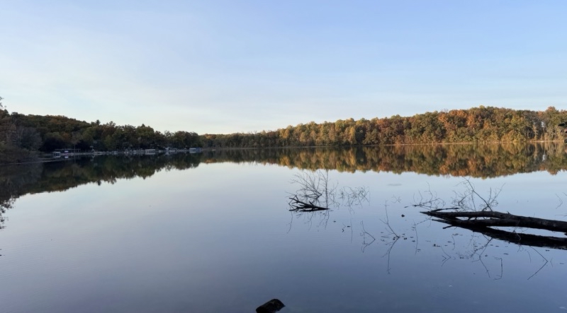
Saturday, October 25, found me up ready to head out again into Pinckney Recreation Area. The morning was sunny but slightly chilly. That probably wouldn’t matter as long as I was moving. I am sure bikers and trail runners preferred the low 50s (maybe) temperature too. The plan was to hike from Crooked Lake to Richard’s house; Lil would spend her time biking the Crooked Lake Trail; Richard would do something. Then we would all gather at his house and go fishing.

As I walked the rolling hills of Crooked Lake trail mountain bikers zipped on by heading in the other direction. A couple trail runners hustled on past. Leaves fell off the tress as the wind caused them to lose their grip. The colors that had been somewhat sparse 10 days before were in abundance now. It was a lovely morning in late October. I was somewhat past the halfway point of my hike when Richard came into view. He had decided to hike from his house towards me. That probably saved me from making a mistake and taking a somewhat longer, or at least less interesting as it would have had a road walk, hike. Togheter we walked the trails through the forest enjoying the company and the weather. Perhaps we should have stopped and had some of the hot tea I was carrying in my thermos. About 90 minutes after starting out, with one small mistake at the start in the campground (so easy to get confused in campgrounds) I found myself climbing the steps to Richard’s front door. Now we had time for tea as we waited for Lil to arrive.

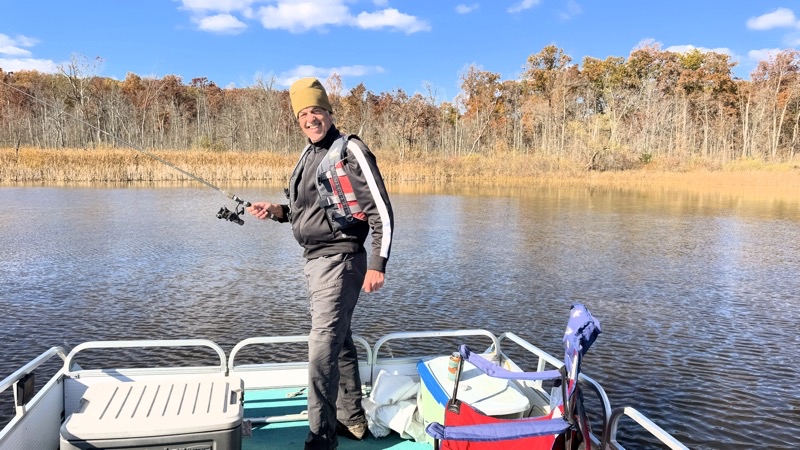
The afternnon ws spent out on Richard’s pontoon boat. Perhaps none of us really has much talent for fishing. I suspect Lil has done the most; she certainly has the gear. It’s good we didn’t need the fish to survive. But it doesn’t have to be out catching your meal. It can, and in our case certainly was, about being outside with people you like in a pleasing location. We certainly had that. The Deer Camp beer made by Upper Hand Brewing along with the smoked cream cheese and crackers just helped to round out a very fine mid-autumnal afternoon.

Photo taken Oct 26, 2024 at 10:46 AM

Standing on a fishing pier jutting out into Crooked Lake. The smell of smoke from campfires drifts on the wind from nearby campsites. It’s a crisp clear morning and the leaves are really starting to change color. It’s lovely.

—October 26, 2024 at 10:46 AM.

Maps are centered on the photo: Google map, Apple map, OpenTopoMap map

Photo taken Oct 26, 2024 at 2:38 PM

We found a shallow spot, maybe 15 feet deep, on the northern shore of Halfmoon Lake. We’ve been out on the lake under pretty clear sunny skies for 90 minutes and lost a few worms to fish but caught nothing. Richard is enjoying himself as are Lil and I.

—October 26, 2024 at 2:38 PM.

Maps are centered on the photo: Google map, Apple map, OpenTopoMap map
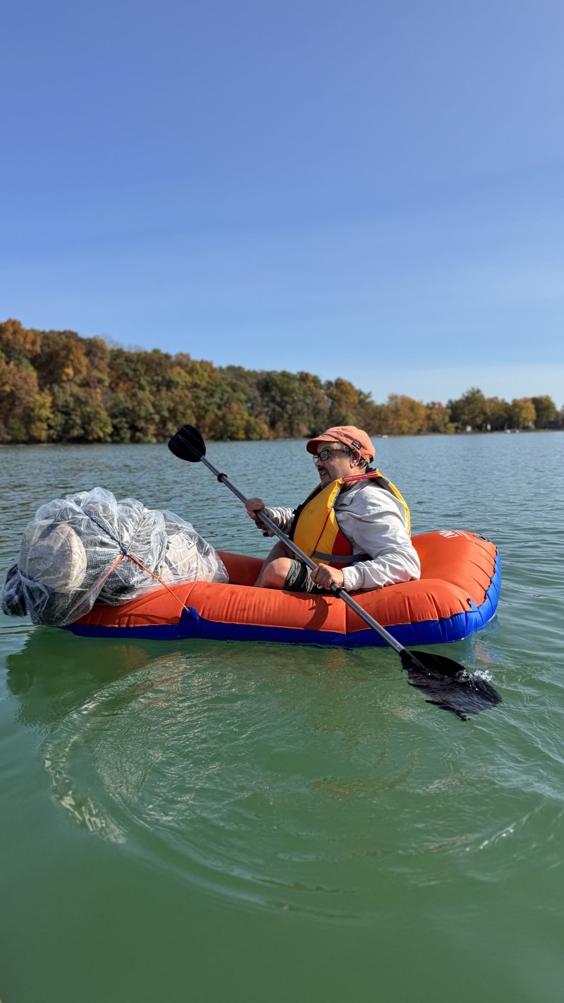
Photo taken Oct 26, 2024 at 4:02 PM

With the fun music of Da Yoopers playing in the background and the sun shining down upon us for the past 3 hours success has come: a fish has been caught. This tiny sunfish was the first of 2 Lil caught along with a not much larger bluegill. Enough for a few bites but it’s good none of us needs the fish to survive.

--October 26, 2024 at 4:02 PM.

Maps are centered on the photo: Google map, Apple map, OpenTopoMap map
Monday, May 13, 2024

Niagara Falls - May 12, 2024

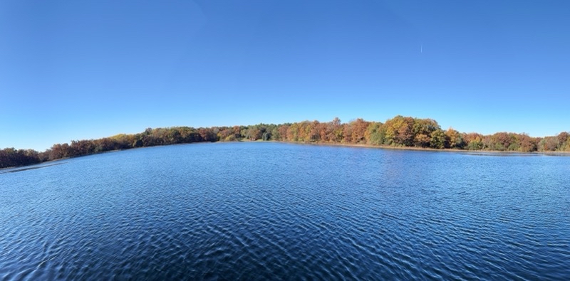
Our road trip across Ontario is coming to a close and we are ending it with perhaps one of the most spectacular places you can find in North America: Niagara Falls. Since we are in Canada, specifically Toronto, we are visiting the Canadian side of the falls where Horseshoe Falls, the largest by far, resides.

Photo taken May 12, 2024 at 10:08 AM

We can feel a bit of mist already coming off Horseshoe Falls just downstream of where we are. If it was windier it could easily get nasty quickly.

—May 12, 2024 at 10:08 AM.

Maps are centered on the photo: Google map, Apple map, OpenTopoMap map
Once we parked (and learned of the CAN$35 parking fee) we easily found our way to the Niagara River. Just follow the sound of thousands of tons of water plunging 54 to 58 meters down Horseshoe Falls (I suppose the American Falls and Bridal Veil Falls add some rumble but they’re farther away and only account for about 1/10th of the volume of the water flow that pours over the falls). As we approached the visitor center where tours like the Journey Behind the Falls start we passed through our first bit of Niagara mist. Drenching chilly droplets of water hit us with gentle force. If you stood there for a few minutes you would get quite wet. Horseshoe Falls is nearby.

We started with a journey behind the falls. After receiving our bright yellow plastic ponchos (to be recycled later) we boarded an elevator to descend about 20 meters to tunnels that lead to portals. The portals, or openings, are behind Horseshoe Falls and in another direction to lower and upper observation decks where you can see the Falls up close. Here you get your money’s worth out of the bright yellow plastic poncho which are given to every visitor. The portals let you peer through an opening that is perhaps 6 feet wide and probably no more than 10 feet high. Considering that the crest-line of Horseshoe Falls is about 2,200 feet (670m) each portal is giving you a pretty tiny glimpse of the water pouring by just a few yards from where we are standing. Even these tiny glimpses from both portals is impressive. The second portal is about a third of a way around Horseshoe Falls and seems to have a more impressive flow of water pouring by.

Photo taken May 12, 2024 at 10:38 AM

This is Great Portal, the second portal behind Horseshoe Falls. It sits about 200 meters around the Horseshoe: just under one third of the way round. During peak tourist season about 2,800 cubic meters of water flows over Horseshoe Falls every second. If we are generous and call this portal 1.5 meters wide that suggests about 6.2 cms water (6,200 liters per second) is passing by each second (about 45 bathtubs filled with water).

--May 12, 2024 at 10:38 AM.

Maps are centered on the photo: Google map, Apple map, OpenTopoMap map
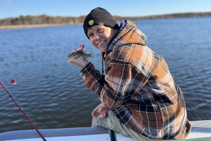
Photo taken May 12, 2024 at 10:47 AM

Judy is getting wet from the spray from Horseshoe Falls as she stands on the upper observation deck. Photo by Jonathan.

—May 12, 2024 at 10:47 AM.

Maps are centered on the photo: Google map, Apple map, OpenTopoMap map
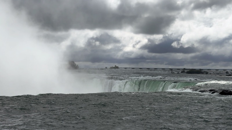
Photo taken May 12, 2024 at 10:52 AM

On the upper deck with Horseshoe Falls thundering behind me. Photo by Jonathan.

—May 12, 2024 at 10:52 AM.

Maps are centered on the photo: Google map, Apple map, OpenTopoMap map
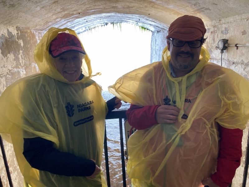
We were told that this is not a busy day and if that is so I am glad we were not here on a busy day. THe tunnel was full enough as it was and there were plenty of people on the observation decks experiencing the power of Horseshoe Falls up close (though not too close) and personal. We could gaze up to the top of the falls and down into the pool at their base where a Maid of the Mist was just motoring in to give her passengers a drenching and spectacular view.

Photo taken May 12, 2024 at 10:44 AM

This appears to be the Hornblower which is the boat that runs from the Canadian side.

—May 12, 2024 at 10:44 AM.

Maps are centered on the photo: Google map, Apple map, OpenTopoMap map
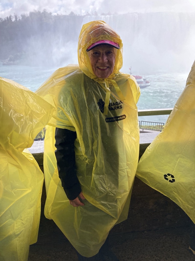
After leaving the tunnels we continued to walk along the paved promenade to where the City Cruise (Hornblower) is docked. I think this boat is smaller than the Maid of the Mists boats. LIke them it runs frequently throughout the day. A boat tour lasts about 20 minutes which is just enough time to carry passengers to within a few hundred feet of the base of Horseshoe Falls to see them in their full power and glory and get well soaked at the same time. We would get to have that experience in short order. It really is a remarkable experience that is hard to properly express. I am glad it wasn’t chilly and windy out because the cold large drops of water that splashed us were chilly enough.

Photo taken May 12, 2024 at 11:32 AM

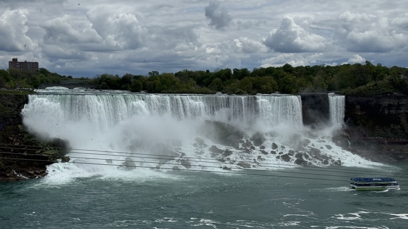
A good view of Horseshoe Falls which is over twice as tall as the other two falls and considerably wider

—May 12, 2024 at 11:32 AM.

Maps are centered on the photo: Google map, Apple map, OpenTopoMap map
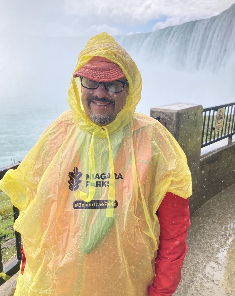
Photo taken May 12, 2024 at 11:35 AM

Horseshoe Falls thunders down behind Dad. Photo by Judy

--May 12, 2024 at 11:35 AM.

Maps are centered on the photo: Google map, Apple map, OpenTopoMap map
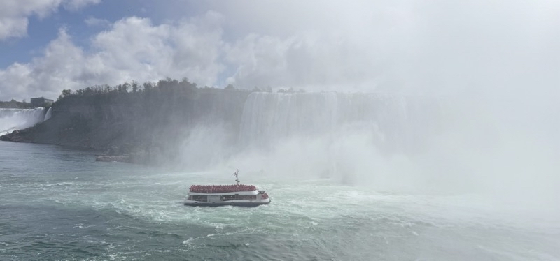
Photo taken May 12, 2024 at 12:45 PM

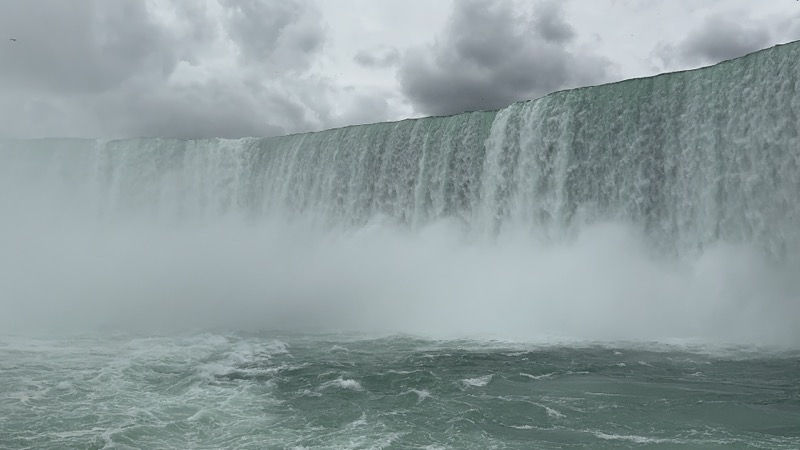
Large cold drops of water are drenching us as we stand on the upper deck at the bow of the boat. I think we are within 500 feet of the cascade that is the 670 meters wide and 54-58 meters tall Horseshoe Falls. It’s impressive.

—May 12, 2024 at 12:45 PM.

Maps are centered on the photo: Google map, Apple map, OpenTopoMap map
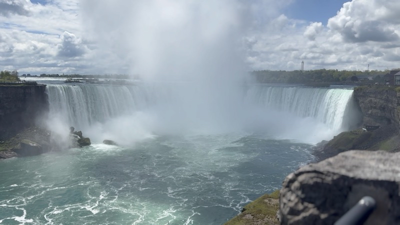
Photo taken May 12, 2024 at 12:50 PM

We’ve been soaked by Horseshoe Falls and are cruising past the falls on the American side on our way back to the dock.

--May 12, 2024 at 12:50 PM.

Maps are centered on the photo: Google map, Apple map, OpenTopoMap map
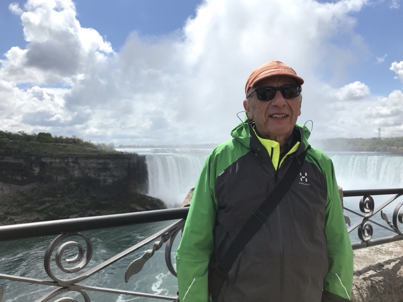
Photo taken May 12, 2024 at 1:34 PM

On the left is the American Falls and next to it is Bridal Veil Falls. These two falls account for just a small fraction of the water volume that pours over the three waterfalls that comprise Niagara Falls.

--May 12, 2024 at 1:34 PM.

Maps are centered on the photo: Google map, Apple map, OpenTopoMap map
One thing that surprised us as we walked along the river was the relative lack of even small eateries or food trucks. We think Niagara Parks is trying to limit the touristy aspects of the place as much as they can. However, it begs the question of where do the thousands of people who surely visit each day go when they want a bite to eat. There were a couple cafeteria-like places and perhaps a bar and grill by the boat tours dock but not much else. While we did not see places for people to eat we did see numerous large hotels strung out for a very long ways along the river. The city has a bus service,WEGO, that runs between the hotels and various points of interest but we did not take advantage of it. Perhaps visitors are all eating meals in their hotels. We do know that Niagara-on-the-Lake , a small bustling town some 20 to 30 minutes away (depending on traffic), has quite a few restaurants. We pretty much settled on the first place we came to , an Irish pub, and lunch was decent if not memorable. Perhaps we should have stood in the lengthy line that curled around the block to an ice cream parlor instead.

Tuesday, March 12, 2024

Cold Weather Survival Class and Camp

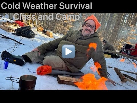
Play video Cold Weather Survival Class and Camp
▶️ Play Cold Weather Survival Class and Camp

On the weekend of February 3-4, 2024 Andy and I took part in a general skills class targeted towards cold weather survival. The class was organized and taught by Michael Neiger and some fellow associates. Michael has extensive outdoor experience including considerable work in search-and-rescue. I certainly do not think I know that much about backcountry survivial and my experience is a match flame against what Michael and his colleagues bring with their bonfire of knowledge. I certainly can learn more (and what is just as good Michael knows he can still learn more).

Driving up towards Hartwick Pines State Park under steadily lightening but rather overcast skies Andy I pondered what would be covered. We arrived a little before 09:00 and found the lecture-room fairly well filled. Coffee was ever-so-slowly percolating in a giant urn and many people took Michael’s suggestion of bringing food to share up with enthusiasm. With one thing and another the morning session didn’t start at 09:00 but in time people were settled and the presentation of information began.

This was an overview class. Michael and Todd had a lot of material to cover and they still needed time for lunch and then the outdoor portion of the class. That would be the pattern for both days: information presentation in the morning and outdoor skills work outside in the afternoon. I’m not going to try and discuss all that was talked about in the mornings from navigation, what to carry on your body, suriving on ice and how to recover if you fall through, communications, food, shelter building, and so much more. If you want to spend time outdoors , especially away from well travelled spots, a good primer class like this is certainly worthwhile. Of course, simple information dumps only go so far; you need to practice skills. In this class that meant some basic fire building skills and some basic shelter building.

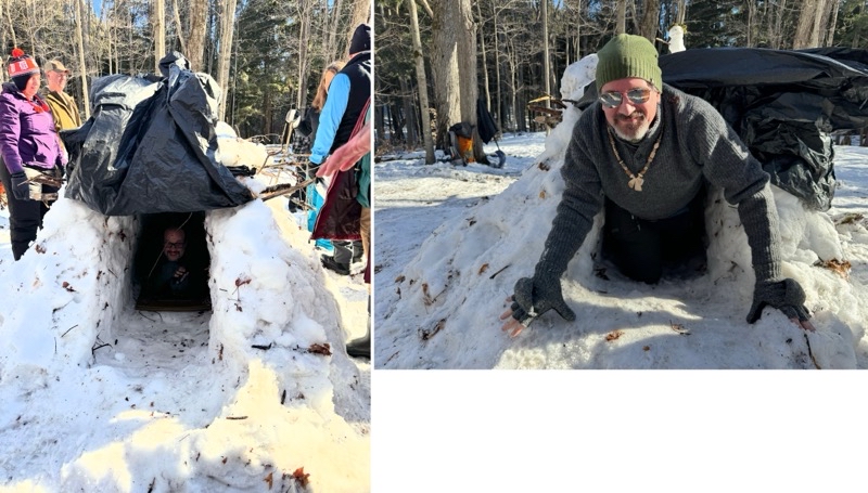
I wish I had video of us building the snow trench. With over 20 people tossing snow on to a pile that was surely 8 feet long by at leastt 6 feet wide and likely 4 feet tall did not take all that long. Then a couple people hollowed out the center while the rest of us gathered long branches and pine boughs to place atop of the opened-to-the-sky roof. While only one person could really lay down inside the trench you could get two, maybe three, people squeezed inside sitting against each other. It certainly would be proof against nasty weather outside and would warm up too.

We also threw up a debris-style shelter. With many people working to gather materiel it goes quickly. If I have a complaint against the class it is that you likley don’t get a proper sense of how long it would take to build a shelter like this beacause with 2 or 3 people it would certainly take far longer. But knowing how to do it and then doing it are valuable as you will know it is possible. Michael also quickly showed how a survival space-blanket can be turned into a basic shelter against bad weather.

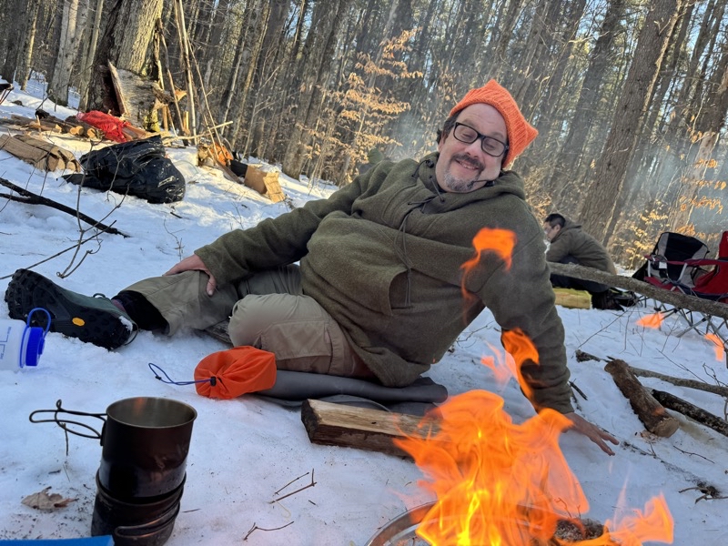
On the second day we had more information-packed sldies to abosrb before venturing outside, again sunny low 40s (hardly cold) weather, to practice skills: fire making. If people took nothing else away from the class but the fact that patience is required and that you need far more fuel of all sizes than you think then I would say it was a success. I think everyone got their fires going. Goodness knows it is easier to get things going properly when you have a bit of help from your partners. To be sure Sunny, Kristen, and I probably took a good 20 minutes to get our kindling, tinder, and fuel sticks ready, then lit and burning. But we got the snow in my modest-sized cup melting and boiling. Practice and patience win the day.

I do not know how many people camped at vairous places around Grayling. I suspect the local hotels saw a bit of extra business which I bet was welcome because this has been a poor winter for snow-sports based recreation. Andy and I managed to carefully drive into the campground at Lake John. We heard a dog and some people in the distance but I think we had the campground to ourselves and the wildlife we heard. The barking of a deer was the most noticeable but the hoot of a great horned owl is always nice to hear too.

Photo taken Feb 3, 2024 at 2:42 PM

One of the things the several dozen attendees at this cold weather survival class including me (left)and Andy (right) did was build a snow trench shelter.

--February 3, 2024 at 2:42 PM.

Maps are centered on the photo: Google map, Apple map, OpenTopoMap map
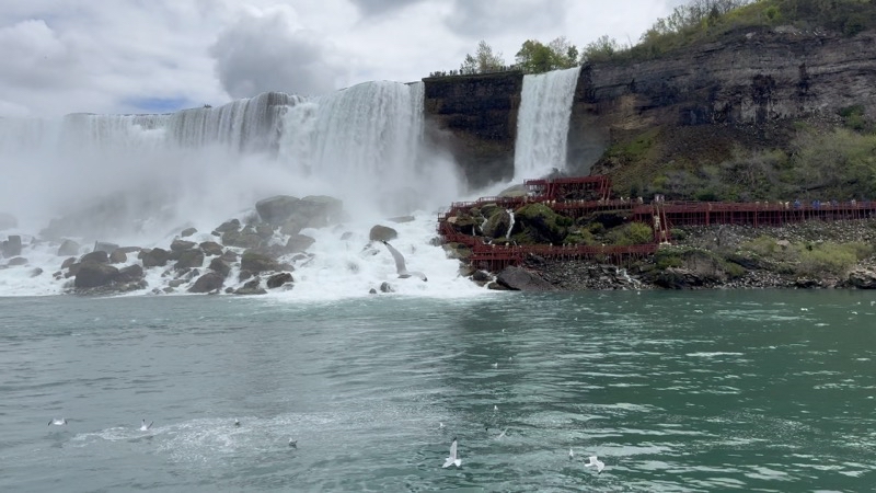
Photo taken Feb 4, 2024 at 4:03 PM

--February 4, 2024 at 4:03 PM.

Maps are centered on the photo: Google map, Apple map, OpenTopoMap map