Wednesday, October 3, 2018

Pomieri Hotel Day 3 - Walk 3 Petralia Sottana to Pomieri Hotel

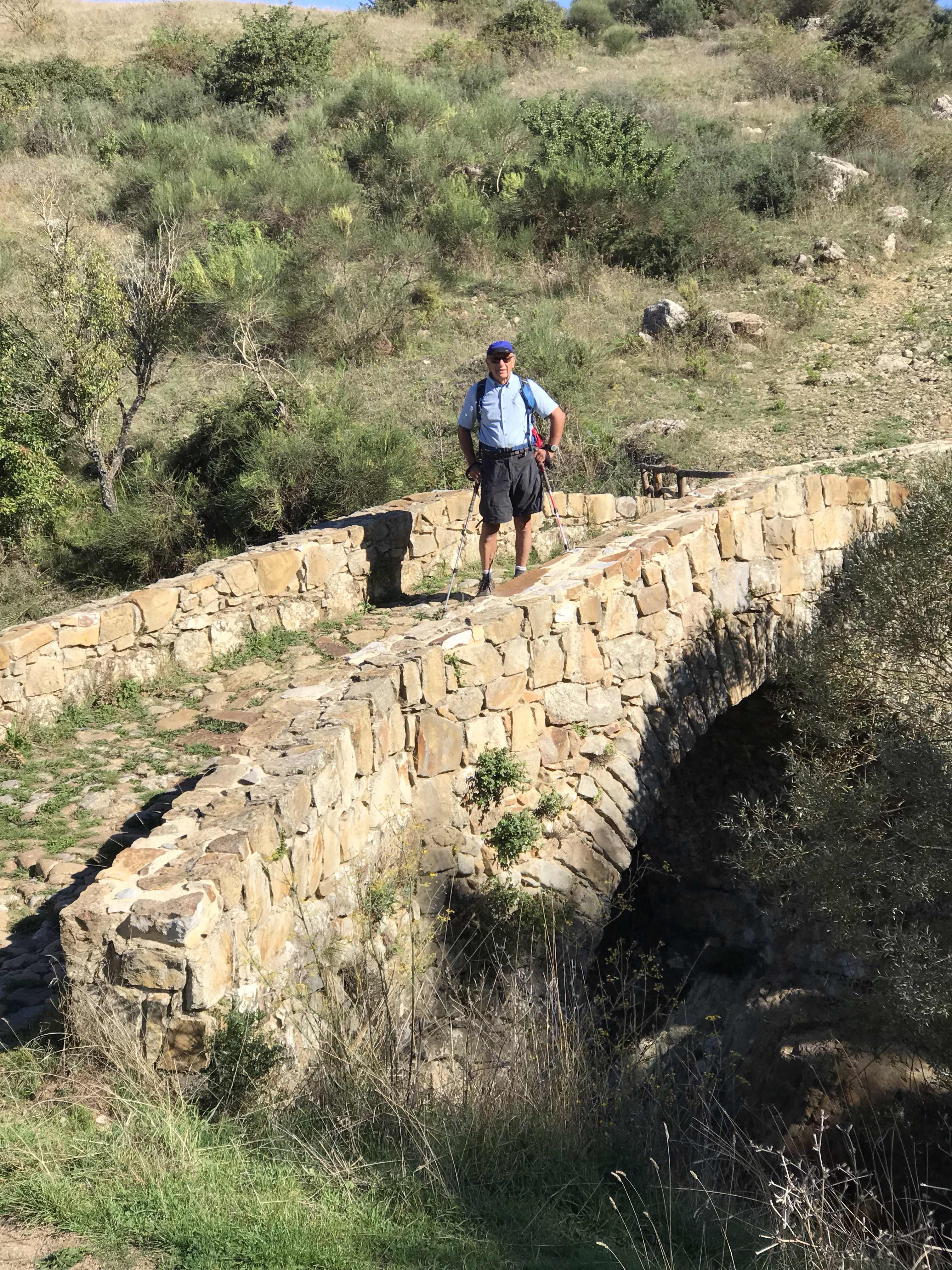
The morning dawned clear and with the promise of great warmth. We were fed, packed, and ready to hit the trail a little before 09:00. Today the book said the walk would be 11.5km with , as I recall without checking, 700m ascent and 350m descent.  The first 2.5km or so were along paved roads for the most part  with some lanes thrown in. That got us out of town and to the start of the Trail of Peace (Sentieri a Pacem).   We began following gently ascending paths that would first take us to, and across, a Roman bridge that spans a fast-flowing stream. It is a remarkable bridge that seems to be cut from the rock itself. If you ignore the excessive quantities of thorny bushes encrouching on the narrow path the next stretch is really quite lovely. We found ourselves wishing we had loppers to provide the trail some TLC.


We continued on and generally upward along mountain roads that would at times span some lengthy steep stretches. The footing was good so it is just a physical workout. In the distance we heard cowbells and birds in some pretty glades.  Pretty all around. 


I wish I could say we ate a fine repast in a lovely setting for lunch but that would be untrue. The setting was nice enough but the quality of lunches we are getting is rather poor. Leave aside the meager fillings in the sandwiches the bread itself is hardly what you would think Italy should be creating. It is fuel at best.  Fuel that we used on the next big climb up a rock-strewn faint trail where we, and Maggie and George who had long since caught up to us, made an error. Mom was right the place was too pretty to be right. That cost us a good 400m and plenty of time but we found our way back to where we needed to be and slogged up the remaining rocky faint trail along the telegraph poles. Too bad the  trail descending the last km or so was not really any better. Not even that pretty just tough going. THe 600 year-old oak  was impressive but we were ready to be done by then. The last km or so is just annoying as you go through psture and other stuff. 


But we made it be mid-afternoon and it was a good day. The hotel rooms are spartan and, as noted, Internet access is iffy but at least dinner was very good.


Stats: We walked 12.7km today and I think our error added about 400 meters to that. Total ascent 609m; descent 276m. We took 59 minutes in breaks and walked for 5 hours 11 minutes. Our thermometers, baking in the sun, pushed 80F which seems high. Not much wind today.

Dad on bridge

roman bridge


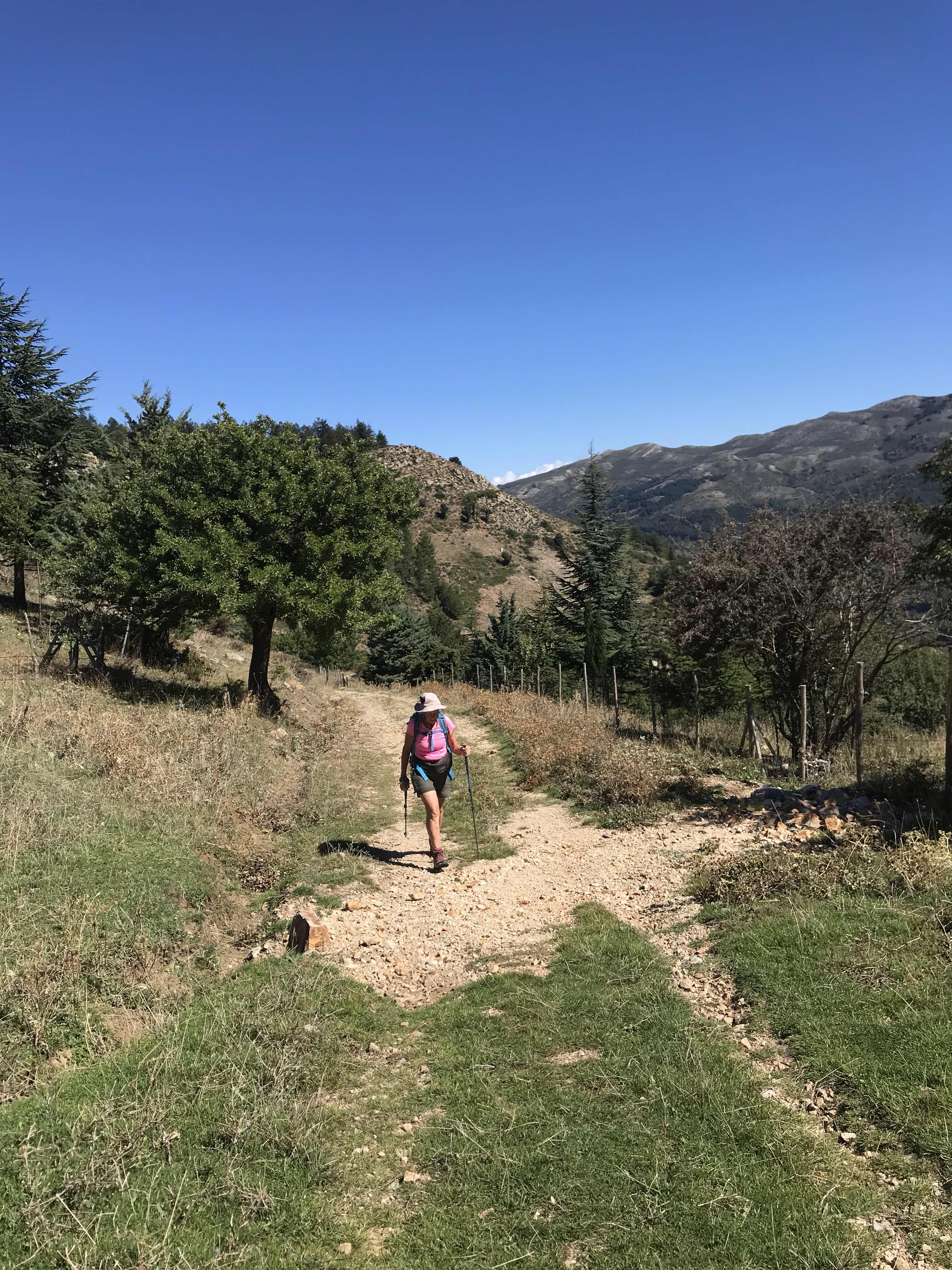
mom

room view

Photos

  1. Dad on the Roman bridge.
  2. You can get a bit better sense of how the bridge is built into the living rock here.
  3. In the area of lunch. We are climbing again and it is about to get steep and rocky. 
  4. It took two hours to get to this cow.  We probably hiked about 2.1km and ascended 160 meters before descending 70 meters (sure felt like a lot more).    Perhaps 1.1km to go with a bit more desent and a bit more ascent too.
  5. The 600-year-old oak tree. The trunk is reportedly 7m around and that seems like it might be low as I am sure it is wider than a measly 1.1m.
  6. The view from our spartan hotel Pomierie windows


Tuesday, October 2, 2018

Petralia Sottana Day 2 - Walk 2 Into the High Places

ken at aqueduct


What a differnce a day makes. We awoke to clear blue skies with nearly zero clouds. The temperature promised to be at least as warm as the day before and the winds would be far less intense. A fine day for our first full day in the area of Petralia SOttana. After a decent, though not great, Continental-style breakfast (food is fresh but we are finding ourselves unimpressed by the breads) we gathered up our gear and struck out from  the hotel just before 09:00 to do a walk that our Inntravel notes say is about 14km long and features about 700m ascent and descent. The first part of the walk reprises the last bit of the walk we did the  previous day. The treat being once again at the Roman aqueduct where we could see the waning moon through the milenia-old arches.


At this point we turned left and after a short time on a paved road (going right would take you to Petralia Soprana) we reached what would be the start of the real meat of the walk. A cobbblestone road wound steadily up into forests of what I believe is part of Parco  della Madonie. At this point the forest seems to be a pine forest but as we climbed that changed to perhaps one of cork trees. Along the way we picked up a four-legged companion Mom would dub Scout.  Scout would hang with us, more or less, for about 10km.


Our road climbed steadily and we enjoyed the lovely morning.  Soon Maggie and George caught up to us. It turns out we are not the only people on an Inntravel walking trip. They’re doing the same thing we are: we just did not meet them until about 4km into the walk.  Up and onward .  We were making good time and, in fact, were perhaps lulled into complacency as we almost missed the sharp turn of path 10 into the woods. There is a tiny, hard to spot  sign but you better not blink otherwise you will miss it (some of us did; Mom did not).


The notes are really quite good. They warn that the path becomes indistinct and confusing. THey are right. I think it is a trail but it is one made solely by the traffic that walks it. It is not a built trail. It is more akin to a human version of a game trail. Maybe not that bad but hardly good.  We actually had some  confusion finding our way to the steep swithback that would lead to perhaps the standout point of the walk on a very windy grassy plateau.


On the plateau the trail vanishes but the directions were good enough that we were able to spot landmarks, tiny posts and cairns as well a copse of  trees, to make our way across without trouble.  Though windy it was still a lovely early afternoon and a great place for lunch before we joined up with path 25 for the trek down back towards the Roman aqueduct.


Path 25 has some gnarly steep bits but overall is essentially a two-track through ever-descending pasturelands. It is nice enough. We strode past numerous cows and in time were back where we started our climb. The last descent, along the path we had trodden now twice, seemed to last too long. Between that last bit and the steep town street my quads sure hurt. Still and all a very fine first full day.


Stats: sunny and warm. I am not sure I believe my thermometer saying it was in the mid-70s but then it was in the sun all day. The winds on top were strong but otherwise pretty much a non-issue. We walked 14.7km taking 6 hours to walk and about 45 minutes in breaks. We ascended/descended 634m.


mountain town view

windy grassy plateau


Photos.

  1. Me and the aqueduct. Look carefully and you might spot the waning moon through the arch.
  2. Petralia. Soprana in the distance.  We are probably not to far from the start of the final push up the switchbacks to the plateau. It is late-morning and the weather is superb.
  3. On the windy plateau. From left to right: Maggie, George, Dad, and Mom. I do not see Scout but he is trotting about. In just a few hundred meters we found a spot to settle down for lunch.
  4. We are descending along the track back towards the intersection. We probably are about halfway to that point. We are not sure what that steam-like stuff is. Is it even steam? Is it a volcanic vent of some type. Are is it something more prosaic like dust by some human activity.

Sunday, September 30, 2018

Petralia Sottana Day 1 - Walk 1 Between Petralia Sottana and Petralia Soprana

petralia Soprana

To get into the mountains and our first town we had to take a train, bus, and taxi from Catania to Petralia Sottana. We got to this mountain town, and it is certainly nestled into the hills, a bit before noon. Fortunately we found staff at the hotel (name here) and were able to get into our rooms right away. The sun was in and out and the winds were blowing surprisingly hard. It was going to be a blustery afternoon.  


This town features narrow cobblestone streets that twist and climb amongst the hills where Petralia Sottana is located. We walked into the center of town to find a quick lunch and when you are not on level ground you are dropping quickly down streets as you walk a few hundred meters and descend 30 meters. People get good workouts walking in this town. We found our modest meal and that gave us the energy to tackle one of the Inntravel walks during the rest of the afternoon.


The walk is a circuit-walk that starts at the hotel and winds through the town before climbing out of the habitation into a small forest. Now and then views of Parco della Madonie were seen. Now and then we could look back down into the town we had left. The clouds moved in and the wind picked up. It was about 60F but felt colder with the windchill.  We continued along modest paths and small roads that eventually would take us into  the town of Petralia Soprana. This town seems to have just as many twisty narrow streets that climbs among more hills. Many little, and not so small, churches were passed. Places to grab a bite to eat too - too bad we had eaten already.  It seemed like a nice town.


We left it curling around the backside of a tiny hill (why Inntravel calls it a mount eludes us) before we began descending paths that wound past pastures before we reached an aqueduct that still spots some deck between the several standing arches. Sheep grazed by the aquaduct and we continued down the grassy paths back towards Petralia Sottana. The walk was just over 8.3km and we climbed (and then descended) about 240 meters. Inntravel writes it would take 2 hours 45 minutes to walk and that is about what it did take. They were a bit off on the elevation gain and loss but we won’t complain about having less to do. It was a nice opening taste of the area and used up the bulk of the remaining afternoon.


If their is a downside so far it is dinner. The restaurant that is attached to the hotel seems to just have pizza. They have some ante pasta dishes but you don’t (well we don’t) want cold dishes for dinner after a good day of hill walking. The pizza was OK but it isn’t going to live in memory as  a remarkable dish either.


Stats: Blustery afternoon tending towards overcast with winds pushing 26MPH and a high temperature around 60F. We walked into the downtown twice and each time that meant of walk of about 1.2km roundtrip with ascent/descent of 30m. The major walk was 8.3km and we ascended/descended 240m. Walking time for the major walk was about 2 hours 47 minutes and we took just 9 minutes (or so) in breaks.


parco della Madonie

streets of Petralia Sottana

church

san Muchele (Michelle?) in petralia Soprana

aquiduct and sheep

Photos

  1. Petralia Soprana. The upper town that may be smaller than the lower town but that is just maybe how it felt to me. 
  2. A view of Parco della Madonie from Petralia Sottana.
  3. I know not much of a picture but it gives you a tiny sense of the twisty narrow steep streets that fill both towns.
  4. A small church not far from Petralia Soprana. Too bad there is a bunch of trash strewn about the grounds. We This fountain and small church of the piazza San Michele in Petralia Soprana is quite nice. 
  5. Sheep are doing a great job keeping the grass short by what remains of this Roman aqueduct.

Saturday, September 29, 2018

36 Hours in Catania, Sicily

roman amphitheater

We arrived mid-morning and breezed through the airport to get a taxi into the heart of Catania. The morning was overcast and it sure looked like it could rain a modest bit though weather reports suggested it would be minimal.  Driving into the town we had a different sense of things from Florence. It felt somehow less good. Not bad just less good. Maybe that is just because of the weather. The Una Hotel Palace presents a grand lobby and we found the staff, in particular Rita, quite helpful. Too bad their sense of time is just a bit off. Well we were not really expecting to get rooms when we arrived or even when we came back after our first walk. Let’s focus on that instead.


The streets of Catania seem to mix modern and narrow steep ancient. Too bad they seem to share trash. A street cleaner went by but if it left a cleaner street behind I did not see it. Oh well. We strolled into the heart of the town where a fountain topped with an elephant on a pedestal. Why the city chose an elephant as its mascot I have no idea.  We visited the large fresh foods market noted for its fish but home to meats and veggies too though oddly enough we did not notice fresh breads. We then visited an excavated Roman amphitheater. I found myself wondering if vendors sold food in the high-ceilinged passageways we walked through. Also, if they had even minimal facilities for bathrooms: probably not. I hope the shows people saw were impressive because I am confident the seating was impressively uncomfortable. 


An easy day of some modest wandering finished off with a nice enough dinner that featured many styles of veal, french fries, a roasted potato type dish, and other things. We may or may not be eating local fare but we are certainly eating inexpensively.


Our next day, our one full day, we spent doing a tour of Mount Etna (Monte Etna) and Taormina. Numerous companies provide tours of Europe’s largest volcano. Some give you an option to take a cablecar to the summit at about 3,200m and you may have a chance to explore a lava tube too. Maybe those options get you further away from the hordes of people but I’d not be surprised if they don’t. Our tour was much more relaxed. We spent a brief time strolling, no real special gear needed though warmer clothing and a windbreaker are advisable.  It is hard to get a sense of scale as you stand amongst some of the several hundred craters at 2,000m. Mount Etna has destroyed Catania, I think, 7 times. It has spewed lava far more often than that.  


Our stop at an agricultural business making, we think, all sorts of jellies, honey, pesto, olive oils, and wine was a nice treat. And our visit through the bustling resort/market town of Taormina was fun too in its way. They build towns into the steep hillsides that hug the coast here.  All in all, a nice way to spend the day.

passageway in amphitheater

Monte Etna and Mom

Mo te Etna and Ken

Mount Etna 2000 meters

coast at Taorima


Photos

  1. The seats at the amphitheater we visited. Catania has another  that is underground now (so many bits of history lay under the modern city) but we could not explore that one. 
  2. High-ceilinged passageways run behind the seating. It is impressive considering how old the place is-1BC
  3. You get.a sense of how big Monte Etna is from these 2 photos taken on our way there.  We are at above 1,110m above sea level and maybe 15-20 minutes drive from the parking lot that hosts vast numbers of tour buses and cars.
  4. I think there are something like 300 craters on the slopes of Mount Etna. Here is just one sample. It is sunny, but windy, and we were glad we were wearing warmer clothing. Too bad you can’t really get a sense of things with so many people about.
  5. A coastal view near Taormina.

Wednesday, September 26, 2018

Quick Glimpse of Florence

Florence, Italy, Tuesday  9:00PM - This will be just a quick little note because I am tired and I have to get up in about seven hours to catch the flight to Catania. We have spent the last day and a half wondering the historic areas   of Florence.  Our hotel, called Pendini, is meters away from the heart of the old city.  We have crossed the teeming Ponte Vecchio, gazed upon the intricate designs on the walls of the Duomo, explored Uffizi gallery, and more. Here are some photos to give a sense of things. 


Photo

River Arno from Ponte Vecchio

Diomo from the Uffizi Gallery

ponte Vecchio from uffizi

pitti Palace sculpture garden
Duomo


  1. The Arno River from the bustling Ponte Vecchio. 
  2. The people below are waiting to enter the Uffizi gallery. It’s a remarkable place. You can see the dome of the Duomo and, I think, the tower of City Hall too. 
  3. From inside Uffizi you have some great cityscapes like this view of Ponte Vecchio and bridges beyond. The buildings are small bustling shops. 
  4. One of many intriguing sculptures in the gardens at Pitti Palace. We had been hoping for more green grounds but the art we found sprinkled throughout the extensive hillside grounds was special. 
  5. A view of the Duomo. Though perhaps not obvious it’s crowded here and getting more so as the afternoon progresses. I really like the stonework you see on the facade. 


Sunday, July 29, 2018

Maine morning

mom and at Ocean Point resort

Good morning from Ocean point resort. Our first day of kayaking started out sunny and then the fog rolled in. By the end of our 12 km kayak the fog was  thick  and the air was hot and moist. A bit spooky on the calm water (swells earlier)  the tolling of belled  buoys and blasts from a ferry’s foghorn and breakers on an invisible shore. 


This morning yhe clouds and fog have left. 


Wednesday, July 4, 2018

Wicklow way Day 5 - Cronewoods Parking Lot Area to Eden House Pub

overview map. Cronewoods to the end

Today is our final day on the Wicklow Way and we have been told that it is supposed to be a pretty section of the Way. We took a taxi to just beyond the parking lot, to avoid the 2.5 km walk on a narrow paved road, and hoisted our packs at 09:10 under once again clear blue sky.


We quickly joined a path that would run alongside of a river for a time before curling around fields of bracken for a kilometer or so. Pretty walking and apparently popular too. Too bad it would not last. Soon we found ourselves making a short modestly steep ascent up to a forest road which we would follow  along with our attendant hoard of sometimes-biting but alway annoying flies. The most interesting thing about this stretch of trail were the three horse riders we passed heading in the other direction. 


We passed by, or near at least, a hostel that is definitely used by walkers. We had met a couple heading in the other direction already and soon would catch up with a troop of English scouts who had stayed there the night before and were also heading in our direction.  We had been walking either forestry roads or minor paved roads now for upwards of 5km.

Last biew of Wicklow Mountains
We entered, I believe, Charlestown woods and began a steady gradual ascent along more forestry road. This forest has been denuded to a degree so isn’t that pretty. You get a view now and then looking back to the Wicklow Mountains and ahead towards Dublin but it’s not great. Worse today because it was hazy.  The forestry road would take us to a stretch of rocky (big boulder steps)trail that slowed me down a lot. It didn’t bother the trail runners who zoomed on by heading down. It isn’t precisely hard just slow going as you step from large rock to large rock over a stretch of a few hundred meters. Views would appear now and then but I am sure we were expecting better as we approached the top.


As the rocks came to an end they were replaced by gravel path with big  gaps seemingly every 20 meters. Most people will just step over them with a smile.  I had my usual pause, plant pole, step over, and keep going style of travel. Along this stretch of a kilometer or two we saw many people out for a day walk. It is easy walking but not really all that eye catching.


Off the top and on to another forestry road and down we went. The sky had actually clouded up a bit and a tiny nip was in the air. Not enough to really be a bother but a change in the weather we had been seeing. We  continued on down, decending gradually, and leapfrogging with the scouts and a French lady we had stayed with at Coolakay House. Down and down. 


The Way would eventually pass over a stream, we had been wondering when, and we would start moving through farmlands and more prosperous seeming places for a time. That forestry road would end and we would begin a long slog along first a quiet and then, for much longer, busy paved road. The directions let us down here.  Perhaps we just read them badly but we walked along that nasty road for something like 1.8km. This is an awful bit of WIcklow Way and I hope they come up with a way to get it off the road.


The climb away from the road towards Fairycastle is nice enough as it follows a gravel-based path that has some rocks scattered about for good measure. You get some vistas though they don’t really count as eye candy. It starts with a steady modestly steep climb but soon levels out as it crosses the tops. Breezy and cooler up there as well as popular.   I enjoyed the level bits and ascent but the gradual descent had just enough chasm-sized gaps to slow me down and be annoying.  As we neared the end of this bit, somewhere around kilometer 16 of the day, we had been hearing the roar of the M50 for a while. That is sad. 

heather fields of Fairycastle

Dublin and the Irish Sea
It’s a shame you have to pound down the forestry road from the end of this path for a good 1.5km to reach a carpark where I am sure many who do the hike as a day trip park. It is enough of a descent that you notice it and would really feel it on the ascent up. 


The Wicklow Way continues past the carpark  soon joining a minor paved road and then bigger paved roads.  The M50 roars in the dsitance and we push on and on along the paved roads. 3.5km and more along the roads to Marlay  Park where the directions are less than ideal for helping get you through  the park. To be brutally honest if I were doing this again I would try to get a taxi at the carpark and call it a day and end of hike there. Those last 3.5km or so sucked. Why Sherpa/Footfalls has us end at Eden House is a bit of a mystery. I suppose it is because it is a pub and taxis can find it easily. 


This last day was nothing special. I am glad it  wasn’t our first day. The slog on the paved roads and then steady climb up the forestry road to the path that then leads to the Fairycastle tops would have been a real drag. That portion, to be fair, is quite pretty and it is open and covered in heather.  While not in bloom the heather gives the space a soft look. 


Marlay Park is a nice park and clearly a place where many things from families having fun to major concert events take place. I think we would have enjoyed it more if we hadn’t first had to plod under and past the M50 for so seemingly long a time. The group of food trucks though with one selling , a bit overpriced, ice cream though was a welcome surprise which we took advantage of.


Stats: 22.4km. 600m ascent; 650m descent. The climbs come in two big hills first to the Charlestown woods tops and Faircastle tops. Descents are off those tops with the biggest being after Faircastle. A couple of short modestly steep and rocky bits but generally easy going. The 1.8km paved (and busy) road walk just before you ascend on path to Fairycastle is no fun at all. Weather: Mostly sunny with a bit of overcast now and then. Highs on the tops were in the mid-70s and warmer down below.


Photos

  1. Overview map. Cronewoods to eden House Pub.
  2. Climbing up to the tops of Charlestown Forest (I think) with a last view of the WIcklow Mountains fading into that smoky haze.
  3. The tops of Fairycastle are covered with fields of heather. The trail is hardpacked dirt with rocks now and then and gaps, probably for water and erosion control, sprinkled in along the way. Pretty in its way but if the weather turned foul you would want to hustle off this open country as quickly as you could. The people in the background are some of the young folks out on a scouts trip.
  4. Mom and Dad gazing at our first really good view of the Dublin Mountain and outskirts of Dublin. Too bad we could hear the roar of the M50 while we look out towards the city and Irish Sea.